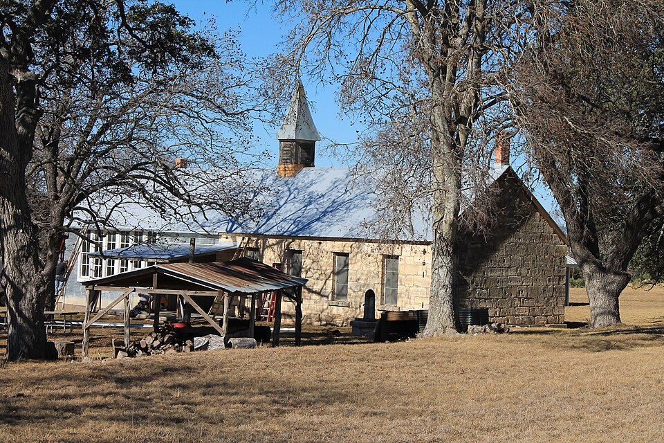
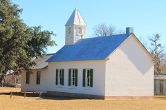
Listed on the National Register of Historic Places in 2005.
From the record
“Williams Creek School is located at 5501 South Ranch to Market Road 1623 in Gillespie County, in the U.S. state of Texas. Although now consolidated with the community of Stonewall, the school is actually located south of there in the ghost town of Albert.”
Wikipedia article Williams Creek School (Gillespie County, Texas), CC BY-SA 4.0.
One of 18 National Register listings published here for Gillespie County · listed in 2005 · category: Building.
National Register reference number.05000384- the number the National Park Service assigned this property when it was listed, and the key its nomination file is catalogued under at the National Archives.
Fires near this property
102 since 1992
Regional context, not property-specific
evidence. The
federal wildfire occurrence database
lists 102 fires within 5 miles of Williams Creek School
between 1992 and 2020, burning about 1,330 acres in total. 1 started naturally. None was recorded as arson.
Distance is straight-line from the map coordinates, so a fire counted
here may appear on a neighbouring settlement's page as well.
Reported cause
Fires
Debris and open burning
70
Missing data/not specified/undetermined
13
Equipment and vehicle use
11
Power generation/transmission/distribution
4
Recreation and ceremony
2
Smoking
1
Natural
1
The most recent of
them, most recent first, with the day each was reported and the service
that recorded it.
Regional context, not property-specific
evidence. The National Weather Service names
Stonewall, the town this property stands in, in 12 storm reports between 1997 and 2025: 8 hail, 3 thunderstorm wind, 1 tornado.
The reports record 5 injuries. Each account below is quoted exactly as the forecast office
filed it, from the NOAA Storm Events Database, and each date
opens the federal record of that event.
The strongest of the Friday night tornadoes struck the town of Stonewall. This tornado, rated F3 on the Fujita Scale, was preceded by brief gusty winds of 30 to 40 miles per hour, very heavy rainfall and spotty .5-inch hail. The tornado formed around 830 pm CST near the intersection of Hahn Road and SH290. It moved north-northeastward for .75 miles, crossing SH290 and the Pedernales River. Just north of the river, it made a slight turn toward the east, now moving another mile toward the northeast. It crossed North River Road and continued over open country until it crossed Ranch Road 1623. After passing RR1623 for approximately .25 miles, it dissipated. The worst damage, F3 level, was to trees and homes between RR1623 and SH290, across the northwest and north central part of Stonewall. Ninety homes sustained damage with 6 destroyed. In addition, 7 mobile homes were destroyed and 20 damaged. Damage was also reported to 22 buildings. A two-story home had the entire second story destroyed, and a concrete building lost most of its walls and all of its roof. Other damage along the path typically included destroyed and damaged roofs and walls of homes and businesses as well as widespread damage to trees. The tornado path was approximately .25 miles in width and 2.5 miles in length. Although the tornado was not seen due to the late hour and darkness, residents did report that after heavy rain and hail, the wind became calm, and it was followed by a "roaring sound" so often reported in tornadoes. Five persons were injured with one man hospitalized as a result of the tornado.
No historic map-sheet match is published
for this property yet. That does not mean no map exists. This record needs
a coordinate-quality review before it can be joined to a sheet boundary.
Browse the county's mapped places while that work is
pending.
Listed places nearby
2 within 8 miles
Other National Register properties close
enough to walk or drive between, ordered by distance from this one. Both
positions come from the same geocoding pass that matched these properties
to their map sheets.
Listing record. National Park Service National Register of Historic Places, listed-properties dataset, current to 2026-05-22.
Map join. Address geocoded through the United States Census geocoder, then tested against the published boundary of every sheet in the USGS Historical Topographic Map Collection.
How this page is made. Listing fields come from federal records; map-sheet coverage is a labelled coordinate-to-boundary calculation, not a source-field claim.
Wildfire. Short, Karen C. 2022. Spatial wildfire occurrence data for the United States, 1992-2020 [FPA_FOD_20221014]. 6th Edition. Fort Collins, CO: Forest Service Research Data Archive. https://doi.org/10.2737/RDS-2013-0009.6 Collected with United States Government funding and usable without additional permissions or fees.
Storms. NOAA National Centers for Environmental Information, Storm Events Database https://www.ncei.noaa.gov/stormevents/ A work of the United States government, no copyright under 17 U.S.C. 105. Narratives are quoted verbatim from the National Weather Service report and are not edited or summarised.
 Block
Block