 Block
BlockFrom the record
One of 6 National Register listings published here for Uvalde County · listed in 2019 · category: District.
Sources: the National Register database, National Park Service
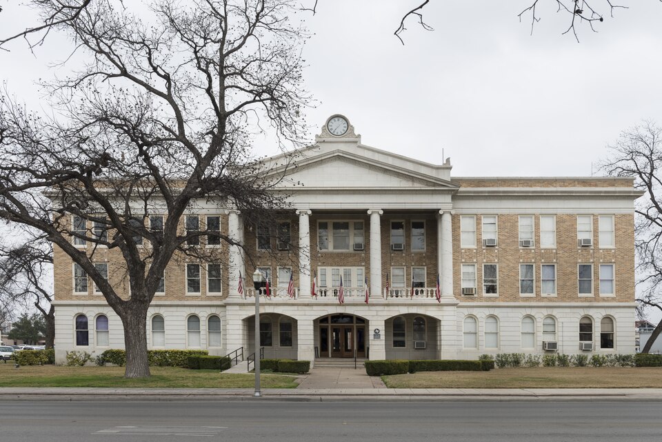
Listed on the National Register of Historic Places in 2019.
One of 6 National Register listings published here for Uvalde County · listed in 2019 · category: District.
Sources: the National Register database, National Park Service
Regional context, not property-specific evidence. The federal wildfire occurrence database lists 147 fires within 5 miles of Uvalde Downtown Historic District between 2006 and 2015, burning about 521 acres in total. None started naturally. 2 were recorded as arson. Distance is straight-line from the map coordinates, so a fire counted here may appear on a neighbouring settlement's page as well.
| Reported cause | Fires |
|---|---|
| Debris and open burning | 97 |
| Smoking | 26 |
| Equipment and vehicle use | 11 |
| Missing data/not specified/undetermined | 8 |
| Misuse of fire by a minor | 2 |
| Arson/incendiarism | 2 |
| Recreation and ceremony | 1 |
The most recent of them, most recent first, with the day each was reported and the service that recorded it.
| Date | Cause | Size | Reported by | Name on the report |
|---|---|---|---|---|
| 23 September 2006 | Debris and open burning | 1.0 acres | Texas A & M Forest Service | not named |
| 22 September 2007 | Arson/incendiarism | 1.0 acres | Texas A & M Forest Service | not named |
| 2 September 2006 | Debris and open burning | 1.0 acres | Texas A & M Forest Service | not named |
| 15 September 2007 | Equipment and vehicle use | 1.0 acres | Texas A & M Forest Service | not named |
| 15 September 2006 | Debris and open burning | 4.0 acres | Texas A & M Forest Service | not named |
| 12 September 2007 | Equipment and vehicle use | 20 acres | Texas A & M Forest Service | not named |
| 6 August 2006 | Debris and open burning | 20 acres | Texas A & M Forest Service | not named |
| 21 August 2006 | Missing data/not specified/undetermined | 6.0 acres | Texas A & M Forest Service | not named |
Regional context, not property-specific evidence. The federal mineral resources record lists 3 workings within 5 miles of Uvalde Downtown Historic District: 1 producer, 1 occurrence, 1 past producer. 1 still produces. What was taken out: Stone, Crushed/Broken, Stone, Dimension, Sand and Gravel, Construction. Distance is straight-line from the map coordinates, so a quarry counted here may appear on a neighbouring settlement's page as well.
| Where | Site | Commodity | Status | Recorded |
|---|---|---|---|---|
| Alamo Ready Mix Concrete Operation | Sand and Gravel, Construction | Past Producer | ||
| Ange Quarry | Stone, Dimension | Occurrence | ||
| Ballard and Hale Operation | Stone, Crushed/Broken | Producer |
Regional context, not property-specific evidence. The National Weather Service names Uvalde, the town this property stands in, in 75 storm reports between 1993 and 2025: 36 hail, 17 flash flood, 15 thunderstorm wind, 3 tornado. No death or injury is recorded in these reports. Each account below is quoted exactly as the forecast office filed it, from the NOAA Storm Events Database, and each date opens the federal record of that event.
| When | Event | Place named | Harm | What the report says |
|---|---|---|---|---|
| March 2006 | Thunderstorm Wind | Uvalde | $2,000,000 | During the late evening, a severe thunderstorm struck just south of the Uvalde downtown area. The damage began five miles southwest of Uvalde and continued south of the town to 7 miles east of the Uvalde airport. The most widespread of the damage was southwest of the city in the Uvalde estates area. Nearly all debris was reported by emergency management to have blown toward the east in an area approximately 3 miles wide and 5 miles long. Damage in this area included damage to about 100 homes and mobile homes. Many of the mobile homes were overturned or rolled and destroyed, with some of the damage occurring while occupants were still inside their mobile homes. Scores of roofs were damaged or destroyed and hundreds of trees were knocked over, with pieces of sheet metal, aluminum, tree branches and broken glass everywhere. Miraculously, there were no deaths and no serious injuries. The type of damage and the fact that nearly all the debris was blown toward the east indicates that nearly all of this damage was due to severe thunderstorm winds. Wind speeds in this event were estimated to be between 80 and 90 mph. This wind damage became spotty as the storm continued eastward...moving just south of the Uvalde downtown area. |
| March 2006 | Tornado (F2) | Uvalde | $1,500,000 | The most severe level of damage was located approximately 5 miles to the east of the Uvalde airport along Agape Road. This was due to a combination of both severe thunderstorm winds and a strong tornado. The wind damage, which had ended just south of Uvalde, once again was observed beginning just west of the Agape area by the team. The damage continued toward the east nearly one quarter mile to the Agape compound. Roof damage was noted at the first buildings, along with widespread damage to trees. Continuing to the east, the team found a mobile home that had been completely destroyed with the debris deposited about 30 yards to the south. This was the first time damage had been thrown in any direction except to the east and is believed to be just east of the starting point of the tornado. About 50 yards further to the east, an asphalt road was observed to have chunks of the topping removed and tossed toward the southeast. Very nearby, a large three-story concrete and steel-beam gymnasium valued at one million dollars had been gutted by the storm. The windward, west side was not blown inward as would have occurred with severe thunderstorm winds. Instead, it was pulled outward. A 40-foot steel beam had been bolted in a dozen different places to the building. The beam was pulled from the building and thrown back 15 feet to the northwest. Although many of the supporting steel beams held, several were pulled away and tossed. Concrete blocks, filled solid with concrete in their construction, had been ripped out of the building and lay tossed and strewn over the area. Much of the wall structure was destroyed. Pieces of sheet metal were strewn to the east and southeast for nearly one half mile. Additional damage to vegetation stretched for another 2 miles east of the gymnasium. Some of this damage was clearly due to severe thunderstorm winds and some of the damage was due to the tornado. Based on the level of damage of the mobile home and the gymnasium, the tornado was rated F2. The path width was estimated at 50 yards and the path length was estimated at 2 miles. From the reports available, it is thought the tornado developed about 1020 pm CST and dissipated around 1025 pm CST. It is the strongest tornado in South Central Texas since the evening of October 12, 2001, when an F3 tornado struck Stonewall, and an F2 tornado struck Hondo. |
| March 2002 | Hail | Uvalde | $250,000 | Large hail, propelled by high winds, caused widespread damage to roofs and glass in the east part of the county. |
| June 1997 | Thunderstorm Wind | Uvalde | $100,000 | A severe thunderstorm downburst partially collapsed a dormitory roof at Southwest Texas Junior College in Uvalde. Emergency personnel reported trees uprooted and branches scattered around the city after the thunderstorm ended. |
| February 2001 | Thunderstorm Wind | Uvalde | $40,000 | Severe thunderstorm winds struck near Uvalde, destroying two mobile homes and knocking down several trees and utility poles. |
| June 1998 | Thunderstorm Wind | Uvalde | $30,000 | A severe downburst knocked over numerous large tree limbs. The wind also knocked out power lines in the Uvalde area. |
| September 1997 | Thunderstorm Wind | Uvalde | $30,000 | no account filed |
| June 2023 | Thunderstorm Wind | Uvalde | $10,000 | A thunderstorm produced wind gusts estimated at 70 mph that knocked down a tree in Uvalde. The tree fell onto a house at Garden St. and High St. and caused the roof to collapse. |
| May 2020 | Thunderstorm Wind | Uvalde | $10,000 | A thunderstorm produced wind gusts estimated at 65 mph that knocked down tree limbs and power lines in Uvalde. |
| May 2013 | Thunderstorm Wind | North Uvalde | $10,000 | A thunderstorm produced wind gusts estimated at 70 mph that snapped six power poles and downed large trees. |
| July 1998 | Thunderstorm Wind | Uvalde | $10,000 | A brief downburst blew down tree limbs and knocked over trees near Uvalde. |
| February 2000 | Hail | Uvalde | $10,000 | no account filed |
| May 1999 | Thunderstorm Wind | Uvalde | $10,000 | no account filed |
| May 2017 | Thunderstorm Wind | Uvalde | $5,000 | A thunderstorm produced wind gusts estimated at 65 mph knocking down power lines across Hwy 83 south of Uvalde. |
| June 1999 | Flash Flood | Uvalde | $5,000 | no account filed |
| April 2025 | Hail | North Uvalde | $2,000 | A thunderstorm produced ping pong ball to golf ball size hail north of Uvalde. The hail broke several windows in a house. |
| July 2012 | Hail | Uvalde | $2,000 | A thunderstorm produced golf ball size hail that broke windows at the Uvalde Memorial Hospital. |
| May 2025 | Hail | Uvalde | - | A thunderstorm produced nickel to quarter size hail in Uvalde. |
| April 2025 | Hail | Uvalde | - | A thunderstorm produced quarter to half dollar size hail in Uvalde. |
| April 2023 | Hail | Uvalde | - | A thunderstorm produced ping pong ball size hail in Uvalde. |
| May 2022 | Hail | Uvalde | - | A thunderstorm produced quarter size hail in Uvalde. |
| May 2021 | Flash Flood | Uvalde | - | Thunderstorms produced heavy rain that led to flash flooding. There were a number of streets closed in Uvalde including FM 3447 and FM 2369. |
| April 2021 | Hail | North Uvalde | - | A thunderstorm produced baseball size hail northwest of Uvalde. |
| April 2021 | Hail | Uvalde | - | A thunderstorm produced golf ball size hail in Uvalde. |
| May 2020 | Hail | Uvalde | - | A thunderstorm produced half dollar size hail in Uvalde. This hail was reported on MPing. |
| May 2020 | Hail | North Uvalde | - | A thunderstorm produced two inch hail on Hwy 90 west of Uvalde. |
| June 2019 | Flash Flood | North Uvalde | - | Thunderstorms produced heavy rain that led to flash flooding closing Hwy 55 outside Uvalde. |
| September 2018 | Flash Flood | North Uvalde | - | Thunderstorms produced heavy rain that led to flash flooding closing multiple roads around Uvalde including Hwy 55. |
| September 2016 | Flash Flood | North Uvalde | - | Thunderstorms produced heavy rain that caused flash flooding closing parts of Hwy 55 northwest of Uvalde. |
| March 2016 | Hail | North Uvalde | - | A thunderstorm produced one inch hail around the Rancho Encino subdivision in Uvalde. |
| May 2015 | Flash Flood | North Uvalde | - | Highway 55 and FM 1403 was reportedly flooded northwest of the city of Uvalde. |
| May 2015 | Flash Flood | Uvalde | - | Thunderstorms produced heavy rain that caused flash flooding requiring three water rescues in Uvalde and closing numerous roads. |
| October 2015 | Flash Flood | Uvalde | - | Thunderstorms produced heavy rain that caused flash flooding closing FM481 with one foot of water over the road southwest of Uvalde. |
| July 2014 | Flash Flood | Uvalde | - | Thunderstorms produced heavy rain that caused flash flooding closing a few roads in Uvalde. |
| June 2014 | Funnel Cloud | North Uvalde | - | Several funnel clouds were spotted out of thunderstorms in Uvalde County. |
| June 2014 | Thunderstorm Wind | Uvalde | - | A thunderstorm produced wind gusts estimated at 60 to 70 mph that downed numerous trees, power poles, damaged a grain silo north of Uvalde, overturned several train cars in Uvalde, overturned some airplanes at the Uvalde Airport, and caused power outages. |
| April 2014 | Hail | Uvalde | - | Quarter to Golfball sized hail was reported around the City of Uvalde. |
| July 2012 | Thunderstorm Wind | Uvalde | - | A thunderstorm produced wind gusts estimated at 58 mph that blew down trees and caused power outages in Uvalde. |
| May 2012 | Flash Flood | North Uvalde | - | Thunderstorms produced heavy rain that flooded low water crossings closing Highway 55 northwest of Uvalde to just south of the Uvalde-Real County line. |
| November 2011 | Thunderstorm Wind | Uvalde | - | A thunderstorm produced wind gusts estimated at 58 mph which damaged a livestock barn near Uvalde. |
| October 2011 | Flash Flood | North Uvalde | - | Thunderstorms produced heavy rain which caused flooding north of Uvalde. RM 1403 had more than two feet of water running over it. |
| April 2010 | Hail | North Uvalde | - | A thunderstorm produced golf ball to tennis ball size hail along Highway 83 north of Uvalde. |
| March 2009 | Hail | Uvalde | - | A thunderstorm moved through the Uvalde area and produced nickel size hail. |
| March 2009 | Hail | Uvalde | - | A thunderstorm moved through the Uvalde area and produced hail ranging from quarter to golf ball size. We received three reports of severe size hail from this storm. |
| July 2007 | Flash Flood | Uvalde | - | Rainfall over the northern part of Uvalde County averaged from 4 to 6 inches, with up to 12 inches from northwest of Uvalde to Utopia. High water shut down a 36-mile stretch of tracks around Knippa, halting a westbound Amtrak train with 176 passengers for several hours. SH127, FM1050, and SH55 were closed due to high water and Garner State Park was evacuated due to flooding. |
| July 2007 | Flood | Uvalde | - | The Frio River below the Dry Frio near Uvalde crested at 22.0 ft on 07/21 at 1245cst, where flood stage is 12 ft. |
| July 2007 | Flood | Uvalde | - | The Nueces River below Uvalde crested at 17.2 ft on 07/21 at 1700cst, where flood stage is 11 ft. |
| July 2007 | Flash Flood | Uvalde | - | Thunderstorms produced between 2 and 3 inches of rain over northern Uvalde County, with up to 5 inches in the extreme northwestern part of the county. Flash flooding closed US55 and FM1050. |
| July 2007 | Flash Flood | Uvalde | - | Thunderstorms formed across northern Val Verde, Edwards and Real Counties and moved slowly southward into Kinney and Uvalde Counties. Rain amounts in Uvalde County generally averaged from 2 to 3 inches, with up to 5 inches in the extreme northwest part of the county. SH55 and FM481 were closed near Uvalde with FM1051 closed just south of Camp Wood. |
| May 2007 | Flash Flood | Uvalde | - | Scattered showers and thunderstorms produced general 1 to 2 inch rain amounts in southwestern Uvalde County, with 3 to 4 inches southwest of the city of Uvalde. Among other roads, FM481 and FM117 were closed due to high water. |
| March 2007 | Flash Flood | Uvalde | - | Thunderstorms from Brackettville through the extreme northwestern corner of Uvalde County and into the Barksdale and Camp Wood areas produced between 3 and 5 inches of rain in the early morning hours reported that FM334 was closed for several hours during the morning due to the flash flooding. |
| July 2007 | Flash Flood | Uvalde | - | Thunderstorms formed north of Uvalde and continued to move slowly southeastward across the county, producing general rain amounts of 2 to 3 inches. Highest totals were 5 inches in the extreme northwest corner of Uvalde County, as well as just north of Knippa and also in the extreme southeast corner of county. Many county roads were closed due to flash flooding including FM140, SH55, and SH127. |
| April 2002 | Tornado (F0) | Uvalde | - | The tornadic supercell tracked eastward out of Kinney County and into Uvalde County. Shortly after crossing the county line, an off duty police officer reported a short-lived tornado in an open field near US90. It caused no known damage. |
| February 2000 | Tornado (F0) | Uvalde | - | Reported by Sheriff's Department in open country moving southeastward. |
| March 1993 | Hail | Uvalde | - | The storms continued to move to the east and into Uvalde County. A co-op observer reported 1.00-inch hail in the northern part of the city of Uvalde. The Uvalde Police Department reported bigger than golfball-size hail in the city, a few minutes later they reported baseball-size hail. |
| March 1993 | Hail | Uvalde | - | The storms continued to move to the east and into Uvalde County. A co-op observer reported 1.00-inch hail in the northern part of the city of Uvalde. The Uvalde Police Department reported bigger than golfball-size hail in the city, a few minutes later they reported baseball-size hail. |
| October 1993 | Thunderstorm Wind | Uvalde | - | County Sheriff's Office reported straight line winds in and near the town of Sabinal. Several trees were uprooted and large metal building was blown over. |
| March 1993 | Hail | Uvalde | - | The storms continued to move to the east and into Uvalde County. A co-op observer reported 1.00-inch hail in the northern part of the city of Uvalde. The Uvalde Police Department reported bigger than golfball-size hail in the city, a few minutes later they reported baseball-size hail. |
| May 2020 | Hail | Uvalde | - | no account filed |
| July 2012 | Hail | Uvalde | - | no account filed |
No historic map-sheet match is published for this property yet. That does not mean no map exists. This record needs a coordinate-quality review before it can be joined to a sheet boundary. Browse the county's mapped places while that work is pending.
Other National Register properties close enough to walk or drive between, ordered by distance from this one. Both positions come from the same geocoding pass that matched these properties to their map sheets.
| Photograph | Property | Distance | Listed |
|---|---|---|---|
 | Grand Opera House | under 500 feet | 1978 |
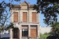 | First National Bank | 0.2 miles | 2014 |
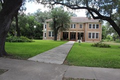 | John Nance Garner House | 0.4 miles | 1976 |
 | Nicolas Street School | 0.6 miles | 2010 |
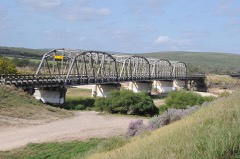 | State Highway 3 Bridge at the Nueces River | 7.0 miles | 1996 |
| National Archives record | The nomination case file for reference 100004009 in Record Group 79. |
| Uvalde County | All 6 listed properties in this county. |