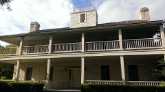
National Register reference number.11000515- the number the National Park Service assigned this property when it was listed, and the key its nomination file is catalogued under at the National Archives.
Fires near this property
168 since 2005
Regional context, not property-specific
evidence. The
federal wildfire occurrence database
lists 168 fires within 5 miles of Hutto Commercial Historic District
between 2005 and 2017, burning about 1,547 acres in total. None started naturally. 1 was recorded as arson.
Distance is straight-line from the map coordinates, so a fire counted
here may appear on a neighbouring settlement's page as well.
Reported cause
Fires
Missing data/not specified/undetermined
116
Debris and open burning
33
Equipment and vehicle use
6
Recreation and ceremony
4
Power generation/transmission/distribution
4
Misuse of fire by a minor
2
Railroad operations and maintenance
1
Smoking
1
Arson/incendiarism
1
The most recent of
them, most recent first, with the day each was reported and the service
that recorded it.
Regional context, not property-specific
evidence. The National Weather Service names
Hutto, the town this property stands in, in 36 storm reports between 1995 and 2025: 20 hail, 9 flash flood, 3 thunderstorm wind, 2 tornado.
The reports record 1 death. Each account below is quoted exactly as the forecast office
filed it, from the NOAA Storm Events Database, and each date
opens the federal record of that event.
Thunderstorms produced heavy rain that caused flash flooding around the county. Numerous roads were closed including Hairy Man Rd. The Bull Run Creek hike and bike trail was flooded. A 55 year old man died when his vehicle was swept away near CR 143 and Hwy 195 north of Georgetown. 38 homes were destroyed and 57 homes sustained major damage. Losses for infrastructure totaled more than 7 million dollars.
Roofs were blown off houses as well as the main building of the High School in Hutto. Classes had to be cancelled for the following day. Several barns were flattened, trees were blown over and power lines were destroyed north of Hutto. A high school football game, already underway, was cancelled as the storm approached, and all persons evacuated into the school. This quick action no doubt prevented numerous injuries.
Several videos from social media show a weak tornado formed along an outflow boundary near Limmer Loop on the east side of Round Rock. From video it appears this was a landspout tornado and not associated with a thunderstorm. There was one backyard shed that was heavily damaged. This damage was near Limmer Loop and Will Smith Dr. The tornado only lasted about a minute or two and appears to have moved southwest toward CR 110 where it quickly dissipated. Maximum winds are estimated to be at 70 mph.
Thunderstorms produced heavy rain that led to flash flooding closing FM 1660 near the New Hope Church south of Hutto. The flooding was between Brushy Creek and Cottonwood Creek.
Thunderstorms produced heavy rain that caused flash flooding closing CR123 south of Hwy 79 near Brushy Creek. Numerous other locations in Williamson County had water over roadways.
Thunderstorms produced heavy rain with 6.67 inches in three and half hours that caused flash flooding. The Forest Creek Golf Club was flooded with Forest Creek Dr. closed at the clubhouse.
Heavy rain from Tropical Storm Hermine produced flash flooding which stranded two cars: one in Round Rock at the intersection of Wyoming Springs Drive and Cloud Peak Lane and the other in Cedar Park in the 1000 block of Great Oaks Drive.
Skywarn-trained Amateur Radio Operators observed a small funnel as it dipped below clouds near Hutto. It quickly lifted back into the thunderstorm without touching down.
A Skywarn-trained Amateur Radio Spotter observed a small tornado as it touched down north of Hutto about 15 minutes after the Round Rock tornado. This tornado was estimated at 30yds wide and moved toward the northeast for approximately one quarter mile long before lifting and dissipating. The tornado was also rated F0 on the Fujita Scale.
No historic map-sheet match is published
for this property yet. That does not mean no map exists. This record needs
a coordinate-quality review before it can be joined to a sheet boundary.
Browse the county's mapped places while that work is
pending.
Listed places nearby
3 within 8 miles
Other National Register properties close
enough to walk or drive between, ordered by distance from this one. Both
positions come from the same geocoding pass that matched these properties
to their map sheets.
Listing record. National Park Service National Register of Historic Places, listed-properties dataset, current to 2026-05-22.
Map join. Address geocoded through the United States Census geocoder, then tested against the published boundary of every sheet in the USGS Historical Topographic Map Collection.
How this page is made. Listing fields come from federal records; map-sheet coverage is a labelled coordinate-to-boundary calculation, not a source-field claim.
Wildfire. Short, Karen C. 2022. Spatial wildfire occurrence data for the United States, 1992-2020 [FPA_FOD_20221014]. 6th Edition. Fort Collins, CO: Forest Service Research Data Archive. https://doi.org/10.2737/RDS-2013-0009.6 Collected with United States Government funding and usable without additional permissions or fees.
Storms. NOAA National Centers for Environmental Information, Storm Events Database https://www.ncei.noaa.gov/stormevents/ A work of the United States government, no copyright under 17 U.S.C. 105. Narratives are quoted verbatim from the National Weather Service report and are not edited or summarised.
 Block
Block