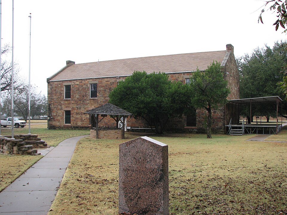
| April 2014 | Hail | Newcastle | $40,000 | The Young County Emergency Manager reported golf ball sized hail at Fort Belknap. |
| June 2012 | Thunderstorm Wind | Newcastle | $30,000 | Downburst winds caused damage in Newcastle. Large trees were knocked down; some of the trees were a foot in diameter. Power lines and power poles were also knocked down. Light roof damage was reported around the town, and a few 15'x15' outbuilding were blown up against houses. |
| March 2007 | Lightning | Newcastle | $30,000 | A lightning strike struck a mobile home and destroyed it. No one was injured. |
| May 2013 | Hail | Newcastle | $20,000 | Hail to the size of a chicken egg was reported near Newcastle. Quarter and golf ball sized hail was also reported. |
| April 2008 | Hail | Newcastle | $20,000 | Baseball to golfball-size hail was reported south of Olney. |
| June 2007 | Thunderstorm Wind | Newcastle | $10,000 | Power lines and poles were downed with power outages reported. |
| June 2002 | Thunderstorm Wind | Newcastle | $10,000 | The roof was blown off a grocery store and multiple power lines were blown down. |
| June 1997 | Thunderstorm Wind | Newcastle | $10,000 | Strong winds removed the roof from a mobile home. |
| June 2012 | Thunderstorm Wind | Newcastle | $7,000 | Two power poles were blown over east of Newcastle along Highway 380. |
| May 2009 | Thunderstorm Wind | Newcastle | $7,000 | Minor roof damage was observed in Newcastle. Shingles were torn off other houses. |
| June 2011 | Hail | Newcastle | $6,000 | no account filed |
| April 2014 | Hail | Newcastle | $5,000 | Golf ball sized hail has reported by fire and rescue 6 miles southwest of Newcastle, TX. |
| May 2012 | Hail | Newcastle | $5,000 | Ping pong ball sized hail was reported in Newcastle via HAM radio. |
| May 2012 | Thunderstorm Wind | Newcastle | $5,000 | Storm spotters estimated thunderstorm winds of 60 mph in Newcastle. |
| April 1997 | Thunderstorm Wind | Newcastle | $5,000 | High winds tore shingles from the roof of a home. |
| October 2012 | Hail | Newcastle | $4,000 | Golf ball sized hail was reported in Newcastle. |
| June 2012 | Hail | Newcastle | $2,000 | Tennis to baseball sized hail was reported near Fort Belknap State Park. |
| May 1999 | Thunderstorm Wind | Newcastle | $100 | Large tree limbs were blown down by thunderstorm winds. |
| March 2023 | Hail | Newcastle | - | Dime sized hail reported near Newcastle. |
| March 2018 | Hail | Newcastle | - | A storm chaser reported quarter-sized hail approximately 4 miles west-southwest of the city of Newcastle, TX. |
| May 2015 | Flash Flood | Newcastle | - | Young County Sheriff's Department reported water over Hwy 380 west of Newcastle, TX. |
| May 2015 | Hail | Newcastle | - | Emergency management reported golf ball sized hail on FM 3109 approximately 8 miles west of Graham, TX. |
| May 2015 | Hail | Newcastle | - | Emergency management reported golf ball sized hail on FM 3109 approximately 8 miles west of Graham, TX. |
| April 2014 | Hail | Newcastle | - | Young County Sheriff's deputies reported quarter sized hail north of Newcastle. |
| May 2013 | Hail | Newcastle | - | Hail to the size of a tea cup was reported in Newcastle. |
| May 2012 | Hail | Newcastle | - | Half dollar sized hail was reported in Newcastle. |
| September 2010 | Flood | Newcastle | - | Residual flooding continued along FM 926 west of Newcastle after the rain ended. |
| September 2010 | Flash Flood | Newcastle | - | Flooding was reported along FM 926 approximately 1 mile west of Newcastle. |
| June 2007 | Flash Flood | Newcastle | - | Roads were closed near Highway 380 due to high water. |
| April 2004 | Flash Flood | Newcastle | - | Flash flooding reported by a spotter in Newcastle. |
| May 2000 | Tornado (F0) | Newcastle | - | A brief tornado was reported. No damage or injury reports were received. |
| May 1999 | Thunderstorm Wind | Newcastle | - | Large tree limbs were blown down. |
| July 1995 | Hail | Newcastle | - | Trees were blown down by thunderstorm winds. |
| July 1995 | Hail | Newcastle | - | Trees were blown down by thunderstorm winds. |
| July 1995 | Hail | Newcastle | - | Power lines were blown down by high winds. |
| May 1994 | Tornado (F0) | Newcastle | - | A brief tornado was reported two miles north of Newcastle. |
| May 1993 | Tornado (F1) | Newcastle | - | A brief tornado touchdown uprooted a few trees in open country., |
| May 2015 | Hail | Newcastle | - | no account filed |
| April 2008 | Hail | Newcastle | - | no account filed |
| April 2007 | Hail | Newcastle | - | no account filed |
| April 2004 | Hail | Newcastle | - | no account filed |
| April 2004 | Thunderstorm Wind | Newcastle | - | no account filed |
| June 2004 | Hail | Newcastle | - | no account filed |
| June 2003 | Thunderstorm Wind | Newcastle | - | no account filed |
| June 2003 | Hail | Newcastle | - | no account filed |
| June 2003 | Hail | Newcastle | - | no account filed |
| June 2003 | Hail | Newcastle | - | no account filed |
| September 2001 | Hail | Newcastle | - | no account filed |
| September 2001 | Hail | Newcastle | - | no account filed |
| April 2000 | Hail | Newcastle | - | no account filed |
| April 2000 | Hail | Newcastle | - | no account filed |
| April 2000 | Hail | Newcastle | - | no account filed |
| April 2000 | Hail | Newcastle | - | no account filed |
| April 2000 | Thunderstorm Wind | Newcastle | - | no account filed |
| May 1999 | Hail | Newcastle | - | no account filed |
| May 1999 | Hail | Newcastle | - | no account filed |
| May 1998 | Hail | Newcastle | - | no account filed |
| May 1998 | Hail | Newcastle | - | no account filed |
| June 1997 | Hail | Newcastle | - | no account filed |
| July 1996 | Thunderstorm Wind | Newcastle | - | no account filed |
 Block
Block