| June 2007 | Tornado (EF0) | Decatur | 5 hurt, $50,000 | A tornado touched down near Highway 51 and caused damage in the Quail Run subdivision. A mobile home was moved from its underpinning and had its windows blown out, and two residential roofs, sheds, and a trampoline were damaged two miles north of Highway 380 near the Wise/Denton County line. Several people suffered minor injuries. |
| October 2001 | Tornado (F2) | Decatur | 1 hurt, $750,000 | The second Wise county tornado touched down on the southwest side of Decatur, with initial damage to trees and a large storage shed. The tornado strengthened as it moved east northeast into the Lipsey Subdivision. Several homes sustained roof damage and numerous trees were blown down or snapped off. One large home on Garland Street was rendered uninhabitable, as most of the roof was blown off and two exterior walls were destroyed. The occupant escaped with minor injuries. The tornado crossed Highway 51, blowing down numerous trees, power lines, and utility poles. A large portion of the roof of the Church of Christ building was removed and blown into a tree about one mile away. The Wise County Regional Hospital had some windows broken. As the tornado crossed Highway 287, it weakened doing sporadic F0 damage to trees in a residential area just south of downtown. The tornado reintensified just east of downtown near the intersection if Business Highway 81 and Old Denton Road, where a 10,000 square foot storage building was destroyed. The tornado continued moving northeast, severely damaging three homes. Two four inch diameter posts from a gazebo were thrown 1/4 of a mile and driven one foot into the ground. The tornado crossed Highway 380, heavily damaging a ranch, then moved into a heavily wooded area blowing down hundreds of trees before dissipating. Damage occurred to 50 homes,at least 8 businesses, and 2 churches. |
| June 2011 | Thunderstorm Wind | Decatur | 1 hurt, $20,000 | Sections of the roof of the Sunset Inn in Decatur were blown off by thunderstorm winds. One person was injured by falling debris and was transported to the hospital. |
| May 1998 | Hail | Decatur | $2,000,000 | Large hail struck three car dealerships in Decatur, causing an estimated $2 million in damage. |
| June 2010 | Thunderstorm Wind | Decatur | $100,000 | A local auto-repair business suffered damage to six bay doors in Decatur. There were also tree limbs scattered along roadways and several homes had shingles removed from the roofs. |
| March 2017 | Hail | Decatur | $75,000 | A social media report indicated 2-inch diameter hail in the town of Decatur. |
| May 2024 | Flash Flood | Decatur | $50,000 | Multiple high water rescues were reported in Decatur and Rhome. |
| June 2011 | Thunderstorm Wind | Decatur | $40,000 | Trees were uprooted and snapped in Decatur. The golden arches at McDonald's were knocked down, and the Dairy Queen and Taco Bell signs were also damaged along with other business signs in the city. Power lines were also knocked down and shingles were torn off roofs. A home weather station on Highway 287 on the north side of town measured a 62 MPH wind gust. A 50 foot hackberry tree, the largest in the county, was knocked down in Decatur by the storm, and it fell on a garage, crushing the car underneath. |
| April 2008 | Hail | Decatur | $40,000 | Softball-size hail was reported at the Sherriff's Office. Windows of houses and cars were broken by the hail. |
| May 2011 | Thunderstorm Wind | Decatur | $35,000 | A NWS survey determined straight-line winds caused damage south of Decatur. Near FM 730 and Private Road 4184, trees were uprooted, large tree limbs were broken, the roof of a home was damaged, and a large metal barn at a dairy farm was heavily damaged. Tree damage then extended to the northeast, and a few manufactured homes and RVs were damaged at a business near Highway 287. |
| March 2025 | Thunderstorm Wind | Decatur | $20,000 | Trained spotter reported estimated 80 mph winds, along with an uprooted 2 foot tree. |
| November 2015 | Hail | Decatur | $20,000 | The Decatur Police Department reported baseball sized hail, which produced damage to several of their police vehicles. |
| April 2008 | Hail | Decatur | $20,000 | no account filed |
| May 2011 | Thunderstorm Wind | Decatur | $15,000 | Thunderstorm winds damaged some street and business signs along Highway 287 in Decatur. |
| June 2011 | Thunderstorm Wind | Decatur | $15,000 | The automated weather station at Decatur Municipal Airport (KLUD) measured a 59 MPH wind gust. |
| May 2007 | Thunderstorm Wind | Decatur | $15,000 | Trees were blown down and uprooted, damaging a pool deck. One trailer home northwest of Decatur had its roof blown off. |
| February 2001 | Thunderstorm Wind | Decatur | $15,000 | Wind gusts to 61 mph were recorded at Decatur High School. Numerous reports of trees and power lines blown down, storage buildings damaged, and damage to roofs. A mobile home was blown over just north of town, and south of town an 18 wheeler was blown off highway 287. |
| October 2025 | Flash Flood | Decatur | $10,000 | A water rescue was conducted near Preskitt Rd and FM 51. |
| May 2009 | Hail | Decatur | $10,000 | Golfball to Hen Egg size hail fell in Downtown Decatur. |
| April 2007 | Hail | Decatur | $10,000 | Hen egg-size hail reported. |
| December 2006 | Thunderstorm Wind | Decatur | $10,000 | A few signs were blown down along Highways 114 and 151 near the leading edge of a shallow line of thunderstorms. |
| April 2002 | Lightning | Decatur | $10,000 | A tank battery fire was started by a lightning strike. |
| May 2002 | Thunderstorm Wind | Decatur | $10,000 | Two houses unroofed on the south side of Decatur along Highway 730. |
| September 2001 | Thunderstorm Wind | Decatur | $10,000 | A mobile home was unroofed in Bluett. |
| July 1995 | Thunderstorm Wind | Decatur | $10,000 | Greenwood Road, between Greenwood and Decatur, was blocked by trees blown down by high winds. There were also numerous reports of trees blown onto power lines, causing widespread power outages. |
| April 2002 | Thunderstorm Wind | Decatur | $7,000 | Mobile homes were damaged by high winds. |
| August 2007 | Flash Flood | Decatur | $5,000 | A few roads were flooded and one high water rescue was needed on Highway 380 in town. |
| March 2006 | Lightning | Decatur | $5,000 | Lightning struck an electrical box on the side of an apartment complex and started a fire inside the wall. The fire was extinguished after the sheet rock was pulled down. |
| March 2004 | Thunderstorm Wind | Decatur | $5,000 | Telephone poles were blown down by high winds. |
| June 2003 | Thunderstorm Wind | Decatur | $5,000 | Outbuildings destroyed by high winds. |
| April 2002 | Thunderstorm Wind | Decatur | $5,000 | Street signs were blown down, four power poles blown down, a barn was damaged, and a large window was blown out. |
| June 1999 | Hail | Decatur | $5,000 | A country club sustained damaged from the hail. |
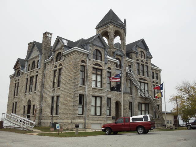
| August 1994 | Thunderstorm Wind | Decatur | $5,000 | Strong winds damaged the courthouse roof. |
| May 1994 | Thunderstorm Wind | Decatur | $5,000 | Trees were blown down by thunderstorm winds. |
| June 1994 | Thunderstorm Wind | Decatur | $5,000 | Trees were blown down by thunderstorm winds between Decatur and Alvord. |
| May 2011 | Thunderstorm Wind | Decatur | $3,000 | Thunderstorm winds in Decatur were estimated to be near 60 MPH. |
| April 2014 | Hail | Decatur | $2,000 | Ping pong ball sized hail was reported 9 miles southeast of Decatur. |
| June 2012 | Thunderstorm Wind | Decatur | $2,000 | A HAM radio operator reported 60-65 mph winds in Decatur. The strong thunderstorm winds were produced during the dissipating stages of the storm. |
| June 2012 | Thunderstorm Wind | Decatur | $2,000 | A spotter measured 65 mph winds approximately 4 miles south-southwest of Decatur. The spotter also reported large tree branches were knocked down. The strong thunderstorm winds were produced during the dissipating stages of the storm. |
| June 2008 | Lightning | Decatur | $2,000 | A home south of Decatur was struck by lightning. Only the phone system was damaged. |
| April 2002 | Thunderstorm Wind | Decatur | $2,000 | Outbuildings were destroyed by high winds. |
| September 2001 | Thunderstorm Wind | Decatur | $1,000 | Trees and power lines were blown down. |
| April 1999 | Thunderstorm Wind | Decatur | $1,000 | A large tree was blown down onto a fence. |
| July 1994 | Thunderstorm Wind | Decatur | $500 | Large tree limbs were blown down by thunderstorm winds. |
| March 2026 | Thunderstorm Wind | Decatur | - | A trained spotter reported a 67 mph wind gust on a personal weather station just west of Decatur. Small tree limbs were observed on the roadway. |
| April 2026 | Hail | Decatur | - | Report of 1.25 inch hail near Decatur from mPING. |
| March 2025 | Thunderstorm Wind | Decatur | - | A 70 mph wind gust was measured on the west side of Decatur. |
| April 2025 | Flash Flood | Decatur | - | Multiple flooded roads were reported in Wise County, including portions of W Thompson St, FM 51, Old Decatur Rd at Alvord Rd, Halsell St, and several county roads. |
| June 2024 | Hail | Decatur | - | Reported via mPing. |
| May 2023 | Thunderstorm Wind | Decatur | - | A public report indicated 4-inch diameter tree limbs down along FM 1450. |
| March 2023 | Thunderstorm Wind | Decatur | - | A trained spotter measured a 71 mph wind gust via a personal weather station in Decatur. |
| October 2022 | Thunderstorm Wind | Decatur | - | Spotter network report of 60 mph winds in Decatur. |
| October 2022 | Hail | Decatur | - | A trained spotter reported nickel sized hail in Decatur, TX. |
| January 2020 | Flood | Decatur | - | Emergency Management reported county roads across mainly the southeast portion of the county remained flooded after around 3-4 inches of rain fell earlier. |
| March 2017 | Hail | Decatur | - | Amateur radio reported ping pong ball sized hail approximately 2 miles south of Decatur, TX. |
| July 2016 | Thunderstorm Wind | Decatur | - | Multiple large tree branches down in southwest Decatur. Estimated diameter of tree branch is 6 inches. |
| July 2016 | Thunderstorm Wind | Decatur | - | A trained spotter reported an estimated wind gust of 60 MPH in Decatur. |
| May 2015 | Flash Flood | Decatur | - | Amateur radio reported that water was coming into a home near Wild Horse Road in Decatur, TX and approaching the front door of another home on the same road. The water was measured to be 8 inches deep. |
| November 2015 | Hail | Decatur | - | A public report of golf-ball sized hail was reported via social media in Decatur, TX at 510 PM. |
| November 2015 | Hail | Decatur | - | A National Weather Service employee reported hen-egg sized hail in Decatur, TX. |
 Block
Block