 Block
BlockFrom the record
6 National Register listings published here.
Sources: the National Register database, National Park Service
69 topographic sheets cover 33 settlements here, and 6 properties are on the National Register of Historic Places.
6 National Register listings published here.
Sources: the National Register database, National Park Service
Every property in this county listed on the National Register of Historic Places, with the year it was listed and the federal nomination document.
| Photograph | Property | Type | Listed | Reference |
|---|---|---|---|---|
 | Administration Building, Decatur Baptist College | building | 1971 | 71000973 |
| Bridgeport Commercial Historic District | district | 2024 | 100011085 | |
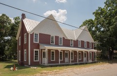 | J. T. Brown Hotel | building | 1979 | 79003026 |
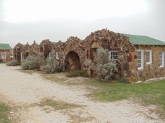 | Texas Tourist Camp | building | 1997 | 97000477 |
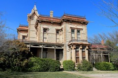 | Waggoner Mansion | building | 1974 | 74002098 |
 | Wise County Courthouse | building | 1976 | 76002085 |
Drawn when these were printed as single large sheets: the town seen from the air, and the county divided into its farms with every owner named. Each opens the original at the Library of Congress.




Selected from the Digital Public Library of America's 2 image records catalogued for this county. Every one shown here carries a public-domain status or a licence that permits reuse on a site that carries advertising; non-commercial, share-alike and restricted images are excluded. The selection is spread across the county's towns (at most eight per town), so no single institution's bulk upload crowds out the rest. Each opens the holding library's record, and the complete set at the Digital Public Library of America is one click away.

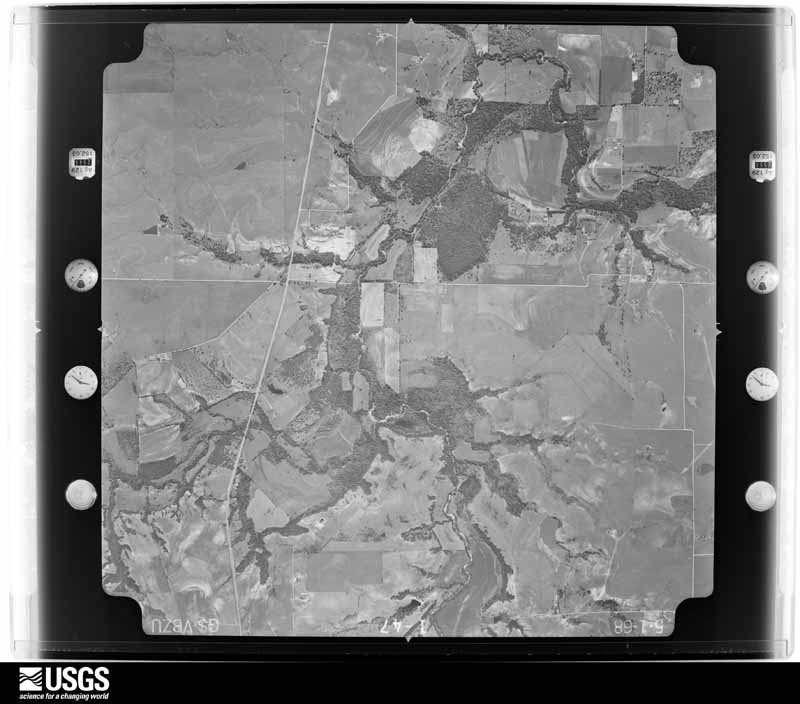
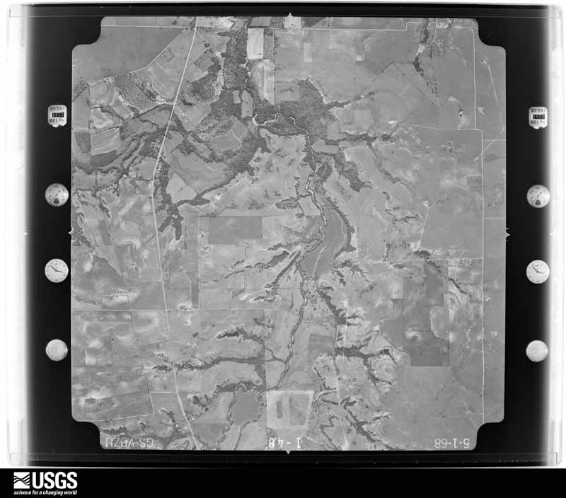
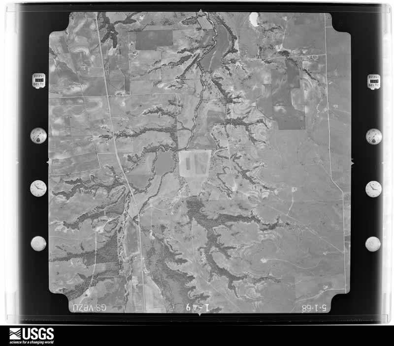
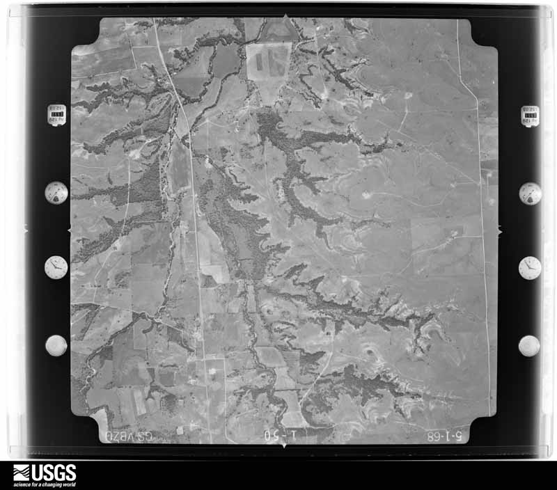
Flown by the U.S. Geological Survey between 1937 and 1989, the Aerial Photo Single Frames collection is the definitive mid-century view of the land: fields, roads and rivers as the camera saw them. The Survey holds 359 frames inside the rectangle that bounds this county; the 20 frames below were taken over the county itself, chosen across the decades of flights (at most four a year from that rectangle), so one flight cannot crowd out the rest. The full set is free to browse and download at EarthExplorer under the dataset Aerial Photo Single Frames.
















The thermometers that kept this county's weather, and the gages that measured the flow of its streams, as the federal records hold them. The extremes below are measured values from those records, not estimates.
Who lived here in 1950, one enumeration district at a time, as the Census Bureau described each district. Each row opens its official National Archives result, with Population Schedules and ED Maps available there.
Every wildfire the federal occurrence database records inside this county: 1,309 of them, burning about 34,290 acres. 29 started naturally and 56 were recorded as arson. Each settlement page carries the fires within five miles of it.
| Reported cause | Fires |
|---|---|
| Missing data/not specified/undetermined | 477 |
| Debris and open burning | 363 |
| Equipment and vehicle use | 219 |
| Arson/incendiarism | 56 |
| Power generation/transmission/distribution | 48 |
| Smoking | 45 |
| Recreation and ceremony | 44 |
| Natural | 29 |
| Misuse of fire by a minor | 11 |
| Railroad operations and maintenance | 10 |
| Fireworks | 6 |
| Other causes | 1 |
The five largest, by the area the report gives. Two of them were set deliberately.
| Date | Cause | Size | Reported by | Name on the report |
|---|---|---|---|---|
| 16 March 1996 | Missing data/not specified/undetermined | 12,201 acres | Texas A & M Forest Service | POOLVILLE FIRE |
| 27 December 2005 | Missing data/not specified/undetermined | 2,600 acres | Texas A & M Forest Service | 730 COMPLEX |
| 28 July 2011 | Debris and open burning | 1,900 acres | Texas A & M Forest Service | BRIDGEPORT WILDFIRE |
| 10 February 1996 | Arson/incendiarism | 900 acres | National Forests And Grasslands In Texas | CLOWER |
| 29 December 2016 | Debris and open burning | 860 acres | Texas A & M Forest Service | 2265 |
| 29 January 2008 | Smoking | 800 acres | Texas A & M Forest Service | not named |
| 6 March 1996 | Arson/incendiarism | 700 acres | National Forests And Grasslands In Texas | WINDY |
| 12 August 2005 | Missing data/not specified/undetermined | 600 acres | Texas A & M Forest Service | NORTH TX - 6 |
Every settlement page carries the fires within five miles of it - see the settlement index below.
The NOAA Storm Events Database holds 964 reports for this county, causing 3 deaths, 34 injuries and about $24,064,880 in recorded property damage. Each settlement page carries the reports that name it.
| Kind of event | Reports |
|---|---|
| Hail | 474 |
| Thunderstorm Wind | 313 |
| Flash Flood | 74 |
| Tornado | 66 |
| Lightning | 16 |
| Flood | 15 |
| Heavy Rain | 6 |
The most serious of them, by death, then injury, then recorded damage. The accounts are quoted exactly as the forecast office filed them.
| When | Event | Place named | Harm | What the report says |
|---|---|---|---|---|
| December 1999 | Tornado (F1) | Chico | 2 killed, 3 hurt, $600,000 | Two persons were killed in a mobile home which was destroyed by a tornado. Three other people were injured. Three mobile homes were destroyed, with two of them heavily damaged. Many outbuildings were damaged or destroyed. |
| April 2026 | Tornado (EF2) | Bridgeport Muni Arpt | 1 killed, 6 hurt, $5,000,000 | An EF-2 tornado occurred on the southwest side of Runaway Bay with peak winds estimated at 130 mph. This tornado formed just south of Highway 380 near Port O Call Drive and Pinto Court where a 100 to 200 yard wide swath of EF-0 tree damage was observed. The tornado then continued towards the west, uprooting some trees and snapping large branches as it approached Cimmarron Trail. By this time the tornado was nearly a third of a mile wide, causing substantial tree damage and minor roof damage before moving into a residential area between Cimmarron Trail and Jasper Creek Road. Most homes in this neighborhood sustained high-end EF-0 and EF-1 damage with heavily damaged manufactured homes, broken windows, failed garage doors, uprooted trees, and substantial roof damage to single family homes. Within the broader area of EF-0/EF-1 damage, small vortices embedded in the tornado produced narrow corridors of EF-2 damage. The first instance was a two-floor residence on the northeast corner of the Cactus Canyon Drive and Brookview Drive intersection. Here, the home lost a substantial amount of roofing along with some exterior walls on the second floor. Two single-wide manufactured homes in the vicinity of this house were completely destroyed with debris displaced away from their original location. A second home in the northeast side of the neighborhood on Cactus Canyon Drive lost nearly all of its roofing. Wind estimates of this damage ranged from 120-125 mph. The most intense damage was observed with a double-wide manufactured home near the intersection of Overland Trail and Cumberland Trail. The metal frame was found 100 yards downwind of the original home site, with additional debris several hundred yards to the west. Severe tree damage was also noted just on the west side of Jasper Creek Road. This damage was consistent with a high-end EF-2 intensity tornado containing estimated wind speeds of up to 130 mph. A fatality occurred in this destroyed residence. The tornado was also at its peak width during this time, just over half a mile wide. The tornado continued into a forested area dissipating approximately 600 yards west of Jasper Creek Road, completing its 1.4 mile long path. |
| June 2007 | Tornado (EF0) | Decatur | 5 hurt, $50,000 | A tornado touched down near Highway 51 and caused damage in the Quail Run subdivision. A mobile home was moved from its underpinning and had its windows blown out, and two residential roofs, sheds, and a trampoline were damaged two miles north of Highway 380 near the Wise/Denton County line. Several people suffered minor injuries. |
| May 1994 | Thunderstorm Wind | Cottondale | 4 hurt, $500,000 | At 2.3 miles north of Cottondale one house was destroyed, and at least two mobile homes were destroyed by high winds. Damage was reported to four other mobile homes. A car and a truck were also destroyed. The sheriff's office reported four injuries, one of which was serious. |
| March 2023 | Tornado (EF1) | Boonsville | 3 hurt | This is a continuation of a tornado that began in Parker County. The tornado developed along Pine Road west of Poolville, where the roof of a single family home sustained damaged. As the tornado tracked northeast, it produced extensive damage to trees across the northwestern side of Poolville including snapped trunks and uprooted trees. Structural damage includes the uplift and overturning of a metal garage structure near the intersection of Pine Road and Lone Star Road, roof and siding damage to a few single family residences, and the complete collapse of a large covered pavilion roof near the Poolville Cemetery. The tornado continued to move north-northeast towards the Wise County line producing additional damage to trees and several outdoor buildings along Clover Drive. Multiple manufactured homes along and just south of Highway 199 were damaged as the tornado crossed the county line. There were 3 injuries reported with damage in this area. The tornado appears to have lifted as it crossed Highway 199 with isolated damage noted beyond the end of the tornado track. |
| December 2022 | Tornado (EF2) | Paradise | 2 hurt | An EF-2 tornado affected Wise County from southeast of Paradise to southeast of Decatur. The tornado started along Thompson Road where tree damage was noted along with minor structure damage. Moving northeast the tornado impacted structures and trees along CRs 4380 & 4396. The tornado appeared to strengthen and widen as it approached CR 4280 near CR 4191. The tornado struck two homes along CR 4191 causing EF-2 damage. Continuing northeast, the tornado caused EF-2 roof damage to two more homes along FM 730. The next notable damage was to an industrial park near Highway 287 and FM 2264. This area was rated EF-1. By this time, the tornado had narrowed in width. It continued to do minor damage until it lifted north of CR 4010. Maximum estimated winds were 125 mph. |
| October 2001 | Tornado (F2) | Decatur | 1 hurt, $750,000 | The second Wise county tornado touched down on the southwest side of Decatur, with initial damage to trees and a large storage shed. The tornado strengthened as it moved east northeast into the Lipsey Subdivision. Several homes sustained roof damage and numerous trees were blown down or snapped off. One large home on Garland Street was rendered uninhabitable, as most of the roof was blown off and two exterior walls were destroyed. The occupant escaped with minor injuries. The tornado crossed Highway 51, blowing down numerous trees, power lines, and utility poles. A large portion of the roof of the Church of Christ building was removed and blown into a tree about one mile away. The Wise County Regional Hospital had some windows broken. As the tornado crossed Highway 287, it weakened doing sporadic F0 damage to trees in a residential area just south of downtown. The tornado reintensified just east of downtown near the intersection if Business Highway 81 and Old Denton Road, where a 10,000 square foot storage building was destroyed. The tornado continued moving northeast, severely damaging three homes. Two four inch diameter posts from a gazebo were thrown 1/4 of a mile and driven one foot into the ground. The tornado crossed Highway 380, heavily damaging a ranch, then moved into a heavily wooded area blowing down hundreds of trees before dissipating. Damage occurred to 50 homes,at least 8 businesses, and 2 churches. |
| June 2011 | Thunderstorm Wind | Bridgeport Muni Arpt | 1 hurt, $300,000 | The roof was blown off 2-story condominium complex on Runaway Bay Drive in Runaway Bay. All of the units in the complex were damaged or destroyed. Also, a tree fell on a house on Lakeview Drive, and the house was significantly damaged. A man at the condo complex was slightly injured and treated at the scene. |
| May 2015 | Tornado (EF1) | Ford | 1 hurt, $250,000 | A National Weather Service damage survey crew found evidence of EF-1 and EF-0 damage across a three mile swath in southeastern Wise County. This multiple vortex tornado occurred over mainly open land, but destroyed two mobile homes, and damaging twelve others. Several power poles and power lines were damaged in the New Fairview area, between the city of Rhome and Decatur. |
| April 1957 | Tornado (F3) | not stated | 1 hurt, $250,000 | no account filed |
| October 2001 | Tornado (F2) | Paradise | 1 hurt, $200,000 | The first tornado touched down in southwest Paradise at the intersection of School House Road and Sunflower. Initial damage was spotty, with damage to trees, mobile homes, and outbuildings. The tornado strengthened as it moved northeast into the downtown area, with the peak F2 intensity along Main Street. The roof of the firehouse was completely removed and thrown several hundred yards. Some bricks on the exterior walls of the firehouse were removed. A woman in the firehouse received a head injury from flying debris, and was treated at a local hospital. A water tower was blown over across the street from the firehouse. Numerous trees along Main Street were either sheared off or uprooted. The tornado crossed Highway114, flipping over a tractor trailer and causing tree damage at an orchard. |
| June 2011 | Thunderstorm Wind | Decatur | 1 hurt, $20,000 | Sections of the roof of the Sunset Inn in Decatur were blown off by thunderstorm winds. One person was injured by falling debris and was transported to the hospital. |
| June 2011 | Thunderstorm Wind | Park Spgs | 1 hurt, $12,000 | A travel trailer was blown over near Private Road 1889 and County Road 1886 near Crafton. One person inside suffered minor injuries. |
| July 2008 | Thunderstorm Wind | Alvord | 1 hurt, $12,000 | A downburst blew over two barns. One person was injured by the debris and transported to a Fort Worth hospital by helicopter. |
| April 1974 | Tornado (F1) | not stated | 1 hurt, $2,500 | no account filed |
| March 2024 | Lightning | Alvord | 1 hurt | A 19-year-old male motocross rider was struck by lightning while racing at Oak Hill Raceway in Alvord. He survived with injuries. |
| October 2000 | Lightning | Rhome | 1 hurt | A boy was in critical condition after being struck by lightning in the parking lot of the Texas Motor Speedway. |
| May 1998 | Hail | Decatur | $2,000,000 | Large hail struck three car dealerships in Decatur, causing an estimated $2 million in damage. |
| April 2016 | Hail | Alvord | $1,000,000 | A public report indicated baseball sized hail along Highway 287 between Alvord, TX and Sunset, TX. |
| March 2025 | Tornado (EF1) | Cottondale | $750,000 | Widespread damaging straight-line winds occurred across much of Wise County during the predawn hours of March 4th, 2025. Within this broad wind field, a NWS WFO Fort Worth survey team identified a relatively short track tornado north of the Cottondale community. This tornado formed near the intersection of FM 2123 and FM 3552, where a wood frame residence lost much of its roof and internal rafters. The peak intensity of the tornado was determined from the damage at this residence, with EF-1 intensity winds estimated around 110 mph. The tornado impacted two outbuildings nearby, producing EF-0 roof damage. The tornado moved eastward, roughly paralleling County Road 3470 for at least two miles. Along this path, many larger hardwood trees exhibited limb damage, and a few outbuildings, frame residences, and manufactured homes also exhibited mostly high end EF-0 and low end EF-1 roof and fascia damage. The tornado dissipated near the intersection of County Road 3470 and School House Road. |
| April 2024 | Hail | Keeter | $500,000 | Grapefruit sized hail was reported 5 miles northeast of Springtown by an NWS employee. |
| February 2022 | Hail | Bluett | $500,000 | Numerous houses in the Heritage Creek Subdivision sustained broken windows, damaged roofs, and other property damage from wind-driven large hail. |
| May 2021 | Thunderstorm Wind | Chico | $500,000 | With help from a damage survey by the Emergency Manager, a large area of wind damage was tracked across northern Wise County. The damage extended about 2-2.5 miles on either side of the line plotted with this entry. Along the path, many trees and tree limbs were reported down and sheet metal was torn off sheds. At one home on FM 730, minor roof damage was reported and an entry gate was bent back about 90 degrees. The steeple was broken at New Hope Fellowship Church on FM 51 and water damage occurred inside the church. More notable damage was reported near the end of the damage path around the Allison area. Several larger barns were damaged or destroyed, some trees fell into or onto houses, a 5th wheel was pushed onto its side, and an office-type chair was found embedded into the siding of a house. |
| April 2016 | Hail | Alvord | $500,000 | A cooperative observer reported baseball sized hail in Alvord, TX. |
| March 2016 | Flash Flood | Bridgeport | $500,000 | Amateur radio reported several high water rescues and numerous flooding reports in Bridgeport, TX. The newspaper reported high water rescues at 8th St near Harwood Park and also evacuations of homes on Halsell St and at P&W Trailer Park. Water also covered portions of Highway 380 west of Bridgeport. |
| August 1994 | Thunderstorm Wind | Bridgeport | $500,000 | At Runaway Bay (7 SW Bridgeport), nine condominium units were unroofed by high winds. |
| August 1994 | Thunderstorm Wind | Newark | $500,000 | Two mobile homes and the post office were unroofed by high winds. |
| May 1994 | Thunderstorm Wind | Greenwood | $500,000 | A downburst wind between Greenwood and Slidell destroyed two mobile homes and damaged three. Three outbuildings were damaged, and a cattle trailer was overturned. |
| May 2015 | Tornado (EF1) | Bridgeport Muni Arpt | $450,000 | A National Weather Service damage survey crew found tornado damage consistent with EF-1 damage in the city of Runaway Bay. This was the second of two tornadoes to affect Runaway Bay on the 19th. This tornado began over Lake Bridgeport before moving southwest into the city. Several homes were damaged, with damage ranging from superficial shingle damage to complete roof loss. One home had the second story balcony removed, and the two apartment units were considered a total loss. |
| May 1998 | Tornado (F0) | Paradise | $400,000 | A tornado touched down at Bay Landing, a private RV park on the southeast side of Lake Bridgeport along US 380. Fifteen campers and recreation vehicles were damaged or destroyed. |
| April 2024 | Hail | Keeter | $300,000 | Report from mPing. |
| March 2023 | Thunderstorm Wind | Cottondale | $300,000 | Sporadic wind damage was reported from southwest of Cottondale to south of Decatur. The damage mostly consisted of tree damage, damage to outbuildings and barns, and power poles. |
| May 2015 | Tornado (EF1) | Balsora | $300,000 | A National Weather Service damage survey crew found tornado damage along a two and a half mile path across western Wise County. The tornado began on the west side of Farm to Market Road 920, west of the Balsora community. As the tornado moved eastward, several homes, mobile homes, and farm buildings were damaged or destroyed. The most significant damage was done to a mobile home, where the roof was completely taken off. |
| May 1982 | Tornado (F1) | not stated | $250,000 | no account filed |
| May 1975 | Tornado (F2) | not stated | $250,000 | no account filed |
| March 2016 | Flood | Chico | $200,000 | Wise County Sheriff's Department reported that roads remained closed in many areas across the county, including Cottondale, Boyd, Paradise, Bridgeport, Decatur and Chico. Some roads near creeks and rivers remained flooded through the 8th and into 9th until the river levels receded. The flood waters damaged roads, culverts, bridges across the county. Lake Bridgeport was closed to recreational traffic as the lake rose nearly 2 feet above its conservation pool. |
| August 2012 | Lightning | Newark | $200,000 | A home in the Chisholm Springs subdivision in Newark, TX was struck by lightning. The bolt set the house on fire, destroying it. Three girls inside the home escaped without injury. |
| May 2015 | Flash Flood | Bridgeport | $180,000 | Broadcast media reported that the creek running through Bridgeport, TX was out of its banks and had shut down the portion of Highway 114 running through town. The Sonic in Bridgeport had several feet of water in the parking lot.||Additional damage was found across a wide swath of Wise County, including the Bridgeport Fire Station, which was flooded. Damage to the station included a sewer backup, sheet rock and carpet damage, as well as destroying the station's freezer. The Hardwood Park and city pool flooded, and a total of six homes were evacuated. |
| May 1998 | Thunderstorm Wind | Lake Bridgeport | $175,000 | Thunderstorm winds blew over six trailers at Paradise Bay on the south side of the lake. |
| February 2022 | Hail | Paradise | $150,000 | Wind driven ping pong to golf ball sized hail damaged windows, vehicles and fences to the southeast of Paradise. The winds were estimated at 60-70 mph. |
| June 2010 | Thunderstorm Wind | Decatur Muni Arpt | $150,000 | An aircraft hanger was blown over, three aircraft were damaged and one was destroyed due to high winds. The report was relayed by the FAA. |
| June 2008 | Lightning | Slidell | $150,000 | Lightning started a tank battery fire near FM 455. Three firefighter departments battled the fire. |
| May 2015 | Tornado (EF1) | Bluett | $120,000 | A National Weather Service damage survey team found tornado damage east of the city of Decatur. The tornado took a non-standard path, with the tornado taking a due south path for approximately three-quarters of a mile, before turning due east, and then slightly southeast. The tornado damaged several storage buildings, and damaged several roofs. |
| April 2024 | Hail | Boyd | $100,000 | Report from MPing. |
| June 2019 | Thunderstorm Wind | Newark | $100,000 | A manufactured home on Private Road 4866 in Briar was damaged and shifted back about 4 feet by thunderstorms winds. The skirting of the home was peeled and windows were knocked out or blown out. In addition, a large metal garage system was damaged. The garage doors were pushed in and part of the metal roof was peeled off. Another public report indicated additional home and tree damage in the Briar area, particularly in the Hills of Briar Oak Addition. |
| March 2017 | Hail | Paradise | $100,000 | A trained spotter reported 2-inch diameter hail approximately 4 miles south of Decatur, TX. |
| May 2011 | Lightning | Bridgeport | $100,000 | Lightning struck six tank batteries near an injection well in Bridgeport igniting a massive oil fire. |
| September 2010 | Flash Flood | Slidell | $100,000 | At least 10 cars stalled on Highway 287 north of Decatur due to high water on parts of the highway. There was also one foot of water over Highway 114 at Farm-to-Market Road 718 near the city of Aurora. |
| June 2010 | Thunderstorm Wind | Decatur | $100,000 | A local auto-repair business suffered damage to six bay doors in Decatur. There were also tree limbs scattered along roadways and several homes had shingles removed from the roofs. |
| June 2004 | Flash Flood | Boyd | $100,000 | Several roads were closed due to flooding around Boyd, and by 1027 AM, many roads around Boyd were closed. These roads and highways remained closed as of 329 PM, and at 900 PM, barricades remained on the highway between Boyd and Springtown. Numerous county roads and bridges were completely washed out and several homes were flooded from the 6th to the 9th. |
| April 1995 | Thunderstorm Wind | Rhome | $100,000 | Seventy percent of the roof of a Dairy Queen restaurant was destroyed by high winds. Flying debris from the Dairy Queen damaged a nearby house. |
| April 2024 | Hail | Rhome | $100,000 | no account filed |
| May 2021 | Hail | Rhome | $100,000 | no account filed |
| March 2016 | Hail | Slidell | $100,000 | no account filed |
| April 1996 | Tornado (F2) | Boyd | $100,000 | no account filed |
| February 2022 | Hail | Bluett | $80,000 | A home near the intersection of FM 2264 and CR 4430 in Rhome sustained 2 broken windows and significant damage to 4 vehicles from wind-driven large hail. |
| May 2015 | Tornado (EF0) | Balsora | $80,000 | A National Weather Service damage survey team found evidence of a weak tornado to the south of the city of Runaway Bay. This was the first of two tornadoes in the city. This one produced tree damage on the southwest side of Runaway Bay, before damaging approximately ten roofs on the south side of US 380. The tornado continued southeast, damaging farm buildings to the southeast of Lake Bridgeport. |
| May 2015 | Flash Flood | Greenwood | $80,000 | The Wise County Sheriff's office reported numerous road closures across the county due to quickly rising water. Several homes were evacuated between Decatur and Chico, and numerous high water rescues were performed by public safety officials. Fast moving water was also reported on Highway 380 to the west of Bridgeport. |
| May 2011 | Thunderstorm Wind | Chico | $80,000 | On County Road 1450 near Chico, a mobile home was blown off its foundation, part of the roof was torn off a second home, a barn was destroyed, a boat was tossed, trees were uprooted or snapped near the top, and other outbuildings were blown into trees. Additional scattered tree damage extended northeast of this location into southern Montague County. A NWS survey determined straight-line winds caused this damage. |
| August 1995 | Thunderstorm Wind | Bridgeport | $80,000 | An apparent microburst destroyed one home, damaged two others, and blew down trees and power lines. |
The Survey's mineral resources record lists 14 workings inside this county. 12 still produce and 2 are closed or unrecorded. Each settlement page carries the workings within five miles of it.
| Commodity | Workings |
|---|---|
| Stone, Crushed/Broken | 7 |
| Sand and Gravel, Construction | 3 |
| Limestone, General | 2 |
| Fire Clay (Refractory) | 1 |
| Clay | 1 |
The least common of them first, because a county's hundredth gravel pit says nothing its first ten did not.
| Where | Site | Commodity | Status | Recorded |
|---|---|---|---|---|
| Bridgeport Pit | Fire Clay (Refractory) | Producer | Sedimentary | |
| Bridgeport Pit & Plants | Clay | Producer | ||
| Bridgeport Quarry | Limestone, General | Producer | ||
| Perch Hill Quarry | Limestone, General | Producer | ||
| Boyd Pit | Sand and Gravel, Construction | Past Producer | ||
| General Portland Newark Dredge | Sand and Gravel, Construction | Producer | ||
| Texas Industries Boyd Pit and Plant | Sand and Gravel, Construction | Producer | ||
| Bridgeport Quarry & Plant | Stone, Crushed/Broken | Producer | ||
| Brutex Operation | Stone, Crushed/Broken | Past Producer | ||
| Chico Crushed Stone Operation | Stone, Crushed/Broken | Producer | ||
| General Portland Chico Quarry | Stone, Crushed/Broken | Producer | ||
| Texas Industries Quarry | Stone, Crushed/Broken | Producer | ||
| Trinity Div. Limestone Quarry | Stone, Crushed/Broken | Producer | ||
| Vulcan Materials Chico Quarry | Stone, Crushed/Broken | Producer |
Named settlements recorded in the Geographic Names Information System, each with the topographic sheets covering it. Villages, hamlets and abandoned places alike. Each is shown with the nearest named watercourse or landform and the survey quadrangle it falls on.
Decatur census division · 76234 · On Black Creek · Slidell quadrangle
9 sheets, 1954 to 1991
Decatur census division · 76234 · On Teeter Branch · Bluett quadrangle
9 sheets, 1954 to 1991
Bridgeport census division · 76426 · On Barton Branch · Boonsville quadrangle
9 sheets, 1954 to 1991
Bridgeport census division · 76426 · On Turkey Creek · Bridgeport West quadrangle
10 sheets, 1954 to 1991
Bridgeport census division · 76073 · On Pecan Branch · Cottondale quadrangle
9 sheets, 1930 to 1991
Decatur census division · 76234 · On Miller Creek · Greenwood quadrangle
8 sheets, 1954 to 1991
Boyd-Rhome census division · 76234 · Near Pat Dick Hill · Decatur quadrangle
11 sheets, 1930 to 1991
Bridgeport census division · 76426 · Bridgeport West quadrangle
10 sheets, 1954 to 1991
Boyd-Rhome census division · 76071 · On Derrett Creek · Rhome quadrangle
9 sheets, 1954 to 1991
Boyd-Rhome census division · 76071 · On Derrett Creek · Azle quadrangle
20 sheets, 1891 to 1985
Bridgeport census division · 76426 · On Coal Bed Branch · Wizard Wells quadrangle
8 sheets, 1954 to 1991
Decatur census division · 76234 · On Harts Creek · Slidell quadrangle
9 sheets, 1954 to 1991