 Block
BlockFrom the record
One of 5 National Register listings published here for Grimes County · listed in 1974 · category: District.
Sources: the case file at the National Archives · the National Register database, National Park Service
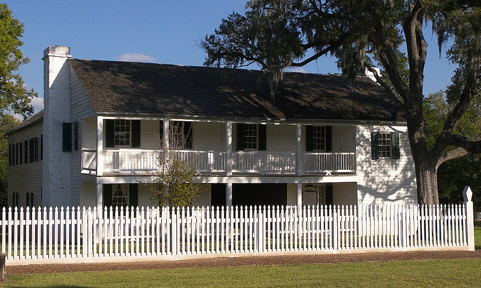
Listed on the National Register of Historic Places in 1974.
One of 5 National Register listings published here for Grimes County · listed in 1974 · category: District.
Sources: the case file at the National Archives · the National Register database, National Park Service
Regional context, not property-specific evidence. The federal wildfire occurrence database lists 87 fires within 5 miles of Anderson Historic District between 1999 and 2020, burning about 511 acres in total. 2 started naturally. 1 was recorded as arson. Distance is straight-line from the map coordinates, so a fire counted here may appear on a neighbouring settlement's page as well.
| Reported cause | Fires |
|---|---|
| Debris and open burning | 71 |
| Missing data/not specified/undetermined | 9 |
| Equipment and vehicle use | 3 |
| Natural | 2 |
| Smoking | 1 |
| Arson/incendiarism | 1 |
The most recent of them, most recent first, with the day each was reported and the service that recorded it.
| Date | Cause | Size | Reported by | Name on the report |
|---|---|---|---|---|
| 30 September 2016 | Equipment and vehicle use | 1.0 acres | Texas A & M Forest Service | CR 215 |
| 21 September 2016 | Debris and open burning | 1.0 acres | Texas A & M Forest Service | CR 405 |
| 20 September 2016 | Debris and open burning | 1.0 acres | Texas A & M Forest Service | JOHNSON |
| 19 September 2006 | Debris and open burning | 5.0 acres | Texas A & M Forest Service | not named |
| 8 August 2018 | Debris and open burning | 5.0 acres | Texas A & M Forest Service | SH 90 |
| 6 August 2005 | Debris and open burning | 1.0 acres | Texas A & M Forest Service | not named |
| 6 August 2003 | Debris and open burning | 50 acres | Texas A & M Forest Service | CONROE - 65 |
| 31 August 2018 | Natural | 5.0 acres | Texas A & M Forest Service | FM 2562 |
Regional context, not property-specific evidence. The federal mineral resources record lists 1 working within 5 miles of Anderson Historic District: 1 past producer. None of them still produces. What was taken out: Stone, Crushed/Broken. Distance is straight-line from the map coordinates, so a quarry counted here may appear on a neighbouring settlement's page as well.
| Where | Site | Commodity | Status | Recorded |
|---|---|---|---|---|
| Unknown | Stone, Crushed/Broken | Past Producer |
Regional context, not property-specific evidence. The National Weather Service names Anderson, the town this property stands in, in 14 storm reports between 1995 and 2025: 7 thunderstorm wind, 2 hail, 2 flash flood, 1 funnel cloud. The reports record 1 death. Each account below is quoted exactly as the forecast office filed it, from the NOAA Storm Events Database, and each date opens the federal record of that event.
| When | Event | Place named | Harm | What the report says |
|---|---|---|---|---|
| October 2006 | Lightning | Anderson | 1 killed, $8,000 | A 21 year old male was struck by lightning while riding a horse. He was transported to a local hospital where he was pronounced dead. Two horses in a nearby pasture were also killed by a lightning strike. |
| April 1996 | Thunderstorm Wind | Anderson | $50,000 | no account filed |
| April 2007 | Thunderstorm Wind | Anderson | $40,000 | Tree blown down onto residential home. |
| March 2002 | Hail | Anderson | $30,000 | no account filed |
| May 2000 | Thunderstorm Wind | Anderson | $15,000 | Trees down. |
| April 2006 | Thunderstorm Wind | Anderson | $10,000 | Numerous trees down in rural areas south of the town of Anderson. |
| March 2001 | Thunderstorm Wind | Anderson | $10,000 | Trees down along County Road 405. |
| December 1995 | Hail | Anderson | $10,000 | no account filed |
| June 2001 | Thunderstorm Wind | Anderson | $1,000 | Large tree down on FM 1774. |
| October 2025 | Tornado (EF0) | Anderson | - | EF-0 tornado touched down south of Anderson producing tree and structural damage starting from CR406 traveling along Holland Creek toward FM 2819, CR 222, FM 2562, FM 1486, and CR232B. One home had all windows broken and a French door sucked out of the back of the home. Another home suffered extensive roof damage. Metal roofing was found twisted around a tree nearby. It was here at the beginning of the storm path where peak winds were estimated at 79 mph. |
| June 2023 | Thunderstorm Wind | Anderson | - | Many instances of trees downed due to thunderstorm wind gusts were reported to Grimes County law enforcement. |
| May 2015 | Flash Flood | Anderson | - | Numerous roads were closed in Anderson. Numerous roads were closed in Plantersville. |
| November 2004 | Flash Flood | Anderson | - | FM 244 south of Highway 30 closed due to flooding. |
| June 2000 | Funnel Cloud | Anderson | - | Funnel cloud over CR 186. |
No historic map-sheet match is published for this property yet. That does not mean no map exists. This record needs a coordinate-quality review before it can be joined to a sheet boundary. Browse the county's mapped places while that work is pending.
Other National Register properties close enough to walk or drive between, ordered by distance from this one. Both positions come from the same geocoding pass that matched these properties to their map sheets.
| Photograph | Property | Distance | Listed |
|---|---|---|---|
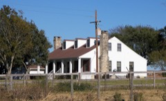 | Foster House | 6.4 miles | 1980 |
| National Archives record | The nomination case file for reference 74002072 in Record Group 79. |
| Grimes County | All 5 listed properties in this county. |