 Block
BlockFrom the record
One of 12 National Register listings published here for Kendall County · listed in 1975 · category: District.
Sources: the case file at the National Archives · the National Register database, National Park Service
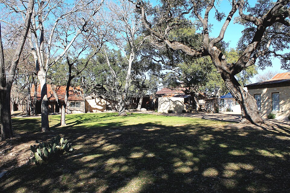
Listed on the National Register of Historic Places in 1975.
One of 12 National Register listings published here for Kendall County · listed in 1975 · category: District.
Sources: the case file at the National Archives · the National Register database, National Park Service
Regional context, not property-specific evidence. The federal wildfire occurrence database lists 41 fires within 5 miles of Sisterdale Valley District between 2006 and 2020, burning about 667 acres in total. 2 started naturally. 1 was recorded as arson. Distance is straight-line from the map coordinates, so a fire counted here may appear on a neighbouring settlement's page as well.
| Reported cause | Fires |
|---|---|
| Debris and open burning | 24 |
| Missing data/not specified/undetermined | 7 |
| Equipment and vehicle use | 6 |
| Natural | 2 |
| Smoking | 1 |
| Arson/incendiarism | 1 |
The most recent of them, most recent first, with the day each was reported and the service that recorded it.
| Date | Cause | Size | Reported by | Name on the report |
|---|---|---|---|---|
| 30 September 2013 | Debris and open burning | 2.0 acres | Texas A & M Forest Service | 473 BRUSH OUT |
| 27 September 2006 | Missing data/not specified/undetermined | 1.0 acres | Texas A & M Forest Service | not named |
| 20 September 2009 | Debris and open burning | 75 acres | Texas A & M Forest Service | N/A |
| 30 August 2015 | Debris and open burning | 2.0 acres | Texas A & M Forest Service | ZOELLER 333 |
| 23 August 2009 | Natural | 20 acres | Texas A & M Forest Service | SISTERDALE |
| 18 August 2006 | Natural | 65 acres | Texas A & M Forest Service | SCHNEIDER RANCH |
| 15 August 2018 | Debris and open burning | 7.0 acres | Texas A & M Forest Service | 925 FM473 BURN |
| 15 August 2011 | Missing data/not specified/undetermined | 15 acres | Texas A & M Forest Service | JOSHUA CREEK FIRE |
Regional context, not property-specific evidence. The National Weather Service names Sisterdale, the town this property stands in, in 19 storm reports between 1997 and 2024: 10 hail, 4 thunderstorm wind, 4 flash flood, 1 tornado. No death or injury is recorded in these reports. Each account below is quoted exactly as the forecast office filed it, from the NOAA Storm Events Database, and each date opens the federal record of that event.
| When | Event | Place named | Harm | What the report says |
|---|---|---|---|---|
| June 1998 | Hail | Sisterdale | $30,000 | Hail broke out windows in buildings. |
| September 1997 | Thunderstorm Wind | Sisterdale | $30,000 | no account filed |
| September 2011 | Thunderstorm Wind | Sisterdale | $20,000 | A thunderstorm produced wind gusts estimated at 60 mph which snapped a large oak tree in half and pulled a tin roof off a house in Sisterdale. |
| May 2006 | Hail | Sisterdale | $10,000 | Hail as large as softballs smashed the windshield and dented the body of a DPS vehicle near Sisterdale. |
| May 2017 | Thunderstorm Wind | Sisterdale | $5,000 | A thunderstorm produced wind gusts estimated at 70 mph that blew down numerous trees on the property of the Sisterdale COOP observer. |
| May 2024 | Hail | Sisterdale | - | A thunderstorm produced quarter size hail southeast of Sisterdale. |
| May 2020 | Hail | Sisterdale | - | A thunderstorm produced quarter size hail near Sisterdale. Report was from mPING. |
| May 2020 | Hail | Sisterdale | - | A thunderstorm produced quarter size hail in Sisterdale. |
| May 2012 | Hail | Sisterdale | - | A thunderstorm produced nickel to quarter size hail and wind gusts estimated at 50 mph. |
| September 2011 | Thunderstorm Wind | Sisterdale | - | A thunderstorm produced wind gusts estimated at 60 mph near Sisterdale. |
| July 2007 | Flash Flood | Sisterdale | - | Scattered showers and thunderstorms over Kendall, Comal and Bexar Counties produced general 2-3 inch rains, with up to 4 inches near Sisterdale. FM473 was shut down between Sisterdale and Kendalia due to high water. |
| January 2007 | Flash Flood | Sisterdale | - | Storms with the cold front dropped between 1 and 2 inches over eastern Kendall County with up to 4 inches in places between Sisterdale and Kendalia. FM473, FM474, and FM3351 were closed in the early afternoon for a short time due to flash flooding. |
| July 2007 | Flash Flood | Sisterdale | - | Thunderstorms across much of Kendall and Bandera Counties produced general rainfall of 2 to 3 inches, with up to 4 inches in the Sisterdale area. FM473 and FM1366 were closed through the evening. |
| July 2007 | Flash Flood | Sisterdale | - | Virtually the entire county received between 2 and 4 inches of rainfall. Highest totals were 8 inches between Sisterdale and Boerne. Nearly all rural roads in Kendall County were shut down due to the flash flooding. |
| May 1997 | Tornado (F0) | Sisterdale | - | Amateur Radio spotters observed a small , short-lived tornado near Sisterdale. |
| May 2012 | Hail | Sisterdale | - | no account filed |
| May 2012 | Hail | Sisterdale | - | no account filed |
| May 2005 | Hail | Sisterdale | - | no account filed |
| June 2003 | Hail | Sisterdale | - | no account filed |
No historic map-sheet match is published for this property yet. That does not mean no map exists. This record needs a coordinate-quality review before it can be joined to a sheet boundary. Browse the county's mapped places while that work is pending.
| National Archives record | The nomination case file for reference 75001996 in Record Group 79. |
| Kendall County | All 12 listed properties in this county. |