| June 1996 | Thunderstorm Wind | Ballinger | $100,000 | no account filed |
| May 2002 | Thunderstorm Wind | Ballinger | $90,000 | Strong thunderstorm winds blew a tree onto a truck. A few outbuildings were also destroyed. |
| March 2020 | Thunderstorm Wind | Ballinger | $70,000 | National Weather Service surveyed damage northwest of Ballinger. They found evidence of damaging straight line west winds estimated at 80 to 90 mph. These damaging winds impacted mostly rural property about 5.5 miles northwest of Ballinger to Hatchel. The swath of wind damage was about 2.5 miles wide and 5 miles long. The powerful thunderstorm winds damaged about 34 power poles, caused roof damage to a barn, destroyed a shed, removed some vinyl siding from a home, moved some hay trailers, uprooted a tree, broke numerous tree limbs, and damaged an irrigation pivot system. |
| June 1997 | Flash Flood | Ballinger | $50,000 | Six inches of rain fell in Ballinger in a three to four hour period. City streets and roads throughout the county were flooded. |
| October 1993 | Thunderstorm Wind | Ballinger | $50,000 | Golfball-size hail was reported in Norton by a weather spotter at the water plant at 1738 CST. The Ballinger Police Department reported golfball-size hail at the Ballinger city park at 1750 CST. The Runnels County Emergency Management Coordinator reported trees uprooted and downed power poles in Ballinger at 1810 CST. |
| May 1994 | Thunderstorm Wind | Ballinger | $50,000 | no account filed |
| May 2012 | Lightning | Ballinger | $45,000 | A lightning strike knocked out the Runnels County dispatch communications system. |
| May 2005 | Lightning | Ballinger | $15,000 | Lightning set a barn on fire. |
| April 2007 | Hail | Ballinger | $10,000 | Golfball size hail and 75 mph winds were reported in Ballinger as a supercell moved across the city. |
| October 2004 | Thunderstorm Wind | Ballinger | $8,000 | Tractor trailer was jacknifed due to the winds. |
| February 2004 | Thunderstorm Wind | Ballinger | $7,000 | An isolated severe thunderstorm went through the southeastern tip of Runnels County and Southwest Coleman County along Lake Ivie. Damage was limited to pole barns and camper shelters at a camp near the lake. Wind gusts were measured at 77 MPH at one location and 59 MPH at another. |
| June 2003 | Thunderstorm Wind | Ballinger | $6,000 | Serveral power lines and trees blown down. |
| April 2007 | Thunderstorm Wind | Ballinger | $5,000 | Trained spotter reported 75 mph winds and golfball size hail. |
| May 1994 | Thunderstorm Wind | Ballinger | $5,000 | no account filed |
| May 2005 | Hail | Ballinger | $3,000 | Golfball size hail fell off and on in the same location for 30 minutes. |
| May 2002 | Thunderstorm Wind | Ballinger | $3,000 | Large tree limbs were snapped off, and a propane tank was blown over. |
| April 2001 | Thunderstorm Wind | Ballinger | $2,000 | Large tree limbs downed by high winds. |
| June 1998 | Thunderstorm Wind | Ballinger | $2,000 | Several large cotton trailers overturned |
| June 2003 | Thunderstorm Wind | Ballinger | $2,000 | no account filed |
| May 1999 | Thunderstorm Wind | Ballinger | $1,000 | A carport in Ballinger was destroyed by high winds. |
| March 1995 | Tornado (F0) | Ballinger | $1,000 | Severe storms occurred in and near the Concho Valley. Spotters and local sheriff's offices reported many hail reports, though little damage was reported. A short-lived tornado was reported near Ballinger by the public and the Department of Public Safety. It ripped the roof off of a storage building. |
| May 2025 | Thunderstorm Wind | Ballinger | - | Public estimated winds gusting to 65 mph. The report was from social media and time was estimated from radar. |
| March 2024 | Hail | Ballinger | - | The Ballinger Fire Department reported golf ball size hail in Ballinger. |
| May 2024 | Hail | Ballinger | - | DELAYED REPORT: Picture from fire department of grapefruit size hail 4 miles east of Ballinger along County Road 123. |
| May 2024 | Hail | Ballinger | - | Public reported ping pong ball size hail. |
| May 2024 | Hail | Ballinger | - | Public reported golf ball size hail. |
| May 2024 | Hail | Ballinger | - | Public report of ping pong ball size hail at the Walmart in Ballinger. |
| May 2024 | Hail | Ballinger | - | Public reported quarter size hail. |
| May 2024 | Hail | Ballinger | - | An amateur radio operator relayed a report of ping pong ball size hail at the hospital in Ballinger. |
| May 2024 | Hail | Ballinger | - | Law enforcement reported golf ball size hail. |
| May 2024 | Tornado (EF2) | Ballinger | - | The tornado damaged trees off County Road 121 and County Road 122|before damaging several structures at a private residence off |County Road 123. The tornado moved a one story house off of its|foundation and severely damaged a metal barn structure next to the|home. The tornado damaged additional trees west of County Road 123. |In addition, the tornado damaged wooden utility poles along County |Road 123. The estimated peak wind of the tornado was 115 mph. |
| May 2024 | Hail | Ballinger | - | Public reported 3 inch diameter hail 1 mile east of Ballinger. |
| June 2024 | Hail | Ballinger | - | Law enforcement reported penny size hail. |
| June 2024 | Thunderstorm Wind | Ballinger | - | Law enforcement reported windows were broken in Ballinger. |
| August 2024 | Thunderstorm Wind | Ballinger | - | Law enforcement reported a power line blown down along Highway 83, just southeast of Ballinger. |
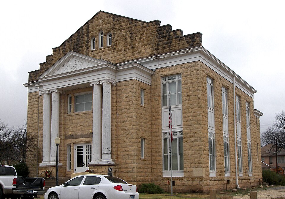
| August 2024 | Thunderstorm Wind | Ballinger | - | Social media reported a tree blown down at the Runnels County Courthouse in Ballinger. |
| August 2024 | Thunderstorm Wind | Ballinger | - | Law enforcement reported 2 power lines blown down in Ballinger. A vacant warehouse had damage to part of the roof, and part of the front of the building. |
| November 2024 | Thunderstorm Wind | Ballinger | - | Mesonet station reported a 61 mph wind gust. |
| April 2023 | Hail | Ballinger | - | There was baseball to tea cup size hail reported in Ballinger. |
| April 2023 | Hail | Ballinger | - | There was nickel to golf ball size hail covering the ground. |
| March 2023 | Hail | Ballinger | - | There were windows broken by golf ball size hail. |
| May 2023 | Hail | Ballinger | - | There was hail up to quarter size beginning to fall in the downtown area. |
| August 2023 | Thunderstorm Wind | Ballinger | - | There were power poles blown down in Ballinger due to strong winds. |
| May 2023 | Hail | Ballinger | - | The time is based on radar. |
| March 2022 | Hail | Ballinger | - | Also, wind gusts over 55 mph were reported. |
| March 2021 | Thunderstorm Wind | Ballinger | - | The Ballinger Volunteer Fire Department reported a few trees and an adjacent shelter blown down by the damaging thunderstorm winds. |
| July 2020 | Hail | Ballinger | - | The report was received through mPING. |
| October 2018 | Flood | Ballinger | - | The public posted photos on Facebook of several streets flooded in Ballinger. |
| April 2016 | Flash Flood | Ballinger | - | A trained spotter reported several low crossings flooded in Ballinger. In addition, a few vehicles were reported stalled near Bearcat Stadium. |
| July 2015 | Flash Flood | Ballinger | - | Flash flooding was reported across Ballinger. |
| April 2015 | Thunderstorm Wind | Ballinger | - | The sheriff's office reported four trees down of 21 inch diameter at FM 382 and FM 2647. In addition, large tree limbs were reported down on FM 382. |
| August 2014 | Thunderstorm Wind | Ballinger | - | The public estimated 50 to 60 mph wind gusts resulting in half inch tree limbs down. |
| May 2014 | Thunderstorm Wind | Ballinger | - | The broadcast media in Ballinger estimated a 60 mph wind gust. |
| May 2013 | Thunderstorm Wind | Ballinger | - | Law Enforcement reported two utility poles, power lines, and a mesquite tree were blown down on the west side of Ballinger. |
| May 2013 | Hail | Ballinger | - | An amateur radio operator reported numerous cars were damaged by the large hail along U.S. Highway 83 and just north of Ballinger. |
| May 2013 | Hail | Ballinger | - | A storm chaser reported baseball size hail on the ground. Time was estimated by radar and previous reports. |
| April 2012 | Hail | Ballinger | - | Nickel size hail was reported in Ballinger. |
| September 2012 | Flood | Ballinger | - | The city park in Ballinger was closed due to water rising in nearby Elm Creek. |
| September 2012 | Flood | Ballinger | - | Law enforcement froms Runnels County and Ballinger issued an evacuation order on the southeast side of Ballinger near the confluence of the Colorado River and Elm Creek. These evacuations were due to flooding. |
| April 2011 | Hail | Ballinger | - | Golfball size hail covered the ground in Ballinger. |
 Block
Block