| May 2020 | Lightning | Port Isabel | $7,000,000 | Lightning strike resulted in a structure fire at Gulfport Condominiums on South Padre Island. The fire was reported around 7 AM CDT. Time of strike was estimated by radar. |
| October 2019 | Thunderstorm Wind | Port Isabel | $2,000,000 | A cluster of potent thunderstorms developed in northeastern Mexico and moved north into Cameron County early Sunday morning. Within this cluster of storms, a strong linear downburst crossed South Padre Island from 1:24 AM CST to 1:40 AM CST. The South Padre Island Police Department reported downed power lines in between the paralleling Padre Blvd and Laguna Blvd on South Padre Island, and at one point all of South Padre Island had lost power due to 31 transmission poles that were taken down by the wind. |
| May 2023 | Thunderstorm Wind | Port Isabel | $1,500,000 | An NWS Storm Survey was conducted on South Padre Island and found several areas of damage along South Padre Island. The survey found a couple of downed fences in the Isla Blanca area on the southern side of the island along with a couple of flipped recreational vehicles (RVs) that were exposed to the wind but only anchored by unfastened scissor jacks. The flipped RVs were initially reported by a member of the public shortly after the storms moved offshore. Winds here were measured at the Brazos Santiago (BZST2) Texas Coastal Ocean Observing Network site (TCOON) to be near 84 mph. A little farther north along the island, the metal roof at Longboards was peeled back along with a canvas type material that was blown onto the second story balcony of an older apartment complex along W Palm Street. Some of the most extensive damage was witnessed at the El Castile Condo at the corner of W Polaris Dr and Laguna Blvd, which lost its roof and roof decking and exposed at least two dozen units to the elements during the storm. Lastly, the South Padre Island Convention Center's Main Exposition hall lost a significant portion of its roof along with a snapped ash tree nearby, suggesting wind speeds remaining near 85 to 90 mph. Additionally, South Padre Island Police Department reported multiple powerlines down across the island immediately after the event.||Note: times listed are based on the survey results. All severe criteria (58 mph or greater wind gusts) occurred between 148 and 206 AM based on reports from various platforms in the area. |
| May 2023 | Thunderstorm Wind | Port Isabel | $100,000 | The Port Isabel Police Department shared pictures on social media showing damage to the Sunoco Gas station awning at the corner of Highway 48 and Highway 100 and an ice chest that had moved several feet from the front of the building. Several pictures of powerlines down were also shown. NOAA's National Ocean Service (NOS) site at Port Isabel (PTIT2) recorded wind gusts of 52 knots, or 60 mph, at 1:54AM CDT, and was used as a guide for when the strongest winds were ending. |
| July 2008 | Flood | Port Isabel | $42,750 | The combination of 14 to 18 inches of rain, poor drainage issues, and the overarching fact that the flat, saturated landscape of the Lower Rio Grande River Delta drains very slowly, maintained widespread flood conditions well after the rains ended during the early morning of the 24th. Numerous roads and neighborhoods, particularly across northern Cameron County, remained flooded right through the weekend which followed Dolly's passage. In some areas, where ground drainage mechanisms were exceptionally poor, the flooding persisted into August. ||One of these areas included neighborhoods across western Cameron County, including La Feria and Santa Rosa, as well as others from San Benito through Harlingen, Rio Hondo, and extending toward Arroyo City, and continuing in some neighborhoods near Bayview and Laguna Heights.||Total property damage from the flooding in Cameron County remains unknown. Insured damages reported from FEMA as of October 1st were estimated to be just under $90 thousand, not including agricultural losses, which are estimated to be much greater. Uninsured damages in locations in the flood zone would likely multiply these values many times over. Note that damage values are split between the longer duration general flood described here, and the earlier flash flood period. Updates will be provided as more data are received. |
| July 2008 | Flash Flood | Port Isabel | $42,750 | A little before noon on the 23rd, the southern and western eyewall of Huricane Dolly began to flare up, with radar data indicating reflectivity above 50 dBZ, which is indicative of blinding torrents of rain. These torrents, falling on top of already heavy rainfall earlier that morning, began to produce high water levels, likely 3 feet or more, starting in Port Isabel, Bayview, and Laguna Vista. Soon after the eyewall intensification, Dolly's center made landfall along the Cameron/Willacy County line, then very slowly edged west through southern Willacy County through the rest of the afternoon and evening, reaching the Hidalgo County line at around 9 PM CDT. ||Throughout the afternoon, blinding, torrential rains persisted over northern and eastern Cameron County, and flash flooding of increasingly high water - as high as 5 feet in some places - spread west into Las Yescas, Rio Hondo, Harlingen, Combes, Santa Rosa, San Benito, and La Feria. Most of San Benito was under water at one point during the late afternoon.||Measured and estimated rainfall totals in the flash flood areas from Dolly ranged from 14 to 18 inches, though there was one unconfirmed report of more than 20 inches along the Cameron/Willacy County line north of Rio Hondo. Hundreds of homes sustained some level of inundation, and farmland was inundated across the flood zone as well. High water and general flooding would continue for another day or two, except much longer in backed up drainage areas.||Total property damage from the flooding in Cameron County remains unknown. Insured damages reported from FEMA as of October 1st were estimated to be just under $90 thousand, not including agricultural losses, which are estimated to be much greater. Uninsured damages in locations in the flood zone would likely multiply these values many times over. Note that damage values are split between the initial flash flood and the longer duration flood. Updates will be provided as more data are received. |
| May 2010 | Thunderstorm Wind | Port Isabel | $25,000 | The thunderstorm complex continued to generate strong, damaging winds as it moved across southeast Cameron County, affecting Bayview, Port Isabel, and South Padre Island. The strongest wind core appeared to rip through Port Isabel across the southern portion of the Town of South Padre Island. At Port Isabel, numerous power outages were the result of power lines and poles blown down at several locations throughout the city. ||As the storm reached South Padre Island, the U.S. Coast Guard Station located in the Bayside recorded a 64 mph wind gust (at 936 AM CST, a six minute recorded observation). At nearly the same time (937 AM CST), a 60 mph gust was recorded by a Citizen Weather Observer Program sensor on Sheepshead Street. In the same area, palm trees were blown down along Coral Street; large metal signs were blown from their mounts along the Queen Isabella Causeway Bridge, and more power lines and a transformer were blown down at the intersection of Constellation Dr. and Laguna Boulevard, all between 930 and 940 AM CST (end time estimated by radar). |
| May 2023 | Thunderstorm Wind | Port Isabel | $20,000 | Port Isabel police department reported several powerlines down around town. Timing based on radar. While wind speeds are estimated, the NOAA National Ocean Service (NOS) at Port Isabel (PTIT2) recorded wind gusts of 52 knots, or 60 mph, at 1:54AM CDT. |
| March 2025 | Tornado (EF0) | Port Isabel | $15,000 | The manager and security officer of the Long Island Village (Port Isabel) swing bridge reported damage from a likely small and brief tornado that crossed the bridge just after 1 AM CST (2 AM CDT) on March 28th. Dollar value of the damage is estimated. |
| April 2023 | Thunderstorm Wind | Port Isabel | $10,000 | Powerlines and traffic lights were downed at the intersection of Highway 100 and Padre Blvd on South Padre Island. Additional images from social media show the sign for the Coral Reef Lounge that had fallen on top of a Camaro. Time approximated based on radar and time report was received. |
| June 2010 | Flash Flood | Port Isabel | $10,000 | More than 6 inches of nearly steady rain in less than 12 hours created poor drainage and flash flood conditions in the Town of South Padre Island, where main and secondary roads became impassible for a period of time during the afternoon of June 30th. While water lapped at structures along Padre Boulevard (Highway 100), no significant damage was reported from the freshwater rainfall as of this writing. |
| May 2009 | Thunderstorm Wind | Port Isabel | $10,000 | Measured winds of 53 mph were recorded at the Isla Grande Resort on the south side of the Town of South Padre Island as a strong thunderstorm swept through. Awnings blew down nearby at Isla Blanca park, where winds may have been a bit higher in the exposed area. |
| October 2005 | Thunderstorm Wind | Port Isabel | $10,000 | Damaging winds associated with strong thunderstorms in the area completely tore out a canopy from its foundation at a local car wash. |
| June 2016 | Thunderstorm Wind | Port Isabel | $5,000 | Thunderstorm wind gusts downed an insecure and improperly installed metal awning onto a truck at the 410 Plaza on South Padre Island. |
| April 1995 | Thunderstorm Wind | Port Isabel | $5,000 | Power lines were blown down in Port Isabel. Sign damage was reported at Port Isable and South Padre Island. A camper trailer was blown over at South Padre Island. |
| June 2010 | Tornado (EF0) | Port Isabel | $4,000 | A fence was reported blown in the middle of the street, and tree limbs were knocked down, behind a convenience store at the intersection of State Highway 100 and Musina Street in Port Isabel. Damage occurred within a wind speed couplet embedded within a rain band, which had a trajectory that later produced a stronger tornado in San Pedro (southwest Cameron County) about 25 minutes later. Estimated wind speed was between 50 and 55 mph. |
| July 2019 | Tornado (EF0) | Port Isabel | $500 | Beach Patrol and Emergency Management from the City of South Padre Island, as well as public video, showed a brief waterspout moved onshore near Gulf Boulevard City Beach Access #10. Before dissipating, the waterspout displaced beach umbrellas and tents, with minimal damage. Time estimated from video, reports, and radar. |
| March 2025 | Thunderstorm Wind | Port Isabel | - | The C-MAN station at Brazos Santiago, just inshore of the Isla Blanca jetty but adjacent to the park on the barrier island, recorded a 51 knot gust at 2 AM CST on March 27th. No damage was reported as of this writing. |
| October 2025 | Tornado (EFU) | Port Isabel | - | A short-lived landspout/waterspout nudged over the sand flats about 200 yards southeast of the U.S. Coast Guard station, and ripped apart a small building housing a generator near the aerostat dirigible located there. An instantaneous 20-foot wind gusts of 47 mph was reported at that site, which was less than 100 feet from the damaged structure. A wind gusts of 33.82 knots was recorded at the nearby Brazos Santiago platform, 0.5 miles to the east. Confirmation of the landspout/waterspout was provided by night camera video. |
| September 2024 | Flash Flood | Port Isabel | - | Emergency Managers provided several photos of flood waters on Padre Blvd extending as far north as the intersection of Padre Blvd and Dolphin Street. Poor drainage in the area likely contributed to water depth between 2 and 3 feet along the highway. Damage was unknown as of this writing. |
| September 2024 | Flood | Port Isabel | - | Cameron County Parks Department reported photographic evidence of 1 to 2 feet of standing water along Park Road 100 north of the City of South Padre Island during the morning of September 10th. |
| April 2023 | Flood | Port Isabel | - | Several members of the public posted images of Padre Blvd on South Padre Island covered in one to two feet of water. One picture showed the water halfway up the wheels of a car near the Grapevine Cafe. The cause of this was the squall line that moved through early in the afternoon of April 23rd. |
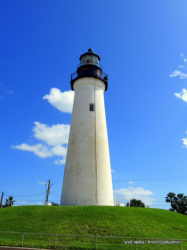
| April 2023 | Thunderstorm Wind | Port Isabel | - | A palm tree was blown down in front of the Port Isabel Lighthouse and fell across Highway 100, blocking most of the west bound lanes. Time was estimated by radar and the 57 mph gust at Port Isabel's NOAA National Ocean Service site (PTIT2) about 0.6 miles away. |
| May 2023 | Thunderstorm Wind | Port Isabel | - | The aerostat site anemometer at the South Padre Island Coast Guard station reported a peak wind gust of 77.3 knots, or 89 mph, at 1:49AM CDT. |
| May 2022 | Thunderstorm Wind | Port Isabel | - | The Texas Coastal Ocean Observing Network (TCOON) site at SPI Brazos Santiago, right near the entrance to Port of Brownsville at the southern tip of South Padre Island, recorded a wind gust of 61 knots, or 70 mph. |
| May 2022 | Thunderstorm Wind | Port Isabel | - | The Texas Coastal Ocean Observing Network (TCOON) site at the South Padre Island Coast Guard Station recorded a wind gust of 54 knots, or 62 mph. This site is on the western side of South Padre Island, about 0.3 miles west of the entrance to Isla Blanca State Park. |
| July 2021 | Flood | Port Isabel | - | Reports received via social media of Marina Drive in Port Isabel covered with several inches of water. |
| July 2021 | Flood | Port Isabel | - | Video received via social media showing several portions of Padre Island Boulevard covered with water along with numerous side streets also experiencing flooding. |
| April 2020 | Thunderstorm Wind | Port Isabel | - | The observation platform at Brazos Santiago, just inshore of the entrance to the Brownsville Ship Channel and along the south side of the Isla Blanca jetty, recorded a wind gusts of 50.54 knots at 1136 AM local time. No damage was reported on the southern tip of South Padre Island. |
| April 2016 | Hail | Port Isabel | - | Several public reports through social media of quarter sized hail on South Padre Island. |
| May 2015 | Flash Flood | Port Isabel | - | South Padre Island Police Department reported water 1 to 1.5 feet to knee deep on some roads, with only the center lane open on Padre Boulevard from the 3500 block to the 5000 block. |
| May 2014 | Thunderstorm Wind | Port Isabel | - | The U.S. Coast Guard weather station, on the bayside of South Padre Island just south of the Queen Isabella Causeway, recorded a wind gust of 50 knots (58 mph). Shortly after, power outages were reported across the southern portion of South Padre Island. |
| May 2014 | Hail | Port Isabel | - | Public reported penny sized hail in Port Isabel. |
| April 2012 | Thunderstorm Wind | Port Isabel | - | As the storm raced east onto South Padre Island, a downburst developed which produced winds up to 57 mph at the Port Isabel Coast Guard Station (along Laguna Vista Bay) and a 1/2 mile swath of estimated 70 to 75 mph winds across the central portion of the resort area of South Padre Island, all occurring roughly between 622 and 628 pm CDT. Reports from residents indicated two small boats sunk at a bayside dock, two winds blown out of shuttle buses, a restaurant awning blown down, a utility pole knocked down at a service station, and lawn furniture strewn around one resident's yard. Reports came from trained spotters and law enforcement. |
| May 2010 | Tornado (EF0) | Port Isabel | - | An off duty Central Region National Weather Service Employee reported a waterspout that briefly moved onshore near Port Isabel. No damage was reported. |
| October 2009 | Thunderstorm Wind | Port Isabel | - | An amateur radio operator reported that the Isla Grande Resort weatherbug station recorded a peak wind gust of 59 miles per hour when a thunderstorm moved through the resort during the passage of a cold front. |
| June 2002 | Flash Flood | Port Isabel | - | Intense thunderstorms produced flash flooding of roads and ditches on South Padre Island. An off-duty NWS employee reported 10 inches of water flowing freely on roadways in the area. |
| May 2000 | Thunderstorm Wind | Port Isabel | - | (Refer to narrative written for Laguna Vista.) |
| February 1999 | Waterspout | Port Isabel | - | Two waterspouts sighted from a ship. |
| May 2005 | Thunderstorm Wind | Port Isabel | - | no account filed |
 Block
Block