 Block
BlockFrom the record
One of 2 National Register listings published here for Pecos County · listed in 1977 · category: Site.
Sources: the case file at the National Archives · the National Register database, National Park Service · the Wikipedia article
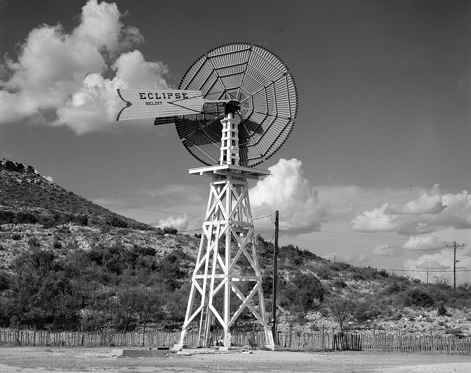
Listed on the National Register of Historic Places in 1977.
One of 2 National Register listings published here for Pecos County · listed in 1977 · category: Site.
Sources: the case file at the National Archives · the National Register database, National Park Service · the Wikipedia article
Regional context, not property-specific evidence. The federal wildfire occurrence database lists 6 fires within 5 miles of Canon Ranch Railroad Eclipse Windmill between 2011 and 2020, burning about 63,817 acres in total. 3 started naturally. None was recorded as arson. Distance is straight-line from the map coordinates, so a fire counted here may appear on a neighbouring settlement's page as well.
| Reported cause | Fires |
|---|---|
| Natural | 3 |
| Missing data/not specified/undetermined | 1 |
| Equipment and vehicle use | 1 |
| Power generation/transmission/distribution | 1 |
The most recent of them, most recent first, with the day each was reported and the service that recorded it.
| Date | Cause | Size | Reported by | Name on the report |
|---|---|---|---|---|
| 7 August 2019 | Missing data/not specified/undetermined | 75 acres | Texas A & M Forest Service | CANON RANCH |
| 14 August 2019 | Natural | 37 acres | Texas A & M Forest Service | YUCCA BUTTE |
| 22 July 2020 | Power generation/transmission/distribution | 5.0 acres | Texas A & M Forest Service | CANNON |
| 3 May 2018 | Natural | 115 acres | Texas A & M Forest Service | CANNON RANCH |
| 11 April 2011 | Natural | 63,427 acres | Texas A & M Forest Service | CANNON COMPLEX |
| 12 October 2019 | Equipment and vehicle use | 158 acres | Texas A & M Forest Service | NOELKE 2 |
Regional context, not property-specific evidence. The National Weather Service names Sheffield, the town this property stands in, in 45 storm reports between 1994 and 2023: 34 hail, 7 flash flood, 3 thunderstorm wind, 1 tornado. No death or injury is recorded in these reports. Each account below is quoted exactly as the forecast office filed it, from the NOAA Storm Events Database, and each date opens the federal record of that event.
| When | Event | Place named | Harm | What the report says |
|---|---|---|---|---|
| June 1999 | Hail | Sheffield | $1,800,000 | no account filed |
| July 2004 | Flash Flood | Sheffield | $130,000 | Heavy rainfall farther north over eastern Pecos County resulted in a crest of twenty feet along the Pecos River just east of Sheffield around 06:00 CST. This crest combined with the continuation of heavy rainfall caused extensive flash flooding in rural areas east and southeast of the city. Shortly before 16:00 CST travelers on Interstate 10 witnessed a pickup truck and a camper trailer floating beneath the Pecos River bridge. A search downstream by local authorities ensued, but many rural location across along the river were inaccessible due to extensive flooding. It was later determined that the pickup and camper trailer were swept into the Pecos River by flash flooding on the Pecos River Ranch near Sheffield. The vehicle and trailer were vacant when they were overtaken by raging flood waters, and were ultimately found many miles down river near the Rio Grande. Several head of cattle also were killed in the flood waters. |
| April 2009 | Hail | Sheffield | $17,500 | The observer's windshield was broken by the hail, along with 4 other vehicles receiving damage. The roofs of a few homes were also damaged by the large hail. |
| May 2003 | Hail | Sheffield | $15,000 | An isolated and very intense supercell thunderstorm affected parts of eastern Pecos County. The storm generally remained south of Interstate 10, between Bakersfield and Sheffield. A rancher reported quarter size hail in rural areas south of the interstate. Radar imagery suggested the storm was potentially tornadic as it approached Sheffield, but spotter reports were unavailable and no tornadoes were observed. The public and law enforcement reported "orange" size hail along Interstate 10 north of Sheffield as the rada- detected circulation passed directly over the city. |
| May 1999 | Hail | Sheffield | $10,000 | no account filed |
| March 2004 | Thunderstorm Wind | Sheffield | $5,000 | A tin roof was blown off of a storage barn by severe thunderstorm winds. |
| October 1994 | Hail | Sheffield | $500 | The Pecos County Sheriff's Office reported dime-size hail. |
| July 2010 | Flash Flood | Sheffield | - | At 510 AM CST, a COOP observer reported significant flooding in and around Sheffield, TX. Highway 349 just south of Sheffield was impassable and closed due to high water. |
| April 2009 | Flash Flood | Sheffield | - | Spotters reported 6 inches of flowing water across roadways. No damage or injuries were reported. |
| September 2008 | Flash Flood | Sheffield | - | At 2255 CST, local law enforcement in Sheffield reported several high water rescues in progress in and around Sheffield. |
| September 2008 | Flash Flood | Sheffield | - | At 0140 CST, local law enforcement continued to report ongoing high water rescues in the community of Sheffield. |
| October 2008 | Hail | Sheffield | - | The Sheffield Fire Department reported skylight windows were knocked out due to quarter sized hail on the western side of town. |
| March 2006 | Hail | Sheffield | - | The Pecos County Sheriff's Department reported 3 to 4 inches of golf ball sized hail covering Interstate 10 between mile markers 319 and 328. Mile marker 328 is about 1/2 mile north of Sheffield. |
| June 2006 | Thunderstorm Wind | Sheffield | - | The fire chief in Sheffield reported 60 mph winds. No damage was reported. |
| August 2004 | Hail | Sheffield | - | A small cluster of severe thunderstorms produced large hail over Sheffield. |
| July 2004 | Flash Flood | Sheffield | - | State Highway 349 was closed from Sheffield south into Terrell County after Pecos County emergency officials successfully rescued motorists from flood waters near the intersection of Farm to Market Road 2400. Intermittent flash flooding along the route also made travel hazardous across Pecos County. |
| October 2004 | Flash Flood | Sheffield | - | The public reported flash flooding that resulted in high water flowing over Farm to Market Road 1901 north of Sheffield. In addition, fire department officials reported flash flooding that caused high water to flow through several city streets. |
| April 1999 | Hail | Sheffield | - | This storm formed southeast of Fort Stockton and moved over open country until coming to Sheffield. |
| June 2023 | Hail | Sheffield | - | no account filed |
| May 2021 | Hail | Sheffield | - | no account filed |
| May 2021 | Hail | Sheffield | - | no account filed |
| April 2019 | Hail | Sheffield | - | no account filed |
| May 2019 | Hail | Sheffield | - | no account filed |
| May 2019 | Hail | Sheffield | - | no account filed |
| May 2019 | Hail | Sheffield | - | no account filed |
| May 2014 | Hail | Sheffield | - | no account filed |
| April 2012 | Hail | Sheffield | - | no account filed |
| April 2009 | Hail | Sheffield | - | no account filed |
| April 2009 | Hail | Sheffield | - | no account filed |
| April 2009 | Hail | Sheffield | - | no account filed |
| April 2009 | Hail | Sheffield | - | no account filed |
| April 2009 | Hail | Sheffield | - | no account filed |
| April 2009 | Hail | Sheffield | - | no account filed |
| October 2006 | Hail | Sheffield | - | no account filed |
| June 2005 | Hail | Sheffield | - | no account filed |
| May 2003 | Hail | Sheffield | - | no account filed |
| April 2002 | Hail | Sheffield | - | no account filed |
| May 2000 | Hail | Sheffield | - | no account filed |
| May 1999 | Hail | Sheffield | - | no account filed |
| May 1999 | Hail | Sheffield | - | no account filed |
| May 1999 | Hail | Sheffield | - | no account filed |
| June 1999 | Thunderstorm Wind | Sheffield | - | no account filed |
| May 1996 | Hail | Sheffield | - | no account filed |
| May 1996 | Hail | Sheffield | - | no account filed |
| April 1994 | Tornado (F0) | Sheffield | - | no account filed |
No historic map-sheet match is published for this property yet. That does not mean no map exists. This record needs a coordinate-quality review before it can be joined to a sheet boundary. Browse the county's mapped places while that work is pending.
| National Archives record | The nomination case file for reference 77001465 in Record Group 79. |
| Wikipedia article | Community-written account of this property, licensed CC BY-SA. |
| Pecos County | All 2 listed properties in this county. |