 Block
BlockFrom the record
One of 9 National Register listings published here for Goliad County · listed in 1979 · category: Building.
Sources: the case file at the National Archives · the National Register database, National Park Service
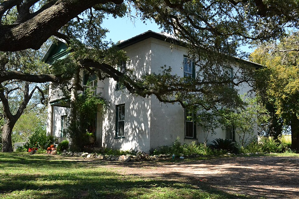
Listed on the National Register of Historic Places in 1979.
One of 9 National Register listings published here for Goliad County · listed in 1979 · category: Building.
Sources: the case file at the National Archives · the National Register database, National Park Service
Regional context, not property-specific evidence. The federal wildfire occurrence database lists 60 fires within 5 miles of Capt. Barton Peck House between 2006 and 2018, burning about 2,054 acres in total. 2 started naturally. None was recorded as arson. Distance is straight-line from the map coordinates, so a fire counted here may appear on a neighbouring settlement's page as well.
| Reported cause | Fires |
|---|---|
| Debris and open burning | 23 |
| Equipment and vehicle use | 15 |
| Missing data/not specified/undetermined | 14 |
| Smoking | 4 |
| Natural | 2 |
| Misuse of fire by a minor | 1 |
| Power generation/transmission/distribution | 1 |
The most recent of them, most recent first, with the day each was reported and the service that recorded it.
| Date | Cause | Size | Reported by | Name on the report |
|---|---|---|---|---|
| 9 September 2011 | Missing data/not specified/undetermined | 500 acres | Texas A & M Forest Service | GRASS FIRE |
| 4 September 2016 | Debris and open burning | 2.0 acres | Texas A & M Forest Service | 16-17 |
| 10 September 2014 | Debris and open burning | 8.0 acres | Texas A & M Forest Service | 033-14 |
| 9 August 2013 | Debris and open burning | 5.0 acres | Texas A & M Forest Service | OAK ST. |
| 22 August 2016 | Debris and open burning | 5.0 acres | Texas A & M Forest Service | 16-14 |
| 21 August 2014 | Debris and open burning | 1.0 acres | Texas A & M Forest Service | 030-14 |
| 20 August 2017 | Equipment and vehicle use | 1.5 acres | Texas A & M Forest Service | 17-33 |
| 28 July 2017 | Equipment and vehicle use | 20 acres | Texas A & M Forest Service | 17-31 |
Regional context, not property-specific evidence. The National Weather Service names Goliad, the town this property stands in, in 65 storm reports between 1993 and 2024: 29 hail, 16 flash flood, 14 thunderstorm wind, 4 tornado. The reports record 1 death. Each account below is quoted exactly as the forecast office filed it, from the NOAA Storm Events Database, and each date opens the federal record of that event.
| When | Event | Place named | Harm | What the report says |
|---|---|---|---|---|
| June 1997 | Flash Flood | Goliad | 1 killed | A nearly stationary area of showers and thunderstorms developed across the county. At 3pm CST...numerous roadways became flooded. The resulting torrential downpours forced a nearby creek to become dangerously rapid as 5 to 6 inches of rainfall fell in approximately 3 hours. Between 4 and 5 pm CST...a 21-year old man drowned as a result after an attempt to cross the swollen creek on horseback. |
| June 2017 | Hail | Goliad | $250,000 | Baseball sized hail occurred in the city of Goliad. |
| June 2021 | Thunderstorm Wind | Goliad | $50,000 | Significant structural damage occurred to the side of the building at the Grace Temple Church in Goliad. |
| May 2019 | Thunderstorm Wind | Goliad | $10,000 | A tin shed was blown over on a farm near Goliad. |
| April 2015 | Thunderstorm Wind | Goliad | $10,000 | Many large trees were snapped at Goliad State Park. |
| April 2015 | Thunderstorm Wind | Goliad | $10,000 | Power lines were blown across the city of Goliad. |
| April 2012 | Hail | Goliad | $10,000 | Golf ball sized hail was reported in Goliad. |
| May 2019 | Hail | Goliad | $5,000 | Quarter sized hail occurred in Goliad. |
| June 2017 | Hail | Goliad | $5,000 | Quarter sized hail occurred on the north side of Goliad. |
| April 2015 | Flash Flood | Goliad | $5,000 | Flooding occurred at Goliad State Park with water into the mission church building. |
| May 2022 | Thunderstorm Wind | Goliad | $1,000 | Power lines were blown down near Highway 183 and San Fernando Road in Goliad. |
| April 2024 | Hail | Goliad | - | Cocorahs station TX-GD-8 reported ping pong size hail. Time estimated by radar. |
| April 2024 | Hail | Goliad | - | Law enforcement reported large hail, time estimated by radar. |
| May 2019 | Thunderstorm Wind | Goliad | - | Public estimated winds gusted up to 60 mph in Goliad. |
| June 2017 | Hail | Goliad | - | Public reported quarter sized hail in Goliad. |
| June 2017 | Thunderstorm Wind | Goliad | - | Public estimated 60 mph winds in Goliad. |
| April 2015 | Hail | Goliad | - | Goliad Sheriffs Office reported quarter sized hail in Goliad. |
| April 2015 | Hail | Goliad | - | Quarter sized hail occurred in Goliad. |
| April 2013 | Flash Flood | Goliad | - | Goliad Sheriff's Office reported water over the road at several intersections within the city of Goliad. |
| April 2013 | Heavy Rain | Goliad | - | Observer measured 5.15 inches of rainfall. |
| April 2013 | Heavy Rain | Goliad | - | Observer measured 4.51 inches of rainfall in Goliad. |
| April 2012 | Hail | Goliad | - | Ping pong ball sized hail was reported on Farm to Market road 1726 northwest of Goliad. |
| May 2009 | Flash Flood | Goliad | - | Two to three inches of rainfall fell in a short time period over the city of Goliad, producing flash flooding of low lying areas and streets. |
| May 2009 | Hail | Goliad | - | Generally penny sized hail fell i nthe city of Goliad, with a few golfball sized hail stones reported. |
| March 2007 | Flash Flood | Goliad | - | Flash flooding of a low water crossing along U.S. 59 was reported roughly 10 miles southwest of Goliad. U.S. 59 was reduced to one lane. Law enforcement reported one vehicle was swept off the road, but the driver was able to escape unharmed.| |
| March 2007 | Flash Flood | Goliad | - | Water reported over U.S. 59 west in Goliad. |
| September 2007 | Tornado (EF0) | Goliad | - | A picture was taken of a tornado that formed just briefly off of Highway 183 and F.M. 622, 3 miles north of Goliad. The tornado remained over open country and produced no damage. The time of the picture and tornado was not exactly known.| |
| December 2002 | Thunderstorm Wind | Goliad | - | Large tree reported down. |
| May 2002 | Hail | Goliad | - | Tree limbs and fences damaged. |
| September 2002 | Tornado (F0) | Goliad | - | Tornado was associated with Tropical Depression Fay. No damage reported. |
| May 2001 | Flash Flood | Goliad | - | Flooding reported on highway 59 and 183 with numerous county roads closed. |
| November 2001 | Tornado (F1) | Goliad | - | 5 NW Goliad - On highway 239 halfway to Charco. |
| November 2001 | Tornado (F0) | Goliad | - | Sheriff reported Tornado along west side of Highway 183 |
| November 2001 | Hail | Goliad | - | HAIL REPORTED 5 MILES NW OF GOLIAD. |
| July 2000 | Thunderstorm Wind | Goliad | - | Thunderstorm wind gust downed a utility pole along FM 239. |
| April 1999 | Flash Flood | Goliad | - | Sheriff reports of numerous roads covered by water throughout the city. |
| January 1998 | Thunderstorm Wind | Goliad | - | Park Ranger reported several large trees downed by thunderstorm wind resulting in road closures. |
| February 1998 | Hail | Goliad | - | Public report of quarter sized hail on highway 183. |
| February 1998 | Thunderstorm Wind | Goliad | - | Sheriff report of thunderstorm wind gust. |
| May 1997 | Hail | Goliad | - | Spotter report of quarter sized hail. |
| June 1997 | Hail | Goliad | - | Sheriff report of dime sized hail. |
| December 1997 | Hail | Goliad | - | NWS Spotter of dime sized hail. |
| December 1997 | Hail | Goliad | - | NWS Spotter report of golfball sized hail. |
| December 1997 | Thunderstorm Wind | Goliad | - | NWS Spotter report of structural damage to a chimney due to strong thunderstorm wind gust. |
| September 1997 | Flash Flood | Goliad | - | Numerous roadways flooded. |
| April 1993 | Thunderstorm Wind | Goliad | - | Several trees were uprooted south of Goliad near the Refugio County line. |
| October 1993 | Hail | Goliad | - | The Goliad Sheriff's Office reported several trees damaged in Schroder. Approximately five minutes later the Department of Public safety reported baseball-size hail at the intersection of Highway 183 and FM 119. |
| November 2004 | Hail | Goliad | - | no account filed |
| April 2002 | Hail | Goliad | - | no account filed |
| May 2002 | Hail | Goliad | - | no account filed |
| September 2002 | Flash Flood | Goliad | - | no account filed |
| September 2002 | Flash Flood | Goliad | - | no account filed |
| November 2001 | Hail | Goliad | - | no account filed |
| November 2001 | Hail | Goliad | - | no account filed |
| July 2000 | Hail | Goliad | - | no account filed |
| May 1999 | Thunderstorm Wind | Goliad | - | no account filed |
| October 1998 | Flash Flood | Goliad | - | no account filed |
| February 1998 | Hail | Goliad | - | no account filed |
| March 1997 | Flash Flood | Goliad | - | no account filed |
| March 1997 | Flash Flood | Goliad | - | no account filed |
No historic map-sheet match is published for this property yet. That does not mean no map exists. This record needs a coordinate-quality review before it can be joined to a sheet boundary. Browse the county's mapped places while that work is pending.
Other National Register properties close enough to walk or drive between, ordered by distance from this one. Both positions come from the same geocoding pass that matched these properties to their map sheets.
| Photograph | Property | Distance | Listed |
|---|---|---|---|
 | Dr. L.W. and Martha E.S. Chilton House | 0.5 miles | 1998 |
| Charles H. and Catherine B. Baker House | 0.6 miles | 1985 | |
 | Goliad County Courthouse Historic District | 0.6 miles | 1976 |
 | Old Market House Museum | 0.7 miles | 1972 |
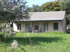 | Jessie W. Stoddard House | 0.8 miles | 1992 |
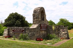 | Goliad State Park Historic District | 1.3 miles | 2001 |
| National Archives record | The nomination case file for reference 79002947 in Record Group 79. |
| Goliad County | All 9 listed properties in this county. |