 Block
BlockFrom the record
One of 2 National Register listings published here for Maverick County · listed in 1980 · category: Building.
Sources: the case file at the National Archives · the National Register database, National Park Service

Listed on the National Register of Historic Places in 1980.
One of 2 National Register listings published here for Maverick County · listed in 1980 · category: Building.
Sources: the case file at the National Archives · the National Register database, National Park Service
Regional context, not property-specific evidence. The federal wildfire occurrence database lists 32 fires within 5 miles of Maverick County Courthouse between 2008 and 2011, burning about 594 acres in total. None started naturally. 1 was recorded as arson. Distance is straight-line from the map coordinates, so a fire counted here may appear on a neighbouring settlement's page as well.
| Reported cause | Fires |
|---|---|
| Missing data/not specified/undetermined | 29 |
| Equipment and vehicle use | 1 |
| Arson/incendiarism | 1 |
| Misuse of fire by a minor | 1 |
The most recent of them, most recent first, with the day each was reported and the service that recorded it.
| Date | Cause | Size | Reported by | Name on the report |
|---|---|---|---|---|
| 4 May 2011 | Arson/incendiarism | 500 acres | Texas A & M Forest Service | COMMANCHE RANCH |
| 9 March 2008 | Missing data/not specified/undetermined | under an acre | Texas A & M Forest Service | not named |
| 9 March 2008 | Missing data/not specified/undetermined | 1.0 acres | Texas A & M Forest Service | not named |
| 8 March 2008 | Missing data/not specified/undetermined | 1.0 acres | Texas A & M Forest Service | not named |
| 8 March 2008 | Missing data/not specified/undetermined | 1.0 acres | Texas A & M Forest Service | not named |
| 7 March 2008 | Missing data/not specified/undetermined | under an acre | Texas A & M Forest Service | not named |
| 7 March 2008 | Missing data/not specified/undetermined | 1.0 acres | Texas A & M Forest Service | not named |
| 6 March 2008 | Missing data/not specified/undetermined | 1.0 acres | Texas A & M Forest Service | not named |
Regional context, not property-specific evidence. The federal mineral resources record lists 3 workings within 5 miles of Maverick County Courthouse: 3 producers. All of them still produce. What was taken out: Fluorine-Fluorite, Sand and Gravel, Construction. Distance is straight-line from the map coordinates, so a quarry counted here may appear on a neighbouring settlement's page as well.
| Where | Site | Commodity | Status | Recorded |
|---|---|---|---|---|
| Hopedale Pit | Sand and Gravel, Construction | Producer | Gravel, Sand | |
| Eagle Pass Fluorspar Mill | Fluorine-Fluorite | Producer | ||
| Piedras Negras Operations | Fluorine-Fluorite | Producer |
Regional context, not property-specific evidence. The National Weather Service names Eagle Pass, the town this property stands in, in 46 storm reports between 1995 and 2025: 24 hail, 11 flash flood, 7 thunderstorm wind, 4 tornado. The reports record 9 deaths and 3 injuries. Each account below is quoted exactly as the forecast office filed it, from the NOAA Storm Events Database, and each date opens the federal record of that event.
| When | Event | Place named | Harm | What the report says |
|---|---|---|---|---|
| April 2007 | Tornado (EF3) | Eagle Pass | 7 killed, $80,000,000 | A supercell thunderstorm formed in the Mexican mountains west of Piedras Negras, across the Rio Grande from Eagle Pass. Reports from west of the Rio Grande indicate that a large and devastating tornado stuck Piedras Negras from the west, then dissipated on the west side of the Rio Grande. The supercell crossed the Rio Grande near 6:00 pm CST and struck the community of Rosita Valley near 6:01pm CST. Severe outflow winds from the storm estimated at between 80 mph and 100 mph struck the community first, causing minor damage to houses and mobile homes. Roofs were partially lifted, exteriors of homes were damaged, and trees were knocked over. Following the wind damage, hail to the size of golfballs struck the area, along with very heavy rain.|Following the winds and hail, the tornado struck next. The team found the tornado touchdown point approximately one-quarter mile to the southwest of the Rosita Valley Elementary School. It struck a four room home destroying the outer walls and leaving only the interior walls standing. This damage was rated as EF-2 damage. The tornado then moved toward the east-northeast, directly toward the school. Along its path it damaged three more homes and destroyed a fourth. Damage to the three homes was rated EF-1 with the destroyed home rated EF-2. The tornado next struck a mobile home, tearing off its frame and tossing the debris into the school building. This also indicated EF-2 damage. Then the tornado crossed Rosita Valley Road, destroying mobile homes and damaging homes and tossing the debris into the south and west sides of the Rosita Valley Elementary School building. The initial strike points at the school showed only minor EF-0 damage. However damage was severe from the center of the school northeastward. It appeared that the tornadic winds were able to open enough of the center part of the roof to enter the interior of the school. These winds as well as winds that entered through wall openings caused severe damage to the north and south wings of the building. This damage indicated wind speeds approaching 140 mph and damage at EF-3 level. To the northwest of the school were two brick retail buildings; both were well-constructed. Outer walls were destroyed in each with damage to interior walls in one of the structures. This also suggested wind speeds near 140 mph and EF-3 level damage.|Finally as the tornado exited the school area it struck an area of single family houses some 200 yards to the northeast. Most of the houses were swept off their foundations and many of them were completely flattened. This damage suggested wind speeds approaching 150 mph, the highest speeds found at Rosita Valley. This was mid-range EF-3 damage. In conclusionthe tornado was rated EF-3 on the Enhanced Fujita Scale with a path width near one-quarter mile and a path length near four miles. |In all the tornado destroyed one elementary school, along with 59 manufactured homes and 57 houses. Major damage was reported to 21 manufactured homes and 19 houses with minor damage to10 manufactured homes, 22 houses, and 9 apartments. There were seven deaths in Rosita Valley as a result of the tornado. A family of five in one mobile home were killed as it was destroyed and rolled into the Rosita Valley Elementary School. Two other victims were found, one in a permanent home that had collapsed and one in another mobile home. |
| October 2015 | Flash Flood | Eagle Pass | 2 killed, $1,000,000 | Thunderstorms produced heavy rain that led to flash flooding. Flooding was first reported in Eagle Pass at 9:32 PM and the emergency manager began evacuating people from low lying areas in the city. By 11:30 PM several evacuations and swift water rescues had been reported and many creeks were out of their banks including Eagle Pass, Seco, and Elm. At one point, the city of Eagle pass was reporting 90 water rescues with multiple streets flooded. 60 people were left homeless according to reports. Two flash flood fatalities were reported, both male, a 43 year old and a 79 year old. |
| May 1999 | Flash Flood | Eagle Pass | 3 hurt, $10,000 | no account filed |
| April 2009 | Thunderstorm Wind | Eagle Pass | $100,000 | There were power outages in Eagle Pass associated with thunderstorm wind damage. |
| May 2012 | Thunderstorm Wind | Eagle Pass | $25,000 | A thunderstorm produced wind gusts estimated at 50 mph that blew down numerous trees, power lines, light poles, and street signs in Eagle Pass. |
| June 2025 | Thunderstorm Wind | Eagle Pass | $10,000 | A thunderstorm produced wind gusts estimated at 60 mph that knocked down tree limbs and caused power outages in Eagle Pass. |
| March 2020 | Thunderstorm Wind | Eagle Pass | $10,000 | A thunderstorm produced wind gusts estimated at 80 mph. Power lines were blown down at Ave. B and Del Rio Blvd. in Eagle Pass. There was a roof blown off a house and onto a car in the 900 block of Ave C. |
| April 2019 | Thunderstorm Wind | Eagle Pass | $10,000 | A thunderstorm produced wind gusts estimated at 60 mph that downed power lines in Eagle Pass. |
| May 1997 | Flash Flood | Eagle Pass | $10,000 | Brief flash flooding in Eagle Pass forced the evacuation of one family from their home. |
| May 2021 | Thunderstorm Wind | Eagle Pass | $5,000 | A thunderstorm produced wind gusts estimated at 70 mph that knocked down power poles near the intersection of Cleveland St. and Jefferson St. in Eagle Pass. |
| July 2012 | Thunderstorm Wind | Eagle Pass | $500 | A thunderstorm produced wind gusts estimated at 45 mph that broke several 3-4 inch diameter tree branches. |
| September 2025 | Flash Flood | Eagle Pass | - | Thunderstorms produced heavy rain that led to flash flooding. Two and half inches of rain fell in Eagle Pass, which led to flooding at the intersection of Royal Point Dr. and Royal Ridge Dr. A person was rescued from a car stranded in the flood water. |
| April 2023 | Hail | Eagle Pass | - | A thunderstorm produced quarter size hail in Eagle Pass. |
| May 2022 | Hail | Eagle Pass | - | A thunderstorm produced nickel size hail in Eagle Pass. |
| May 2015 | Flash Flood | Eagle Pass | - | Water was reported over the road at the intersection of Highway 57 and 277 and on FM 1021. |
| May 2015 | Flash Flood | Eagle Pass | - | Flooding reported near a creek on Barrera Street in Eagle Pass. Also flooding reported across much of the city, including Highway 57. |
| May 2015 | Flash Flood | Eagle Pass | - | Thunderstorms produced heavy rain that caused flash flooding. Low water crossings in Eagle Pass were barricaded due to the flooding. |
| May 2014 | Flash Flood | Eagle Pass | - | Thunderstorms produced heavy rain that caused flash flooding closing FM 1021 in Eagle Pass and US Highway 277 near Elm Creek. |
| October 2013 | Flash Flood | Eagle Pass | - | Thunderstorms produced heavy rain that caused flash flooding in Eagle Pass. Several homes were evacuated, manhole covers were blown out, roads were damaged by flood water, and several roads were closed due to flooding. |
| April 2012 | Hail | Eagle Pass | - | A thunderstorms produced quarter size hail in the Elm Creek area north of Eagle Pass. |
| July 2007 | Flash Flood | Eagle Pass | - | Between 3 and 4 inches of rain fell northeast of Eagle Pass, with highest amounts near 6 inches. FM481 was closed due to high water. |
| May 2007 | Flash Flood | Eagle Pass | - | Widely scattered showers and thunderstorms produced general 2 to 3 inch rain amounts in the Eagle Pass area. The resulting flash flooding closed FM1021. |
| November 2004 | Tornado (F0) | Eagle Pass | - | Nearly one hour after the first tornado sighting, deputies from the Maverick County Sheriff's Department observed a second small tornado along US57 in open country. The tornado was estimated to be on the ground for about one quarter mile as it tracked toward the east at almost 50 miles and hour. No damage was indicated. The tornado was rated F0 on the Fujita Scale. |
| November 2004 | Tornado (F0) | Eagle Pass | - | About 30 minutes after the first tornado sighting along US57, Skywarn-trained spotters from the Eagle Pass Fire Department reported a second tornado near the same location. This tornado was reported to be on the ground for almost half a mile and was larger than either of the first two. It tracked toward the east over open country at nearly 50 miles an hour. It was also rated F0 on the Fujita Scale. |
| November 2004 | Tornado (F0) | Eagle Pass | - | Deputies from the Maverick County Sheriff's Department observed a small and short-lived tornado as it touched down very briefly in open country north of Eagle Pass. The tornado was reported to be moving toward the east at nearly 45 mph. It was rated F0 on the Fujita Scale. |
| March 1995 | Hail | Eagle Pass | - | In addition to the large hail, two to three inches of rain was reported in both Eagle Pass and Quemado. |
| April 1995 | Hail | Eagle Pass | - | Motorist reported one to 1.00 and 1.50 inch hail on the highway between Eagle Pass and Quemado at 1930CDT. Additional large hail was reported just east of Quemado on highway 131 later that evening. |
| May 2021 | Hail | Eagle Pass | - | no account filed |
| April 2014 | Hail | Eagle Pass | - | no account filed |
| April 2012 | Hail | Eagle Pass | - | no account filed |
| March 2011 | Hail | Eagle Pass | - | no account filed |
| April 2010 | Hail | Eagle Pass | - | no account filed |
| May 2008 | Hail | Eagle Pass | - | no account filed |
| May 2008 | Hail | Eagle Pass | - | no account filed |
| April 2007 | Hail | Eagle Pass | - | no account filed |
| April 2007 | Hail | Eagle Pass | - | no account filed |
| May 2006 | Hail | Eagle Pass | - | no account filed |
| May 2006 | Hail | Eagle Pass | - | no account filed |
| May 2006 | Hail | Eagle Pass | - | no account filed |
| May 2006 | Hail | Eagle Pass | - | no account filed |
| April 2004 | Hail | Eagle Pass | - | no account filed |
| May 2002 | Hail | Eagle Pass | - | no account filed |
| April 2000 | Hail | Eagle Pass | - | no account filed |
| May 2000 | Hail | Eagle Pass | - | no account filed |
| April 1999 | Hail | Eagle Pass | - | no account filed |
| April 1996 | Hail | Eagle Pass | - | no account filed |
No historic map-sheet match is published for this property yet. That does not mean no map exists. This record needs a coordinate-quality review before it can be joined to a sheet boundary. Browse the county's mapped places while that work is pending.
Other National Register properties close enough to walk or drive between, ordered by distance from this one. Both positions come from the same geocoding pass that matched these properties to their map sheets.
| Photograph | Property | Distance | Listed |
|---|---|---|---|
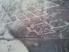 | Fort Duncan | 0.5 miles | 1971 |
| National Archives record | The nomination case file for reference 80004141 in Record Group 79. |
| Maverick County | All 2 listed properties in this county. |