 Block
BlockFrom the record
One of 72 National Register listings published here for Bell County · listed in 1983 · category: Building.
Sources: the case file at the National Archives · the National Register database, National Park Service
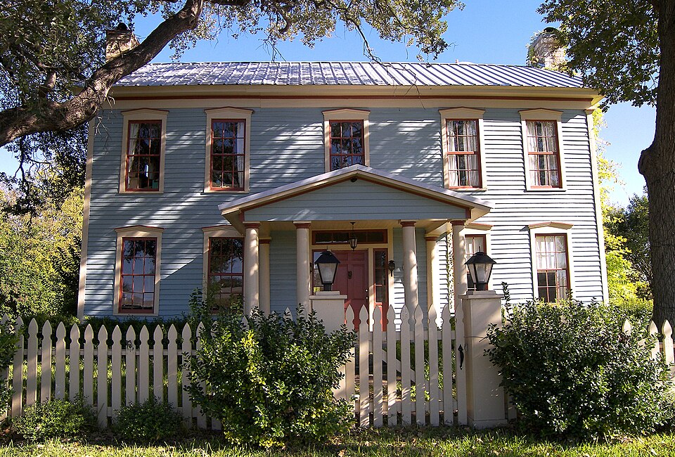
Listed on the National Register of Historic Places in 1983.
One of 72 National Register listings published here for Bell County · listed in 1983 · category: Building.
Sources: the case file at the National Archives · the National Register database, National Park Service
Regional context, not property-specific evidence. The federal wildfire occurrence database lists 92 fires within 5 miles of Fowler House between 2003 and 2017, burning about 2,114 acres in total. 1 started naturally. 2 were recorded as arson. Distance is straight-line from the map coordinates, so a fire counted here may appear on a neighbouring settlement's page as well.
| Reported cause | Fires |
|---|---|
| Debris and open burning | 53 |
| Missing data/not specified/undetermined | 16 |
| Equipment and vehicle use | 16 |
| Power generation/transmission/distribution | 3 |
| Arson/incendiarism | 2 |
| Natural | 1 |
| Smoking | 1 |
The most recent of them, most recent first, with the day each was reported and the service that recorded it.
| Date | Cause | Size | Reported by | Name on the report |
|---|---|---|---|---|
| 4 September 2011 | Debris and open burning | 1.0 acres | Texas A & M Forest Service | 1220 ELMER KING RD |
| 30 September 2006 | Arson/incendiarism | 1.0 acres | Texas A & M Forest Service | not named |
| 30 September 2005 | Debris and open burning | 261 acres | Texas A & M Forest Service | MUSTANG CREEK |
| 22 September 2011 | Natural | 1.0 acres | Texas A & M Forest Service | HACKBERRY & GOOSNECK |
| 21 September 2008 | Equipment and vehicle use | 1.0 acres | Texas A & M Forest Service | not named |
| 21 September 2006 | Debris and open burning | 2.0 acres | Texas A & M Forest Service | not named |
| 19 September 2008 | Equipment and vehicle use | 10 acres | Texas A & M Forest Service | not named |
| 16 September 2008 | Equipment and vehicle use | 3.0 acres | Texas A & M Forest Service | not named |
Regional context, not property-specific evidence. The federal mineral resources record lists 1 working within 5 miles of Fowler House: 1 past producer. None of them still produces. What was taken out: Sand and Gravel, Construction. Distance is straight-line from the map coordinates, so a quarry counted here may appear on a neighbouring settlement's page as well.
| Where | Site | Commodity | Status | Recorded |
|---|---|---|---|---|
| Unknown | Sand and Gravel, Construction | Past Producer |
Regional context, not property-specific evidence. The National Weather Service names Salado, the town this property stands in, in 45 storm reports between 1993 and 2024: 26 hail, 12 thunderstorm wind, 4 flash flood, 2 flood. No death or injury is recorded in these reports. Each account below is quoted exactly as the forecast office filed it, from the NOAA Storm Events Database, and each date opens the federal record of that event.
| When | Event | Place named | Harm | What the report says |
|---|---|---|---|---|
| April 2022 | Hail | Salado | $1,000,000 | Many social media reports of large hail ranging up to 4 inch in diameter hail was reported in and around the Salado, TX area. This was in addition to the 5.6+ inch hail stone that is noted separately. The large hail fell for several minutes. |
| June 2007 | Flood | Salado | $750,000 | Runoff from heavy rains caused Mills Creek to flood portions of Salado, including Mill Creek Drive and Smith Bluff. About 30 homes were evacuated and one man had to be rescued from his rooftop. A water rescue was required on the Little River, and Salado Creek flooded the Interstate 35 access roads and the bridge on Main Street by four feet of water. One vehicle was washed off the road and a high water rescue was needed. |
| April 2024 | Hail | Salado | $500,000 | Emergency manager reported baseball sized hail fell in Salado. |
| April 2022 | Hail | Salado | $500,000 | A social media picture indicated a 5.6+ inch diameter hail stone in Salado, TX. Swift actions were taken by NWS Fort Worth and the IBHS (Insurance Institute for Business & Home Safety) to preserve and document this record hailstone. The IBHS officially measured the hailstone at: Maximum diameter 5.676 in, Mass 409.3 g, Volume 29.5 in3 making it the largest hail stone on record in the FWD CWA to date. Other large hailstones also fell in this same area. |
| May 2008 | Thunderstorm Wind | Salado | $100,000 | Two foot diameter trees were snapped in half along Highway 95 in Little River Academy. Numerous signs and billboards were blown down between Salado and Little River Academy. Trees fell on and damaged cars in Little River. |
| May 2008 | Thunderstorm Wind | Salado | $50,000 | Numerous trees had large limbs broken. A few trees were uprooted or snapped at the trunk. Several storage buildings were damaged, and a few homes suffered minor roof damage. Additional homes were damaged by falling trees and limbs. |
| May 2008 | Thunderstorm Wind | Salado | $50,000 | Trees were blown down and the high school lost some bricks. A historic home and a restaurant in Salado suffered roof damage. |
| May 2008 | Thunderstorm Wind | Salado | $30,000 | Trees were blown down and a hotel under construction was damaged at I-35 and exit 286. |
| November 2001 | Thunderstorm Wind | Salado | $25,000 | There was wind damage to two recreational vehicles, one mobile home, a two story house, and signswere blown down. |
| May 2001 | Thunderstorm Wind | Salado | $25,000 | A large tree was blown down onto an SUV. |
| May 2008 | Thunderstorm Wind | Salado | $20,000 | A carport was damaged. |
| October 2009 | Flash Flood | Salado | $15,000 | Five bridges in Salado were closed for a few hours due to high water that covered each bridge with up to 3 feet of water. The South Ridge and Chisholm Trail bridges in Mill Creek, the Smith Bluff bridge east of Mill Creek, and two access road bridges along Interstate 35 were all closed down. |
| May 2001 | Tornado (F0) | Salado | $15,000 | The walls of a house bowed in and the roof was lifted off and moved six inches. |
| July 2008 | Thunderstorm Wind | Salado | $12,000 | Rock facing was removed from the wall of a commercial building. |
| June 2019 | Hail | Salado | $10,000 | Broadcast media supplied a picture of hen-egg sized hail in the city of Salado, TX. |
| April 2008 | Hail | Salado | $5,000 | no account filed |
| March 2014 | Hail | Salado | $4,000 | no account filed |
| October 2009 | Flood | Salado | $3,000 | Two flooded bridges along the access road of Interstate 35 in Salado were reopened during the afternoon hours, but the South Ridge bridge and Chisholm Trail bridges in Mill Creek remained closed until the following morning when the water finally drained. The closure of these two bridges cut off residents' access through the subdivision. |
| May 2001 | Thunderstorm Wind | Salado | $2,000 | A porch was blown down by high winds. |
| April 2020 | Thunderstorm Wind | Salado | $1,000 | A social media report indicated downed trees and power lines in the city of Salado, TX. |
| June 2007 | Hail | Salado | $1,000 | no account filed |
| May 2024 | Flash Flood | Salado | - | Media reports all low water crossings near Salado Creek 1 mile east of I-35 are out. |
| April 2022 | Hail | Salado | - | Amateur radio reported half dollar sized hail near the intersection of Highways 2484 and 1670 in Bell County. |
| April 2010 | Hail | Salado | - | Penny size hail was reported in Salado. |
| October 2010 | Hail | Salado | - | Half dollar size hail was reported near Salado. |
| October 2010 | Hail | Salado | - | Quarter size hail was reported 2 miles north of Salado. |
| February 2009 | Thunderstorm Wind | Salado | - | Two 18 wheelers were overturned. A 35-foot communications tower on top of a building was folded over. 70 MPH winds were estimated in the area. |
| June 2007 | Flash Flood | Salado | - | Interstate 35 service roads were flooded north of FM 2484. |
| October 2006 | Hail | Salado | - | Penny-size hail reported from Salado to near Belton. |
| June 2004 | Flash Flood | Salado | - | Water was reported over a street in town, and over FM 1123 outside of Salado. On Church Street, south of the fire department, barricades were up due to high water. |
| March 2000 | Thunderstorm Wind | Salado | - | Tractor trailer rigs were blown off I-35. |
| May 1994 | Hail | Salado | - | Three feet of water was over Interstate 35 in Salado. |
| April 1993 | Hail | Salado | - | Thunderstorms developed late in the afternoon ahead of a cold front and moved slowly southeast through parts of north central and northeast Texas during the evening hours. |
| April 2014 | Hail | Salado | - | no account filed |
| April 2005 | Hail | Salado | - | no account filed |
| November 2004 | Hail | Salado | - | no account filed |
| November 2004 | Hail | Salado | - | no account filed |
| March 2000 | Hail | Salado | - | no account filed |
| April 2000 | Hail | Salado | - | no account filed |
| March 2000 | Hail | Salado | - | no account filed |
| February 1998 | Hail | Salado | - | no account filed |
| May 1997 | Hail | Salado | - | no account filed |
| May 1997 | Hail | Salado | - | no account filed |
| April 1997 | Hail | Salado | - | no account filed |
| September 1996 | Hail | Salado | - | no account filed |
No historic map-sheet match is published for this property yet. That does not mean no map exists. This record needs a coordinate-quality review before it can be joined to a sheet boundary. Browse the county's mapped places while that work is pending.
Other National Register properties close enough to walk or drive between, ordered by distance from this one. Both positions come from the same geocoding pass that matched these properties to their map sheets.
| Photograph | Property | Distance | Listed |
|---|---|---|---|
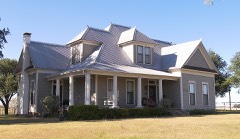 | White-Aiken House | 0.2 miles | 1983 |
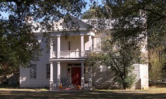 | Capt. Robert Halley House | 0.3 miles | 1983 |
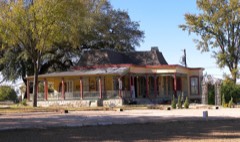 | Vickrey House | 0.5 miles | 1983 |
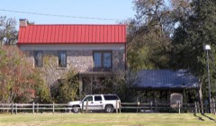 | Barton House | 0.7 miles | 1983 |
| Levi Tenney House | 0.7 miles | 1983 | |
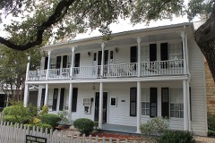 | Norton-Orgain House | 0.7 miles | 1992 |
| National Archives record | The nomination case file for reference 83003081 in Record Group 79. |
| Bell County | All 72 listed properties in this county. |