BlockBefore
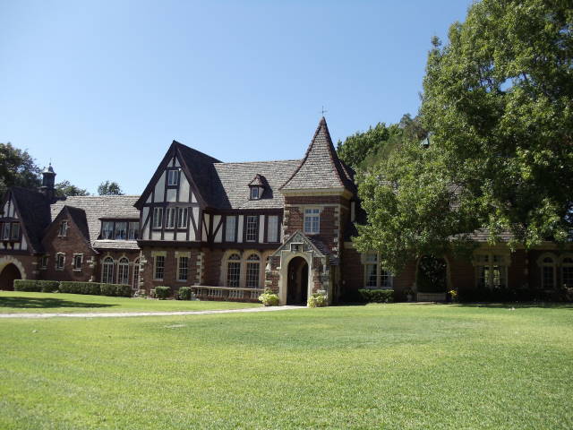
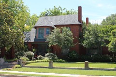
Photograph of Westover Manor
Photograph by Renelibrary, CC BY-SA 3.0. Via Wikimedia Commons.

Westover Manor

Listed on the National Register of Historic Places in 1988.

From the record

“Westover Manor is a historic house located in Westover Hills, Texas. It was added to the National Register of Historic Places on December 15, 1988.”

Wikipedia article Westover Manor, CC BY-SA 4.0.

One of 128 National Register listings published here for Tarrant County · listed in 1988 · category: Building.

Sources: the Wikipedia article · the case file at the National Archives · the National Register database, National Park Service
The listing

  • What is counted as historic. The nomination lists 3 structuress, 2 buildingss as contributing to the listing.
  • Address. 8 Westover Rd., Westover Hills, 76107
  • When was it listed? December 1988
  • Category. building
  • Census division. Fort Worth
  • Architectural style. Tudor Revival architecture
  • National Register reference number. 88002709 - the number the National Park Service assigned this property when it was listed, and the key its nomination file is catalogued under at the National Archives.

Fires near this property

424 since 2005

Regional context, not property-specific evidence. The federal wildfire occurrence database lists 424 fires within 5 miles of Westover Manor between 2005 and 2020, burning about 128 acres in total. 1 started naturally. 5 were recorded as arson. Distance is straight-line from the map coordinates, so a fire counted here may appear on a neighbouring settlement's page as well.

Reported cause Fires
Missing data/not specified/undetermined377
Power generation/transmission/distribution13
Equipment and vehicle use8
Arson/incendiarism5
Railroad operations and maintenance5
Misuse of fire by a minor4
Recreation and ceremony4
Debris and open burning4
Smoking3
Natural1

The most recent of them, most recent first, with the day each was reported and the service that recorded it.

DateCause SizeReported by Name on the report
8 September 2019Missing data/not specified/undeterminedunder an acreTexas A & M Forest ServiceFARNSWORTH
7 September 2015Missing data/not specified/undeterminedunder an acreTexas A & M Forest Service2500
6 September 2014Missing data/not specified/undeterminedunder an acreTexas A & M Forest ServiceNE 23RD
6 September 2014Power generation/transmission/distributionunder an acreTexas A & M Forest ServiceSHERMAN
5 September 2020Missing data/not specified/undeterminedunder an acreTexas A & M Forest ServiceBENBROOK HWY
4 September 2016Missing data/not specified/undeterminedunder an acreTexas A & M Forest ServiceN HENDERSON
4 September 2015Missing data/not specified/undeterminedunder an acreTexas A & M Forest ServiceW LANCASTER
28 September 2020Missing data/not specified/undeterminedunder an acreTexas A & M Forest ServiceSOUTHWEST LOOP

Every fire recorded in Tarrant County

Storms near this property

28 since 1997

Regional context, not property-specific evidence. The National Weather Service names Westover Hills, the town this property stands in, in 28 storm reports between 1997 and 2026: 12 thunderstorm wind, 11 hail, 3 flash flood, 1 lightning. No death or injury is recorded in these reports. Each account below is quoted exactly as the forecast office filed it, from the NOAA Storm Events Database, and each date opens the federal record of that event.

WhenEvent Place namedHarm What the report says
March 2016HailWestover Hills$200,000,000Hen egg sized hail reported near Hulen Street and Vickery Blvd in west Fort Worth. Heavy hail damage was also reported along west Camp Bowie Blvd where numerous homes, businesses, and vehicles were damaged by the hail.
April 2026Flash FloodWestover Hills$60,000Emergency management reported several high water calls at Interstate 30 underpasses, including the Hulen, Alta Mere, and Horne intersections. Social media video showed cars partially submerged on Hulen Street near Interstate 30 in the west part of Fort Worth, with water levels above the headlights.
December 2022Tornado (EF0)Westover Hills$50,000A supercell embedded within the line of storms moved into the White Settlement/far northwestern Fort Worth area shortly after 8:00 AM. As the storm moved over the NAS JRB, video evidence shows a tornado developed near the control tower. Damage was observed to a metal warehouse building where the metal roof was peeled off and scattered across the taxiway. The tornado continued to track northeast damaging a fitness facility before dissipating just south of the commissary near the food court. The heaviest of the damage occurred to the fitness facility, where most of the sunshades were ripped off. Additional damage was observed to trees along the path of the tornado. Maximum estimated winds were 75 mph.
September 2014LightningWestover Hills$50,000The local NBC station reported an apartment fire in the 2300 block of Ridgemar Plaza in Fort Worth. The fire displaced dozens of residents. Fire investigators stated that the fire was likely caused by a lightning strike.
April 2015Thunderstorm WindWestover Hills$15,000Trees were uprooted in and east of Westover Hills.
March 2016Thunderstorm WindWestover Hills$12,000A 66 MPH wind gust was measured at the Fort Worth Joint Reserve Base.
August 2012Thunderstorm WindWestover Hills$10,000A wind gust of 67 MPH was measured at the Naval Air Station Joint Reserve Base (KNFW). Large tree limbs and at least one power pole was knocked down.
June 2011Thunderstorm WindWestover Hills$10,000Large trees were blown down in the Westworth Village area of Ft. Worth.
March 2022Thunderstorm WindWestover Hills$3,000A 58 MPH wind gust was measured at the Fort Worth Joint Reserve Base. Just south of JRB NAS, roof damage was reported at the American Freight and Big Lots businesses.
June 2011Thunderstorm WindWestover Hills$1,000A 70 mph wind gust was measured at the Joint Reserve Base in Fort Worth (KNFW). This gust was associated with a heatburst. In nearby River Oaks, power lines were blown down.
April 2026HailWestover Hills-Report of 1.25 inch hail from mPING.
April 2026Flash FloodWestover Hills-Emergency management reported flooding towards the gate of NAS JRB near Pumphrey Drive and TX 183 in the northwest part of Fort Worth.
April 2026Thunderstorm WindWestover Hills-A 70 mph wind gust was measured at the KNFW AWOS.
March 2025HailWestover Hills-Reported via mPING south of Westworth Village.
March 2025HailWestover Hills-Reported via mPING in Westover Hills.
March 2025Thunderstorm WindWestover Hills-A 62 mph wind gust was measured at the AWOS site at NAS JRB.
May 2025Thunderstorm WindWestover Hills-KNFW measured a 61 mph / 53 kt gust.
October 2025Thunderstorm WindWestover Hills-The KNFW AWOS measured a 63 mph (55 kt) wind gust.
March 2023Thunderstorm WindWestover Hills-A 70 mph wind gust was measured at the NAS JRB in Fort Worth.
September 2023Thunderstorm WindWestover Hills-The AWOS at the Fort Worth Naval Air Station (KNWF) measured 52 kt winds.
April 2021HailWestover Hills-Penny sized hail at Monnig Middle School.
April 2017HailWestover Hills-A National Weather Service employee reported nickel to quarter sized hail near the intersection of Camp Bowie Blvd and Interstate 30.
May 2011Flash FloodWestover Hills-There was approximately a foot of water standing on two lanes at Interstate 30 and Green Oaks Blvd.
March 2009HailWestover Hills-Quarter size hail was reported at the intersection of I-30 and Bryant Irvin in southwest Ft. Worth.
May 2009HailWestover Hills-Half Dollar size hail was reported at the Joint Reserve Base.
June 2023HailWestover Hills-no account filed
May 1999HailWestover Hills-no account filed
April 1997HailWestover Hills-no account filed

Every storm recorded in Tarrant County

Map coverage status

No historic map-sheet match is published for this property yet. That does not mean no map exists. This record needs a coordinate-quality review before it can be joined to a sheet boundary. Browse the county's mapped places while that work is pending.

Listed places nearby

6 within 8 miles

Other National Register properties close enough to walk or drive between, ordered by distance from this one. Both positions come from the same geocoding pass that matched these properties to their map sheets.

Photograph PropertyDistance Listed
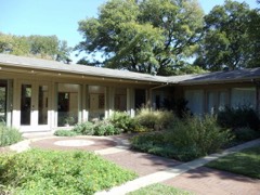
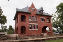
William J. Bryce House0.7 miles1984
Marshall R. Sanguinet House0.8 miles1983
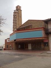
Ridglea Theatre1.1 miles2011
Will Rogers Memorial Center2.2 miles2016
Inc. Texas Garden Clubs Headquarters2.3 miles2011
Fort Worth Botanic Garden2.5 miles2009

Sources for this property

National Archives recordThe nomination case file for reference 88002709 in Record Group 79.
Wikipedia articleCommunity-written account of this property, licensed CC BY-SA.
Tarrant CountyAll 128 listed properties in this county.

Provenance

  • Listing record. National Park Service National Register of Historic Places, listed-properties dataset, current to 2026-05-22.
  • Map join. Address geocoded through the United States Census geocoder, then tested against the published boundary of every sheet in the USGS Historical Topographic Map Collection.
  • How this page is made. Listing fields come from federal records; map-sheet coverage is a labelled coordinate-to-boundary calculation, not a source-field claim.
  • Wildfire. Short, Karen C. 2022. Spatial wildfire occurrence data for the United States, 1992-2020 [FPA_FOD_20221014]. 6th Edition. Fort Collins, CO: Forest Service Research Data Archive. https://doi.org/10.2737/RDS-2013-0009.6 Collected with United States Government funding and usable without additional permissions or fees.
  • Storms. NOAA National Centers for Environmental Information, Storm Events Database https://www.ncei.noaa.gov/stormevents/ A work of the United States government, no copyright under 17 U.S.C. 105. Narratives are quoted verbatim from the National Weather Service report and are not edited or summarised.