 Block
BlockFrom the record
One of 72 National Register listings published here for Bell County · listed in 1990 · category: Building.
Sources: the case file at the National Archives · the National Register database, National Park Service
Listed on the National Register of Historic Places in 1990.
One of 72 National Register listings published here for Bell County · listed in 1990 · category: Building.
Sources: the case file at the National Archives · the National Register database, National Park Service
Regional context, not property-specific evidence. The federal wildfire occurrence database lists 81 fires within 5 miles of House at 402 N. East St. between 2002 and 2020, burning about 273 acres in total. None started naturally. 2 were recorded as arson. Distance is straight-line from the map coordinates, so a fire counted here may appear on a neighbouring settlement's page as well.
| Reported cause | Fires |
|---|---|
| Missing data/not specified/undetermined | 39 |
| Debris and open burning | 32 |
| Equipment and vehicle use | 5 |
| Arson/incendiarism | 2 |
| Smoking | 2 |
| Power generation/transmission/distribution | 1 |
The most recent of them, most recent first, with the day each was reported and the service that recorded it.
| Date | Cause | Size | Reported by | Name on the report |
|---|---|---|---|---|
| 7 September 2006 | Equipment and vehicle use | 2.0 acres | Texas A & M Forest Service | not named |
| 5 September 2009 | Arson/incendiarism | 2.0 acres | Texas A & M Forest Service | SHARPING LN |
| 4 September 2011 | Debris and open burning | 1.0 acres | Texas A & M Forest Service | 1220 ELMER KING RD |
| 29 September 2006 | Debris and open burning | 1.0 acres | Texas A & M Forest Service | not named |
| 25 September 2011 | Smoking | 20 acres | Texas A & M Forest Service | MUTUAL AID FOR BELTON FD |
| 22 September 2002 | Missing data/not specified/undetermined | 10 acres | Texas A & M Forest Service | CENTRAL TX - 41 |
| 19 September 2006 | Debris and open burning | 10 acres | Texas A & M Forest Service | not named |
| 19 September 2006 | Debris and open burning | 3.0 acres | Texas A & M Forest Service | not named |
Regional context, not property-specific evidence. The federal mineral resources record lists 16 workings within 5 miles of House at 402 N. East St.: 11 past producers, 4 producers, 1 unknown. 4 still produce. What was taken out: Sand and Gravel, Construction, Stone, Dimension, Limestone, General. Distance is straight-line from the map coordinates, so a quarry counted here may appear on a neighbouring settlement's page as well.
| Where | Site | Commodity | Status | Recorded |
|---|---|---|---|---|
| Belton Rockwool Ind Operation | Stone, Dimension | Producer | ||
| Miller Pit | Limestone, General | Producer | ||
| Belton | Sand and Gravel, Construction | Unknown | ||
| Leon Valley Plant No. 1 | Sand and Gravel, Construction | Producer | ||
| Shallow Ford Construction Operation | Sand and Gravel, Construction | Producer | ||
| Unknown | Sand and Gravel, Construction | Past Producer | ||
| Unknown | Sand and Gravel, Construction | Past Producer | ||
| Unknown | Sand and Gravel, Construction | Past Producer | ||
| Unknown | Sand and Gravel, Construction | Past Producer | ||
| Unknown | Sand and Gravel, Construction | Past Producer |
Regional context, not property-specific evidence. The National Weather Service names Belton, the town this property stands in, in 100 storm reports between 1993 and 2024: 50 hail, 24 thunderstorm wind, 15 flash flood, 6 tornado. No death or injury is recorded in these reports. Each account below is quoted exactly as the forecast office filed it, from the NOAA Storm Events Database, and each date opens the federal record of that event.
| When | Event | Place named | Harm | What the report says |
|---|---|---|---|---|
| May 1997 | Tornado (F3) | Belton | $900,000 | The fourth tornado that was produced by the large supercell thunderstorm developed on the north side of Lake Belton, near Morgans Point where a marina was destroyed. Over 100 boats at the marina were destroyed by the strong tornado that moved slowly south-southwest. Ten homes along the lakeshore also sustained severe damage and damage to trees was nearly total. The tornado dissipated just northeast of Woodland. |
| April 2008 | Tornado (EF0) | Belton | $500,000 | In Belton, amateur radio operators reported power flashes and a few downed trees. In and around Temple, power flashes were reported and numerous roofs, fences, and signs were damaged. One fence which was knocked down was anchored with cement pillars. Guests at a motel which lost a roof were temporarily trapped in their rooms due to their doors being barracaded by debris. Vehicles were damaged by tree limbs and other debris. A duplex also lost a roof and suffered water damage. A golf course lost its scoreboard which was supported by several 4-inch metal poles. An estimated forty trees were uprooted or damaged. |
| April 2022 | Hail | Belton | $250,000 | A trained spotter reported 3-inch diameter hail just southwest of Belton, TX. |
| June 1995 | Thunderstorm Wind | Belton | $250,000 | Extensive wind damage occurred to homes and businesses. Numerous trees and power lines were blown down. |
| October 2015 | Flash Flood | Belton | $200,000 | Nolan Creek in Belton overflowed flooding nearby areas. Voluntary evacuations were requested at a neighborhood near Spring Street and Interstate 35 due to the rising waters. |
| June 1995 | Thunderstorm Wind | Belton | $200,000 | Wind damage occurred to roofs, and wind damage occurred at Lake Belton. |
| March 2006 | Lightning | Belton | $130,000 | Lightning struck a utility box and started a fire at a home on Timberwolf Trail in Morgan's Point Resort. The one-story brick house was completely destroyed by the fire. |
| March 2014 | Hail | Belton | $100,000 | Baseball sized hail damaged many vehicles along Highway 190 in Belton. |
| July 2006 | Thunderstorm Wind | Belton | $70,000 | Several large trees uprooted and large tree limbs snapped. One huge tree fell on a transmission repair shop. Numerous power lines were blown down, as well as a light at a ballfield. A sign at a bank was ripped off. Power was out to about 1,200 people. |
| April 2016 | Hail | Belton | $50,000 | Broadcast media reported hail had grown to the size of golf balls west of Belton High School. |
| June 2006 | Lightning | Belton | $50,000 | Lightning struck and split a marble slab near the front entrance of the University of Mary Hardin-Baylor. The strike damaged the school's telephone and sprinkler systems. Most of the telephones and wiring on the campus had to be replaced. |
| April 2008 | Hail | Belton | $40,000 | Golfball-size hail broke skylights and car windshields. |
| April 2022 | Hail | Belton | $25,000 | A public report indicated golf ball sized hail 3 miles south-southwest of Belton, TX. |
| April 2022 | Hail | Belton | $25,000 | A public report indicated 2 inch diameter hail about 2 miles west-southwest of Belton, TX. |
| April 2022 | Hail | Belton | $25,000 | A public report indicated 2.25 inch diameter hail about 4 miles west-southwest of Belton, TX. |
| May 2008 | Thunderstorm Wind | Belton | $25,000 | A house was damaged and trees were uprooted near the intersection of Armstrong Drive and Elmer King Road. |
| May 2014 | Hail | Belton | $20,000 | Golf ball sized hail was reported in the Miller Heights area of Belton. |
| April 2008 | Hail | Belton | $20,000 | Golfball to baseball-size hail was reported. |
| July 2008 | Thunderstorm Wind | Belton | $20,000 | Power lines were blown down on Main Street and Smith Dairy Road in Belton. Numerous trees and large limbs were also blown down across the city...including several on FM 439 near Lake Belton. |
| April 2006 | Thunderstorm Wind | Belton | $20,000 | Storm spotter measured a 70 MPH wind gust. The emergency manager reported a few mobile homes were damaged. |
| September 1997 | Tornado (F0) | Belton | $20,000 | A tornado destroyed garage doors, damaged the roofs of five homes, and blew down trees and power lines. |
| March 2014 | Hail | Belton | $20,000 | no account filed |
| March 2014 | Thunderstorm Wind | Belton | $15,000 | Strong thunderstorm winds and softball-sized hail blew out the windows in several houses in the Dawson Ranch subdivision near Belton High School. |
| March 2014 | Hail | Belton | $15,000 | Strong thunderstorm winds and softball-sized hail blew out the windows in several houses in the Dawson Ranch subdivision near Belton High School. |
| April 2006 | Flash Flood | Belton | $15,000 | Part of Interstate 35 was closed due to flash flooding. One home was evacuated due to flooding. |
| March 2014 | Hail | Belton | $12,000 | Golf ball sized hail was reported at Highway 190 and 1670 west of Belton. |
| May 2024 | Hail | Belton | $10,000 | Broadcast media relayed photo of golf ball to egg size hail in Belton. |
| June 2019 | Thunderstorm Wind | Belton | $10,000 | Broadcast media reported wind damage to a restaurant in the city of Belton, TX. |
| October 2013 | Thunderstorm Wind | Belton | $10,000 | Approximately half of the trees in Yettie Polk State Park were uprooted or heavily damaged by thunderstorm winds, and the park had to be closed. Crews from the public works department worked overnight to remove debris from roadways. Power lines were also knocked down in the park. |
| June 2007 | Flood | Belton | $10,000 | Heavy rain caused flooding of Belton Lake, closing numerous nearby parks and recreation facilities. |
| September 1999 | Lightning | Belton | $10,000 | no account filed |
| May 2024 | Hail | Belton | $7,000 | Hail up to golf balls was reported in Belton by a trained spotter. |
| September 2011 | Thunderstorm Wind | Belton | $5,000 | Several trees were blown down in Belton. Thunderstorm winds were estimated to be about 60 mph. |
| June 2005 | Thunderstorm Wind | Belton | $5,000 | Numerous power poles were knocked down in and around the city. |
| April 2008 | Hail | Belton | $5,000 | no account filed |
| April 2008 | Hail | Belton | $5,000 | no account filed |
| May 1996 | Thunderstorm Wind | Belton | $5,000 | no account filed |
| October 2006 | Flash Flood | Belton | $3,000 | One home was flooded in Morgan's Point. |
| March 2000 | Thunderstorm Wind | Belton | $2,000 | A building was unroofed by high winds. |
| April 1997 | Thunderstorm Wind | Belton | $2,000 | Strong winds blew down trees and power lines. |
| April 1997 | Thunderstorm Wind | Belton | $2,000 | Power lines were blown down by high winds. |
| September 1995 | Thunderstorm Wind | Belton | $2,000 | Power lines were blown down by high winds. |
| October 2014 | Thunderstorm Wind | Belton | $1,000 | A social media report was received, stating that the metal roof of a storage unit was blown off and several tree limbs and trees were blown down. |
| October 2013 | Thunderstorm Wind | Belton | $1,000 | Multiple trees were uprooted in Belton including a very large live oak. |
| April 1998 | Thunderstorm Wind | Belton | $1,000 | Trees were blown down onto powerlines. |
| May 2024 | Hail | Belton | - | Public reported half dollar hail fell around 1.4 miles ESE of Belton via mPING. |
| May 2024 | Flash Flood | Belton | - | Report from mPING: Street/road flooding; Street/road closed; Vehicles stranded. |
| May 2024 | Flash Flood | Belton | - | Report from mPING: Street/road flooding; Street/road closed; Vehicles stranded. |
| May 2024 | Flood | Belton | - | Report from mPING: River/Creek overflowing; Cropland/Yard/Basement Flooding. |
| April 2023 | Hail | Belton | - | Amateur radio reported nickel sized hail near the intersection of Interstate 35 and Interstate 14 in the south part of Belton, TX. |
| April 2022 | Hail | Belton | - | Amateur radio reported quarter sized hail about 3 miles west-southwest of Belton, TX. |
| April 2022 | Hail | Belton | - | Amateur radio reported quarter sized hail about a mile north-northeast of Belton, TX. |
| April 2022 | Hail | Belton | - | A trained spotter reported quarter sized hail about 4 miles north-northeast of Salado, TX. |
| April 2018 | Hail | Belton | - | Amateur radio reported penny sized hail near the junction of Interstate 14 and Interstate 35. |
| April 2018 | Hail | Belton | - | Amateur radio reported quarter-sized hail near the junction of Interstate 14 and Interstate 35. |
| March 2017 | Hail | Belton | - | Bell County Sheriff's Department reported quarter sized hail in the city of Belton, TX. |
| April 2016 | Hail | Belton | - | Hail to the size of quarters was reported on the south side of Belton, approximately a half of a mile north of the Bell County Expo Center. |
| April 2016 | Hail | Belton | - | Hail to the size of half dollars was reported in the city of Belton. |
| April 2016 | Hail | Belton | - | Trained spotters reported hail slightly larger than quarters. |
| May 2014 | Hail | Belton | - | Penny sized hail was reported approximately 1 mile east-southeast of Belton. |
No historic map-sheet match is published for this property yet. That does not mean no map exists. This record needs a coordinate-quality review before it can be joined to a sheet boundary. Browse the county's mapped places while that work is pending.
Other National Register properties close enough to walk or drive between, ordered by distance from this one. Both positions come from the same geocoding pass that matched these properties to their map sheets.
| Photograph | Property | Distance | Listed |
|---|---|---|---|
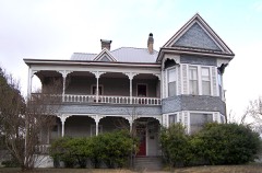 | Morey House | under 500 feet | 1990 |
 | Dr. Taylor Hudson House | under 500 feet | 1990 |
| H. A. and Helena Ware House | under 500 feet | 1990 | |
| Robert Naismith House | 0.1 miles | 1990 | |
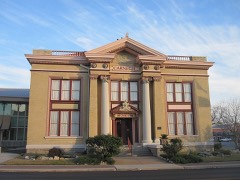 | Carnegie Public Library | 0.1 miles | 1985 |
| W. J. Venable House | 0.1 miles | 1990 |
| National Archives record | The nomination case file for reference 90001878 in Record Group 79. |
| Bell County | All 72 listed properties in this county. |