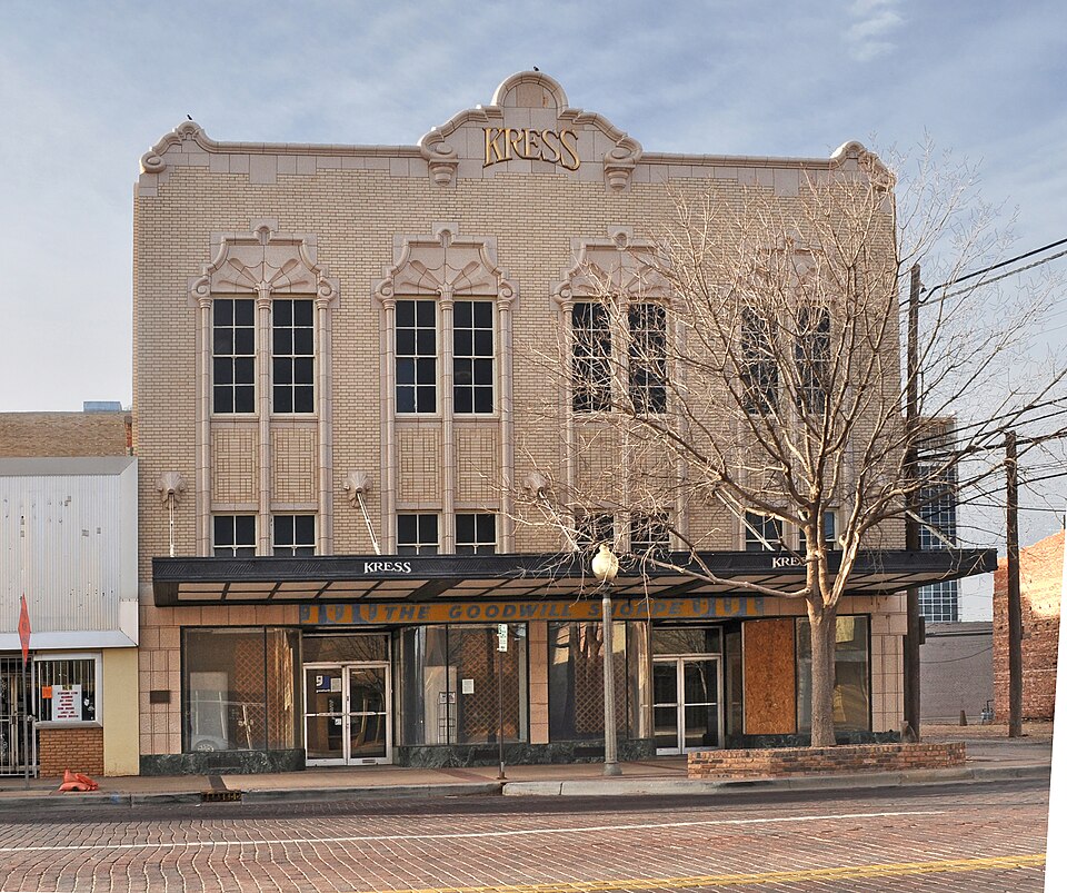
| July 2020 | Thunderstorm Wind | Lubbock | 2 hurt | A thunderstorm formed to the southwest of Lubbock Preston Smith International Airport and moved east bringing damaging winds gusts to the north part of the city of Lubbock. The winds toppled a brick wall of an old roofless structure, downed power poles, and caused considerable property damage at Joyland Amusement Park. In addition, a few people were injured by falling tree limbs at Joyland. |
| May 2001 | Hail | Lubbock | $25,000,000 | A storm chaser reported quarter size hail at 8th Street and Milwaukee Avenue. Wind-driven hail caused extensive property damage. |
| May 2001 | Hail | Lubbock | $25,000,000 | An off-duty NWS employee reported quarter size hail on the southwest side of town. Wind-driven hail caused extensive property damage. |
| May 2001 | Hail | Lubbock | $20,000,000 | Storm spotters reported hail up to quarter size covering the ground at 19th Street and Loop 289 on the west side of town. Wind-driven hail caused extensive property damage. Crops were devastated throughout the western and southern portion of the county. |
| April 1997 | Hail | Lubbock | $18,000,000 | no account filed |
| May 2001 | Hail | Lubbock | $15,000,000 | An off-duty NWS meteorologist reported hail up to quarter size covering the ground on the south side of town near 82nd Street and University Avenue. Wind-driven hail caused extensive property damage. |
| April 1997 | Hail | Lubbock | $12,000,000 | no account filed |
| May 2001 | Hail | Lubbock | $10,000,000 | Wind-driven hail caused extensive property damage. |
| May 1996 | Hail | Lubbock | $1,000,000 | no account filed |
| August 2011 | Flash Flood | Lubbock | $500,000 | There was flash flooding over portions of the city of Lubbock due to rainfall between one and four inches over a period of about one hour. Several high water rescues were performed and many motorists became stuck in water over the roadways. Several roads were also closed due to high water. A parking lot of a restaurant flooded out several vehicles. |
| March 1993 | Thunderstorm Wind | Lubbock | $500,000 | As the Terry County Supercell moved across Lubbock County, it left a swath of severe weather. Golfball-size hail was reported at Reese Air Force Base and near the Carlisle community. As the storm moved across western and northern sections of Lubbock, a series of downbursts and two weak tornadoes occurred. The downbursts damaged several light and telephone poles, the roof of an elementary school suffered minor damage, and approximately 100 vehicles had window damage. The first tornado touched down in the west-central part of Lubbock. Some buildings at Lubbock Christian University suffered damage, and windows were blown out at a Junior High School north of LCU. The second tornado struck north-central Lubbock, near the Lubbock State School. Damage in this area was confined mainly to windows. As the storm passed Lubbock International Airport, the NWS Office's wind equipment measured a wind gust to 77 mph. Total damage from the storm is estimated at $400,000. |
| April 1999 | Lightning | Lubbock | $470,000 | Lightning struck a house in the Lakeridge subdivision and started a fire that resulted in extensive damage. |
| May 1999 | Hail | Lubbock | $300,000 | A hailstorm that caused significant damage in Levelland continued moving east into western Lubbock County, then turned southeast. It moved from the former Reese Air Force Base through Wolfforth and the extreme southwest tip of the City of Lubbock. Many roofs and vehicles were damaged by golfball to baseball-size hail, and there was one report of grapefruit-size hail (in Wolfforth). In Lubbock, much of the damage was concentrated south and west of the intersection of 82nd Street and Slide Road. |
| May 1996 | Hail | Lubbock | $300,000 | no account filed |
| August 2011 | Lightning | Lubbock | $250,000 | Local broadcast and print media reported numerous lightning started structure fires around the city of Lubbock. One of these fires destroyed the Hunter's Way apartment complex near the intersection of 56th Street and West Loop 289. One firefighter was taken to the hospital with minor injuries sustained while fighting the fire. One five minute plot of cloud to ground lightning data displayed around 1200 strikes over Lubbock County. |
| July 2016 | Thunderstorm Wind | Lubbock | $200,000 | Straight line winds caused extensive damage to a localized area near 36th Street and Magnolia Avenue in Lubbock around 1624 CST. The strong winds flipped over a travel trailer at an auto yard and also peeled a roof off of a business. Additionally, a semi-truck trailer was flipped and several trees were snapped. Several power outages were also reported in the area. |
| June 2002 | Hail | Lubbock | $200,000 | An off-duty NWS employee reported hail larger than golfball size. |
| April 2010 | Flood | Lubbock | $150,000 | Flooding from heavy rainfall resulted in the closure of numerous roadways in the Lubbock area. Portions of south Indiana Avenue were washed away by the flood waters. A number of roadways were flooded in the Ransom Canyon and Buffalo Springs Lake areas of eastern Lubbock County, where some residences were also isolated by rising flood waters. No injuries were reported. |
| August 2008 | Lightning | Lubbock | $150,000 | Lubbock Fire Department officials and the local broadcast media reported that lightning initiated three different house fires in the city during the 17:00 CST hour. Damages to two of the homes was classified as moderate to severe. No injuries were reported. |
| May 2002 | Hail | Lubbock | $150,000 | The Ransom Canyon PD reported golfball size hail. |
| May 2002 | Hail | Lubbock | $150,000 | The public reported golfball size hail at 46th Street and Chicago Avenue. |
| April 2001 | Hail | Lubbock | $150,000 | Golfball size hail was reported on the southwest side of Lubbock. |
| June 2008 | Lightning | Lubbock | $125,000 | Extremely frequent and vivid cloud-to-ground lightning activity accompanied a severe thunderstorm over the Lubbock vicinity during the late evening of the 19th. The lightning sparked a fire that damaged a home near the intersection of County Road 7610 and south University Avenue around 22:15 CST. By 22:30 CST, a local utility provider reported that approximately 15,000 households across the city were affected by lightning-induced power outages. |
| March 2007 | Flash Flood | Lubbock | $115,000 | Flash flooding was widespread in the western and northwestern portions of Lubbock. Flowing flood waters ran down a number of city streets including: Frankford Avenue, Quaker Avenue, 4th Street, 18th Street, 66th Street, and Spur 327. |The Lubbock Police Department reported that twenty-one vehicles were disabled in the flood waters. At least thirteen accidents were attributed to the weather. No major injuries were reported, but a few motorists were assisted in evacuating their flooded vehicles. Property damages were estimated to total $120,000 in the city.| |
| November 2015 | Thunderstorm Wind | Lubbock | $100,000 | A severe downburst traveled from near 63rd Street and Elgin Avenue in northwest Lubbock to the Lubbock International Airport. A NWS storm survey team estimated winds of 80 mph in northwest Lubbock where some trees were uprooted and multiple power lines and/or poles were downed. One of the fallen trees caused some damage to a house. At the Lubbock International Airport, a wind gust of 71 mph was measured at 1918 CST which destroyed some windows in an empty hangar and pushed a luggage cart into a King Air 99 aircraft, but the plane was not damaged. Also, a Texas Tech University West Texas mesonet station northwest of the campus measured a gust to 59 mph at 1915 CST. |
| April 2013 | Thunderstorm Wind | Lubbock | $100,000 | A 58 mph severe thunderstorm wind gust was measured at a local television studio. Several reports of damage to buildings and vehicles were reported around the same time. |
| September 2010 | Thunderstorm Wind | Lubbock | $100,000 | Local emergency managers and National Weather Service meteorologists estimated thunderstorm winds to be in excess of 60 mph to 70 mph over portions of southwest Lubbock around 16:40 CST. The winds were accompanied by large hail. Numerous reports were received of downed fences and trees. A trampoline was lofted by the winds and blown a considerable distance. Structural damage were minor, but wind blown hail shattered windows in at least one residence. No injuries were reported. |
| July 2009 | Lightning | Lubbock | $100,000 | An apartment complex was struck by lightning around midnight CST on the 29th. The strike caused a fire which displaced several tenants. No injuries were reported, but significant damages occurred to the apartment unit. |
| May 2008 | Tornado (EF0) | Lubbock | $100,000 | A relatively broad, but weak, tornadic circulation developed beneath a well-defined wall cloud near the north Loop 289 and Interstate 27 interchange in north Lubbock shortly after 15:00 CST. The brief tornado, which was photographed by a National Weather Service meteorologist, struck the Beck Steel industrial facilities and severely damaged the roof of a large metal warehouse-type structure. Car windows in a nearby parking lot also were blown out. Damage was consistent with 70 to 80 mph wind speeds via estimates using the Enhanced-Fujita Scale. No injuries were reported. |
| August 2008 | Lightning | Lubbock | $100,000 | Very frequent cloud-to-ground lightning accompanied thunderstorm activity over the Lubbock vicinity during the very early morning hours of the 11th. A lightning strike caused damage to a water control system. The damage resulted in a water outage that impacted a portion of the city through much of the day. |
| May 2007 | Flood | Lubbock | $100,000 | Persistent and heavy rainfall resulted in flooding across portions of Lubbock. The flooding was characterized by a gradual increase in water level near many playa lakes, in construction zones, and in typically flood prone city streets.|Initial reports at 12:53 CST indicated that water was over the curbs along Elgin Street between 75th and 78th Streets, and also at the intersection of University and 82nd. By 13:34 CST up to two feet of water was reported in many of the city streets in Idalou. At 13:38 CST, local officials blockaded several blocks of Peoria Street due to high water.|Between 14:00 and 14:30 CST reports were received of road closings at Frankford Avenue and 98th Street and Erskine Avenue between the 4800 block and Loop 289.|Water continued to rise across Lubbock, and by 15:04 CST, at least one vehicle stalled in standing water that was up to the doors on 98th Street between Quaker and Slide. Several automobiles were reportedly stalled in heavy flooding at Milwaukee and 34th Street, and also at Avenue U and 50th Street, and the intersection of Erskine and Milwaukee.|No injuries were reported. However, the Lubbock Police Department attributed thirty-one traffic accidents to the weather. |
| September 2007 | Flash Flood | Lubbock | $100,000 | Local newspapers and law enforcement officials reported that very heavy rainfall resulted in flash flooding in rural areas northwest of Lubbock. News articles also indicated that numerous vehicles became stranded in high water flowing through city streets. The Lubbock County Sheriff's Office reported that a motorist escaped her car moments before it was swept away from a rural roadway in northwest Lubbock County. No injuries were reported. |
| May 2006 | Thunderstorm Wind | Lubbock | $100,000 | A cluster of high based thunderstorms produced a series of microbursts from near Lubbock International Airport to Idalou. At 15:28 CST a 62 MPH gust was recorded by the Lubbock International Airport Automated Surface Observing System as the initial downburst activity began just north of Lubbock. Public and law enforcement officials reported severe winds and thick blowing dust during the next hour as the complex of storms produced continuous microbursts along its eastward path. Shortly before 16:30 CST the Idalou Police Chief reported that a well-developed gustnado formed along the leading edge of a microburst dust foot. The gustnado struck a portion of the city and resulted in minor damage. Power lines and poles, fences, and other light weight objects were blown down. More than 1,500 residents temporarily lost electrical power. A few vehicles also suffered damage from wind-blown debris. |
| April 2001 | Hail | Lubbock | $100,000 | An off-duty NWS employee reported hen egg size hail on the west side of town. |
| June 1996 | Thunderstorm Wind | Lubbock | $100,000 | no account filed |
| May 1996 | Hail | Lubbock | $100,000 | no account filed |
| April 2007 | Tornado (EF0) | Lubbock | $75,000 | |A brief tornado was observed to cause damage in the west part of Lubbock between 13:00 and 13:03 CST. A local man photographed a condensation funnel extending a short distance out of the parent cloud base. Meanwhile, an automotive business sustained damage as the tornadic circulation broke tree limbs and ripped sheet medal from a few structures near the intersections of U.S. Highway 84 and Quaker Avenue and University and Kent. No injuries were reported. |
| August 2004 | Hail | Lubbock | $75,000 | The public reported golfball size hail. |
| March 2007 | Flash Flood | Lubbock | $50,000 | Flash flooding became widespread over the eastern half of Lubbock county including the city of Lubbock during the evening hours of the 25th. Heavy rainfall rates in excess of one inch per hour caused flash flooding in many city streets including the intersection of Memphis Street and 93rd Street. A vehicle was stalled along 3rd Street where high water threatened a number of residences. Flash flooding also resulted in the closure of U.S. Highway 87 south of Lubbock where several vehicle were inundated with flood waters. The Lubbock Fire Department conducted a high water rescue at the intersection of 82nd Street and U.S. Highway 87. No serious injuries were reported. |
| May 2004 | Lightning | Lubbock | $50,000 | Lightning struck a house causing a fire that resulted in major damage. |
| June 2002 | Hail | Lubbock | $50,000 | An off-duty NWS employee reported golfball size hail near Loop 289 and Highway 87. |
| June 2002 | Hail | Lubbock | $50,000 | Golfball size hail fell at the NWS office on the south side of town. |
| March 1993 | Tornado (F1) | Lubbock | $50,000 | As the Terry County Supercell moved across Lubbock County, it left a swath of severe weather. Golfball-size hail was reported at Reese Air Force Base and near the Carlisle community. As the storm moved across western and northern sections of Lubbock, a series of downbursts and two weak tornadoes occurred. The downbursts damaged several light and telephone poles, the roof of an elementary school suffered minor damage, and approximately 100 vehicles had window damage. The first tornado touched down in the west-central part of Lubbock. Some buildings at Lubbock Christian University suffered damage, and windows were blown out at a Junior High School north of LCU. The second tornado struck north-central Lubbock, near the Lubbock State School. Damage in this area was confined mainly to windows. As the storm passed Lubbock International Airport, the NWS Office's wind equipment measured a wind gust to 77 mph. Total damage from the storm is estimated at $400,000. |
| May 1993 | Hail | Lubbock | $50,000 | A supercell thunderstorm moved over northern portions of the city of Lubbock. The storm caused minor roof damage at the Lubbock State School and produced larger than golf ball-size hail along north Loop 289. Hail fell for 21 minutes at the National Weather Service Forecast Office, with much of the hail between quarter and golf ball-size. The hail caused minor damage to numerous vehicles and a few roofs. As the storm moved into eastern Lubbock County, baseball-size hail was reported by the Lubbock County Sheriff's Office. |
| May 2002 | Hail | Lubbock | $50,000 | no account filed |
| June 1994 | Hail | Lubbock | $50,000 | no account filed |
| June 1994 | Thunderstorm Wind | Lubbock | $50,000 | no account filed |
| June 1994 | Thunderstorm Wind | Lubbock | $50,000 | no account filed |
| December 1993 | Thunderstorm Wind | Lubbock | $50,000 | no account filed |
| July 2017 | Lightning | Lubbock | $45,000 | Lightning struck a house and adjacent tree in east-central Lubbock. The single story family residence became heavily consumed by fire before fire crews could respond. Fire officials were able to extricate two people; one who later succumbed to their injuries at the hospital. |
| March 2000 | Hail | Lubbock | $45,000 | Golfball size hail was reported at the intersection of 34th Street and University Avenue. |
| May 2001 | Lightning | Lubbock | $40,000 | Lightning struck a house and caused a fire in the attic and another in the garage. The electrical wiring throughout the house was damaged. |
| May 2008 | Lightning | Lubbock | $25,000 | Lightning sparked a structure fire near downtown Lubbock around 16:30 CST. A local business, located in the 600 block of Broadway Avenue, lost equipment in the fire. No injuries were reported. In addition, more than 350 homes and businesses were temporarily without power due to lightning strikes to local utilities. |
| May 2006 | Thunderstorm Wind | Lubbock | $25,000 | Several reports were received from local emergency officials, the media, and the public of thunderstorm wind gusts between 60 and 65 MPH in the immediate Lubbock vicinity. An anemometer recorded a 65 MPH gust at a local television station at 18:02 CST. Reported damage was relatively light and included several downed trees and utility poles. One lightweight tin structure also was damaged. About 200 Lubbock residents lost power as a result of the downed power poles and lines. |
| May 2004 | Hail | Lubbock | $25,000 | no account filed |
| May 2011 | Hail | Lubbock | $20,000 | Broadcast media and a Texas Tech mesonet meteorologist reported quarter size hail around 82nd Street and University Avenue in south Lubbock. Minor car damage was reported. |
| September 2010 | Thunderstorm Wind | Lubbock | $20,000 | Multiple reports of wind damage were received as a second severe storm impacted the Lubbock vicinity. A severe storm backbuilt over north Lubbock from the northeastern portions of the county and southeastern Hale County shortly before 19:00 CST. At 18:43 CST the Lubbock Police Department reported that winds had downed several utility lines in the north-central portions of the city. At 18:48 CST, the National Weather Service's and Texas Tech University's Atmospheric Science Department's Blue Norther' softball team reported that thunderstorm winds estimated in excess of 60 mph struck the Burl Huffman Sports Complex in northwest Lubbock. By 18:53 CST, law enforcement officials reported that utility poles were downed by the winds in northeast Lubbock. No significant structural damage or injuries were reported. |
| May 2001 | Thunderstorm Wind | Lubbock | $20,000 | Strong thunderstorm wind blew down billboards, power lines, and trees. Windows were also blown out of houses. An NWS storm survey suggested wind gusts associated with this damage were in the 70 to 90 mph range. |
| April 2009 | Heavy Rain | Lubbock | $15,000 | Skywarn storm spotters reported that a combination of accumulating hail and heavy rainfall resulted in ponding water over the intersection of north Loop 289 and U.S. Highway 62/82 in northeast Lubbock. Additional newspaper and law enforcement reports indicate that three motorists were assisted when their vehicles became stranded in high water over Lubbock city streets, and an additional car was reportedly submerged in Idalou. Urban street flooding additionally prompted Texas Tech University to cancel evening classes, and minor water damage occurred to a business. |
| May 2008 | Hail | Lubbock | $15,000 | Local broadcast media meteorologists reported baseball size hail near the intersection of South Loop 289 and U.S. Highway 87 in south Lubbock. Some vehicles were reportedly damaged. |
 Block
Block