BlockBefore
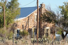
Photograph of State Highway 9 Bridge at the Llano River
Photograph by Larry D. Moore, CC BY 4.0. Via Wikimedia Commons.

State Highway 9 Bridge at the Llano River

Listed on the National Register of Historic Places in 1996.

From the record

“The State Highway 9 Bridge at the Llano River in Texas connects Mason County to the Gillespie County seat of Fredericksburg. On June 14, 1935, a disastrous flood crested the Llano River at 41.5 feet (10 m), washing out the two truss spans, as well as the center pier, of the 1930 bridge of State Highway 9 across the Llano River in Mason County, Texas.”

Wikipedia article State Highway 9 Bridge at the Llano River, CC BY-SA 4.0.

One of 5 National Register listings published here for Mason County · listed in 1996 · category: Structure.

Sources: the Wikipedia article · the case file at the National Archives · the National Register database, National Park Service

The listing

  • What is counted as historic. The nomination lists 1 structure as contributing to the listing.
  • Address. US 87, 10 mi. S of TX 29, Mason, 76856
  • When was it listed? October 1996
  • Category. structure
  • Also known as. Historic Bridges of Texas MPS
  • Census division. Mason West
  • National Register reference number. 96001128 - the number the National Park Service assigned this property when it was listed, and the key its nomination file is catalogued under at the National Archives.

Fires near this property

32 since 2005

Regional context, not property-specific evidence. The federal wildfire occurrence database lists 32 fires within 5 miles of State Highway 9 Bridge at the Llano River between 2005 and 2017, burning about 1,284 acres in total. 6 started naturally. None was recorded as arson. Distance is straight-line from the map coordinates, so a fire counted here may appear on a neighbouring settlement's page as well.

Reported cause Fires
Debris and open burning12
Missing data/not specified/undetermined11
Natural6
Equipment and vehicle use3

The most recent of them, most recent first, with the day each was reported and the service that recorded it.

DateCause SizeReported by Name on the report
30 September 2017Debris and open burning10 acresTexas A & M Forest ServiceRR 152/LKOTHMANN
29 September 2011Natural7.0 acresTexas A & M Forest ServiceZESCH FIRE
7 August 2015Missing data/not specified/undetermined1.0 acresTexas A & M Forest ServiceUS87S/KELLER VELINO RD
3 August 2010Debris and open burning3.0 acresTexas A & M Forest Service87S/1636 KETTNER-WILLMANN RD/DKEENER
28 August 2009Natural10 acresTexas A & M Forest Service8000 SIMONSVILLE RD/G. MARTIN
23 August 2011Debris and open burning1.0 acresTexas A & M Forest ServiceRR1723/SIMONSVILLE RD/TWO SISTERS RD
16 August 2017Natural2.0 acresTexas A & M Forest ServiceSH29E/LOWER WILLOW CREEK RD/WJORDAN
12 August 2009Natural2.0 acresTexas A & M Forest ServiceRR152/BILLYBODE

Every fire recorded in Mason County

Mines and quarries near this property

2 within 5 miles

Regional context, not property-specific evidence. The federal mineral resources record lists 2 workings within 5 miles of State Highway 9 Bridge at the Llano River: 1 producer, 1 occurrence. 1 still produces. What was taken out: Granite, Copper. Distance is straight-line from the map coordinates, so a quarry counted here may appear on a neighbouring settlement's page as well.

Where SiteCommodity StatusRecorded
Bauer ProspectCopperOccurrence
Mason County QuarryGraniteProducer

Every working recorded in Mason County

Storms near this property

60 of 68 shown

Regional context, not property-specific evidence. The National Weather Service names Mason, the town this property stands in, in 68 storm reports between 1994 and 2025: 40 hail, 14 thunderstorm wind, 10 flash flood, 2 tornado. The reports record 1 injury. Each account below is quoted exactly as the forecast office filed it, from the NOAA Storm Events Database, and each date opens the federal record of that event.

WhenEvent Place namedHarm What the report says
May 2010Thunderstorm WindMason1 hurtA NWS survey team reported several trees down, a trading auction's facility roof was severely damage, and an old barn was also damaged. The team found no damage to nearby structures. Law Enforcement Officials reported many power lines down across the town of Mason.
June 1997Flash FloodMason$2,000,000Four to eight inches of rain fell over most of Mason County but much higher amounts fell in a few areas.In the town of Mason 10 to 11 inches of rain was reported and in northeast Mason County, there was an unofficial report of 25 inches of rain. Farm-to-Market roads were closed throughout the county.
November 1996Thunderstorm WindMason$500,000no account filed
May 2005HailMason$100,000The supercell that developed in northern Concho County reached Mason. The storm produced hail across the northern half of the city, and the largest hail stones were noted just to the east of town. Mason was spared considerable damage with the main core of the storm passing within a mile or two of town.
May 2006Tornado (F0)Mason$80,000The tornado damaged trees, a metal fence, and ripped some sheet metal roofing off a barn. A hunting cabin was also destroyed.
October 1996Flash FloodMason$50,000no account filed
January 1995HailMason$10,000Thunderstorms produced large hail in a strip one mile long and three miles wide west of the city of Mason. Trees were stripped of their leaves and hail was piled up to 12 inches deep in places. Cars were dented and windows were broken in homes and buildings. Grass and vegetation was reported to have been beaten to the ground in the storm. The thunderstorm moved northeastward but produced no large hail in Mason.
May 2004HailMason$10,000no account filed
March 2004Thunderstorm WindMason$5,000A storage shed and trees were blown over.
November 2000Thunderstorm WindMason$5,000Thunderstorm winds downed tree limbs and power lines across the town of Mason.
February 1998Thunderstorm WindMason$5,000no account filed
August 1997Thunderstorm WindMason$5,000no account filed
May 1994HailMason$5,000no account filed
September 2003Thunderstorm WindMason$2,000Strong thunderstorm winds ripped shingles off of a roof and knocked down tree limbs.
July 2000Thunderstorm WindMason$2,000A downburst struck near the town of Mason. A telephone pole was snapped and several trees were blown over.
February 1998LightningMason$2,0005 heifers struck and killed by lightning
May 2025HailMason-A trained spotter reported a lot of 1 inch diameter size hail with a few golf ball size hail mixed in.
July 2025Flash FloodMason-Law enforcement reported that a low water crossing along James River Road was flooded. Time is estimated by radar.
April 2021HailMason-Report came from Mping.
April 2017HailMason-The public reported one inch hail, with a few larger stones, off of Art Hedwigs Road.
June 2017Flash FloodMason-A National Weather Service Rainfall Observer located about 3 miles southwest of Mason reported water flowing across low water crossings. He also reported small streams and creeks were also flooding in that same area.
September 2017Thunderstorm WindMason-Law enforcement officials reported a barn roof was blown off and trees were snapped in Mason.
May 2013Thunderstorm WindMason-Law enforcement reported debris covering Ranch Road 783 about 8 miles south southwest of Mason. In addition, his patrol car was blown off the road.
June 2007Flash FloodMason-Flooding was reported along FM Roads 152,386 and 1871 in Mason County.|
April 2006Thunderstorm WindMason-Numerous branches were blown down.
May 2006Thunderstorm WindMason-This was measured by the Mason RAWS site located at the airport.
May 2005HailMason-This is the last report received in Mason County as the storm began to weaken. The storm moved southeast towards the Hill country.
May 2005HailMason-The largest hail stones were noted just to the northeast of Mason.
May 2004Flash FloodMason-Highway 29 west of Mason had water flowing over it for several hours due to very heavy rains.
May 2004Tornado (F0)Mason-Law enforcement officers spotted a tornado just to the south of Mason.
October 2003Flash FloodMason-Some roads in Mason impassable after heavy rains.
May 2003Flash FloodMason-The Mason County Sheriff reported several road closures due to flash flooding in the town of Mason.
December 2002HailMason-Hail covered the ground and caused automobiles to slide off the road.
May 2022HailMason-no account filed
April 2021HailMason-no account filed
April 2015HailMason-no account filed
May 2015HailMason-no account filed
April 2014HailMason-no account filed
June 2013HailMason-no account filed
May 2010HailMason-no account filed
March 2009HailMason-no account filed
June 2007Heavy RainMason-no account filed
April 2006HailMason-no account filed
May 2006HailMason-no account filed
March 2005HailMason-no account filed
May 2005HailMason-no account filed
March 2004Thunderstorm WindMason-no account filed
May 2004HailMason-no account filed
May 2003HailMason-no account filed
June 2003Thunderstorm WindMason-no account filed
April 2002HailMason-no account filed

Every storm recorded in Mason County

Map coverage status

No historic map-sheet match is published for this property yet. That does not mean no map exists. This record needs a coordinate-quality review before it can be joined to a sheet boundary. Browse the county's mapped places while that work is pending.

Listed places nearby

1 within 8 miles

Other National Register properties close enough to walk or drive between, ordered by distance from this one. Both positions come from the same geocoding pass that matched these properties to their map sheets.

Photograph PropertyDistance Listed
Heinrich and Fredericka Hasse House5.4 miles1990

Sources for this property

National Archives recordThe nomination case file for reference 96001128 in Record Group 79.
Wikipedia articleCommunity-written account of this property, licensed CC BY-SA.
Mason CountyAll 5 listed properties in this county.

Provenance

  • Listing record. National Park Service National Register of Historic Places, listed-properties dataset, current to 2026-05-22.
  • Map join. Address geocoded through the United States Census geocoder, then tested against the published boundary of every sheet in the USGS Historical Topographic Map Collection.
  • How this page is made. Listing fields come from federal records; map-sheet coverage is a labelled coordinate-to-boundary calculation, not a source-field claim.
  • Wildfire. Short, Karen C. 2022. Spatial wildfire occurrence data for the United States, 1992-2020 [FPA_FOD_20221014]. 6th Edition. Fort Collins, CO: Forest Service Research Data Archive. https://doi.org/10.2737/RDS-2013-0009.6 Collected with United States Government funding and usable without additional permissions or fees.
  • Mines and quarries. USGS Mineral Resources Data System (MRDS) https://mrdata.usgs.gov/mrds/ A work of the United States government, no copyright under 17 U.S.C. 105.
  • Storms. NOAA National Centers for Environmental Information, Storm Events Database https://www.ncei.noaa.gov/stormevents/ A work of the United States government, no copyright under 17 U.S.C. 105. Narratives are quoted verbatim from the National Weather Service report and are not edited or summarised.