 Block
BlockFrom the record
One of 56 National Register listings published here for El Paso County · listed in 1997 · category: District.
Sources: the case file at the National Archives · the National Register database, National Park Service

Listed on the National Register of Historic Places in 1997.
One of 56 National Register listings published here for El Paso County · listed in 1997 · category: District.
Sources: the case file at the National Archives · the National Register database, National Park Service
Regional context, not property-specific evidence. The National Weather Service names San Elizario, the town this property stands in, in 2 storm reports between 2013 and 2014: 1 thunderstorm wind, 1 flash flood. No death or injury is recorded in these reports. Each account below is quoted exactly as the forecast office filed it, from the NOAA Storm Events Database, and each date opens the federal record of that event.
| When | Event | Place named | Harm | What the report says |
|---|---|---|---|---|
| June 2013 | Thunderstorm Wind | San Elizario | $3,000 | Radio operators reported wind damage to several trees near San Elizario High School. |
| September 2014 | Flash Flood | San Elizario | - | Interstate 10 near Piedras continued to be closed through this time period. Several portions of Gateway Drive both east and west were closed due to mud and rock slides caused by the heavy rain. Numerous water rescues were reported with the worst location in east El Paso near the intersection of Fierro and Bywood where 2 people were pulled to safety. ||Cars were stalled at North Mesa Street near the University of El Paso. Other areas where cars were stalled included the intersections of Cotton and Missouri as well as Gold Avenue and Elm Street. ||Several other major intersections in El Paso were closed by 1030pm including Montwood and Wedgewood, McRae and Gateway East, Montana and Piedras, Yarbrough and Montwood, and Hawkins and North Loop. ||Trans Mountain Road was closed due to flooding, heavy rain and poor visibility. |
No historic map-sheet match is published for this property yet. That does not mean no map exists. This record needs a coordinate-quality review before it can be joined to a sheet boundary. Browse the county's mapped places while that work is pending.
Other National Register properties close enough to walk or drive between, ordered by distance from this one. Both positions come from the same geocoding pass that matched these properties to their map sheets.
| Photograph | Property | Distance | Listed |
|---|---|---|---|
 | Presidio Chapel of San Elizario | under 500 feet | 1972 |
| El Paso County Water Improvement District No. 1 | 1.5 miles | 1997 | |
| Rio Vista Farm Historic District | 5.3 miles | ||
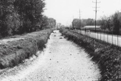 | Franklin Canal | 5.3 miles | 1992 |
 | Socorro Mission, Church | 5.4 miles | 1972 |
 | Ysleta Mission | 8.0 miles | 1972 |
| National Archives record | The nomination case file for reference 97000205 in Record Group 79. |
| El Paso County | All 56 listed properties in this county. |