 Block
BlockFrom the record
One of 14 National Register listings published here for Brewster County · listed in 1997 · category: Building.
Sources: the case file at the National Archives · the National Register database, National Park Service
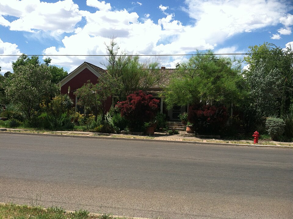
Listed on the National Register of Historic Places in 1997.
One of 14 National Register listings published here for Brewster County · listed in 1997 · category: Building.
Sources: the case file at the National Archives · the National Register database, National Park Service
Regional context, not property-specific evidence. The federal wildfire occurrence database lists 26 fires within 5 miles of Nolte-Rooney House between 2006 and 2012, burning about 41,347 acres in total. 4 started naturally. 2 were recorded as arson. Distance is straight-line from the map coordinates, so a fire counted here may appear on a neighbouring settlement's page as well.
| Reported cause | Fires |
|---|---|
| Missing data/not specified/undetermined | 7 |
| Smoking | 5 |
| Natural | 4 |
| Debris and open burning | 3 |
| Arson/incendiarism | 2 |
| Equipment and vehicle use | 2 |
| Railroad operations and maintenance | 2 |
| Misuse of fire by a minor | 1 |
The most recent of them, most recent first, with the day each was reported and the service that recorded it.
| Date | Cause | Size | Reported by | Name on the report |
|---|---|---|---|---|
| 11 August 2011 | Natural | 3.0 acres | Texas A & M Forest Service | DEVILS BACKBONE FIRE |
| 4 July 2006 | Smoking | 1.0 acres | Texas A & M Forest Service | not named |
| 29 July 2011 | Natural | 3.0 acres | Texas A & M Forest Service | SEALE 2 FIRE |
| 29 July 2011 | Natural | 10 acres | Texas A & M Forest Service | SEALE FIRE |
| 28 July 2006 | Natural | 1.0 acres | Texas A & M Forest Service | not named |
| 23 May 2006 | Smoking | 1.0 acres | Texas A & M Forest Service | not named |
| 12 May 2006 | Railroad operations and maintenance | 1.0 acres | Texas A & M Forest Service | not named |
| 12 May 2006 | Railroad operations and maintenance | 1.0 acres | Texas A & M Forest Service | not named |
Regional context, not property-specific evidence. The federal mineral resources record lists 4 workings within 5 miles of Nolte-Rooney House: 3 producers, 1 occurrence. 3 still produce. What was taken out: Sand and Gravel, Construction, Bentonite. Distance is straight-line from the map coordinates, so a quarry counted here may appear on a neighbouring settlement's page as well.
| Where | Site | Commodity | Status | Recorded |
|---|---|---|---|---|
| Alpine Bentonite Pit | Bentonite | Occurrence | Bentonite | |
| Border Mines Bentonite Plant | Bentonite | Producer | ||
| Kimball Quarry & Plant | Sand and Gravel, Construction | Producer | ||
| Unnamed Pit | Sand and Gravel, Construction | Producer | Gravel, Sand |
Regional context, not property-specific evidence. The National Weather Service names Alpine, the town this property stands in, in 161 storm reports between 1993 and 2025: 96 hail, 35 flash flood, 13 thunderstorm wind, 13 heavy rain. No death or injury is recorded in these reports. Each account below is quoted exactly as the forecast office filed it, from the NOAA Storm Events Database, and each date opens the federal record of that event.
| When | Event | Place named | Harm | What the report says |
|---|---|---|---|---|
| October 1995 | Hail | Alpine | $3,000,000 | An HP supercell moving to the southeast through northern Brewster County pummelled much of Alpine with large hail and high winds. The west and northwest sides of the city were hardest hit with windows knocked out of numerous houses, and about 200 homes having the paint blasted off the exterior walls. Many cars were damaged in the storm as well. The hail was two inches deep in some parts of town. During the storm a wind gust was measured at 56 mph. Total property damage was estimated at about $3 million. |
| July 2025 | Flash Flood | Alpine | $50,000 | Emergency Management in Alpine reported one home inundated by flooding due to heavy rainfall and numerous road closures by local authorities. The time of occurrence is estimated by radar. The total cost of damages is also estimated. |
| August 2004 | Flash Flood | Alpine | $50,000 | The Alpine Police Department barricaded city streets at several low water crossings at 14:15 CST due to flash flooding. Shortly before 1600 CST Alpine Creek began to overflow its banks, and washed away the police barricades. During the next half hour, residents were evacuated from several homes along the creek as flood waters continued to rise. |
| May 2010 | Hail | Alpine | $45,000 | Several windows and skylights were broken by the hail on one home. In addition, two more homes received roof and window damage. One vehicle also reported damage. |
| August 2002 | Flash Flood | Alpine | $30,000 | no account filed |
| June 2014 | Hail | Alpine | $29,000 | A thunderstorm moved across Brewster County and produced baseball sized hail on the edge of Alpine. There were car dents, damaged shingles, and broken house windows as a result of this hail. The cost of damage is a rough estimate. |
| July 1999 | Thunderstorm Wind | Alpine | $20,000 | Strong thunderstorms in the Alpine area dropped around 2 inches of rain in 40 minutes and contained at least one microburst that lifted a roof off a house, damaged a porch, overturned sheds, and downed utility lines and tree limbs. |
| May 1996 | Thunderstorm Wind | Alpine | $20,000 | no account filed |
| May 2008 | Hail | Alpine | $10,000 | Brewster County emergency manager reported baseball sized hail at Hilltop Ranch. |
| July 2004 | Flash Flood | Alpine | $10,000 | Heavy rainfall and excessive runoff resulted in flash flooding along Alpine Creek. Police officers barricaded several city streets as flood waters inundated the roadways. Water levels in some locations climbed to three feet. Damage was reported to be minimum, but several houses were threatened. |
| July 1997 | Flash Flood | Alpine | $10,000 | Training cells in the Alpine area caused heavy rains and flooding in the city. About 3.5 inches of rain fell over the western half of the city. A van stalled in an underpass and eventually was almost submerged with the roof extending only 18" above the water. Two other vehicles were stranded in water as well. |
| August 1997 | Thunderstorm Wind | Alpine | $10,000 | A thunderstorm moving over the city of Alpine collapsed, producing a wet microburst that blew the roof off a trailer, overturned a carport, and knocked down sheds. The storm was not moving extremely fast (at 18kt) but was the fastest moving of the 44 cells on the Midland radar. The storm dumped half its volume in one 6 minute scan with the VIL dropping from 38 to 19 kg/m2. The debris was blown in the direction of the storm movement (NE-SW). |
| May 2018 | Thunderstorm Wind | Alpine | $5,000 | A thunderstorm moved across Brewster County and produced wind damage in Alpine. A power pole was blown down and signs were shattered and blown down due to strong winds and hail. The cost of damage is a very rough estimate. |
| June 2013 | Thunderstorm Wind | Alpine | $5,000 | A thunderstorm moved across Brewster County and produced an estimated 65 mph wind gust in Alpine. A tree fell on a vehicle. The size of the tree and damage to the vehicle are unknown. The cost of damage is a rough estimate. |
| August 2002 | Thunderstorm Wind | Alpine | $5,000 | no account filed |
| June 1998 | Thunderstorm Wind | Alpine | $3,000 | A cluster of small storms moved over Alpine with microburst winds knocking down utility poles and blowing out windows. |
| October 2009 | Thunderstorm Wind | Alpine | $2,000 | A transmission power pole was reported down along State Highway 118. |
| May 1999 | Hail | Alpine | $2,000 | Car windows damaged. |
| October 2015 | Flash Flood | Alpine | $500 | Heavy rain fell across Brewster County and produced flash flooding in Alpine. Underpasses on Highway 90 in Alpine were flooded with an estimated two to three feet of water. The cost of damage is a very rough estimate. |
| June 2014 | Flash Flood | Alpine | $500 | Heavy rain moved across Brewster County and produced flash flooding near Alpine. A pasture was flooded. The cost of damage is a very rough estimate. |
| July 2012 | Flash Flood | Alpine | $500 | A wide area of heavy rain moved through Brewster County and produced flash flooding in Alpine. Four and a half feet of running water was reported across low- lying crossings in the town. Bridges and crossways were closed due to the flooding. No damage was reported, so the cost of damage is a very rough estimate. |
| July 2012 | Flash Flood | Alpine | $500 | Heavy rain moved through Brewster County and produced widespread flooding across Alpine. No damage was indicated, so the cost of damage is a very rough estimate. |
| June 2013 | Hail | Alpine | $200 | A thunderstorm moved across Brewster County and produced pingpong ball sized hail in Alpine. Trees were stripped of leaves, and flower gardens were destroyed. The cost of damage is a rough estimate. |
| March 2025 | Hail | Alpine | - | Received a phone call of quarter size hail 8 miles south of Alpine along State Highway 118. Time is estimated from radar. |
| May 2025 | Hail | Alpine | - | An MPING report of dime-size hail was received from the public. |
| May 2023 | Hail | Alpine | - | Ping pong to golf ball-sized hail was observed in Alpine. |
| May 2019 | Hail | Alpine | - | A thunderstorm moved across Brewster County and produced nickel sized hail and minor street flooding eight miles southeast of Alpine. |
| May 2018 | Hail | Alpine | - | Dime to nickel sized hail was reported three miles east of Alpine. |
| August 2017 | Heavy Rain | Alpine | - | Heavy rain fell near Alpine, TX for about 20 minutes. Anywhere from 0.75 to 0.99 inches of rain fell. |
| May 2016 | Funnel Cloud | Alpine | - | A thunderstorm moved across Brewster County and produced a funnel cloud/gustnado just north of Alpine. No damage was reported with this storm. |
| August 2016 | Heavy Rain | Alpine | - | Heavy rain fell south of Alpine for around an hour. There was a total of 1.35 inches of rain. |
| August 2016 | Thunderstorm Wind | Alpine | - | A thunderstorm moved across Brewster County and produced a 62 mph wind gust near Alpine. |
| July 2016 | Heavy Rain | Alpine | - | Heavy rain fell for 40 minutes near Alpine and resulted in about 0.70 inches of accumulation. |
| May 2015 | Heavy Rain | Alpine | - | Heavy rain fell near Alpine. A total of 0.10 to 0.24 inches was recorded over a period of ten minutes. |
| August 2015 | Heavy Rain | Alpine | - | Heavy rain fell across Brewster County with a COOP observer near Alpine reporting 1.00 to 1.24 inches of rain in 30 minutes. |
| August 2014 | Heavy Rain | Alpine | - | Heavy rain fell near Alpine with three quarters to an inch falling in 40 minutes. |
| July 2014 | Heavy Rain | Alpine | - | Heavy rain fell near Alpine with three quarters to almost an inch falling in fifteen minutes. |
| August 2014 | Thunderstorm Wind | Alpine | - | A thunderstorm moved across Brewster County and produced a 59 mph wind gust in Alpine. No damage was reported. |
| April 2014 | Heavy Rain | Alpine | - | Heavy rain fell 8 miles southeast of Alpine with 0.22 inches of rain falling in 12 minutes. |
| June 2014 | Heavy Rain | Alpine | - | There was heavy rain near Alpine and one to one and a quarter of an inch of rain fell in 50 minutes. |
| June 2014 | Heavy Rain | Alpine | - | Heavy rain fell across Brewster County near Alpine. Almost one inch of rain fell in fifteen minutes. This rain caused minor street flooding. |
| September 2014 | Heavy Rain | Alpine | - | Heavy rain fell near Alpine with three quarters to near an inch falling in one hour and fifteen minutes. |
| June 2013 | Flash Flood | Alpine | - | Heavy rain moved across Brewster County and produced flash flooding in Alpine. Six to ten inches of water was running over the streets in downtown Alpine. Since there was no damage reported, the cost of damage is assumed to be zero. |
| June 2013 | Flash Flood | Alpine | - | Heavy rain moved across Brewster County and produced flash flooding about eight miles southeast of Alpine. Low water crossings were reported to be flooded. The cost of damage is assumed to be zero since no damage was reported. |
| June 2013 | Heavy Rain | Alpine | - | Heavy rain moved across Brewster County. Almost two inches of rain was reported to have fallen within two hours about eight miles southeast of Alpine. |
| May 2013 | Hail | Alpine | - | A thunderstorm moved over Brewster County and produced penny sized hail in Alpine. |
| May 2013 | Heavy Rain | Alpine | - | A thunderstorm moved over Brewster County and produced heavy rain in Alpine. |
| April 2013 | Hail | Alpine | - | A thunderstorm developed over Brewster County and produced quarter sized hail in Alpine. |
| April 2013 | Hail | Alpine | - | A thunderstorm moved over Brewster County and produced golfball sized hail 22 miles south southeast of Alpine. The hail covered the road. |
| May 2013 | Hail | Alpine | - | A thunderstorm moved over Brewster County and produced nickel sized hail three miles west southwest of Alpine. |
| August 2008 | Flash Flood | Alpine | - | Creeks were reported to be out of their banks, with flooding in the city of Alpine. |
| September 2008 | Flash Flood | Alpine | - | At 0225 CST, Local law enforcement in Alpine reported 2 feet of water flowing across U.S. Highway 90 on the west side of Alpine. They also reported several creek crossings closed in and around Alpine. |
| April 2007 | Hail | Alpine | - | Golfball size hail fell along U.S. Highway 67 northeast of Alpine. |
| June 2007 | Flash Flood | Alpine | - | Widespread flooding occurred throughout the city of Alpine. Low water crossings had up to 1.5 feet of water running over the road. Several streets had to be closed due to high water from heavy rains. |
| May 2007 | Hail | Alpine | - | Nickel to quarter sized hail fell south of Alpine. |
| May 2006 | Hail | Alpine | - | Pea to golfball size hail fell in Alpine. |
| May 2006 | Hail | Alpine | - | Nickel to golfball size hail in and around Alpine. |
| September 2006 | Flash Flood | Alpine | - | The Alpine Police Department reported that low water crossings in Alpine had been barricaded due to a foot of water running across most of those crossings. |
| June 2005 | Hail | Alpine | - | Motorists reported nickel size hail along Texas Highway 118 south of Alpine. |
| June 2005 | Hail | Alpine | - | Several reports were received of nickel to quarter size hail as a severe storm tracked south of Alpine. |
No historic map-sheet match is published for this property yet. That does not mean no map exists. This record needs a coordinate-quality review before it can be joined to a sheet boundary. Browse the county's mapped places while that work is pending.
Other National Register properties close enough to walk or drive between, ordered by distance from this one. Both positions come from the same geocoding pass that matched these properties to their map sheets.
| Photograph | Property | Distance | Listed |
|---|---|---|---|
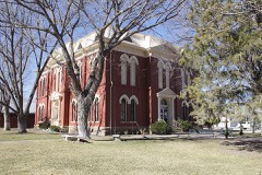 | Brewster County Courthouse and Jail | 0.3 miles | 1978 |
| Holland Hotel | 0.3 miles | 2025 | |
| Grandview Courts-Siesta Motel | 0.6 miles | 2025 |
| National Archives record | The nomination case file for reference 97000360 in Record Group 79. |
| Brewster County | All 14 listed properties in this county. |