 Block
Lehi, Utah
21 topographic sheets cover this place, the earliest surveyed in 1885 and the latest in 1998. It stands in the Lehi census division. It lies in ZIP code area 84043. It lies near Cedar Hollow. The Survey maps it on the Lehi quadrangle. 75,907 people lived here at the 2020 count. It stands 4,564 feet above sea level.
Research this city
On record in Lehi
Buildings and businesses the archive holds for this place. Each opens its own page, with the source record it came from.
On the National Register 12 of 17 shown
 Thomas Austin Houselisted 1982
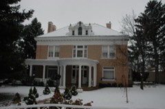 Thomas R. Cutler Mansionlisted 1984
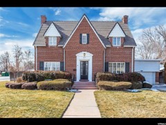 Dr. Elmo and Rhea Eddington Houselisted 1998
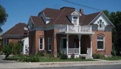 James H. and Rhoda H. Gardner Houselisted 1998
 Samuel I. and Olena J. Goodwin Houselisted 1998
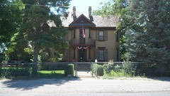 Christian and Sarah Knudsen Houselisted 1998
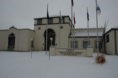 Lehi City Halllisted 1982
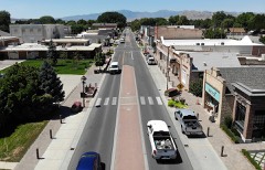 Lehi Main Street Historic Districtlisted 1998
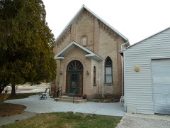 Lehi North Branch Meetinghouselisted 1998
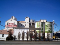 Lehi Roller Millslisted 1994
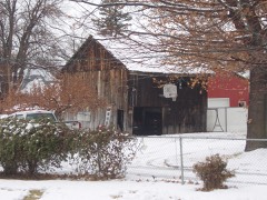 Lehi Ward Tithing Barn-Centennial Halllisted 1998
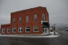 Harry B. Merrihew Drugstorelisted 1982
Surveyed buildings and structures 1 record
- Jordan Narrows Bridge, Crossing Jordan River at 9600 North, Lehifederal building survey, 13 photographs
Population over time
2 figuresLehi grew from 47,407 to 75,907 between 2010 and 2020. These are the recorded population figures Wikidata holds for this place, reached through the Geographic Names Information System number this page is keyed on rather than by name, so they belong to this place and not to another of the same name. Most are census counts, but not all are: an early figure may be a founding or settlement estimate, and an estimate published within five years of a census is left out. The change column is computed, and is left blank where more than 20 years separate a figure from the one before it, because a gap that long is not a change between two counts.
| Year | People | Change |
|---|---|---|
| 2010 | 47,407 | |
| 2020 | 75,907 | +28,500 (+60%) |
Topographic sheets covering this place
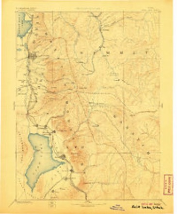
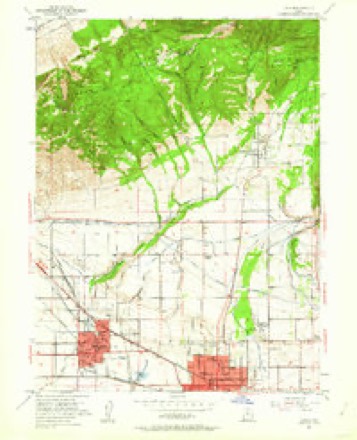
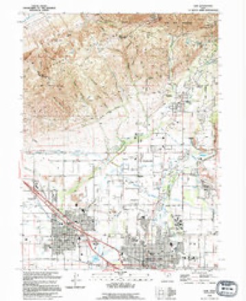
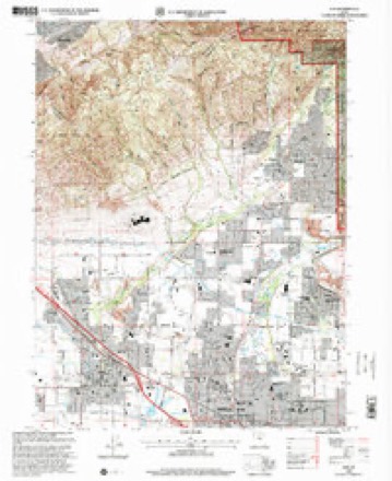
8 surveys from 21 printed sheetsMatched by testing this settlement's coordinate against the published boundary of every sheet in the United States Geological Survey's historical collection. Each opens the scanned sheet at the Survey.
- 1885 USGS Salt Lake quadrangle1:250000, 7 printings
- 1951 USGS Lehi quadrangle1:24000, 5 printings
- 1954 USGS Salt Lake City quadrangle1:250000, 4 printings
- 1958 USGS Salt Lake City quadrangle1:250000
- 1960 USGS Salt Lake City quadrangle1:250000
- 1986 USGS Provo quadrangle1:100000
- 1994 USGS Lehi quadrangle1:24000
- 1998 USGS Lehi quadrangle1:24000
What the histories say of this town
3,766 words1 chapter about Lehi from the published histories of the county, public domain and reproduced complete.
| Chapter | From | Length |
|---|---|---|
| Utah County: a Graphic Account of Its Foundings, Its Wonderful Growth | Utah County: a Graphic Account of Its Foundings, Its Wonderful Growth and Its Splendid Promise for the Future : Also a Descriptive Review of Its Resources, Attractions, Industries, Leading Business Houses and Institutions, with Portraits and Biographical Sketches of Its Pioneers and Early Settlers (1897) | 3,766 words |
Fires near this place
131 since 1992Regional context, not property-specific evidence. The federal wildfire occurrence database lists 131 fires within 5 miles of Lehi between 1992 and 2020, burning about 1,578 acres in total. 2 started naturally. 6 were recorded as arson. Distance is straight-line from the map coordinates, so a fire counted here may appear on a neighbouring settlement's page as well.
| Reported cause | Fires |
|---|---|
| Missing data/not specified/undetermined | 80 |
| Debris and open burning | 21 |
| Railroad operations and maintenance | 8 |
| Arson/incendiarism | 6 |
| Equipment and vehicle use | 4 |
| Fireworks | 2 |
| Recreation and ceremony | 2 |
| Power generation/transmission/distribution | 2 |
| Smoking | 2 |
| Natural | 2 |
| Misuse of fire by a minor | 1 |
| Firearms and explosives use | 1 |
The most recent of them, most recent first, with the day each was reported and the service that recorded it.
| Date | Cause | Size | Reported by | Name on the report |
|---|---|---|---|---|
| 9 September 2009 | Debris and open burning | under an acre | Utah Division Forestry Fire State Lands | BUCKWALTER |
| 8 September 2016 | Power generation/transmission/distribution | under an acre | Utah Division Forestry Fire State Lands | FA 0806 REDWD INCORP |
| 8 September 2006 | Smoking | under an acre | Utah Division Forestry Fire State Lands | 11600 W. |
| 6 September 2001 | Debris and open burning | under an acre | Utah Division Forestry Fire State Lands | SHIP FIRE |
| 5 September 1994 | Missing data/not specified/undetermined | under an acre | Utah Division Forestry Fire State Lands | ILLEGAL BURN |
| 3 September 2003 | Firearms and explosives use | 30 acres | Salt Lake Field Office | HARVSTHILL |
| 29 September 2009 | Debris and open burning | under an acre | Utah Division Forestry Fire State Lands | BUCKWALTER #2 |
| 28 September 1994 | Missing data/not specified/undetermined | under an acre | Utah Division Forestry Fire State Lands | SOLO # 3 |
Settlements close enough to share some of these fires:
Mines and quarries near this place
10 of 34 shownRegional context, not property-specific evidence. The federal mineral resources record lists 34 workings within 5 miles of Lehi: 15 past producers, 13 producers, 4 occurrences, 2 unknowns. 13 still produce. What was taken out: Sand and Gravel, Construction, Geothermal, Iron. Distance is straight-line from the map coordinates, so a quarry counted here may appear on a neighbouring settlement's page as well.
| Where | Site | Commodity | Status | Recorded |
|---|---|---|---|---|
| Dry Hollow Prospects | Iron | Occurrence | Hematite | |
| Crater Hot Springs | Geothermal | Unknown | ||
| Saratoga Hot Springs | Geothermal | Unknown | ||
| American Fork Gravel Pit | Sand and Gravel, Construction | Past Producer | Unconsolidated Sediments | |
| Christen Gravel Pit | Sand and Gravel, Construction | Past Producer | Unconsolidated Sediments | |
| Gravel Pit In Twn 55 Rng 1e Sec 13 | Sand and Gravel, Construction | Producer | ||
| Intermountain Sand Pit | Sand and Gravel, Construction | Producer | ||
| International Sand and Gravel Pit | Sand and Gravel, Construction | Past Producer | Unconsolidated Sediments | |
| Johnson Gravel Pit | Sand and Gravel, Construction | Occurrence | ||
| Johnson Gravel Pit | Sand and Gravel, Construction | Past Producer | Shale |
Storms near this place
30 since 2000Regional context, not property-specific evidence. The National Weather Service names Lehi in 30 storm reports between 2000 and 2024: 15 thunderstorm wind, 8 hail, 4 flash flood, 1 tornado. The reports record 1 death. Each account below is quoted exactly as the forecast office filed it, from the NOAA Storm Events Database, and each date opens the federal record of that event.
| When | Event | Place named | Harm | What the report says |
|---|---|---|---|---|
| August 2015 | Lightning | Lehi | 1 killed | A family was having a picnic in a park in Lehi, Utah, when a thunderstorm moved across the area. Lightning struck a nearby tree, and critically injured a 50-year-old woman. No one else in the party was seriously injured, but the victim passed away in a hospital a few days later. |
| September 2012 | Flash Flood | Lehi | $1,000,000 | Heavy rain over the Dump Fire burn scar created a debris flow, flooding a portion of Saratoga Springs, and forcing the closure of Highway 68 for a period of time. Twenty residences experienced flood damage, with 11 of those homes having water in their basements, and 9 of those homes experiencing solely yard damage. Finished basements were completely destroyed in 5 separate homes, with the most impacted home having mud nine feet deep in the basement. Structural damage to homes was estimated at $250,000, and many personal possessions inside the homes were also damaged or destroyed. Public infrastructure was also impacted, with approximately $200,000 worth of damage to a nearby park and $50,000 of fencing destroyed. |
| August 2024 | Hail | Lehi | $50,000 | Social media reports showed 1.5 inch diameter hail at Lehi. Time and location are estimated by radar. |
| October 2015 | Flash Flood | Lehi | $50,000 | Flash flooding was reported in Lehi, with some flooded residential roadways. In addition, approximately six homes sustained flood damage, primarily to basements. |
| August 2024 | Hail | Lehi | $15,000 | Social media photos from around Eagle Mountain, Saratoga Springs, and Lehi showed 1-1.5 inch diameter hail. |
| August 2000 | Flash Flood | Lehi | $10,000 | Heavy rain brought flooding in the Saratoga Springs area, with 2 homes having their basements flooded. Some road damage was also reported with the flooding. |
| August 2024 | Flash Flood | Lehi | $5,000 | Time is estimated. Homes in Saratoga Springs sustained water damage due to intense bursts of rain, in particular on South Island Road. City parks were also impacted with floodwaters. Construction sites were also affected by rainfall. |
| August 2024 | Hail | Lehi | - | One inch diameter hail was reported at Saratoga Springs. |
| August 2024 | Thunderstorm Wind | Lehi | - | A wind gust of 59 mph was recorded at a personal weather station in Saratoga Springs. |
| August 2024 | Thunderstorm Wind | Lehi | - | A wind gust of 62 mph was recorded at the Marina mesonet site. |
| September 2024 | Thunderstorm Wind | Lehi | - | The Pioneer Crossing mesonet station recorded a wind gust of 63 mph as a result of outflow winds associated with a nearby cluster of showers and thunderstorms moving through the area. |
| July 2023 | Thunderstorm Wind | Lehi | - | The Point of the Mountain (I-15 Alpine) mesonet station recorded a wind gust of 62 mph as a result of outflow winds associated with a line of showers and thunderstorms moving through the area. |
| June 2022 | Thunderstorm Wind | Lehi | - | The Pioneer Crossing mesonet station recorded a peak wind gust of 60 mph. |
| August 2021 | Thunderstorm Wind | Lehi | - | The Point of the Mountain automated weather station recorded a peak wind gust of 65 mph. |
| August 2021 | Thunderstorm Wind | Lehi | - | The Pioneer Crossing automated weather station recorded a peak wind gust of 58 mph. |
| May 2020 | Thunderstorm Wind | Lehi | - | The Pioneer Crossing sensor recorded a peak wind gust of 59 mph. |
| April 2018 | Thunderstorm Wind | Lehi | - | Saratoga Springs reported a peak wind gust of 61 mph. |
| July 2014 | Thunderstorm Wind | Lehi | - | A sensor in Saratoga Springs recorded a peak wind gust of 62 mph. |
| August 2014 | Hail | Lehi | - | Penny sized hail was reported in Lehi. |
| April 2014 | Thunderstorm Wind | Lehi | - | A sensor in Saratoga Springs recorded a peak wind gust of 63 mph. |
| June 2013 | Thunderstorm Wind | Lehi | - | A sensor in Saratoga Springs recorded a maximum wind gust of 59 mph. |
| July 2013 | Thunderstorm Wind | Lehi | - | The Pioneer Crossing sensor near Saratoga Springs, Utah recorded a maximum wind gust of 59 mph. |
| July 2013 | Thunderstorm Wind | Lehi | - | A sensor in Saratoga Springs recorded a maximum wind gust of 58 mph. |
| September 2013 | Debris Flow | Lehi | - | A debris flow was reported off of the Dump Fire burn scar, but prior mitigation was successful, as retention ponds filled up, but debris did not flow into the towns of Eagle Mountain or Saratoga Springs. |
| May 2011 | Hail | Lehi | - | Penny-sized hail was reported in Lehi. |
| April 2010 | Hail | Lehi | - | Hail with a diameter of 0.75 inches and 1.00 inch were both reported with this storm near Lehi. |
| September 2007 | Thunderstorm Wind | Lehi | - | A 53 knot wind gust was measured at Lehi, Utah. |
| August 2007 | Hail | Lehi | - | Pictures of penny to nickel sized hail in Eagle Mountain were shown on KUTV. |
| September 2006 | Hail | Lehi | - | Along Redwood rd. near center of town. |
| May 2005 | Tornado (F0) | Lehi | - | Brief tornado touchdown along Utah Lake shore...photographed by spotter. |
Nearest settlements
The eight closest, with where each one stands in the county. Distances are straight-line, computed from the Geographic Names Information System coordinates.
| Map | Place | Distance | Sheets |
|---|---|---|---|
| American Fork | 3.1 miles | 21 | |
| Saratoga Springs | 4.1 miles | 22 | |
| Saratoga Resort | 4.1 miles | 22 | |
| Wing | 4.3 miles | 20 | |
| Clinton | 4.5 miles | 22 | |
| Cedar Hills | 5.1 miles | 21 | |
| Alpine | 5.7 miles | 21 | |
| Highland | 5.9 miles | 21 |
Elsewhere
Matched on this settlement's Geographic Names Information System number rather than its name, so it cannot be a different place of the same name in another state.
| Wikipedia article on Lehi | An encyclopaedic summary. Its text is share-alike, so it is linked here rather than copied. |
| Wikidata item Q1010595 | The structured record the population and elevation above come from. Public domain (CC0). |
Provenance
This settlement is recorded in the Geographic Names Information System as feature 1442553. The sheet list is computed by point-in-boundary test against the United States Geological Survey's historical topographic inventory. Both are works of the United States government and carry no copyright under 17 U.S.C. 105.
Wildfire. Short, Karen C. 2022. Spatial wildfire occurrence data for the United States, 1992-2020 [FPA_FOD_20221014]. 6th Edition. Fort Collins, CO: Forest Service Research Data Archive. https://doi.org/10.2737/RDS-2013-0009.6 Collected with United States Government funding and usable without additional permissions or fees.
Mines and quarries. USGS Mineral Resources Data System (MRDS) https://mrdata.usgs.gov/mrds/ A work of the United States government, no copyright under 17 U.S.C. 105.
Storms. NOAA National Centers for Environmental Information, Storm Events Database https://www.ncei.noaa.gov/stormevents/ A work of the United States government, no copyright under 17 U.S.C. 105. Narratives are quoted verbatim from the National Weather Service report and are not edited or summarised.