 Block
Notom, Utah
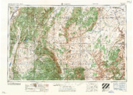
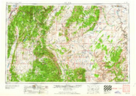
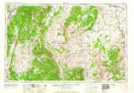
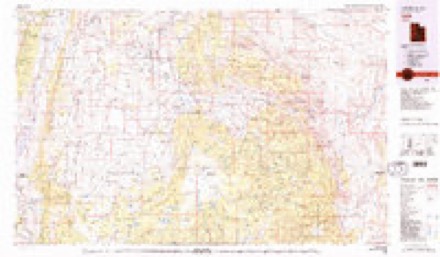
20 topographic sheets cover this place, the earliest surveyed in 1885 and the latest in 1987. It stands in the Hanksville census division. It lies in ZIP code area 84775. It stands on Capitol Wash. The Survey maps it on the Notom quadrangle. It stands 5,236 feet above sea level.
Topographic sheets covering this place
9 surveys from 20 printed sheetsMatched by testing this settlement's coordinate against the published boundary of every sheet in the United States Geological Survey's historical collection. Each opens the scanned sheet at the Survey.
- 1885 USGS Fish Lake quadrangle1:250000
- 1896 USGS Fish Lake quadrangle1:250000, 4 printings
- 1952 USGS Notom quadrangle1:62500, 3 printings
- 1952 USGS Notom 4 NE quadrangle1:24000
- 1956 USGS Salina quadrangle1:250000, 5 printings
- 1960 USGS Salina quadrangle1:250000, 2 printings
- 1962 USGS Salina quadrangle1:250000
- 1980 USGS Loa quadrangle1:100000, 2 printings
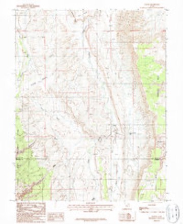
- 1987 USGS Notom quadrangle1:24000
Fires near this place
1 since 2009Regional context, not property-specific evidence. The federal wildfire occurrence database lists 1 fire within 5 miles of Notom in 2009, burning under an acre in total. 1 started naturally. None was recorded as arson. Distance is straight-line from the map coordinates, so a fire counted here may appear on a neighbouring settlement's page as well.
| Reported cause | Fires |
|---|---|
| Natural | 1 |
The most recent of them, most recent first, with the day each was reported and the service that recorded it.
| Date | Cause | Size | Reported by | Name on the report |
|---|---|---|---|---|
| 29 July 2009 | Natural | under an acre | Capitol Reef National Park | EAST BNDY |
Mines and quarries near this place
10 of 11 shownRegional context, not property-specific evidence. The federal mineral resources record lists 11 workings within 5 miles of Notom: 6 past producers, 4 occurrences, 1 producer. 1 still produces. What was taken out: Uranium, Uranium, Vanadium, Gypsum-Anhydrite, Gemstone. Distance is straight-line from the map coordinates, so a quarry counted here may appear on a neighbouring settlement's page as well.
| Where | Site | Commodity | Status | Recorded |
|---|---|---|---|---|
| Billy's Dream | Vanadium, Uranium | Past Producer | Carnotite | |
| Capitol Reef Gypsum | Gypsum-Anhydrite | Occurrence | Alabaster | |
| Capitol Reef Gypsum | Gypsum-Anhydrite | Occurrence | ||
| Notom Bench Jasper | Gemstone | Occurrence | ||
| Notom Bench Jasper | Gemstone | Occurrence | ||
| Billy'sS Dream | Uranium, Vanadium | Past Producer | ||
| Blue Tail Fly | Uranium, Vanadium | Past Producer | Carnotite | |
| Blue Tail Fly | Uranium, Vanadium | Past Producer | ||
| Green Light-Kim | Uranium | Past Producer | Underground | |
| Notom Mine | Uranium | Producer |
Storms near this place
24 since 2008Regional context, not property-specific evidence. The National Weather Service names Notom in 24 storm reports between 2008 and 2024: 24 flash flood. No death or injury is recorded in these reports. Each account below is quoted exactly as the forecast office filed it, from the NOAA Storm Events Database, and each date opens the federal record of that event.
| When | Event | Place named | Harm | What the report says |
|---|---|---|---|---|
| October 2012 | Flash Flood | Notom | $15,000 | Flash flooding occurred in Capitol Reef National Park, with all washes along Scenic Drive producing 6 to 8 inch flows across the road. This flooding caused many of the dirt roads across the park to be impassable for a few days. In addition, a large tree fell over State Route 24 due to erosion along the Fremont River, closing the highway for about an hour and a half. Water also crossed over State Route 24 at milepost 100 near Caineville. |
| August 2017 | Flash Flood | Notom | $2,000 | Flash flooding was reported in Capitol Reef National Park, with 4 to 6 inches of flowing water reported in Capitol Gorge. This water damaged the dirt road that provides access to the Capitol Gorge area. |
| August 2024 | Flash Flood | Notom | - | A park ranger reported water across Notom Road from Burrow Wash. |
| July 2022 | Flash Flood | Notom | - | A flood wave around 3 feet or higher passed through Pleasant Creek within Captitol Reef National Park. The flood wave was associated with heavy rainfall in close vicinity to the creek. |
| September 2022 | Flash Flood | Notom | - | Park rangers relayed a report of flash flooding in Capitol Gorge, with floodwaters as much as 4 feet deep. This is associated with showers and thunderstorms which moved through the area between around 12:30 pm MST to 2:00 pm MST and produced around 0.50 inches of rainfall. |
| July 2021 | Flash Flood | Notom | - | Capitol Reef National Park officials reported 5 inches of debris, mud, and gravel overflowing the Scenic Drive by the Capitol Gorge area. High-flowing water was also reported in a usually dry wash at the end of the Scenic Drive. Scenic Drive was closed beyond Grand Wash. |
| August 2021 | Flash Flood | Notom | - | Capitol Reef National Park officials reported flash flooding on several drainages in the Park. |
| July 2020 | Flash Flood | Notom | - | Flash flooding was reported in Grand Wash of Capitol Reef National Park, with water flowing 2 feet deep and 20 feet wide. The Freemont River and Capitol Gorge also had significant flows. Adddiionally, the Scenic Drive was closed. |
| September 2017 | Flash Flood | Notom | - | Flash flooding was reported on Pleasant Creek in Capitol Reef National Park. |
| October 2016 | Flash Flood | Notom | - | Rangers at Capitol Reef National Park reported flash flooding in the Capitol Gorge. |
| September 2015 | Flash Flood | Notom | - | Significant flash flooding was reported in Capitol Reef National Park, with multiple flood waves reported along Sulphur Creek. Flash flooding also occurred in both Spring Canyon and Chimney Rock Canyon. The Spring Canyon flooding was generally between 6 inches and two feet deep, though it reached as high as 5 feet deep through the narrow section. Water flowing through Chimney Rock Canyon was reported to be one foot deep. |
| September 2014 | Flash Flood | Notom | - | Park rangers in Capitol Reef National Park reported flash flooding along Pleasant Creek. |
| August 2014 | Flash Flood | Notom | - | Heavy rain caused flash flooding in Capitol Reef National Park, with both Grand Wash and Capitol Gorge experiencing flooding. Rangers also closed the Scenic Drive due to flooding. |
| July 2014 | Flash Flood | Notom | - | Flash flooding was observed along Pleasant Creek in Capitol Reef National Park, with the worst flooding at the south end of the Scenic Drive. |
| May 2014 | Flash Flood | Notom | - | A visitor to Capitol Reef National Park reported a flash flood in the Cottonwood Wash. |
| August 2013 | Flash Flood | Notom | - | Small flash floods were reported in Capitol Reef National Park, but the Fremont River rose significantly when all of these washes combined into the main river as it flowed toward Caineville. |
| September 2013 | Flash Flood | Notom | - | Park rangers reported flooding in the Capitol Gorge section of Capitol Reef National Park, with water a foot high flowing through the Gorge, leading them to temporarily close the area to visitors. Additional flooding was also reported in and around other portions of Capitol Reef National Park, including impassable roads in Cathedral Valley and along the |Notom-Bullfrog Road. |
| August 2011 | Flash Flood | Notom | - | Park rangers at Capitol Reef National Park reported a large flash flood along Sulpher Creek. |
| July 2011 | Flash Flood | Notom | - | Widespread flash flooding occurred in Capitol Reef National Park. Water crossed the Scenic Drive in multiple locations from the visitors center to the Slickrock Divide, forcing rangers to close the road. In addition, flash flooding was reported in Sulphur Creek. |
| July 2011 | Flash Flood | Notom | - | Park rangers in Capitol Reef National Park reported flash flooding along Sulphur Creek. |
| August 2011 | Flash Flood | Notom | - | Flash flooding was reported along Pleasant Creek, Sandy Creek, and Burro Wash in and near Capitol Reef National Park. |
| August 2010 | Flash Flood | Notom | - | Flash flooding occurred along the Scenic Drive of Capitol Reef National Park, as well as the Grand Wash and several roads further south in the park. |
| July 2009 | Flash Flood | Notom | - | Flash flooding was reported at Sulphur Creek near mile marker 72 on SR 24. |
| August 2008 | Flash Flood | Notom | - | Park Rangers reported water flowing over Notom Road near Capitol Reef National Park. |
Nearest settlements
The eight closest, with where each one stands in the county. Distances are straight-line, computed from the Geographic Names Information System coordinates.
| Map | Place | Distance | Sheets |
|---|---|---|---|
| Fruita | 7.7 miles | 20 | |
| Caineville | 8.7 miles | 19 | |
| Grover | 12.3 miles | 22 | |
| Torrey | 16.6 miles | 22 | |
| Teasdale | 19.4 miles | 22 | |
| Hanksville | 23.5 miles | 20 | |
| Bicknell | 23.7 miles | 18 | |
| Lyman | 27.4 miles | 19 |
Elsewhere
Matched on this settlement's Geographic Names Information System number rather than its name, so it cannot be a different place of the same name in another state.
| Wikidata item Q108002169 | The structured record the population and elevation above come from. Public domain (CC0). |
Provenance
This settlement is recorded in the Geographic Names Information System as feature 1437651. The sheet list is computed by point-in-boundary test against the United States Geological Survey's historical topographic inventory. Both are works of the United States government and carry no copyright under 17 U.S.C. 105.
Wildfire. Short, Karen C. 2022. Spatial wildfire occurrence data for the United States, 1992-2020 [FPA_FOD_20221014]. 6th Edition. Fort Collins, CO: Forest Service Research Data Archive. https://doi.org/10.2737/RDS-2013-0009.6 Collected with United States Government funding and usable without additional permissions or fees.
Mines and quarries. USGS Mineral Resources Data System (MRDS) https://mrdata.usgs.gov/mrds/ A work of the United States government, no copyright under 17 U.S.C. 105.
Storms. NOAA National Centers for Environmental Information, Storm Events Database https://www.ncei.noaa.gov/stormevents/ A work of the United States government, no copyright under 17 U.S.C. 105. Narratives are quoted verbatim from the National Weather Service report and are not edited or summarised.