 Block
Provo, Utah
22 topographic sheets cover this place, the earliest surveyed in 1885 and the latest in 1998. It stands in the Provo-Orem census division. It lies in ZIP code area 84601. It lies near Slide Canyon. The Survey maps it on the Provo quadrangle. 115,162 people lived here at the 2020 count. It stands 4,551 feet above sea level.
Research this city
On record in Provo
Buildings and businesses the archive holds for this place. Each opens its own page, with the source record it came from.
On the National Register 12 of 43 shown
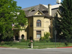 Reed O. Smoot HouseNational Historic Landmark · listed 1975
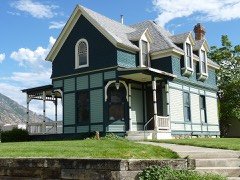 William D. Alexander Houselisted 1983
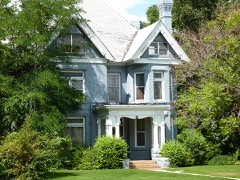 Dr. Samuel H. Allen House and Carriage Houselisted 1979
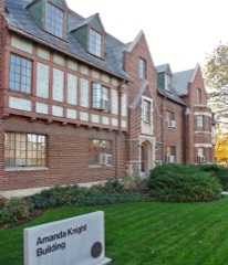 Amanda Knight Halllisted 2021
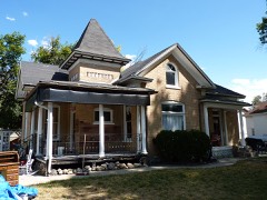 Beebe, Angus, George and Martha Ansil, Houselisted 1980
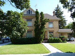 John E. Booth Houselisted 1982
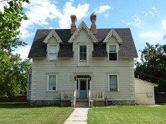 George M. Brown Houselisted 1982
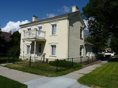 Clark-Taylor Houselisted 1975
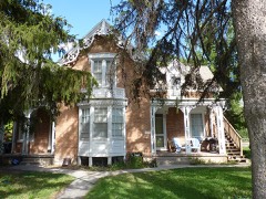 Harvey H. Cluff Houselisted 1982
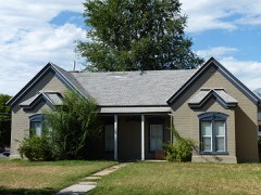 Charles E. Davies Houselisted 1982
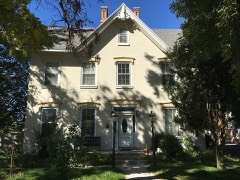 Simon P. Sr. Eggertsen Houselisted 1977
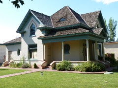 Joseph H. Frisby Houselisted 1984
Surveyed buildings and structures 6 records
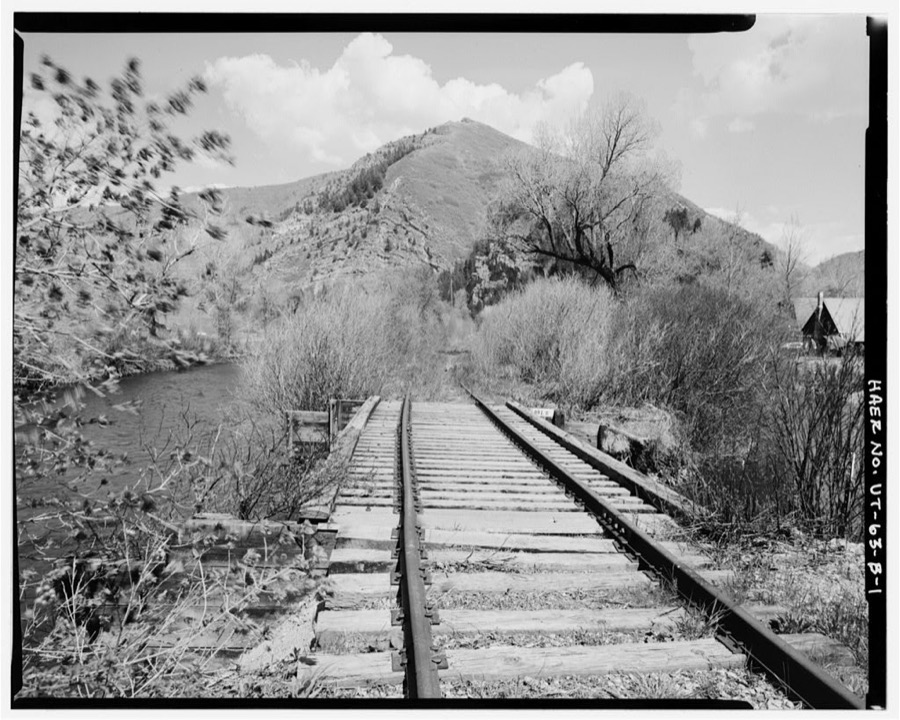
- Heber Creeper Railroad Line, Following course of Provo River, between Provo & Heber City, Provofederal building survey, 2 photographs
- Heber Creeper Railroad Line, Olmstead Bridge, Spanning Provo River, Provofederal building survey, 7 photographs
- Heber Creeper Railroad Line, Section from Bridal Veil Falls to Vivian Park, Between Provo & Heber City, Provofederal building survey, 19 photographs
- Heber Creeper Railroad Line, Vivian Park Bridge, Spanning South Fork of Provo River, Provofederal building survey, 4 photographs
- Provo Brickyard, Turbine House, 1620 North 200 West Street, Provofederal building survey, 5 photographs
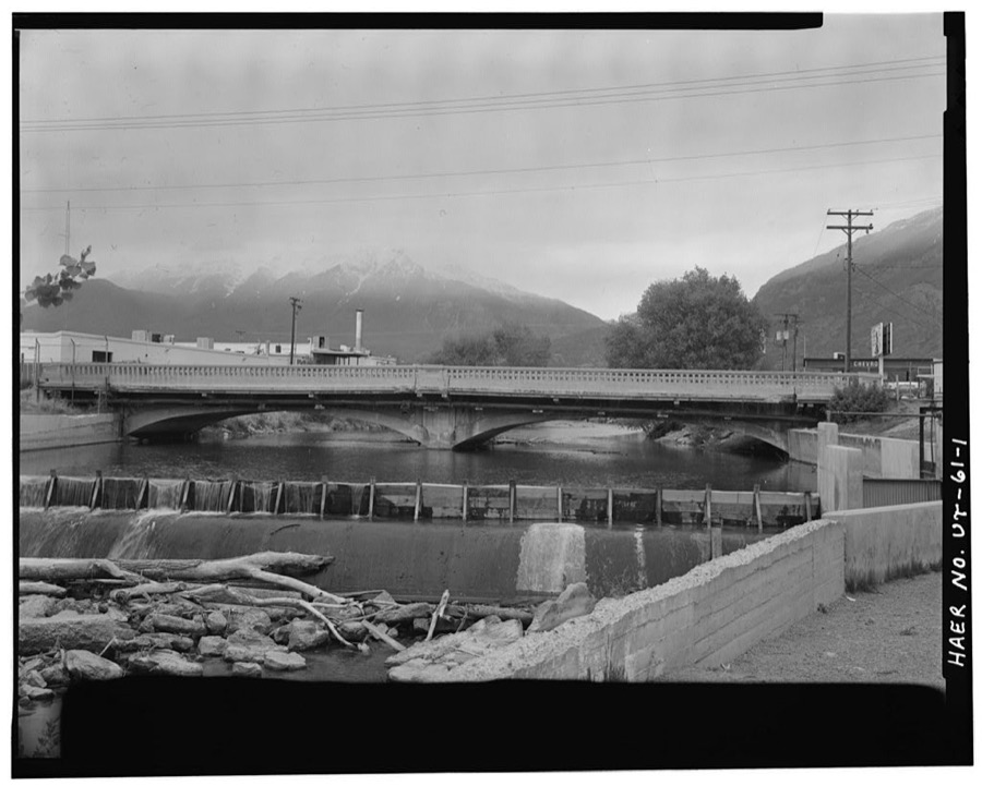
- Provo River Bridge, 625 West Columbia Lane, Provofederal building survey, 12 photographs
Population over time
3 figuresProvo grew from 2,030 to 115,162 between 1860 and 2020. These are the recorded population figures Wikidata holds for this place, reached through the Geographic Names Information System number this page is keyed on rather than by name, so they belong to this place and not to another of the same name. Most are census counts, but not all are: an early figure may be a founding or settlement estimate, and an estimate published within five years of a census is left out. The change column is computed, and is left blank where more than 20 years separate a figure from the one before it, because a gap that long is not a change between two counts.
| Year | People | Change |
|---|---|---|
| 1860 | 2,030 | |
| 2010 | 112,488 | |
| 2020 | 115,162 | +2,674 (+2%) |
Topographic sheets covering this place
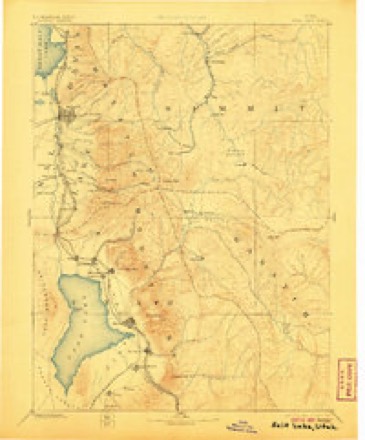
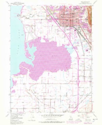
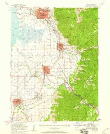
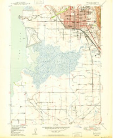
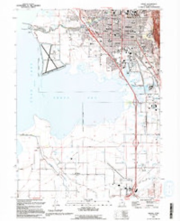
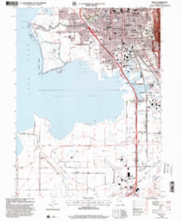
10 surveys from 22 printed sheetsMatched by testing this settlement's coordinate against the published boundary of every sheet in the United States Geological Survey's historical collection. Each opens the scanned sheet at the Survey.
- 1885 USGS Salt Lake quadrangle1:250000, 7 printings
- 1948 USGS Provo quadrangle1:24000, 3 printings
- 1949 USGS Provo quadrangle1:62500
- 1950 USGS Provo quadrangle1:24000
- 1954 USGS Salt Lake City quadrangle1:250000, 4 printings
- 1958 USGS Salt Lake City quadrangle1:250000
- 1960 USGS Salt Lake City quadrangle1:250000
- 1986 USGS Provo quadrangle1:100000
- 1993 USGS Provo quadrangle1:24000, 2 printings
- 1998 USGS Provo quadrangle1:24000
What the histories say of this town
4,846 words1 chapter about Provo from the published histories of the county, public domain and reproduced complete.
| Chapter | From | Length |
|---|---|---|
| Utah County: a Graphic Account of Its Foundings, Its Wonderful Growth | Utah County: a Graphic Account of Its Foundings, Its Wonderful Growth and Its Splendid Promise for the Future : Also a Descriptive Review of Its Resources, Attractions, Industries, Leading Business Houses and Institutions, with Portraits and Biographical Sketches of Its Pioneers and Early Settlers (1897) | 4,846 words |
Photographs
5 photographs,Taken for the Office of War Information and the Farm Security Administration, who photographed the country between 1935 and 1944. Works of United States government photographers, with no known restriction on use. Each opens its catalogue record.
Photographer not recorded. Library of Congress
Photographer not recorded. Library of Congress
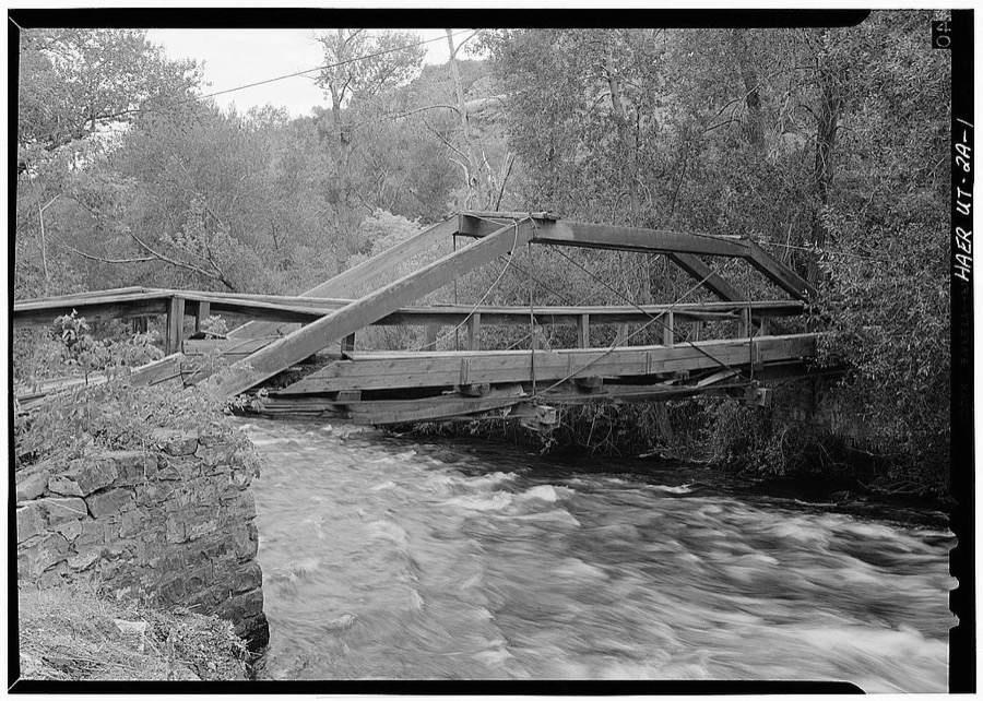
Photographer not recorded. Library of Congress
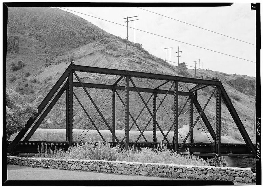
Photographer not recorded. Library of Congress
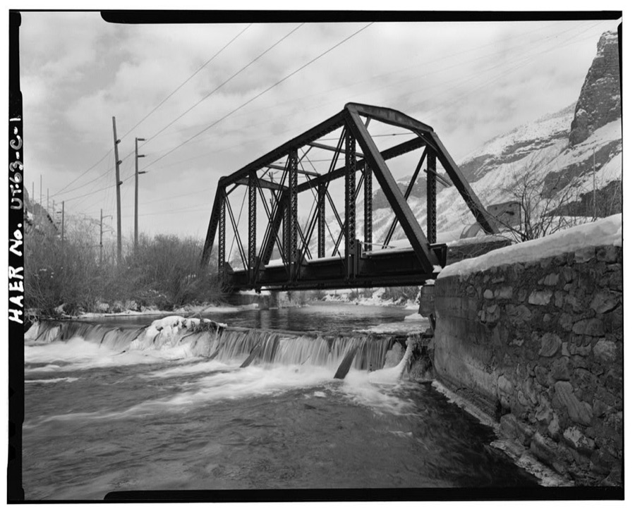
Photographer not recorded. Library of Congress
Fires near this place
140 since 1992Regional context, not property-specific evidence. The federal wildfire occurrence database lists 140 fires within 5 miles of Provo between 1992 and 2020, burning about 5,275 acres in total. 27 started naturally. 22 were recorded as arson. Distance is straight-line from the map coordinates, so a fire counted here may appear on a neighbouring settlement's page as well.
| Reported cause | Fires |
|---|---|
| Missing data/not specified/undetermined | 41 |
| Natural | 27 |
| Arson/incendiarism | 22 |
| Recreation and ceremony | 14 |
| Debris and open burning | 13 |
| Fireworks | 7 |
| Power generation/transmission/distribution | 4 |
| Misuse of fire by a minor | 4 |
| Equipment and vehicle use | 4 |
| Railroad operations and maintenance | 2 |
| Other causes | 1 |
| Firearms and explosives use | 1 |
The most recent of them, most recent first, with the day each was reported and the service that recorded it.
| Date | Cause | Size | Reported by | Name on the report |
|---|---|---|---|---|
| 7 September 2009 | Recreation and ceremony | under an acre | Uinta-Wasatch-Cache National Forest | STEAK KNIFE |
| 7 September 1996 | Arson/incendiarism | 40 acres | Uinta-Wasatch-Cache National Forest | Y-MOUNTAIN #2 |
| 5 September 1996 | Missing data/not specified/undetermined | under an acre | Utah Division Forestry Fire State Lands | BMT |
| 5 September 1996 | Missing data/not specified/undetermined | under an acre | Utah Division Forestry Fire State Lands | HARVEY'S |
| 5 September 1996 | Arson/incendiarism | 7.5 acres | Uinta-Wasatch-Cache National Forest | EAST LAWN |
| 4 September 1997 | Fireworks | under an acre | Uinta-Wasatch-Cache National Forest | SQUAW PEAK OVERLOOK |
| 28 September 2000 | Missing data/not specified/undetermined | under an acre | Utah Division Forestry Fire State Lands | FARMER FIRE |
| 27 September 2004 | Missing data/not specified/undetermined | under an acre | Utah Division Forestry Fire State Lands | not named |
Settlements close enough to share some of these fires:
Mines and quarries near this place
10 of 37 shownRegional context, not property-specific evidence. The federal mineral resources record lists 37 workings within 5 miles of Provo: 20 past producers, 14 producers, 2 occurrences, 1 plant. 15 still produce. What was taken out: Sand and Gravel, Construction, Clay, Limestone, General, Stone, Crushed/Broken. Distance is straight-line from the map coordinates, so a quarry counted here may appear on a neighbouring settlement's page as well.
| Where | Site | Commodity | Status | Recorded |
|---|---|---|---|---|
| (Facility) Ironton Smelter Dump | Stone, Crushed/Broken | Plant | Surface | |
| Buckley Mine | Silver, Lead, Zinc | Past Producer | 1902, 1917 | |
| Ironton Adit | Manganese, Iron | Occurrence | Vein | |
| Lower Slate Canyon Quarry | Slate, Dimension | Past Producer | Metamorphic | |
| Monarch | Silver, Lead, Zinc | Past Producer | Replacement | |
| Monarch Mine | Zinc, Silver, Lead | Past Producer | ||
| Squaw Peak | Lead | Producer | ||
| Stubbs Pit | Fire Clay (Refractory) | Past Producer | ||
| Ironton North Quarry | Limestone, General | Past Producer | Surface | |
| Ironton South Quarry | Limestone, General | Past Producer | Surface |
Storms near this place
23 since 1993Regional context, not property-specific evidence. The National Weather Service names Provo in 23 storm reports between 1993 and 2016: 18 thunderstorm wind, 3 hail, 2 funnel cloud. The reports record 15 injuries. Each account below is quoted exactly as the forecast office filed it, from the NOAA Storm Events Database, and each date opens the federal record of that event.
| When | Event | Place named | Harm | What the report says |
|---|---|---|---|---|
| May 1994 | Thunderstorm Wind | Provo | 15 hurt, $50,000,000 | no account filed |
| July 2002 | Thunderstorm Wind | Provo | $50,000 | A 71 mph (62 kts) wind gust was reported from a severe thunderstorm. Several trees and power poles were knocked down or damaged. There was also damage to cars and structures. |
| April 1997 | Thunderstorm Wind | Provo | $20,000 | no account filed |
| March 2003 | Thunderstorm Wind | Provo | $5,000 | Severe thunderstorms along a cold front blew through Utah County, tearing down tree limbs, blowing shingles off roofs and flipping over a trampoline. Springville reported a gust to 69 mph (60 kts) and Provo BYU recorded a gust to 62 mph (54 kts). |
| June 2008 | Thunderstorm Wind | Provo | $4,000 | Several trees were knocked down around the Orem and Provo area as the result of an overnight microburst. The highest recorded wind gust was 51 mph near Vineyard. |
| September 2016 | Thunderstorm Wind | Provo | $2,000 | A dry microburst knocked down several power lines along Freedom Boulevard in Provo. |
| April 2014 | Thunderstorm Wind | Provo | $2,000 | The Eyring Science Center sensor in Provo recorded a 60 mph wind gust. In addition, multiple large trees were knocked down in the Orem area from this early morning thunderstorm. |
| May 1998 | Thunderstorm Wind | Provo | $1,000 | no account filed |
| July 1998 | Thunderstorm Wind | Provo | $600 | no account filed |
| August 2006 | Thunderstorm Wind | Provo | - | at BYU |
| June 2005 | Thunderstorm Wind | Provo | - | Provo BYU |
| June 2001 | Thunderstorm Wind | Provo | - | Microburst wind gusts of 72 mph (63 kts) at Provo BYU knocked down small trees and broke some large branches. |
| July 1995 | Thunderstorm Wind | Provo | - | This gust was measured by an anemometer approximately 147 feet above ground level. |
| May 1994 | Thunderstorm Wind | Provo | - | Microburst winds downed tree limbs and power lines in the Provo area. Tooele County 5 N Erda,27,1707MST,,,0,0,0,0,Thunderstorm Wind |
| May 1994 | Thunderstorm Wind | Provo | - | An upper level disturbance associated cold front brought thunderstorms and microburst winds to the Wasatch front. In Tooele county, gusts were estimated between 70 and 80 mph. In West Jordan, a Cessna 140 broke its tie downs, was blown 50 feet and flipped over. Also in West Jordan, a swamp cooler was blown off a house. In Layton, a U Haul van was overturned. The top 20 feet of several trees were snapped of in Syracuse. In Kearns, gusts estimated between 80 and 90 mph snapped a 50 foot tall pine tree of at the base. |
| April 1993 | Thunderstorm Wind | Provo | - | A squall line formed in advance of an approaching cold front. Most of the moisture ahead of the cold front was in the middle and high levels. Therefore, the thunderstorms that developed, produced microburst winds. In the Tremonton area, these winds blew a few small fences and trees down, and a few shingles off houses. However, one larger 100-year-old pine tree was blown over onto a house, but it caused no major damage. The large hail that fell was brief and soft, and caused no damage. |
| September 1998 | Hail | Provo | - | no account filed |
| June 1998 | Hail | Provo | - | no account filed |
| June 1998 | Funnel Cloud | Provo | - | no account filed |
| June 1998 | Funnel Cloud | Provo | - | no account filed |
| May 1996 | Hail | Provo | - | no account filed |
| June 1995 | Thunderstorm Wind | Provo | - | no account filed |
| August 1995 | Thunderstorm Wind | Provo | - | no account filed |
Nearest settlements
The eight closest, with where each one stands in the county. Distances are straight-line, computed from the Geographic Names Information System coordinates.
Elsewhere
Matched on this settlement's Geographic Names Information System number rather than its name, so it cannot be a different place of the same name in another state.
| Wikipedia article on Provo | An encyclopaedic summary. Its text is share-alike, so it is linked here rather than copied. |
| Wikidata item Q23443 | The structured record the population and elevation above come from. Public domain (CC0). |
Provenance
This settlement is recorded in the Geographic Names Information System as feature 1444661. The sheet list is computed by point-in-boundary test against the United States Geological Survey's historical topographic inventory. Both are works of the United States government and carry no copyright under 17 U.S.C. 105.
Wildfire. Short, Karen C. 2022. Spatial wildfire occurrence data for the United States, 1992-2020 [FPA_FOD_20221014]. 6th Edition. Fort Collins, CO: Forest Service Research Data Archive. https://doi.org/10.2737/RDS-2013-0009.6 Collected with United States Government funding and usable without additional permissions or fees.
Mines and quarries. USGS Mineral Resources Data System (MRDS) https://mrdata.usgs.gov/mrds/ A work of the United States government, no copyright under 17 U.S.C. 105.
Storms. NOAA National Centers for Environmental Information, Storm Events Database https://www.ncei.noaa.gov/stormevents/ A work of the United States government, no copyright under 17 U.S.C. 105. Narratives are quoted verbatim from the National Weather Service report and are not edited or summarised.