 Block
From the record
One of 83 National Register listings published here for Sanpete County · listed in 2020 · category: Building.
Sources: the National Register database, National Park Service
Listed on the National Register of Historic Places in 2020.
One of 83 National Register listings published here for Sanpete County · listed in 2020 · category: Building.
Sources: the National Register database, National Park Service
Regional context, not property-specific evidence. The federal wildfire occurrence database lists 60 fires within 5 miles of Cox Family Big House Complex between 1992 and 2020, burning about 381 acres in total. 16 started naturally. 4 were recorded as arson. Distance is straight-line from the map coordinates, so a fire counted here may appear on a neighbouring settlement's page as well.
| Reported cause | Fires |
|---|---|
| Missing data/not specified/undetermined | 18 |
| Natural | 16 |
| Debris and open burning | 11 |
| Recreation and ceremony | 5 |
| Equipment and vehicle use | 4 |
| Arson/incendiarism | 4 |
| Fireworks | 1 |
| Firearms and explosives use | 1 |
The most recent of them, most recent first, with the day each was reported and the service that recorded it.
| Date | Cause | Size | Reported by | Name on the report |
|---|---|---|---|---|
| 4 September 2001 | Natural | under an acre | Utah Division Forestry Fire State Lands | DODGES CANYON |
| 4 September 1993 | Missing data/not specified/undetermined | under an acre | Utah Division Forestry Fire State Lands | PALASADE |
| 26 September 2020 | Firearms and explosives use | 2.0 acres | Central Area | OUTSIDE THE BASEMENT |
| 20 September 2017 | Equipment and vehicle use | under an acre | Utah Division Forestry Fire State Lands | BULL |
| 17 September 2004 | Missing data/not specified/undetermined | 1.0 acres | Utah Division Forestry Fire State Lands | not named |
| 17 September 2003 | Recreation and ceremony | under an acre | Manti-Lasal National Forest | BROCKS |
| 16 September 2019 | Recreation and ceremony | under an acre | Utah Division Forestry Fire State Lands | PALISADES 2 |
| 14 September 2017 | Debris and open burning | under an acre | Utah Division Forestry Fire State Lands | WILLOW CREEK ROAD |
Regional context, not property-specific evidence. The federal mineral resources record lists 31 workings within 5 miles of Cox Family Big House Complex: 18 past producers, 8 occurrences, 5 producers. 5 still produce. What was taken out: Sand and Gravel, Construction, Uranium, Stone, Dimension, Stone. Distance is straight-line from the map coordinates, so a quarry counted here may appear on a neighbouring settlement's page as well.
| Where | Site | Commodity | Status | Recorded |
|---|---|---|---|---|
| Alunite Mineral | Aluminum | Occurrence | ||
| Betty A, | Vanadium, Uranium | Producer | ||
| Temple Hill Quarries | Stone, Dimension | Past Producer | Limestone | |
| Temple Hill Quarries | Stone | Past Producer | ||
| Little Vernon | Uranium | Occurrence | Carnotite | |
| Moab Mine | Uranium | Producer | ||
| North Mesa | Uranium | Producer | ||
| White Mesa Mine | Uranium | Past Producer | ||
| Yellow Circle Mining Co. | Uranium | Producer | ||
| Manti Canyon Gravel Pit #1 | Sand and Gravel, Construction | Past Producer | Gravel |
Regional context, not property-specific evidence. The National Weather Service names Manti, the town this property stands in, in 3 storm reports between 2002 and 2024: 1 tornado, 1 hail, 1 thunderstorm wind. No death or injury is recorded in these reports. Each account below is quoted exactly as the forecast office filed it, from the NOAA Storm Events Database, and each date opens the federal record of that event.
| When | Event | Place named | Harm | What the report says |
|---|---|---|---|---|
| September 2002 | Tornado (F2) | Manti | $2,000,000 | An F2 tornado began one mile south-southwest of Manti and moved northeast through Southeast Manti. The first mile of the tornado path was across open land, however the tornado produced some remarkable damage at the start. A 10X12 foot pioneer building was lifted, rotated 90 degrees, and moved 8 feet before being dropped back to the ground. At the south end of Manti, the tornado struck the Anderson Lumber business and did substantial damage. A 40 foot semi-trailer, loaded with insulation, was lifted and thrown onto it's side approximately 35 to 40 feet away. A large amount of debris, along with a 10X10 foot wooden shed, was thrown across Highway 89 and over the hill some 200 to 300 feet away. The wide swath of the tornado did considerable damage as it moved through the residential area in Southeast Manti. As the tornado exited the residential area, where some of the heaviest damage occurred, a 26 foot camp trailer was lifted and thrown to the west-northwest some 150 to 200 feet and disintegrated. The tornado continued across open farmland another half a mile or so before dissipating near the mountains. It has been determined that this was a high-end F2 tornado, with winds as high as 157 mph. The distance traveled was 2.75 miles, and the width was 800 feet. Time on the ground was approximately 15 minutes. Estimated damage is around $2,000,000, but could still go higher. Amazingly, there were no injuries. |
| July 2024 | Thunderstorm Wind | Manti | - | The US-89 at MP 254 South Manti mesonet station recorded a wind gust of 64 mph as a result of outflow winds associated with a nearby cluster of showers and thunderstorms moving through the area. |
| September 2002 | Hail | Manti | - | The storm that produced the F2 tornado in Manti, also dropped 1 3/4 inch (reported as apricot-size) hail on the town. |
No historic map-sheet match is published for this property yet. That does not mean no map exists. This record needs a coordinate-quality review before it can be joined to a sheet boundary. Browse the county's mapped places while that work is pending.
Other National Register properties close enough to walk or drive between, ordered by distance from this one. Both positions come from the same geocoding pass that matched these properties to their map sheets.
| Photograph | Property | Distance | Listed |
|---|---|---|---|
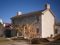 | Cox-Shoemaker-Parry House | under 500 feet | 1982 |
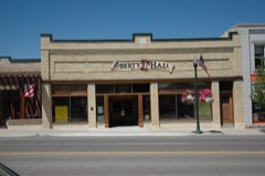 | Manti Motor Company Building | under 500 feet | 2008 |
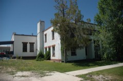 | Manti National Guard Armory | 0.1 miles | 1986 |
 | Sanpete County Courthouse | 0.1 miles | 1985 |
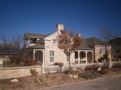 | Ezra and Abigail Shomaker House | 0.2 miles | 2014 |
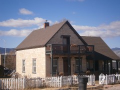 | Poulsen-Hall House | 0.2 miles | 2011 |
| National Archives record | The nomination case file for reference 100005176 in Record Group 79. |
| Sanpete County | All 83 listed properties in this county. |