 Block
From the record
One of 399 National Register listings published here for Salt Lake County · listed in 2023 · category: Building.
Sources: the National Register database, National Park Service
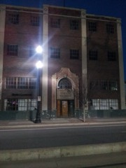
Listed on the National Register of Historic Places in 2023.
One of 399 National Register listings published here for Salt Lake County · listed in 2023 · category: Building.
Sources: the National Register database, National Park Service
Regional context, not property-specific evidence. The federal wildfire occurrence database lists 24 fires within 5 miles of Salt Lake City 15th Ward LDS Meetinghouse between 1992 and 2020, burning about 433 acres in total. 2 started naturally. 1 was recorded as arson. Distance is straight-line from the map coordinates, so a fire counted here may appear on a neighbouring settlement's page as well.
| Reported cause | Fires |
|---|---|
| Missing data/not specified/undetermined | 13 |
| Recreation and ceremony | 3 |
| Railroad operations and maintenance | 2 |
| Natural | 2 |
| Power generation/transmission/distribution | 1 |
| Arson/incendiarism | 1 |
| Fireworks | 1 |
| Equipment and vehicle use | 1 |
The most recent of them, most recent first, with the day each was reported and the service that recorded it.
| Date | Cause | Size | Reported by | Name on the report |
|---|---|---|---|---|
| 14 September 2020 | Recreation and ceremony | 35 acres | Utah Division Forestry Fire State Lands | CONNECTICUT |
| 13 September 1999 | Missing data/not specified/undetermined | under an acre | Utah Division Forestry Fire State Lands | TRAILER |
| 11 September 2007 | Missing data/not specified/undetermined | under an acre | Uinta-Wasatch-Cache National Forest | ENSIGN PEAK |
| 6 August 2016 | Missing data/not specified/undetermined | 5.0 acres | Utah Division Forestry Fire State Lands | ENSIGN INCORPORATED |
| 22 August 2020 | Missing data/not specified/undetermined | 1.0 acres | Utah Division Forestry Fire State Lands | BECK ST ASSIST |
| 21 August 2003 | Natural | 1.0 acres | Uinta-Wasatch-Cache National Forest | EAGLEWOOD |
| 20 August 2019 | Missing data/not specified/undetermined | 1.0 acres | Utah Division Forestry Fire State Lands | BANGERTER ASSIST |
| 20 August 2019 | Railroad operations and maintenance | 9.6 acres | Utah Division Forestry Fire State Lands | STANDLEE EAST ASSIST |
Regional context, not property-specific evidence. The federal mineral resources record lists 40 workings within 5 miles of Salt Lake City 15th Ward LDS Meetinghouse: 29 producers, 5 past producers, 4 occurrences, 2 unknowns. 29 still produce. What was taken out: Sand and Gravel, Construction, Iron, Limestone, General, Barium-Barite. Distance is straight-line from the map coordinates, so a quarry counted here may appear on a neighbouring settlement's page as well.
| Where | Site | Commodity | Status | Recorded |
|---|---|---|---|---|
| Home and Wood Pit | Limestone, General, Sand and Gravel, Construction | Producer | ||
| Intermountain Smelting Corp | Antimony | Producer | ||
| Becks Hot Springs | Geothermal | Unknown | ||
| Custom Milling & Supply Mill | Barium-Barite | Past Producer | ||
| Eisenman Barite Mill | Barium-Barite | Producer | ||
| Wasatch 8ot Springs | Geothermal | Unknown | ||
| Limekiln Gulch North Quarry | Limestone, General, Iron | Past Producer | Calcite, Limonite | |
| Limekiln Gulch South Quarry | Limestone, General | Past Producer | Calcite | |
| Magnet Iron | Iron | Producer | Replacement | |
| Spring Gulch Quarry | Iron | Occurrence | Hematite, Limonite |
Regional context, not property-specific evidence. The National Weather Service names Salt Lake City, the town this property stands in, in 31 storm reports between 1993 and 2024: 17 thunderstorm wind, 8 hail, 2 tornado, 2 flash flood. The reports record 1 death and 83 injuries. Each account below is quoted exactly as the forecast office filed it, from the NOAA Storm Events Database, and each date opens the federal record of that event.
| When | Event | Place named | Harm | What the report says |
|---|---|---|---|---|
| August 1999 | Tornado (F2) | Salt Lake City | 1 killed, 80 hurt, $170,000,000 | Around lunch time, a tornado touched down in the southwest portions of Salt Lake City. The tornado intensified to an F2 on the Fujita scale, and moved northeast through the metropolitan area of Salt Lake City. It caused widespread damage at the Delta Center, then ripped across an outdoor retailers convention tent, where the lone fatality occurred along with many of the injuries. After blowing out many windows in the Wyndam Hotel, the tornado continued its northeast track, knocking down scaffolding and shearing off a crane at the LDS Assembly Hall construction site. Next it skirted the Capitol Building, ripping out several large trees there and in historic Memory Grove. It then moved into the residential area known as The Avenues, damaging hundreds of trees and ripping the roofs off of several homes, before finally lifting back into the clouds. All told, there was 1 fatality, 80 injured, 300 buildings and homes sustained damage, with 34 homes deemed uninhabitable. At least 500 trees were totally destroyed, with 300 more damaged. Many vehicles were damaged or totalled as well. |
| July 2006 | Thunderstorm Wind | Salt Lake City | 2 hurt, $50,000 | chemical tank toppled by the wind. |
| July 1996 | Thunderstorm Wind | Salt Lake City | 1 hurt, $100,000 | no account filed |
| October 1994 | Hail | Salt Lake City | $500,000 | A cold upper level trough moved across northern Utah this day. The first of two severe thunderstorms moved northward through the Salt Lake Valley dropping 0.75-inch hail at the NWSFO Salt Lake, and surrounding area. The same storm dropped 1.00-inch diameter hail about 1 mile north at the FAA ARTCC at approximately 5:00MST. The McDonnell Douglas plant (approximately 1 mile north of the NWSFO) sustained roof damage estimated at $250,000. Hail dents in this roof were estimated at 5 to 10 per square foot. |
| May 1994 | Thunderstorm Wind | Salt Lake City | $500,000 | A large thunderstorm complex developed near the center of an upper level disturbance and moved rapidly from southwest to northeast across northern Utah. The first significant damage occurred in the Sugarville as three trees were blown ito a house. Four-foot diameter trees were uprooted in the area. Next a grain elevator was blown down in Elberta. At 1140MST, the Tooele Army Depot (north base) reported 20 to 30 car windows blown out, empty storage containers the size of tractor semi-trailer were blown off railroad flat cars, and damage to many structures. Clean up and repair costs estimated at $150,000. About 1145MST, a chicken farm in Lakeshore suffered structural damage estimated at $400,000. At 1153MST, an anemometer on the twelfth story of Brigham Young University in Provo measured a gust at 121 mph. The BYU campus alone incurred $1 million in damage. The city of Provo was hard hit, with $ 8 million in damage to public and private property. Damage included power outages to 90 per cent of the city. Between three thousand and five thousand trees were destroyed, being blown into cars, powers lines, and houses. Nineteen homes had "significant damage", with two being condemned. Of the fifteen injuries, most were broken bones and lacerations, while a fifteen year old girl went into intensive care when an air conditioner fell on her. At 1236MST, the Salt Lake International Airport measured a peak gust at 62 mph. One DC-3 airplane was pushed a quarter mile down the tarmac and clipped two planes. Nine other planes sustained damage, with a total plane damage estimate at $1 million. At 1238MST, a measured gust at 81 mph took part of the roof off the SaltAir Pavilion, with damage estimated at $270,000. Between 1215MST and 1315MST, over 50 incidents of downed power lines were reported in the Salt Lake valley, with 20 power poles on fire. |
| May 1994 | Thunderstorm Wind | Salt Lake City | $500,000 | no account filed |
| October 2015 | Flash Flood | Salt Lake City | $100,000 | Heavy rain brought road, parking lot, and basement flooding to the Sugarhouse and Foothill areas of Salt Lake City. The flooding damaged multiple streets including Roxberry Road, Sherwood Drive, and 1300 South near 2500 East. There was also a significant amount of water on Foothill Drive, particularly near 2200 South. Approximately six homes also experienced basement flooding across the area. |
| October 2015 | Flash Flood | Salt Lake City | $100,000 | Heavy rain brought road, parking lot, and basement flooding to the Sugarhouse and Foothill areas of Salt Lake City. The flooding damaged multiple streets including Roxberry Road, Sherwood Drive, and 1300 South near 2500 East. There was also a significant amount of water on Foothill Drive, particularly near 2200 South. Approximately six homes also experienced basement flooding across the area. |
| July 2024 | Thunderstorm Wind | Salt Lake City | $50,000 | Multiple pictures and reports indicated wind damage in the Sugarhouse area associated with an area of decaying convection moving through. Reports included a healthy hardwood tree around 2 feet in diameter snapped at the trunk, with multiple 8 to 10 inch limbs down across the neighborhood. Additionally, reports mentioned many cars potentially totaled or significantly damaged as a result. |
| August 2001 | Thunderstorm Wind | Salt Lake City | $50,000 | Severe thunderstorms brought strong winds, hail, and torrential rains to much of the Salt Lake Valley. Little Cottonwood Canyon had a wind gust to 74 mph (64 kts), and Riverton reported a gust to 70 mph (61 kts). Significant street and house flooding occurred from Herriman to downtown Salt Lake City, along with some tree damage. Rainfall ranged from .50 inches to over 2 inches across the valley with this storm. |
| May 1994 | Thunderstorm Wind | Salt Lake City | $50,000 | Microburst winds estimated between 40 and 50 mph crossed the Great Salt Lake, capsizing one sailboat and driving three onto some rocks, one of which was a total loss. |
| October 1997 | Lightning | Salt Lake City | $26,000 | no account filed |
| September 2017 | Flood | Salt Lake City | $15,000 | Heavy rain caused flood damage to the Salt Lake City Justice Court and to a nearby Crossfit gym. |
| June 1997 | Hail | Salt Lake City | $15,000 | A severe thunderstorm tracked across the northern Salt Lake Valley. The storm began in West Valley City with 1" diameter hail. It then tracked into downtown Salt Lake City where 3/4" hail was measured at 7the South & State Street. The last report of severe hail came from the University of Utah Meteorology Department where 1" diameter hail was again measured. There were a few reports of minor damage from this storm. |
| August 2023 | Thunderstorm Wind | Salt Lake City | $10,000 | Rocky Mountain Power outage of 11,000+ customers resulting from crane hitting power lines. Crane was reported to have fallen in part due to high winds. |
| June 2005 | Thunderstorm Wind | Salt Lake City | $10,000 | 5 ft diameter tree down on house...extensive damage near 3rd South and 10th East.. |
| July 1998 | Thunderstorm Wind | Salt Lake City | $10,000 | no account filed |
| June 1997 | Hail | Salt Lake City | $2,000 | A severe thunderstorm dropped 1" diameter hail from Beck Street into North Salt Lake. |
| September 1998 | Tornado (F0) | Salt Lake City | $2,000 | no account filed |
| July 2023 | Thunderstorm Wind | Salt Lake City | $1,000 | Large tree limbs were downed in Salt Lake City as a result of strong thunderstorm related outflow winds in the area. |
| June 2014 | Thunderstorm Wind | Salt Lake City | $1,000 | A large, healthy tree was snapped half way up the trunk after a strong thunderstorm wind gust. |
| July 2023 | Thunderstorm Wind | Salt Lake City | $500 | A 12-inch-diameter tree branch was downed as a result of strong thunderstorm related outflow winds in the area. |
| April 2023 | Hail | Salt Lake City | - | Social media reports showed quarter-sized hail in Sugarhouse. |
| September 2021 | Hail | Salt Lake City | - | Hail up to 1 inch in diameter fell in Salt Lake City. |
| June 2018 | Hail | Salt Lake City | - | Quarter-sized hail was reported near the University of Utah in Salt Lake City. |
| July 2006 | Hail | Salt Lake City | - | large hail at Parleys Summit |
| August 2006 | Thunderstorm Wind | Salt Lake City | - | Trees down, shigles blown off a few roofs, and branches up to 2" thick snapped. |
| August 1999 | Thunderstorm Wind | Salt Lake City | - | Thunderstorm winds gusted to 60 mph (52 kts) in North Salt Lake. |
| July 1994 | Thunderstorm Wind | Salt Lake City | - | Microburst winds blew from the west and northwest along the Wasatch front producing isolated damage reports. The most significant damage occurred in the Woods Cross area. With wind gusts estimated at 80 mph, gravel and small debris became airborne and was driven into a few new cars, damaging the paint and breaking out windows. Auto damage was estimated at $20,000. An adjacent building lost a few shingles. Lightning started at least 12 range fires in Box Elder and Tooele Counties. The northwest microburst winds blew choking smoke into the Salt Lake and Tooele valleys. |
| September 1994 | Thunderstorm Wind | Salt Lake City | - | Microburst winds to 60 mph were measured at the WSFO Salt Lake City. |
| April 1993 | Hail | Salt Lake City | - | no account filed |
No historic map-sheet match is published for this property yet. That does not mean no map exists. This record needs a coordinate-quality review before it can be joined to a sheet boundary. Browse the county's mapped places while that work is pending.
Other National Register properties close enough to walk or drive between, ordered by distance from this one. Both positions come from the same geocoding pass that matched these properties to their map sheets.
| Photograph | Property | Distance | Listed |
|---|---|---|---|
| The Nettie Gregory Center | 0.3 miles | 2025 | |
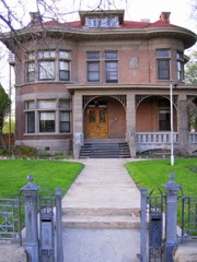 | Albert Fisher Mansion and Carriage House | 0.5 miles | 2008 |
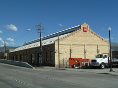 | Salt Lake Engineering Works-Bogue Supply Company Building | 0.5 miles | 2003 |
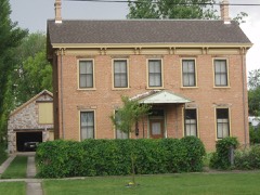 | Thomas and Mary Hepworth House | 0.5 miles | 2000 |
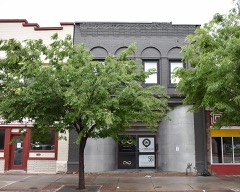 | Building at 561 W. 200 South | 0.6 miles | 1982 |
 | Central Warehouse | 0.6 miles | 1982 |
| National Archives record | The nomination case file for reference 100008752 in Record Group 79. |
| Salt Lake County | All 399 listed properties in this county. |