 Block
From the record
One of 93 National Register listings published here for Washington County · listed in 1978 · category: Structure.
Sources: the case file at the National Archives · the National Register database, National Park Service
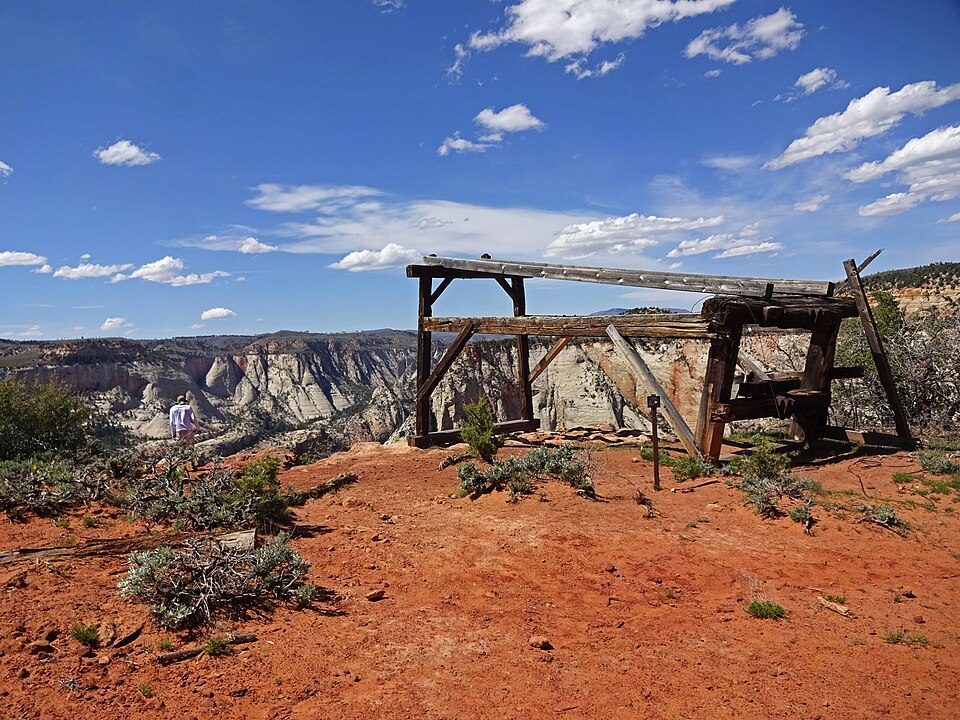
Listed on the National Register of Historic Places in 1978.
One of 93 National Register listings published here for Washington County · listed in 1978 · category: Structure.
Sources: the case file at the National Archives · the National Register database, National Park Service
Regional context, not property-specific evidence. The federal wildfire occurrence database lists 188 fires within 5 miles of Cable Mountain Draw Works between 1992 and 2020, burning about 1,564 acres in total. 142 started naturally. 3 were recorded as arson. Distance is straight-line from the map coordinates, so a fire counted here may appear on a neighbouring settlement's page as well.
| Reported cause | Fires |
|---|---|
| Natural | 142 |
| Recreation and ceremony | 18 |
| Missing data/not specified/undetermined | 12 |
| Equipment and vehicle use | 4 |
| Smoking | 4 |
| Debris and open burning | 3 |
| Arson/incendiarism | 3 |
| Misuse of fire by a minor | 1 |
| Other causes | 1 |
The most recent of them, most recent first, with the day each was reported and the service that recorded it.
| Date | Cause | Size | Reported by | Name on the report |
|---|---|---|---|---|
| 9 September 2011 | Natural | under an acre | Utah Division Forestry Fire State Lands | JOLLEY |
| 8 September 1997 | Natural | under an acre | Zion National Park | MOKI |
| 6 September 1995 | Natural | under an acre | Zion National Park | TIN ROOF |
| 5 September 1995 | Natural | under an acre | Zion National Park | OAK CREEK |
| 3 September 2011 | Natural | 196 acres | Zion National Park | HERBS |
| 3 September 2006 | Natural | under an acre | Zion National Park | COUNTY FIRE |
| 3 September 2006 | Natural | under an acre | Zion National Park | WYLIE |
| 3 September 1995 | Recreation and ceremony | under an acre | Zion National Park | NEIGHBOR |
Regional context, not property-specific evidence. The federal mineral resources record lists 1 working within 5 miles of Cable Mountain Draw Works: 1 unknown. None of them still produces. What was taken out: Uranium. Distance is straight-line from the map coordinates, so a quarry counted here may appear on a neighbouring settlement's page as well.
| Where | Site | Commodity | Status | Recorded |
|---|---|---|---|---|
| Lynn Group | Uranium | Unknown | 1949 |
Regional context, not property-specific evidence. The National Weather Service names Springdale, the town this property stands in, in 43 storm reports between 2003 and 2024: 39 flash flood, 1 flood, 1 hail, 1 heavy rain. The reports record 5 injuries. Each account below is quoted exactly as the forecast office filed it, from the NOAA Storm Events Database, and each date opens the federal record of that event.
| When | Event | Place named | Harm | What the report says |
|---|---|---|---|---|
| July 2010 | Flash Flood | Springdale | 3 hurt | Heavy rain caused flash flooding in multiple slot canyons and high travel areas in Zion National Park. These areas included Lodge Canyon, Pine Creek Canyon, Spry Canyon, Clear Creek, and Highway 9. Three hikers were caught in the Spry Canyon flood and went over two cliffs, the first of which was 40 feet high, and the second 60 feet high. All three men survived the ordeal. |
| July 2020 | Debris Flow | Springdale | 2 hurt | Multiple rockslides occurred along the River Walk Trail in Zion National Park, with two known minor injuries. Additional heavy rain resulted in flash flooding at Crazy Quilt and Checkerboard areas. |
| August 2016 | Flash Flood | Springdale | $1,000,000 | Heavy rainfall in and around the city of Kanab led to widespread flash flooding across the area. Significant damage occurred at Kanab Elementary, a city park, youth baseball fields, a city swimming pool, a local hospital, and approximately 20 homes. |
| July 2015 | Flash Flood | Springdale | $50,000 | Park rangers reported flash flooding in Zion National Park, particularly in the Pine Creek drainage. The Virgin River had significant rises from Zion National Park down to St. George, with the river gauge at St. George rising from near 30 cfs up to 2310 cfs. Flooding was also reported in several other locations across the county, including Washington City, Bloomington, and St. George, with at least a dozen different roads in these areas receiving some level of flooding throughout the event. |
| August 2024 | Flash Flood | Springdale | - | The East Fork Virgin River near Glendale gauge showed two distinct flash flood waves. One at 8:45 p.m. MDT around 145 cfs and one at 10:45 p.m. MDT around 500 cfs. |
| August 2023 | Flash Flood | Springdale | - | The North Fork of the Virgin River at Springdale river gage reported a flood wave of 883 cfs. This was an increase from 64 cfs the previous hour. Additionally, Zion NP staff reported several waterfalls. |
| August 2023 | Flash Flood | Springdale | - | There was a 798 cfs rise on the East Fork of the Virgin River on gauge ESTU1. |
| September 2023 | Flash Flood | Springdale | - | As a result of heavy rain in the area, the East Fork Virgin - Springdale, guage recorded a rapid rise in flow from its initial general flow level of around 68 CFS. An initial peak of 1228 CFS was observed at approximately 4:00 pm MST. The river then fell to 359 CFS at approximately 7:00 pm MST, before rising again to a secondary peak of 858 CFS at approximately 11:00 pm MST. |
| August 2023 | Flash Flood | Springdale | - | Zion National Park rangers reported multiple large waterfalls throughout the park. Additionally, the river gage on the Virgin River at Virgin recorded an increase in flows from 77 cfs to 1604 cfs between 12:00 and 1:00 p.m. MDT. |
| July 2022 | Flash Flood | Springdale | - | Rangers at Zion National Park reported flash flooding in Pine Creek and side canyons off of Bridge Mountain due to excessive rainfall in the region. |
| August 2022 | Flash Flood | Springdale | - | The North Fork Virgin - Springdale, Nr gauge rose from near 50 cfs. to 1160 cfs. A corresponding rise over 3 ft. was recorded on the gauge height. |
| August 2022 | Flash Flood | Springdale | - | Flash flooding was reported along Pine Creek near the Zion-Mount Carmel Tunnel. |
| June 2021 | Flash Flood | Springdale | - | Significant flash flooding occurred from the entrance of Zion National Park, across the eastern portions of the park. State Route 9 within the park closed due to flooding and debris on the roadway. |
| July 2021 | Flash Flood | Springdale | - | A significant flash flood wave in Pine Creek was reported by Zion National Park staff. |
| July 2021 | Flash Flood | Springdale | - | Zion National Park dispatch personnel reported numerous slot canyons experienced flooding, including Pine Creek and Spry Canyon. The Zion automated weather station recorded 1.29 inches of rain in one hour. In addition, the East Fork Virgin stream gauge on the East Fort Virgin River near Springdale recorded a peak flow of 2790 CFS. |
| March 2020 | Heavy Rain | Springdale | - | A Zion National Park automated weather station recorded 1.89 inches of rain. |
| May 2019 | Flash Flood | Springdale | - | Zion National Park officials reported flash flooding in numerous slot canyons and creeks across the eastern portion of the Park. |
| July 2018 | Flash Flood | Springdale | - | Heavy rain caused flash flooding in the city of Hildale, as well as nearby Short Creek. |
| August 2018 | Flash Flood | Springdale | - | Heavy rain caused a large flash flood on the Virgin River in Zion National Park. The peak flow observed at the river was 4090 cfs. |
| June 2016 | Flash Flood | Springdale | - | Flash flooding occurred along the East Fork of the Virgin River, where the river gauge indicated a rise from 43 cfs to 1880 cfs in 15 minutes. |
| August 2016 | Hail | Springdale | - | Large hail fell over Springdale, with some of the hail stones reported to be as large as ping pong balls. |
| August 2015 | Flash Flood | Springdale | - | Park rangers reported flash flooding in the Pine Creek slot canyon, with extreme used to described the flooding. |
| October 2015 | Flash Flood | Springdale | - | Flash flooding was reported in several locations across Zion National Park. This flooding included the Emerald Pools area, but most of the flooding occurred on the east side of the park, including Spry Canyon, Pine Creek Canyon, and a few other small canyons nearby. |
| September 2015 | Flash Flood | Springdale | - | Park rangers at Zion National Park reported flash flooding through the area, with the worst flooding near the Emerald Pools. Waterfalls and minor rockfalls were also reported across the park. |
| July 2015 | Flash Flood | Springdale | - | Large flows were reported along the East Fork of the Virgin River, with the gauge near Springdale measuring flow rates as high as 1140 cfs. |
| August 2014 | Flash Flood | Springdale | - | Flash flooding was reported in several drainages in Zion National Park, with the worst flooding in Birch Hollow, Heaps Canyon, and Pine Creek. |
| August 2014 | Flash Flood | Springdale | - | Heavy rain caused flash flooding in Zion National Park, with flooding stranding a few hikers in the Narrows until the waters receded. The gauge on the North Fork of the Virgin River rose to 1577 cfs. |
| July 2014 | Flash Flood | Springdale | - | Flash flooding occurred in Zion National Park, with the river gauge at the North Fork of the Virgin River rising to 253 cfs. Park rangers reported that Behunin Canyon, Heaps Canyon, and Pine Creek all experienced flash flooding. |
| September 2013 | Flash Flood | Springdale | - | Park rangers in Zion National Park reported flash flooding in Clear Creek and Keyhole Canyon. |
| July 2013 | Flash Flood | Springdale | - | Flash flooding was reported in Zion National Park, including at the popular canyoneering route called The Subway. |
| August 2013 | Flash Flood | Springdale | - | Flash flooding was reported on both Clear Creek and the East Fork of the Virgin River, as well as several slot canyons in the area. The river gauge on the East Fork rose to 1795 cfs. |
| August 2013 | Flash Flood | Springdale | - | Significant and widespread flash flooding was reported across Zion National Park after more than an inch of rain fell over the park. The heavy rain filled culverts, and large rocks were washed onto the main scenic drive, resulting in the road being closed down for a period of time. Many canyons were running very high with water, and the gauge on the North Fork of the Virgin River rose to 3159 cfs. |
| July 2012 | Flash Flood | Springdale | - | Multiple drainages across Zion National Park experienced significant flash flooding. The North Fork of the Virgin River was included, with the gauge there increasing from 59 cfs to 1433 cfs in two hours. |
| September 2011 | Flash Flood | Springdale | - | Flash flooding was reported in Zion National Park along the East Fork of the Virgin River, with the gauge along this river rising to 1665 cfs. |
| October 2010 | Flood | Springdale | - | Flooding was reported across Zion National Park, including in the Oak Creek and Emerald Pools areas. |
| July 2007 | Flash Flood | Springdale | - | Numerous reports of flash flooding were received from Zion NP, including Left Fork Creek, The Narrows, Emerald Ponds, and Oak Creek. Zion NP reported no injuries, but as many as 25 hikers were stranded. North fork of the Virgin River rose from 100 CFS to 4687 CFS within one hour. |
| August 2007 | Flash Flood | Springdale | - | Most slot canyons in Zion NP were reported to have significant runoff from heavy rain in the morning with 0.63 inches of rain in 3 hours and a storm total of 1.52 inches. There was also 0.88 inches of rain at Lava Point in 3 hours with a storm total of 1.16 inches. |
| December 2007 | Flash Flood | Springdale | - | Rangers at Zion National Park reported flash flooding in areas of the park. |
| September 2007 | Flash Flood | Springdale | - | Flash flooding was reported in Telephone Canyon and a few smaller slot canyons. An observer reported that the north fork of the Virgin River at the Narrows was near bank full. |
| September 2007 | Flash Flood | Springdale | - | Widespread flash flooding occurred in canyons that empty into Zion Canyon. Kolob Creek was spilling over its banks in spots. |
| July 2006 | Flash Flood | Springdale | - | North Fork of the Virgin River gause rose from 67 CFS to 682 CFS in 2 hours. Amatuer Radio operators report flooding of the North Fork. |
| August 2005 | Flash Flood | Springdale | - | East Fork of Virgin River flow rate rose from 76 to 306 cfs in just over an hour. |
| July 2003 | Flash Flood | Springdale | - | Flash flooding occurred on the North Fork of the Virgin River between Zion National Park and Springdale. River rises of 110 cubic feet per second were recorded. |
No historic map-sheet match is published for this property yet. That does not mean no map exists. This record needs a coordinate-quality review before it can be joined to a sheet boundary. Browse the county's mapped places while that work is pending.
Other National Register properties close enough to walk or drive between, ordered by distance from this one. Both positions come from the same geocoding pass that matched these properties to their map sheets.
| Photograph | Property | Distance | Listed |
|---|---|---|---|
 | Hidden Canyon Trail | 0.2 miles | 1987 |
| Hidden Canyon Trail | 0.3 miles | 1987 |
 | East Rim Trail | 0.4 miles | 1987 |
 | Cable Creek Bridge | 0.5 miles | 1996 |
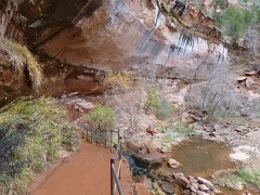 | Emerald Pools Trail | 0.6 miles | 1987 |
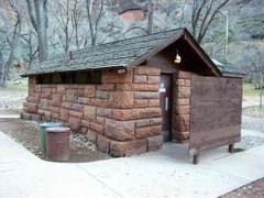 | Grotto Camping Ground South Comfort Station | 0.7 miles | 1987 |
| National Archives record | The nomination case file for reference 78000281 in Record Group 79. |
| Washington County | All 93 listed properties in this county. |