
BlockBefore
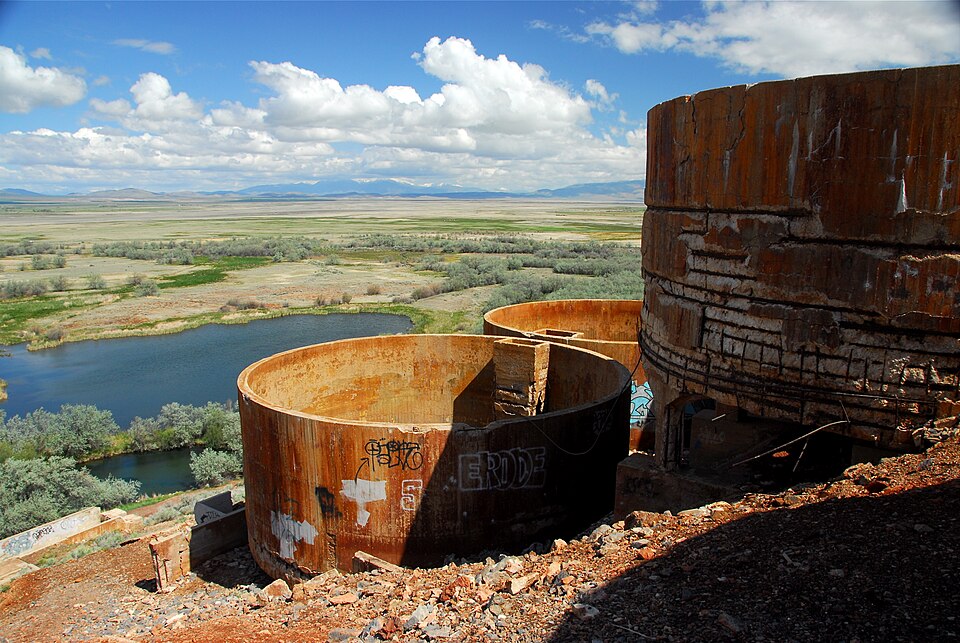
Photograph of Tintic Standard Reduction Mill
Photograph by DT Brimhall, CC BY-SA 3.0. Via Wikimedia Commons.

Tintic Standard Reduction Mill

Listed on the National Register of Historic Places in 1978.

From the record

“The Tintic Standard Reduction Mill - also known as the Tintic Mill or Harold Mill - built in 1920, and only operating from 1921 to 1925, is an abandoned refinery or concentrator located on the west slope of Warm Springs Mountain on the southern edge of Genola, Utah, United States. In 2002, the Utah Department of Environmental Quality tested the soil and found it contained high levels of arsenic and lead, which can lead to serious health problems and even death.”

Wikipedia article Tintic Standard Reduction Mill, CC BY-SA 4.0.

One of 183 National Register listings published here for Utah County · listed in 1978 · category: Structure.

Sources: the Wikipedia article · the case file at the National Archives · the National Register database, National Park Service
The listing

  • What is counted as historic. The nomination lists 1 structure as contributing to the listing.
  • Address. E of Goshen off U.S. 6, Goshen, 84655
  • When was it listed? September 1978
  • Category. structure
  • Census division. Goshen
  • National Register reference number. 78002700 - the number the National Park Service assigned this property when it was listed, and the key its nomination file is catalogued under at the National Archives.

Fires near this property

172 since 1992

Regional context, not property-specific evidence. The federal wildfire occurrence database lists 172 fires within 5 miles of Tintic Standard Reduction Mill between 1992 and 2020, burning about 12,882 acres in total. 27 started naturally. 5 were recorded as arson. Distance is straight-line from the map coordinates, so a fire counted here may appear on a neighbouring settlement's page as well.

Reported cause Fires
Missing data/not specified/undetermined80
Natural27
Equipment and vehicle use20
Debris and open burning14
Power generation/transmission/distribution8
Railroad operations and maintenance6
Arson/incendiarism5
Firearms and explosives use5
Recreation and ceremony3
Fireworks2
Smoking1
Misuse of fire by a minor1

The most recent of them, most recent first, with the day each was reported and the service that recorded it.

DateCause SizeReported by Name on the report
6 September 2020Missing data/not specified/undetermined5,832 acresUtah Division Forestry Fire State LandsWILLIAM
5 September 2019Natural4.1 acresUtah Division Forestry Fire State LandsWARM SPRINGS
4 September 1995Missing data/not specified/undetermined100 acresUtah Division Forestry Fire State LandsMP 241
30 September 2003Equipment and vehicle useunder an acreUtah Division Forestry Fire State LandsSANTAQUIN CYN1
3 September 2017Missing data/not specified/undeterminedunder an acreUtah Division Forestry Fire State LandsTOM SAWYER
29 September 1999Power generation/transmission/distributionunder an acreUtah Division Forestry Fire State LandsHAWK 2
25 September 2020Equipment and vehicle useunder an acreCentral AreaMM 239
22 September 2010Natural5.0 acresUtah Division Forestry Fire State LandsHERRING

Every fire recorded in Utah County

Mines and quarries near this property

10 of 35 shown

Regional context, not property-specific evidence. The federal mineral resources record lists 35 workings within 5 miles of Tintic Standard Reduction Mill: 26 past producers, 4 occurrences, 4 producers, 1 unknown. 4 still produce. What was taken out: Sand and Gravel, Construction, Fluorine-Fluorite, Clay, Lead, Zinc. Distance is straight-line from the map coordinates, so a quarry counted here may appear on a neighbouring settlement's page as well.

Where SiteCommodity StatusRecorded
Chaffin QuarryDolomite, Limestone, GeneralPast ProducerSurface
Genola ShaftIronOccurrenceVein
Goshen Hill Limestone QuarriesLimestone, GeneralPast ProducerUnderground
Keigley QuarryLimestone, General, DolomiteProducer1943
Oldroyd Calcite QuarryCalciumProducerCalcite
Unknown Ls MineStone, Crushed/BrokenPast Producer
Burriston ClaimClayOccurrenceContact Metasomatic
Burriston ClaimClayPast Producer
Eldorado Nos. 1 and 2Lead, ZincOccurrenceVein
Goshen Peak Se MineFluorine-FluoritePast ProducerSurface

Every working recorded in Utah County

Storms near this property

2 since 2013

Regional context, not property-specific evidence. The National Weather Service names Goshen, the town this property stands in, in 2 storm reports between 2013 and 2016: 1 flash flood, 1 hail. No death or injury is recorded in these reports. Each account below is quoted exactly as the forecast office filed it, from the NOAA Storm Events Database, and each date opens the federal record of that event.

WhenEvent Place namedHarm What the report says
September 2013Flash FloodGoshen$900,000Heavy rain caused flash flooding across much of urban Utah County, with multiple locations recording 0.6-0.8 inches of rain in only 15 minutes. The most significant damage from flooding was reported in Provo, Orem, Payson, and Santaquin. Street flooding was widespread and some roads incurred major damage, with the worst damage occurring at 900 North and Grand Avenue in Provo, where water undercut and washed out a large portion of the asphalt road. Debris from the storm was scattered across most local roadways, taking several days to clean up, and even closed some roads for a period of time. Flowing water caused also caused significant damage to large concrete stairs at Lions Park in Provo. At University Mall in Orem, water quickly filled the parking lot, submerging many cars in more than a foot of water. ||Residential areas also received significant flood damage. In Provo, at least 25 homes had major damage, with more than 50 receiving minor damage. In Orem, approximately 30 homes received flood damage. In Santaquin, about 30 homes had flooding a foot deep or more, while about 30 other homes had flooding with less than a foot of water. Water wasn't the only problem in Santaquin, as the storm drainage system became overwhelmed, and raw sewage flowed into many homes. ||Finally, the flooding also impacted Timpanogos Cave National Monument, where heavy rain and associated debris stranded 150 hikers for several hours, before rangers were able to clear a path and rescue them. The Monument was closed for two full days while debris was cleaned up from both the hiking trails and nearby State Route 92.
May 2016HailGoshen-Penny sized hail was reported south of Santaquin.

Every storm recorded in Utah County

Map coverage status

No historic map-sheet match is published for this property yet. That does not mean no map exists. This record needs a coordinate-quality review before it can be joined to a sheet boundary. Browse the county's mapped places while that work is pending.

Listed places nearby

2 within 8 miles

Other National Register properties close enough to walk or drive between, ordered by distance from this one. Both positions come from the same geocoding pass that matched these properties to their map sheets.

Photograph PropertyDistance Listed
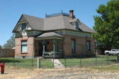
David Morgan House2.6 miles1982
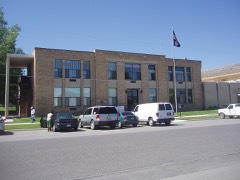
Santaquin Junior High School4.3 miles1985

Sources for this property

National Archives recordThe nomination case file for reference 78002700 in Record Group 79.
Wikipedia articleCommunity-written account of this property, licensed CC BY-SA.
Utah CountyAll 183 listed properties in this county.

Provenance

  • Listing record. National Park Service National Register of Historic Places, listed-properties dataset, current to 2026-05-22.
  • Map join. Address geocoded through the United States Census geocoder, then tested against the published boundary of every sheet in the USGS Historical Topographic Map Collection.
  • How this page is made. Listing fields come from federal records; map-sheet coverage is a labelled coordinate-to-boundary calculation, not a source-field claim.
  • Wildfire. Short, Karen C. 2022. Spatial wildfire occurrence data for the United States, 1992-2020 [FPA_FOD_20221014]. 6th Edition. Fort Collins, CO: Forest Service Research Data Archive. https://doi.org/10.2737/RDS-2013-0009.6 Collected with United States Government funding and usable without additional permissions or fees.
  • Mines and quarries. USGS Mineral Resources Data System (MRDS) https://mrdata.usgs.gov/mrds/ A work of the United States government, no copyright under 17 U.S.C. 105.
  • Storms. NOAA National Centers for Environmental Information, Storm Events Database https://www.ncei.noaa.gov/stormevents/ A work of the United States government, no copyright under 17 U.S.C. 105. Narratives are quoted verbatim from the National Weather Service report and are not edited or summarised.