 Block
From the record
One of 38 National Register listings published here for Wasatch County · listed in 1979 · category: Building.
Sources: the case file at the National Archives · the National Register database, National Park Service
Listed on the National Register of Historic Places in 1979.
One of 38 National Register listings published here for Wasatch County · listed in 1979 · category: Building.
Sources: the case file at the National Archives · the National Register database, National Park Service
Regional context, not property-specific evidence. The federal wildfire occurrence database lists 218 fires within 5 miles of Wasatch Wave Publishing Company Building between 1992 and 2020, burning about 2,202 acres in total. 14 started naturally. 6 were recorded as arson. Distance is straight-line from the map coordinates, so a fire counted here may appear on a neighbouring settlement's page as well.
| Reported cause | Fires |
|---|---|
| Missing data/not specified/undetermined | 66 |
| Debris and open burning | 55 |
| Equipment and vehicle use | 26 |
| Fireworks | 19 |
| Natural | 14 |
| Recreation and ceremony | 9 |
| Power generation/transmission/distribution | 7 |
| Misuse of fire by a minor | 7 |
| Arson/incendiarism | 6 |
| Railroad operations and maintenance | 6 |
| Smoking | 3 |
The most recent of them, most recent first, with the day each was reported and the service that recorded it.
| Date | Cause | Size | Reported by | Name on the report |
|---|---|---|---|---|
| 8 September 1999 | Debris and open burning | under an acre | Utah Division Forestry Fire State Lands | SWEAT |
| 7 September 2017 | Missing data/not specified/undetermined | under an acre | Utah Division Forestry Fire State Lands | HEBER ASSIST 2 |
| 6 September 2006 | Debris and open burning | under an acre | Utah Division Forestry Fire State Lands | SMITH FIRE |
| 6 September 1992 | Missing data/not specified/undetermined | under an acre | Utah Division Forestry Fire State Lands | DEER CREEK RAINBOW BAY |
| 4 September 2001 | Debris and open burning | under an acre | Utah Division Forestry Fire State Lands | COYOTE LANE |
| 30 September 1993 | Missing data/not specified/undetermined | 2.0 acres | Utah Division Forestry Fire State Lands | MIDWAY 6TH SO. |
| 29 September 2001 | Natural | under an acre | Uintah and Ouray Agency | BWALLOW1 |
| 24 September 2000 | Railroad operations and maintenance | under an acre | Utah Division Forestry Fire State Lands | HEBER CREEPER 6 |
Regional context, not property-specific evidence. The federal mineral resources record lists 18 workings within 5 miles of Wasatch Wave Publishing Company Building: 9 producers, 6 past producers, 2 unknowns, 1 occurrence. 9 still produce. What was taken out: Sand and Gravel, Construction, Stone, Crushed/Broken, Phosphorus-Phosphates, Limestone, High Calcium. Distance is straight-line from the map coordinates, so a quarry counted here may appear on a neighbouring settlement's page as well.
| Where | Site | Commodity | Status | Recorded |
|---|---|---|---|---|
| Midway Hot Pot | Geothermal | Unknown | ||
| Midway Tufa Quarries | Limestone, High Calcium | Past Producer | Calcite | |
| Park Heber Tunnel | Lead, Zinc, Silver, Gold, Copper | Past Producer | ||
| Phosphate Hill Prospect | Phosphorus-Phosphates | Occurrence | Collophane | |
| Big Hollow Crushed Stone Quarry | Stone, Crushed/Broken | Producer | Quartzite | |
| Charleston Crushed Stone Quarry | Stone, Crushed/Broken | Producer | Limestone, Quartzite | |
| Gravel Pit | Sand and Gravel, Construction | Past Producer | Unconsolidated Sediments | |
| Heber City Borrow Pit. #1 | Sand and Gravel, Construction | Past Producer | Unconsolidated Sediments | |
| Heber City Borrow Pit. #2 | Sand and Gravel, Construction | Past Producer | Unconsolidated Sediments | |
| Ut Dept of Hwys No 26010 | Sand and Gravel, Construction | Producer |
Regional context, not property-specific evidence. The National Weather Service names Heber City, the town this property stands in, in 9 storm reports between 1994 and 2006: 4 thunderstorm wind, 4 hail, 1 lightning. The reports record 1 death and 1 injury. Each account below is quoted exactly as the forecast office filed it, from the NOAA Storm Events Database, and each date opens the federal record of that event.
| When | Event | Place named | Harm | What the report says |
|---|---|---|---|---|
| March 2001 | Thunderstorm Wind | Heber City | 1 killed, 1 hurt, $1,000 | Two men were canoeing on Jordanelle Reservoir when thunderstorm outflow winds estimated at 45mph (39kts) capsized the canoe. The men were thrown into the 34 degree water about 25 feet from shore, but they were pushed out further by the wind as they hung onto the canoe. They both became hypothermic, and the 27-year-old man let go of the canoe and drowned. The other man was rescued and sent to the hospital, where he recovered. |
| July 2002 | Thunderstorm Wind | Heber City | $30,000 | Thunderstorm winds estimated at 60-70 mph (52-61 kts) blew through portions of Heber City, blowing down trees and power lines and taking shingles off roofs. |
| August 2004 | Lightning | Heber City | $15,000 | no account filed |
| June 2002 | Thunderstorm Wind | Heber City | $1,000 | no account filed |
| August 2006 | Hail | Heber City | - | Near Jordanelle Reservoir |
| August 2006 | Hail | Heber City | - | at Jordanelle Reservior |
| September 2005 | Hail | Heber City | - | Large hail at Strawberry reservoir |
| June 1996 | Hail | Heber City | - | no account filed |
| May 1994 | Thunderstorm Wind | Heber City | - | no account filed |
No historic map-sheet match is published for this property yet. That does not mean no map exists. This record needs a coordinate-quality review before it can be joined to a sheet boundary. Browse the county's mapped places while that work is pending.
Other National Register properties close enough to walk or drive between, ordered by distance from this one. Both positions come from the same geocoding pass that matched these properties to their map sheets.
| Photograph | Property | Distance | Listed |
|---|---|---|---|
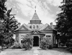 | Abram Hatch House | under 500 feet | 1975 |
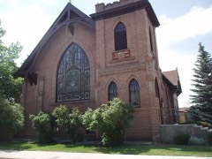 | Heber Second Ward Meetinghouse | 0.1 miles | 1978 |
| Wasatch Stake Tabernacle and Heber Amusement Hall | 0.1 miles | 1970 | |
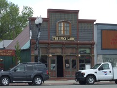 | Wasatch Saloon | 0.1 miles | 1980 |
| Clotworthy-McMillan House | 0.2 miles | 1999 | |
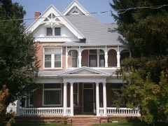 | Austin-Wherritt House | 0.3 miles | 1979 |
| National Archives record | The nomination case file for reference 79002519 in Record Group 79. |
| Wasatch County | All 38 listed properties in this county. |