 Block
From the record
One of 70 National Register listings published here for Davis County · listed in 1982 · category: Building · built in 1887.
Sources: the case file at the National Archives · the National Register database, National Park Service
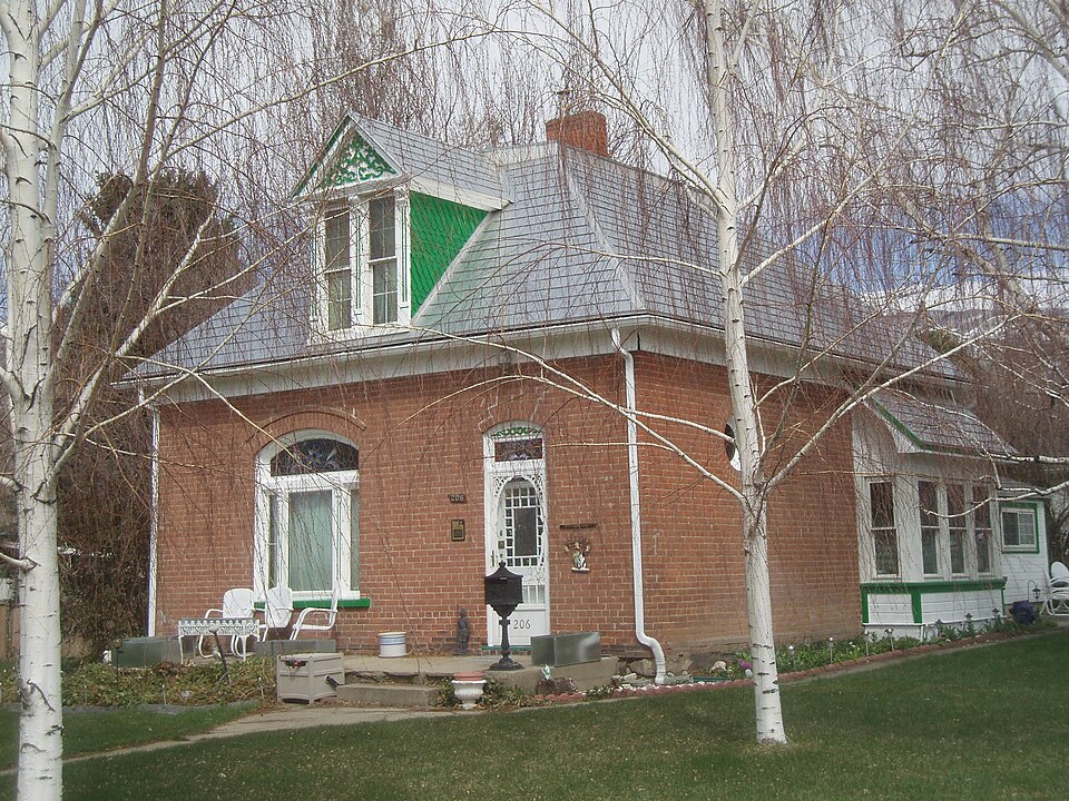
Built in 1887. Listed on the National Register of Historic Places in 1982.
One of 70 National Register listings published here for Davis County · listed in 1982 · category: Building · built in 1887.
Sources: the case file at the National Archives · the National Register database, National Park Service
Regional context, not property-specific evidence. The federal wildfire occurrence database lists 66 fires within 5 miles of James Green House between 1992 and 2020, burning about 3,308 acres in total. 9 started naturally. 3 were recorded as arson. Distance is straight-line from the map coordinates, so a fire counted here may appear on a neighbouring settlement's page as well.
| Reported cause | Fires |
|---|---|
| Missing data/not specified/undetermined | 21 |
| Recreation and ceremony | 12 |
| Natural | 9 |
| Fireworks | 9 |
| Equipment and vehicle use | 6 |
| Smoking | 3 |
| Arson/incendiarism | 3 |
| Misuse of fire by a minor | 3 |
The most recent of them, most recent first, with the day each was reported and the service that recorded it.
| Date | Cause | Size | Reported by | Name on the report |
|---|---|---|---|---|
| 6 September 1994 | Natural | under an acre | Uinta-Wasatch-Cache National Forest | LUCKY LYNN |
| 6 September 1994 | Natural | under an acre | Uinta-Wasatch-Cache National Forest | TELEPHONE POLE |
| 28 September 2014 | Recreation and ceremony | under an acre | Uinta-Wasatch-Cache National Forest | BUCKLAND 2 |
| 22 September 1992 | Natural | under an acre | Uinta-Wasatch-Cache National Forest | not named |
| 2 September 2016 | Recreation and ceremony | 2.0 acres | Utah Division Forestry Fire State Lands | BURNHAM |
| 16 September 2000 | Recreation and ceremony | under an acre | Uinta-Wasatch-Cache National Forest | BUCKLAND FLAT |
| 15 September 2011 | Missing data/not specified/undetermined | 37 acres | Uinta-Wasatch-Cache National Forest | PARRISH |
| 14 September 2016 | Natural | under an acre | Utah Division Forestry Fire State Lands | WARD |
Regional context, not property-specific evidence. The federal mineral resources record lists 29 workings within 5 miles of James Green House: 10 occurrences, 10 producers, 5 prospects, 3 past producers. 10 still produce. What was taken out: Sand and Gravel, Construction, Beryllium, Copper, Limestone, General, Sand and Gravel, Construction. Distance is straight-line from the map coordinates, so a quarry counted here may appear on a neighbouring settlement's page as well.
| Where | Site | Commodity | Status | Recorded |
|---|---|---|---|---|
| Buckland Mining and Development Prospect | Copper, Silver, Iron | Occurrence | Vein | |
| Foulger | Quartz | Occurrence | ||
| Home and Wood Pit | Limestone, General, Sand and Gravel, Construction | Producer | ||
| Sessions Mountains Prospect | Lead, Silver | Occurrence | Vein | |
| Upper Ward Canyon Prospects | Copper, Lead, Zinc | Occurrence | Underground | |
| Beryl | Beryllium | Occurrence | ||
| Beryl | Beryllium | Occurrence | ||
| Se Centerville Canyon Prospect | Copper | Occurrence | Vein | |
| Sw Centerville Canyon Prospect | Copper | Occurrence | Malachite | |
| Alvie's Concrete Inc | Sand and Gravel, Construction | Producer |
Regional context, not property-specific evidence. The National Weather Service names Bountiful, the town this property stands in, in 17 storm reports between 1994 and 2024: 8 thunderstorm wind, 5 hail, 1 lightning, 1 funnel cloud. No death or injury is recorded in these reports. Each account below is quoted exactly as the forecast office filed it, from the NOAA Storm Events Database, and each date opens the federal record of that event.
| When | Event | Place named | Harm | What the report says |
|---|---|---|---|---|
| May 1997 | Lightning | Bountiful | $50,000 | no account filed |
| July 2023 | Thunderstorm Wind | Bountiful | $1,500 | A light pole was downed in Bountiful. |
| August 2024 | Thunderstorm Wind | West Bountiful | - | Trees and large branches were downed from a thunderstorm in Woods Cross. |
| July 2022 | Thunderstorm Wind | West Bountiful | - | The Utah Department of Transportation Legacy Parkway mesonet station measured a wind gust of 59 mph at 4:40 pm MST as a result of convective outflow. |
| July 2021 | Thunderstorm Wind | Bountiful | - | A wind gust of 74 mph was recorded in Bountiful. |
| August 2021 | Thunderstorm Wind | West Bountiful | - | The Legacy Parkway automated weather station recorded a peak wind gust of 59 mph. |
| June 2015 | Thunderstorm Wind | West Bountiful | - | A 66 mph wind gust was recorded by the Legacy Parkway sensor. |
| August 2015 | Thunderstorm Wind | Bountiful | - | Peak recorded wind gusts in Davis County included 65 mph in Farmington and 61 mph at the Centerville UDOT sensor. |
| August 2014 | Hail | Bountiful | - | Penny sized hail was reported near the LDS temple in Bountiful. |
| June 2006 | Heavy Rain | Bountiful | - | 1.57" in one hour fell near Bountiful temple resulting in street flooding |
| August 2005 | Tornado (F0) | Bountiful | - | Tornado touched down on the northern part of Antelope Island...photographed by a resident. |
| August 2005 | Hail | Bountiful | - | 1" hail in Bountiful |
| April 2002 | Hail | Bountiful | - | A severe thunderstorm produced 3/4 inch hail in the town of Bountiful. |
| October 2000 | Funnel Cloud | Bountiful | - | A funnel cloud was spotted in Bountiful near the temple. It retreated back into the cloud after a few minutes. |
| August 2000 | Hail | Bountiful | - | A severe thunderstorm dropped 3/4 inch hail on the Bountiful bench. |
| August 1999 | Hail | Bountiful | - | After producing the Salt Lake tornado, that same cell dropped 1 1/2 inch hail in Bountiful. |
| July 1994 | Thunderstorm Wind | West Bountiful | - | no account filed |
No historic map-sheet match is published for this property yet. That does not mean no map exists. This record needs a coordinate-quality review before it can be joined to a sheet boundary. Browse the county's mapped places while that work is pending.
Other National Register properties close enough to walk or drive between, ordered by distance from this one. Both positions come from the same geocoding pass that matched these properties to their map sheets.
| Photograph | Property | Distance | Listed |
|---|---|---|---|
 | Bountiful Historic District | 0.2 miles | 2005 |
 | Bountiful Tabernacle | 0.2 miles | 1976 |
 | James and Jane Eldredge House | 0.8 miles | 2005 |
| West Bountiful Historic District | 1.3 miles | 2004 | |
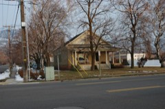 | Rich-Steeper House | 1.5 miles | 1997 |
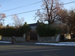 | Melvin Harley Randall House | 1.5 miles | 1980 |
| National Archives record | The nomination case file for reference 82004118 in Record Group 79. |
| Davis County | All 70 listed properties in this county. |