 Block
From the record
One of 15 National Register listings published here for Iron County · listed in 1984 · category: Building.
Sources: the case file at the National Archives · the National Register database, National Park Service
Listed on the National Register of Historic Places in 1984.
One of 15 National Register listings published here for Iron County · listed in 1984 · category: Building.
Sources: the case file at the National Archives · the National Register database, National Park Service
Regional context, not property-specific evidence. The federal wildfire occurrence database lists 249 fires within 5 miles of Old Main and Science Buildings between 1992 and 2020, burning about 372 acres in total. 51 started naturally. 4 were recorded as arson. Distance is straight-line from the map coordinates, so a fire counted here may appear on a neighbouring settlement's page as well.
| Reported cause | Fires |
|---|---|
| Missing data/not specified/undetermined | 88 |
| Natural | 51 |
| Equipment and vehicle use | 37 |
| Fireworks | 20 |
| Debris and open burning | 15 |
| Misuse of fire by a minor | 13 |
| Recreation and ceremony | 12 |
| Arson/incendiarism | 4 |
| Smoking | 4 |
| Power generation/transmission/distribution | 4 |
| Other causes | 1 |
The most recent of them, most recent first, with the day each was reported and the service that recorded it.
| Date | Cause | Size | Reported by | Name on the report |
|---|---|---|---|---|
| 9 September 2018 | Equipment and vehicle use | under an acre | Southwest Area | MM57 I15 |
| 9 September 2004 | Missing data/not specified/undetermined | under an acre | Utah Division Forestry Fire State Lands | not named |
| 8 September 2011 | Equipment and vehicle use | under an acre | Utah Division Forestry Fire State Lands | MARLBORO |
| 7 September 2019 | Arson/incendiarism | under an acre | Cedar City Field Office | KANARRA MOUNTAIN |
| 6 September 2018 | Equipment and vehicle use | under an acre | Southwest Area | MM58 I15 |
| 6 September 1999 | Misuse of fire by a minor | under an acre | Utah Division Forestry Fire State Lands | SPRUCE FIRE |
| 6 September 1995 | Missing data/not specified/undetermined | 2.0 acres | Utah Division Forestry Fire State Lands | PARKWEST |
| 30 September 2019 | Equipment and vehicle use | under an acre | Utah Division Forestry Fire State Lands | 4890 |
Regional context, not property-specific evidence. The federal mineral resources record lists 29 workings within 5 miles of Old Main and Science Buildings: 16 past producers, 12 producers, 1 occurrence. 12 still produce. What was taken out: Sand and Gravel, Construction, Gypsum-Anhydrite, Uranium. Distance is straight-line from the map coordinates, so a quarry counted here may appear on a neighbouring settlement's page as well.
| Where | Site | Commodity | Status | Recorded |
|---|---|---|---|---|
| B & D #1 | Uranium | Occurrence | ||
| Coal Creek Canyon Gypsum Deposit | Gypsum-Anhydrite | Past Producer | 1923 | |
| Coal Creek Canyon Gypsum Deposit | Gypsum-Anhydrite | Past Producer | ||
| Cedar Aggregate Products Pit | Sand and Gravel, Construction | Producer | ||
| Condominium Pit | Sand and Gravel, Construction | Past Producer | Andesite, Limestone, Sandstone | |
| Condominium Pit | Sand and Gravel, Construction | Past Producer | ||
| Iron County Gravel Pit | Sand and Gravel, Construction | Producer | ||
| R A Childs Pit | Sand and Gravel, Construction | Producer | ||
| Section 24 Gravel Pit | Sand and Gravel, Construction | Past Producer | Surface | |
| Section 24 Gravel Pit | Sand and Gravel, Construction | Past Producer |
Regional context, not property-specific evidence. The National Weather Service names Cedar City, the town this property stands in, in 18 storm reports between 1998 and 2023: 12 flash flood, 3 thunderstorm wind, 1 flood, 1 heavy rain. No death or injury is recorded in these reports. Each account below is quoted exactly as the forecast office filed it, from the NOAA Storm Events Database, and each date opens the federal record of that event.
| When | Event | Place named | Harm | What the report says |
|---|---|---|---|---|
| August 2012 | Flash Flood | Cedar City | $1,500,000 | Major flash flooding occurred in the cities of Enoch and Cedar City on the afternoon of August 17th. Enoch had the most significant damage, with 110 houses damaged by flood waters, while Cedar City mostly experienced street flooding. About 30 of those 110 houses experienced major damage, typically over $30,000 per house, while the rest had more minor damage. Flood waters and some sewage poured into many basements, as well as some ground level floors. The water broke windows and destroyed carpets, walls, and personal belongings in many of the homes. |
| July 2013 | Flash Flood | Cedar City | $400,000 | Significant flash flooding occurred in Cedar City and Enoch, following record rainfall. The Cedar City ASOS recorded 2.25 inches of precipitation for the day, breaking the previous one-day record precipitation for the site. In Cedar City, 30 to 40 homes, as well as one church, experienced flooding, primarily in basements. In addition, heavy rain caused the roof of the Metalcraft Technologies building to collapse, though no one was in the building at the time. In Enoch, two homes and one public works building had significant flooding resulting in damage. Despite all this property damage, no injuries were reported due to the flood waters. |
| October 2004 | Flash Flood | Cedar City | $400,000 | no account filed |
| August 2021 | Flash Flood | Cedar City | $200,000 | Flash flooding was reported on Coal Creek. The Coal Creek near Cedar City gauge rose from 8 CFS to 1160 CFS overnight. Several homes within the Flying L Ranches subdivision outside of Cedar City were damaged by floodwaters. |
| August 2001 | Flash Flood | Cedar City | $50,000 | Portions of Cedar City got pounded with heavy rains, submerging the north freeway interchange with several inches of water and causing a multi-car accident. Streets and basements were also flooded in the Fiddler's Canyon subdivision. |
| June 2000 | Flash Flood | Cedar City | $50,000 | Slow moving thunderstorms formed over Cedar City, causing massive flash flooding. The west side of town received the worst of the flooding. Drainage systems in town were overwhelmed by the storm, as flood waters up to 4 feet deep moved through the streets. One subdivision was evacuated as a wall of water broke through windows and flooded basements. Mud and debris covered Highway 56 west of town, and some intersections were washed out. Several vehicles were also swept down city streets. Two traffic accidents were also caused by the heavy rain and flooding. Rain totals were impressive with one spotter on the west side of town reporting 2.36 inches during the storm. Miraculously, nobody was injured. |
| September 1998 | Flood | Cedar City | $2,000 | no account filed |
| May 2023 | Thunderstorm Wind | Cedar City | - | The Cedar City Regional Airport ASOS recorded a wind gust of 62 mph as a result of outflow winds associated with a nearby cluster of showers and thunderstorms moving through the area. |
| August 2023 | Flash Flood | Cedar City | - | There were reports of flooding at a campground in Cedar Canyon. The Cedar Canyon stream gauge reported a significant rise. |
| July 2021 | Flash Flood | Cedar City | - | Urban flash flooding was reported in Cedar City. A video received via social media showing water flowing down streets near the Ashdown Subdivision. |
| July 2018 | Flash Flood | Cedar City | - | Heavy rain caused flash flooding that temporarily closed state Route 14 at milepost 5. |
| July 2012 | Flash Flood | Cedar City | - | A flash flood occurred on Coal Creek, with the gauge there increasing from 44 cfs to 1021 cfs in one hour. |
| July 2007 | Thunderstorm Wind | Cedar City | - | Thunderstorms wind gusts at Ceder City airport. Gust occurred at 1440 local time. |
| July 2007 | Thunderstorm Wind | Cedar City | - | A 54 knot wind gust was recorded at the Cedar City airport ASOS. |
| August 2005 | Flash Flood | Cedar City | - | SR14 closed due to debris and up to 2ft of water across the road |
| July 2003 | Flash Flood | Cedar City | - | Flash flooding was reported over the mountains about 2 miles east of Cedar City. |
| September 2002 | Hail | Cedar City | - | A severe thunderstorm brought heavy rain and 3/4 inch hail to portions of Cedar City. |
| August 1999 | Heavy Rain | Cedar City | - | A thunderstorm dropped heavy rain in Cedar City for a short period of time, with .31 inches falling in 8 minutes. |
No historic map-sheet match is published for this property yet. That does not mean no map exists. This record needs a coordinate-quality review before it can be joined to a sheet boundary. Browse the county's mapped places while that work is pending.
Other National Register properties close enough to walk or drive between, ordered by distance from this one. Both positions come from the same geocoding pass that matched these properties to their map sheets.
| Photograph | Property | Distance | Listed |
|---|---|---|---|
| Cedar City Historic District | 0.3 miles | 2004 | |
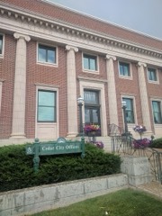 | US Post Office-Cedar City Main | 0.4 miles | 1989 |
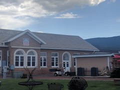 | Cedar City Railroad Depot | 0.5 miles | 1984 |
| George H. Wood House | 0.7 miles | 1978 |
| National Archives record | The nomination case file for reference 84002186 in Record Group 79. |
| Iron County | All 15 listed properties in this county. |