 Block
From the record
One of 18 National Register listings published here for Wayne County · listed in 1986 · category: Building · built in 1935.
Sources: the case file at the National Archives · the National Register database, National Park Service
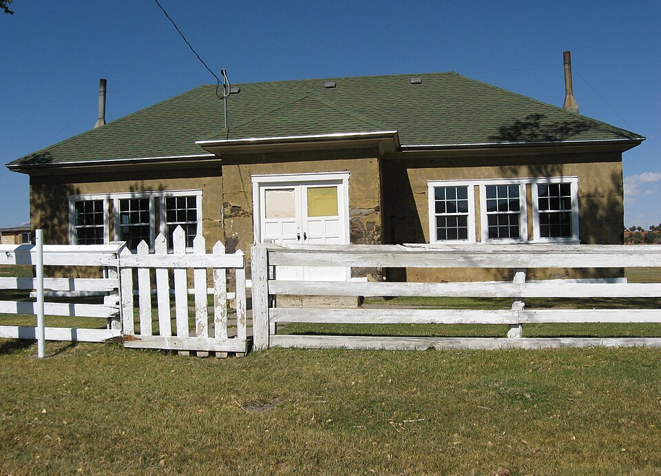
Built in 1935. Listed on the National Register of Historic Places in 1986.
One of 18 National Register listings published here for Wayne County · listed in 1986 · category: Building · built in 1935.
Sources: the case file at the National Archives · the National Register database, National Park Service
Regional context, not property-specific evidence. The federal wildfire occurrence database lists 64 fires within 5 miles of Grover School between 1992 and 2019, burning about 19 acres in total. 53 started naturally. None was recorded as arson. Distance is straight-line from the map coordinates, so a fire counted here may appear on a neighbouring settlement's page as well.
| Reported cause | Fires |
|---|---|
| Natural | 53 |
| Recreation and ceremony | 6 |
| Missing data/not specified/undetermined | 2 |
| Equipment and vehicle use | 1 |
| Fireworks | 1 |
| Misuse of fire by a minor | 1 |
The most recent of them, most recent first, with the day each was reported and the service that recorded it.
| Date | Cause | Size | Reported by | Name on the report |
|---|---|---|---|---|
| 30 September 2008 | Recreation and ceremony | under an acre | Fishlake National Forest | SPRING BRANCH |
| 17 September 2001 | Natural | under an acre | Dixie National Forest | TWIN PEAKS |
| 14 September 2017 | Natural | under an acre | Fishlake National Forest | ROCK CREEK |
| 1 September 2008 | Natural | under an acre | Fishlake National Forest | ROCK CREEK WFU |
| 1 September 1994 | Natural | under an acre | Dixie National Forest | not named |
| 9 August 2003 | Natural | under an acre | Dixie National Forest | I THINK |
| 9 August 2001 | Natural | under an acre | Dixie National Forest | FISH CREEK |
| 9 August 1992 | Natural | 2.0 acres | Dixie National Forest | not named |
Regional context, not property-specific evidence. The federal mineral resources record lists 12 workings within 5 miles of Grover School: 9 past producers, 3 occurrences. None of them still produces. What was taken out: Copper, Gypsum-Anhydrite, Sand and Gravel, Construction, Stone, Dimension. Distance is straight-line from the map coordinates, so a quarry counted here may appear on a neighbouring settlement's page as well.
| Where | Site | Commodity | Status | Recorded |
|---|---|---|---|---|
| Picture Stone Quarry | Stone, Dimension | Past Producer | Sandstone | |
| Picture Stone Quarry | Stone | Past Producer | ||
| Sulpher Creek Copper Prospect | Lead, Copper | Past Producer | ||
| Sulphur Creek Copper Prospect | Copper, Lead | Occurrence | Galena, Malachite, Plumbojarosite | |
| Lion Mountain Gypsum | Gypsum-Anhydrite | Occurrence | Alabaster | |
| Lion Mountain Gypsum | Gypsum-Anhydrite | Occurrence | ||
| Torrey Gravel Pit | Sand and Gravel, Construction | Past Producer | Surface | |
| Torrey Gravel Pit | Sand and Gravel, Construction | Past Producer | ||
| Old Faithful Mine | Copper | Past Producer | 1912 | |
| Old Faithful Mine | Copper | Past Producer |
Regional context, not property-specific evidence. The National Weather Service names Grover, the town this property stands in, in 8 storm reports between 2008 and 2024: 8 flash flood. No death or injury is recorded in these reports. Each account below is quoted exactly as the forecast office filed it, from the NOAA Storm Events Database, and each date opens the federal record of that event.
| When | Event | Place named | Harm | What the report says |
|---|---|---|---|---|
| July 2012 | Flash Flood | Grover | $10,000 | Flash flooding occurred across parts of Capitol Reef National Park, including along Sulphur Creek. The worst of the flooding was in the Cathedral Valley area of the park, where roads were washed out, with trenches 2.5 feet deep. |
| June 2024 | Flash Flood | Grover | - | Flash flooding was reported on Pleasant Creek. |
| July 2022 | Flash Flood | Grover | - | A series of moderate, to at times strong, thunderstorms moved through Capitol Reef National Park over the span of 2 to 3 hours. Multi-Radar/Multi-Sensor 3-hour rainfall estimates showed around 1 to 2 inches within the park. As a result, a flow of 6-8 inches of water moved through Capitol Gorge, as reported by Park officials. |
| July 2017 | Flash Flood | Grover | - | Heavy rain caused flash flooding in portions of Capitol Reef National Park, including Cohab Canyon, Sulphur Creek, and Grand Wash. |
| July 2011 | Flash Flood | Grover | - | Flash flooding occurred in several places across Capitol Reef National Park. The Scenic Drive was closed, with 6 to 8 inches of water flowing over the road. The Grand Wash experienced flash flooding, which also impacted a part of the Scenic Drive. Flash flooding was also observed along Sulphur Creek. |
| August 2011 | Flash Flood | Grover | - | Heavy rain caused flash flooding along Sulpher Creek in Capitol Reef National Park; the flood was categorized as impressive by one of the park rangers. |
| September 2011 | Flash Flood | Grover | - | Moderate to heavy rainfall fell over a broad area near Capitol Reef National Park. This initially caused flash flooding along Sulphur Creek and other parts of Capitol Reef. Eventually this water made its way downstream, causing flash flooding along the Dirty Devil River, which went from 538 to 1419 cfs in a few hours. |
| July 2008 | Flash Flood | Grover | - | Flash flooding occurred in the Capitol Gorge and Grand Wash areas of Capitol Reef National Park. This flooding closed these two areas, as well as the Scenic Drive in the park. |
No historic map-sheet match is published for this property yet. That does not mean no map exists. This record needs a coordinate-quality review before it can be joined to a sheet boundary. Browse the county's mapped places while that work is pending.
Other National Register properties close enough to walk or drive between, ordered by distance from this one. Both positions come from the same geocoding pass that matched these properties to their map sheets.
| Photograph | Property | Distance | Listed |
|---|---|---|---|
| Torrey Log Church-Schoolhouse | 6.1 miles | 1993 | |
 | Civilian Conservation Corps Powder Magazine | 6.3 miles | 1999 |
 | Charles W. and Leah Lee House | 6.4 miles | 1996 |
 | Fruita Rural Historic District | 6.8 miles | 1997 |
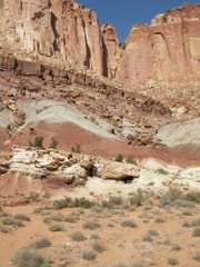 | Oyler Mine | 6.8 miles | 1999 |
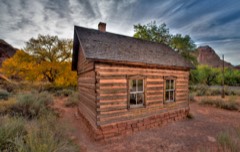 | Fruita Schoolhouse | 6.9 miles | 1972 |
| National Archives record | The nomination case file for reference 86000753 in Record Group 79. |
| Wayne County | All 18 listed properties in this county. |