 Block
From the record
One of 93 National Register listings published here for Washington County · listed in 1995 · category: District.
Sources: the case file at the National Archives · the National Register database, National Park Service
Listed on the National Register of Historic Places in 1995.
One of 93 National Register listings published here for Washington County · listed in 1995 · category: District.
Sources: the case file at the National Archives · the National Register database, National Park Service
Regional context, not property-specific evidence. The federal wildfire occurrence database lists 97 fires within 5 miles of Hurricane Historic District between 1992 and 2020, burning about 4,206 acres in total. 15 started naturally. 1 was recorded as arson. Distance is straight-line from the map coordinates, so a fire counted here may appear on a neighbouring settlement's page as well.
| Reported cause | Fires |
|---|---|
| Missing data/not specified/undetermined | 37 |
| Equipment and vehicle use | 19 |
| Natural | 15 |
| Fireworks | 8 |
| Debris and open burning | 6 |
| Power generation/transmission/distribution | 3 |
| Recreation and ceremony | 3 |
| Misuse of fire by a minor | 3 |
| Arson/incendiarism | 1 |
| Other causes | 1 |
| Firearms and explosives use | 1 |
The most recent of them, most recent first, with the day each was reported and the service that recorded it.
| Date | Cause | Size | Reported by | Name on the report |
|---|---|---|---|---|
| 7 September 2009 | Natural | under an acre | Arizona Strip Field Office | TOQUERVILLE ASSIST 2 |
| 4 September 2011 | Equipment and vehicle use | 1.0 acres | Utah Division Forestry Fire State Lands | HURRICANE ASST.#9 |
| 3 September 2012 | Natural | 5.0 acres | Utah Division Forestry Fire State Lands | HURRICANE ASSIST 05 |
| 3 September 1995 | Missing data/not specified/undetermined | 10 acres | Utah Division Forestry Fire State Lands | TOQUERSVILLE SOUTH |
| 27 September 2020 | Missing data/not specified/undetermined | under an acre | Southwest Area | STATE STREET |
| 20 September 2006 | Equipment and vehicle use | 4.2 acres | Utah Division Forestry Fire State Lands | SKY RANCH 2 |
| 18 September 2006 | Debris and open burning | 38 acres | Utah Division Forestry Fire State Lands | L |
| 7 August 2005 | Natural | 127 acres | Southern Paiute Agency | SHIVWITS |
Regional context, not property-specific evidence. The federal mineral resources record lists 50 workings within 5 miles of Hurricane Historic District: 34 past producers, 8 producers, 5 occurrences, 3 unknowns. 8 still produce. What was taken out: Sand and Gravel, Construction, Silver, Volcanic Materials, Pumice. Distance is straight-line from the map coordinates, so a quarry counted here may appear on a neighbouring settlement's page as well.
| Where | Site | Commodity | Status | Recorded |
|---|---|---|---|---|
| La Verkin Dixie Hot Springs | Geothermal | Unknown | ||
| Nevada | Copper, Uranium, Silver | Past Producer | ||
| Vanderbilt | Silver, Copper | Past Producer | Malachite | |
| Vanderbilt No.5 Mines | Silver, Copper, Uranium | Past Producer | ||
| East Reef Area | Silver, Uranium, Vanadium | Past Producer | CHEMICAL SEDIMENT | |
| Gould Ranch Tar Sand Deposit | Oil Sands | Occurrence | ||
| John Dee Claim | Uranium, Vanadium | Occurrence | ||
| Maud | Silver, Uranium, Copper | Past Producer | Malachite | |
| Timpoweap Canyon Tar Sand Deposit | Oil Sands | Occurrence | ||
| Vanderbilt #4 Mines | Silver, Uranium, Copper | Past Producer | Malachite |
Regional context, not property-specific evidence. The National Weather Service names Hurricane, the town this property stands in, in 6 storm reports between 1994 and 2023: 3 flash flood, 2 flood, 1 thunderstorm wind. No death or injury is recorded in these reports. Each account below is quoted exactly as the forecast office filed it, from the NOAA Storm Events Database, and each date opens the federal record of that event.
| When | Event | Place named | Harm | What the report says |
|---|---|---|---|---|
| September 1997 | Flood | Hurricane | $40,000 | no account filed |
| October 2004 | Flash Flood | Hurricane | $20,000 | no account filed |
| March 2023 | Flood | Hurricane | - | A public video showed water flowing over South 1150 West in Hurricane from Gould Wash. |
| August 2003 | Flash Flood | Hurricane | - | Flash flooding was reported on North Creek near the town of Hurricane. |
| August 2001 | Flash Flood | Hurricane | - | Washington County Sheriff reported at least a foot of water flowing across Highway 59 east of Hurricane as heavy rain pounded the area. |
| July 1994 | Thunderstorm Wind | Hurricane | - | Moonsoon moisture arrived over southern Utah producing heavy rains and wet microburst winds. In New Harmony 2.00" of rain fell in 50 minutes, and flood water depth was two to three feet. The St. George AWOS recorded 0.80" less than 40 minutes which allowed for minor house and street flood. Wind gusts to 60 mph downed power lines and tree limbs. In Hurricane, wind gusts were estimated at 70 to 75 mph. Rainfall of 0.79" in 30 minutes allowed for two to three feet of water to flood State Road 9 between Interstate 15 and Hurricane. In Santa Clara, wind gusts downed tree branches, and 0.25" fell in ten minutes. In Bloomington, several homes and businesses were flooded and wind gusts took down power lines and tree limbs. |
No historic map-sheet match is published for this property yet. That does not mean no map exists. This record needs a coordinate-quality review before it can be joined to a sheet boundary. Browse the county's mapped places while that work is pending.
Other National Register properties close enough to walk or drive between, ordered by distance from this one. Both positions come from the same geocoding pass that matched these properties to their map sheets.
| Photograph | Property | Distance | Listed |
|---|---|---|---|
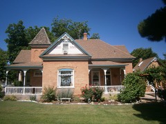 | Samuel and Elizabeth Isom House | under 500 feet | 1993 |
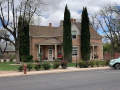 | Emanuel and Ursella Stanworth House | under 500 feet | 1992 |
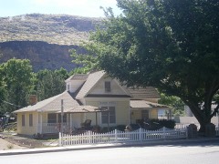 | Bradshaw House-Hotel | 0.1 miles | 1991 |
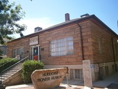 | Hurricane Library-City Hall | 0.2 miles | 1991 |
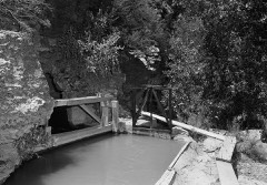 | Hurricane Canal | 1.4 miles | 1977 |
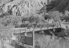 | Hurricane-LaVerkin Bridge | 1.5 miles | 1995 |
| National Archives record | The nomination case file for reference 95000980 in Record Group 79. |
| Washington County | All 93 listed properties in this county. |