 Block
From the record
9 National Register listings published here.
Sources: the National Register database, National Park Service
154 topographic sheets cover 58 settlements here, and 9 properties are on the National Register of Historic Places.
9 National Register listings published here.
Sources: the National Register database, National Park Service
Every property in this county listed on the National Register of Historic Places, with the year it was listed and the federal nomination document.
| Photograph | Property | Type | Listed | Reference |
|---|---|---|---|---|
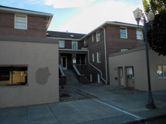 | Bell Hotel | building | 1997 | 97001082 |
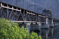 | Beverly Railroad Bridge | structure | 1982 | 82004214 |
| Columbia Basin Project Irrigation Division Headquarters Office | building | 2019 | 100004099 | |
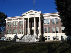 | Grant County Courthouse | building | 1975 | 75001850 |
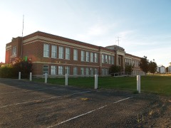 | Hartline School | building | 2010 | 09001217 |
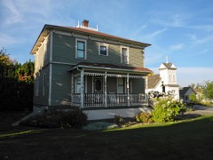 | Samuel and Katherine Reiman House | building | 2008 | 08001201 |
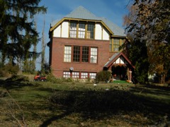 | Stratford School | building | 1990 | 90001606 |
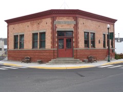 | Wilson Creek State Bank | building | 1975 | 75001851 |
Every wildfire the federal occurrence database records inside this county: 418 of them, burning about 250,715 acres. 57 started naturally and 33 were recorded as arson. Each settlement page carries the fires within five miles of it.
| Reported cause | Fires |
|---|---|
| Missing data/not specified/undetermined | 154 |
| Natural | 57 |
| Equipment and vehicle use | 52 |
| Debris and open burning | 47 |
| Recreation and ceremony | 39 |
| Arson/incendiarism | 33 |
| Fireworks | 11 |
| Power generation/transmission/distribution | 8 |
| Railroad operations and maintenance | 5 |
| Smoking | 4 |
| Firearms and explosives use | 4 |
| Other causes | 3 |
| Misuse of fire by a minor | 1 |
The five largest, by the area the report gives. None of them was recorded as arson.
| Date | Cause | Size | Reported by | Name on the report |
|---|---|---|---|---|
| 3 June 2019 | Missing data/not specified/undetermined | 22,672 acres | Columbia National Wildlife Refuge | 243 COMMAND |
| 19 July 2018 | Missing data/not specified/undetermined | 22,316 acres | Hanford Reach National Monument | L ROAD |
| 8 September 2012 | Natural | 17,049 acres | Spokane District | BARKER CANYON |
| 30 July 2016 | Firearms and explosives use | 16,006 acres | Spokane District | BLACK ROCK ROAD |
| 28 June 2015 | Natural | 14,235 acres | Hanford Reach National Monument | SADDLE LAKES FIRE |
| 14 June 1993 | Equipment and vehicle use | 12,705 acres | Hanford Reach National Monument | HIGHWAY 24 |
| 7 September 2018 | Natural | 11,464 acres | Hanford Reach National Monument | WAHLUKE SLOPE |
| 3 August 1996 | Natural | 8,450 acres | Spokane District | QUINCY |
Every settlement page carries the fires within five miles of it - see the settlement index below.
The NOAA Storm Events Database holds 82 reports for this county, causing no deaths, no injuries and about $583,000 in recorded property damage. Each settlement page carries the reports that name it.
| Kind of event | Reports |
|---|---|
| Thunderstorm Wind | 28 |
| Hail | 17 |
| Funnel Cloud | 11 |
| Flash Flood | 8 |
| Tornado | 6 |
| Heavy Rain | 6 |
| Lightning | 4 |
| Flood | 2 |
The most serious of them, by death, then injury, then recorded damage. The accounts are quoted exactly as the forecast office filed them.
| When | Event | Place named | Harm | What the report says |
|---|---|---|---|---|
| July 2002 | Lightning | Ephrata | $150,000 | A direct hit by lightning set a two-story home on Johnson Road ablaze, completely destroying the home and its contents. The family living in the home escaped without injury. |
| May 2018 | Flash Flood | Ephrata | $100,000 | Flooding from heavy rain producing thunderstorms occurred in Ephrata during the late evening of May 17th. Basin Street, the main road through the downtown business district was flooded with 4 to 8 inches of water with first floor damage to multiple businesses in the downtown area. A portion of the ceiling in the Department of Corrections building collapsed due to standing water on the roof. |
| March 2017 | Flood | Tiflis | $50,000 | A sinkhole caused unstable roadway conditions and forced the closure of Road W-NE near Warden. |
| May 2005 | Hail | Royal City | $50,000 | no account filed |
| July 1998 | Flash Flood | Ephrata | $40,000 | over 3 inches of rain in 3 hours dumped on Ephrata causing its downtown to flood. water was a foot deep in some area, floodng a local grocery store. |
| October 2004 | Thunderstorm Wind | Ephrata | $30,000 | no account filed |
| April 1972 | Tornado (F2) | not stated | $25,000 | no account filed |
| August 2013 | Thunderstorm Wind | Quincy | $20,000 | High winds uprooted a 40 foot tree onto a car in southeastern sections of Quincy. Power and phone outages were reported across southwestern sections of town. Six inches of standing water was on sections of Highway 28 in town. |
| August 2013 | Thunderstorm Wind | Moses Lake | $20,000 | Roughly fifty customers in the Mae Valley subdivision of Moses Lake lost power when strong thunderstorm winds damaged five different power poles holding transmission lines.|As the gust front moved into northern sections of Grant County, law enforcement reported numerous trees and power poles downed in and around Grand Coulee. Overall, 6500 customers loss power across Grant County during the storm. |
| August 1999 | Lightning | Ruff | $20,000 | 2 Houses burned |
| July 2012 | Flash Flood | Corfu | $15,000 | A washout occurred along Lower Crab Creek Road. |
| August 1999 | Lightning | Moses Lake | $10,000 | 1 house burned. |
| July 1998 | Thunderstorm Wind | Ephrata | $10,000 | numerous large trees down |
| June 2009 | Flash Flood | Quincy | $10,000 | no account filed |
| May 2006 | Lightning | Ephrata | $7,000 | no account filed |
| June 2022 | Thunderstorm Wind | Trinidad | $6,000 | Power lines down and over 900 people without power west of Quincy, centered in the crescent bar area. |
| July 1998 | Thunderstorm Wind | Soap Lake | $5,000 | trees and power lines down. |
| September 2010 | Heavy Rain | Ephrata | $5,000 | no account filed |
| July 2012 | Thunderstorm Wind | Electric City | $2,000 | Public reported a few trees completely blown down. Numerous tree limbs were snapped off trees that remain standing. |
| May 2010 | Tornado (EF0) | Wheeler | $2,000 | An EF0 tornado touched down five miles northeast of Moses Lake on Northeast Road P. Non-continuous track from south to northwest for one-half to one-third of a mile. The tornado had an estimated width of 100 yards with winds of 65 to 85 miles per hour. The tornado lifted a section of roof that was unattached and sitting on the ground or leaning against something on the ground. The wind lifted this unattached roof about 20 feet off the ground and dropped it 30 feet from its original location onto the old barn, destroying it. A grain silo was damaged by the tornado. Numerous large tree branches were downed, including one tossed 300 feet from the tree. Numerous shingles were spread 120 yards. The time of the tornado is estimated from 5:15 PST to 5:20 PST. |
| June 2009 | Thunderstorm Wind | (Mwh)Grant Co Arpt M | $2,000 | no account filed |
| July 2012 | Hail | Mae | $1,000 | Hail broke one window and caused window trim from five other windows to break off. The hail also damaged corn and alfalfa fields as well. |
| May 2010 | Thunderstorm Wind | Wheeler | $1,000 | Strong winds from a gust front damaged Simplot's Moses Lake Plant, forcing it to close down for 24 hours for repairs. The damage partially ripped the siding from the wall in the raw potato receiving area. |
| May 2006 | Thunderstorm Wind | Royal City | $1,000 | no account filed |
| May 2023 | Flash Flood | Winchester | $500 | Flash flood in the area of Adams Rd and Rd 13 NW. Mud, rocks, and debris were covering the roadway. |
| March 2019 | Flood | Soap Lake | $500 | A section of RD 19-NW near Soap Lake was temporarily closed due to snow melt flooding. |
| June 2023 | Funnel Cloud | Othello | - | Social media photo showed funnel cloud near Quincy. It was in an isolated area. No damage reported. |
| May 2023 | Tornado (EF0) | Mae | - | Land spout tornado reported by public. No damage or injuries reported. |
| May 2020 | Thunderstorm Wind | Beverly | - | A Mesonet station in Mattawa, Washington measured a wind gust of 68 mph. |
| April 2018 | Funnel Cloud | Ephrata | - | Multiple members of the public reported and photographed a small funnel cloud near Ephrata. |
| June 2015 | Heavy Rain | Royal City | - | A member of the public reported water and debris across highway 262 near the Mardon resort at the south end of Potholes Reservoir which is approximately 15 miles east of Royal City, WA. |
| June 2015 | Hail | Royal City | - | A member of the public reported 0.75 inch hail 11 miles east northeast of Royal City, WA. |
| June 2013 | Heavy Rain | Royal City | - | Moderate to locally heavy rain of 0.25 to 0.50 inches resulted in cherry damage across portions of southern Grant County. |
| September 2013 | Thunderstorm Wind | Ruff | - | Shop doors blown off and power poles downed across Wheeler Road. |
| September 2013 | Thunderstorm Wind | Corfu | - | Winds in Warden were sustained 30 to 35 miles per hour with gusts up to 58 miles per hour as the gust from moved through. Numerous trees downed and widespread power outages across the Moses Lake area. Some trees fell on houses and on vehicles. An outbuilding was destroyed and a fence was damaged by flying debris. At least six power poles were snapped off near Soap Lake. Schools across the Moses Lake area were closed the following day due to impacts from the storm. |
| September 2013 | Flash Flood | Hanson | - | X-NE Road was covered by water and mud for approximately 100 to 150 yards and appeared to be deep in sections. It was likely that the road was impassable during the flash flood, but there were no reports of impacts during the event. Timing of the flash flood was estimated by radar. |
| July 2012 | Thunderstorm Wind | Beverly | - | Measured at the Vantage Washington DOT sensor. |
| June 2010 | Hail | Hanson | - | Large hail from a thunderstorm accumulated to a depth of six inches. |
| June 2010 | Flash Flood | Hanson | - | Very heavy rain led water running down the road and ditches along Highway Two. |
| June 2009 | Funnel Cloud | Winchester | - | A funnel cloud was observed for five minutes along Highway 28. |
| July 2008 | Thunderstorm Wind | Osborne | - | At Steamboat Rock State Park, a tree was blown over. Several other trees had five inch limbs broken. |
| November 2003 | Funnel Cloud | Stratford | - | A brief funnel cloud was observed by Grant County officials northeast of Stratford during the afternoon of November 17th. |
| May 2003 | Tornado (F0) | Warden | - | A small tornado briefly touched down over unpopulated farm land during the afternoon of May 11th. |
| June 2001 | Thunderstorm Wind | Beverly | - | Location: Priest Rapids Dam |
| July 1998 | Funnel Cloud | Moses Lake | - | a pilot relayed a report of a funnel cloud in the vicinity of Moses Lake airport. |
| July 1998 | Hail | Ephrata | - | one inch diameter hail |
| May 1997 | Heavy Rain | Wilson Creek | - | 0.66 inches of rain in 1/2 hour |
| May 1997 | Heavy Rain | Ephrata | - | 6 inches of water on streets of ephrata |
| May 1997 | Thunderstorm Wind | Moses Lake | - | APPLE ORCHARD DAMAGE |
| June 2012 | Funnel Cloud | Naylor | - | no account filed |
| July 2012 | Funnel Cloud | Royal City | - | no account filed |
| July 2012 | Hail | Mae | - | no account filed |
| July 2012 | Hail | (Mwh)Grant Co Arpt M | - | no account filed |
| July 2012 | Hail | Adrian | - | no account filed |
| June 2010 | Hail | Hanson | - | no account filed |
| June 2009 | Hail | Warden | - | no account filed |
| June 2009 | Funnel Cloud | (Eph)Ephrata Muni Ar | - | no account filed |
| July 2008 | Thunderstorm Wind | Osborne | - | no account filed |
| July 2008 | Hail | Hartline | - | no account filed |
| July 2006 | Thunderstorm Wind | Warden | - | no account filed |
The Survey's mineral resources record lists 193 workings inside this county. 11 still produce and 182 are closed or unrecorded. Each settlement page carries the workings within five miles of it.
| Commodity | Workings |
|---|---|
| Sand and Gravel, Construction | 120 |
| Diatomite | 27 |
| Stone, Crushed/Broken | 22 |
| Gold | 4 |
| Stone | 4 |
| Sodium | 4 |
| Pumice | 4 |
| Silver | 3 |
| Molybdenum | 2 |
| Uranium | 2 |
| Molybdenum, Silver | 1 |
| Bismuth | 1 |
| Clay | 1 |
| Bismuth, Gold, Beryllium, Silver | 1 |
The least common of them first, because a county's hundredth gravel pit says nothing its first ten did not.
| Where | Site | Commodity | Status | Recorded |
|---|---|---|---|---|
| Black - Rosauer | Molybdenum, Silver, Gold, Bismuth | Producer | Galena, Molybdenite, Pyrite | |
| Black-Rosauer | Silver, Bismuth, Gold, Lead, Molybdenum | Past Producer | ||
| Electric City | Molybdenum, Bismuth, Gold, Beryllium, Silver | Prospect | ||
| Grant Orchard Pit | Stone, Dimension | Past Producer | ||
| International Titanium Plant | Titanium | Producer | ||
| Rock Top | Clay | Prospect | ||
| Saddle Mountains | Gemstone | Occurrence | ||
| Soap Lake | Salt, Sodium | Occurrence | ||
| Black Rosauer-Electric City | Molybdenum | Occurrence | ||
| Grand Coulee | Uranium | Occurrence | ||
| Peterson | Uranium | Occurrence | ||
| Hope No. 1 | Silver, Gold | Prospect | ||
| Silver Queen | Silver | Prospect | ||
| A.B.C. Placer | Gold | Unknown | ||
| Adrian | Pumice | Past Producer | ||
| Beverly | Pumice | Past Producer | ||
| Carbonate Lake | Sodium | Unknown | ||
| Chinaman Bar Placer | Gold | Occurrence | Placer | |
| Jantz Quarry | Stone | Past Producer | ||
| Mast Pit | Stone | Past Producer | ||
| Mitchell Lake | Sodium | Past Producer | ||
| Pennullick Addition | Stone | Past Producer | ||
| Sentinel Mountain | Pumice | Occurrence | ||
| Sieler Quarry | Stone | Past Producer | ||
| Soap Lake | Pumice | Past Producer | ||
| Sulfate Lake | Sodium | Past Producer | ||
| Bepple Quarry | Stone, Crushed/Broken | Past Producer | ||
| Borrow Pit | Stone, Crushed/Broken | Past Producer | ||
| Carolus Pit | Sand and Gravel, Construction, Stone, Crushed/Broken | Past Producer | ||
| Cathedral Quarry | Stone, Crushed/Broken | Past Producer | ||
| Ds-Gt-175 | Stone, Crushed/Broken | Past Producer | ||
| Ephrata Quarry | Stone, Crushed/Broken | Past Producer | ||
| Imbert Quarry | Stone, Crushed/Broken | Past Producer | ||
| Unnamed Quarry | Stone, Crushed/Broken | Past Producer | ||
| Unnamed Quarry | Stone, Crushed/Broken | Past Producer | ||
| Unnamed Quarry | Stone, Crushed/Broken | Past Producer | ||
| Unnamed Quarry | Stone, Crushed/Broken | Past Producer | ||
| Unnamed Quarry | Stone, Crushed/Broken | Past Producer | ||
| Unnamed Quarry | Stone, Crushed/Broken | Past Producer | ||
| Unnamed Quarry | Stone, Crushed/Broken, Sand and Gravel, Construction | Past Producer | ||
| Unnamed Quarry | Stone, Crushed/Broken | Past Producer | ||
| Unnamed Quarry | Stone, Crushed/Broken | Past Producer | ||
| Unnamed Quarry | Stone, Crushed/Broken | Past Producer | ||
| Unnamed Quarry | Stone, Crushed/Broken | Past Producer | ||
| Unnamed Quarry | Stone, Crushed/Broken | Past Producer | ||
| Unnamed Quarry | Stone, Crushed/Broken | Past Producer | ||
| Warden Sw Quarry | Stone, Crushed/Broken | Past Producer | ||
| Wilson Creek Quarry | Stone, Crushed/Broken | Past Producer | ||
| Dia-Cousti-Lite Deposit | Diatomite | Past Producer | ||
| Grennell Deposit | Diatomite | Past Producer | ||
| Johnson Deposits | Diatomite | Prospect | ||
| Johnson No. 2 Deposit | Diatomite | Prospect | ||
| S. Sec. 9 Deposit | Diatomite | Occurrence | ||
| Sec. 10 Deposit | Diatomite | Prospect | ||
| Sec. 16 Deposit A | Diatomite | Past Producer | ||
| Sec. 16 Deposit B | Diatomite | Prospect | ||
| Sec. 16 Deposit C | Diatomite | Prospect | ||
| Sec. 17 Deposit A | Diatomite | Past Producer | ||
| Sec. 21 Deposit A | Diatomite | Past Producer | ||
| Sec. 21 Deposit B | Diatomite | Past Producer | ||
| Sec. 21 Deposit C | Diatomite | Past Producer | ||
| Sec. 22 Deposit | Diatomite | Past Producer | ||
| Sec. 26 Deposit A | Diatomite | Occurrence | ||
| Sec. 27 Deposit | Diatomite | Occurrence | ||
| Sec. 29 Deposit B | Diatomite | Occurrence | ||
| Sec. 3/10 Pit | Diatomite | Producer | ||
| Sec. 33 Deposit | Diatomite | Unknown | ||
| Sec. 34 Deposit | Diatomite | Prospect | ||
| Sec. 7 Pit | Diatomite | Producer | ||
| Sec. 9 Deposit | Diatomite | Past Producer | ||
| State Products Deposit | Diatomite | Past Producer | ||
| Unnamed Mine | Diatomite | Producer | ||
| Unnamed Mine | Diatomite | Past Producer | ||
| Webley Deposit | Diatomite | Occurrence | ||
| Webley No. 3 Deposit | Diatomite | Occurrence | ||
| Bank Pit | Sand and Gravel, Construction | Past Producer | ||
| Banks Lake Pit | Sand and Gravel, Construction | Producer | ||
| Borrow Pit | Sand and Gravel, Construction | Past Producer | ||
| Borrow Pit | Sand and Gravel, Construction | Past Producer | ||
| Borrow Pit | Sand and Gravel, Construction | Past Producer | ||
| Borrow Pit | Sand and Gravel, Construction | Past Producer | ||
| Borrow Pit | Sand and Gravel, Construction | Past Producer | ||
| Borrow Pit | Sand and Gravel, Construction | Past Producer | ||
| Corfu | Sand and Gravel, Construction | Occurrence | ||
| Corfu Pit | Sand and Gravel, Construction | Past Producer | ||
| Curtis Pit | Sand and Gravel, Construction | Past Producer | ||
| Egbert Pit | Sand and Gravel, Construction | Past Producer | ||
| Elliott Pit | Sand and Gravel, Construction | Producer | ||
| Ephrata Pit | Sand and Gravel, Construction | Past Producer | ||
| Freeman Pit | Sand and Gravel, Construction | Past Producer | ||
| G.T. No. 108 Pit | Sand and Gravel, Construction | Past Producer | ||
| Goyd Pit | Sand and Gravel, Construction | Producer | ||
| Gravel Pit | Sand and Gravel, Construction | Past Producer | ||
| Gravel Pit | Sand and Gravel, Construction | Past Producer | ||
| Gravel Pit | Sand and Gravel, Construction | Past Producer | ||
| Gravel Pit | Sand and Gravel, Construction | Past Producer | ||
| Gravel Pit | Sand and Gravel, Construction | Past Producer | ||
| Gravel Pit | Sand and Gravel, Construction | Past Producer | ||
| Gravel Pit | Sand and Gravel, Construction | Past Producer | ||
| Gravel Pit | Sand and Gravel, Construction | Past Producer | ||
| Gravel Pit | Sand and Gravel, Construction | Past Producer | ||
| Gravel Pit | Sand and Gravel, Construction | Producer | ||
| Gravel Pit | Sand and Gravel, Construction | Past Producer | ||
| Hartline Pit | Sand and Gravel, Construction | Past Producer | ||
| Hartline Pit | Sand and Gravel, Construction | Past Producer | ||
| Hurlbut Pit | Sand and Gravel, Construction | Past Producer | ||
| Laudenback Pit | Sand and Gravel, Construction | Past Producer | ||
| Morton Pit | Sand and Gravel, Construction | Past Producer | ||
| Nagel Pit | Sand and Gravel, Construction | Past Producer | ||
| Nehls Pit | Sand and Gravel, Construction | Past Producer | ||
| Nelson Pit | Sand and Gravel, Construction | Past Producer | ||
| Nelson Pit | Sand and Gravel, Construction | Past Producer | ||
| Ness Pit | Sand and Gravel, Construction | Past Producer | ||
| Qs-Gt-256 | Sand and Gravel, Construction | Past Producer | ||
| Quincy Pit and Plant | Sand and Gravel, Construction | Producer | ||
| Sand Pit | Sand and Gravel, Construction | Past Producer | ||
| Sand Pit | Sand and Gravel, Construction | Past Producer | ||
| Sims Pit | Sand and Gravel, Construction | Past Producer | ||
| Sinclair Pit | Sand and Gravel, Construction | Past Producer | ||
| Soap Lake Pit | Sand and Gravel, Construction | Past Producer | ||
| Stepon Pit | Sand and Gravel, Construction | Past Producer | ||
| Sunland Estates | Sand and Gravel, Construction | Past Producer | ||
| Sutherland Pit | Sand and Gravel, Construction | Past Producer | ||
| Tommer Pit | Sand and Gravel, Construction | Past Producer | ||
| Unnamed Pit | Sand and Gravel, Construction | Past Producer | ||
| Unnamed Pit | Sand and Gravel, Construction | Past Producer | ||
| Unnamed Pit | Sand and Gravel, Construction | Past Producer | ||
| Unnamed Pit | Sand and Gravel, Construction | Past Producer | ||
| Unnamed Pit | Sand and Gravel, Construction | Past Producer | ||
| Unnamed Pit | Sand and Gravel, Construction | Past Producer | ||
| Unnamed Pit | Sand and Gravel, Construction | Past Producer | ||
| Unnamed Pit | Sand and Gravel, Construction | Past Producer | ||
| Unnamed Pit | Sand and Gravel, Construction | Past Producer | ||
| Unnamed Pit | Sand and Gravel, Construction | Past Producer | ||
| Unnamed Pit | Sand and Gravel, Construction | Past Producer | ||
| Unnamed Pit | Sand and Gravel, Construction | Past Producer | ||
| Unnamed Pit | Sand and Gravel, Construction | Past Producer | ||
| Unnamed Pit | Sand and Gravel, Construction | Past Producer | ||
| Unnamed Pit | Sand and Gravel, Construction | Past Producer | ||
| Unnamed Pit | Sand and Gravel, Construction | Past Producer | ||
| Unnamed Pit | Sand and Gravel, Construction | Past Producer | ||
| Unnamed Pit | Sand and Gravel, Construction | Past Producer | ||
| Unnamed Pit | Sand and Gravel, Construction | Past Producer | ||
| Unnamed Pit | Sand and Gravel, Construction | Past Producer | ||
| Unnamed Pit | Sand and Gravel, Construction | Past Producer | ||
| Unnamed Pit | Sand and Gravel, Construction | Past Producer | ||
| Unnamed Pit | Sand and Gravel, Construction | Past Producer | ||
| Unnamed Pit | Sand and Gravel, Construction | Producer | ||
| Unnamed Pit | Sand and Gravel, Construction | Past Producer | ||
| Unnamed Pit | Sand and Gravel, Construction | Past Producer | ||
| Unnamed Pit | Sand and Gravel, Construction | Past Producer | ||
| Unnamed Pit | Sand and Gravel, Construction | Past Producer | ||
| Unnamed Pit | Sand and Gravel, Construction | Past Producer | ||
| Unnamed Pit | Sand and Gravel, Construction | Past Producer | ||
| Unnamed Pit | Sand and Gravel, Construction | Past Producer | ||
| Unnamed Pit | Sand and Gravel, Construction | Past Producer | ||
| Unnamed Pit | Sand and Gravel, Construction | Past Producer | ||
| Unnamed Pit | Sand and Gravel, Construction | Past Producer | ||
| Unnamed Pit | Sand and Gravel, Construction | Past Producer | ||
| Unnamed Pit | Sand and Gravel, Construction | Past Producer | ||
| Unnamed Pit | Sand and Gravel, Construction | Past Producer | ||
| Unnamed Pit | Sand and Gravel, Construction | Past Producer | ||
| Unnamed Pit | Sand and Gravel, Construction | Past Producer | ||
| Unnamed Pit | Sand and Gravel, Construction | Past Producer | ||
| Unnamed Pit | Sand and Gravel, Construction | Past Producer | ||
| Unnamed Pit | Sand and Gravel, Construction | Past Producer | ||
| Unnamed Pit | Sand and Gravel, Construction | Past Producer | ||
| Unnamed Pit | Sand and Gravel, Construction | Past Producer | ||
| Unnamed Pit | Sand and Gravel, Construction | Past Producer | ||
| Unnamed Pit | Sand and Gravel, Construction | Past Producer | ||
| Unnamed Pit | Sand and Gravel, Construction | Past Producer | ||
| Unnamed Pit | Sand and Gravel, Construction | Past Producer | ||
| Unnamed Pit | Sand and Gravel, Construction | Past Producer | ||
| Unnamed Pit | Sand and Gravel, Construction | Past Producer | ||
| Unnamed Pit | Sand and Gravel, Construction | Past Producer | ||
| Unnamed Pit | Sand and Gravel, Construction | Past Producer | ||
| Unnamed Pit | Sand and Gravel, Construction | Past Producer | ||
| Unnamed Pit | Sand and Gravel, Construction | Past Producer | ||
| Unnamed Pit | Sand and Gravel, Construction | Past Producer | ||
| Unnamed Pit | Sand and Gravel, Construction | Past Producer | ||
| Unnamed Pit | Sand and Gravel, Construction | Past Producer | ||
| Unnamed Pit | Sand and Gravel, Construction | Past Producer | ||
| Unnamed Pit | Sand and Gravel, Construction | Past Producer | ||
| Unnamed Pit | Sand and Gravel, Construction | Past Producer | ||
| Unnamed Pit | Sand and Gravel, Construction | Past Producer | ||
| Unnamed Pit | Sand and Gravel, Construction | Past Producer | ||
| Unnamed Pit | Sand and Gravel, Construction | Past Producer | ||
| Unnamed Pit | Sand and Gravel, Construction | Past Producer | ||
| Unnamed Pit | Sand and Gravel, Construction | Past Producer | ||
| Unnamed Pit | Sand and Gravel, Construction | Past Producer | ||
| Unnamed Pit | Sand and Gravel, Construction | Past Producer | ||
| Western Pit | Sand and Gravel, Construction | Past Producer | ||
| Westlake Pit | Sand and Gravel, Construction | Past Producer |
Named settlements recorded in the Geographic Names Information System, each with the topographic sheets covering it. Villages, hamlets and abandoned places alike. Each is shown with the nearest named watercourse or landform and the survey quadrangle it falls on.
Wilson Creek census division · 98851 · Near Black Butte · Stratford quadrangle
10 sheets, 1953 to 1982
Coulee City census division · 98851 · Near Pinto Ridge · Coulee City quadrangle
8 sheets, 1953 to 1965
Warden census division · 98857 · Near Weber Coulee · Bassett Junction quadrangle
13 sheets, 1923 to 1982
Mattawa-Royal City census division · 99321 · On Lower Crab Creek · Beverly quadrangle
16 sheets, 1912 to 1979
Moses Lake census division · 98837 · Near Crest Island · Moses Lake North quadrangle
22 sheets, 1912 to 1982
Coulee City census division · 99115 · Near Don Paul Draw · Coulee City quadrangle
8 sheets, 1953 to 1965
Quincy census division · 98848 · In Crater Coulee · Babcock Ridge quadrangle
14 sheets, 1909 to 1982
Quincy census division · 98848 · Near Lynch Coulee · Babcock Ridge quadrangle
14 sheets, 1909 to 1982
Grand Coulee census division · 99133 · Electric City quadrangle
7 sheets, 1953 to 1977
Mattawa-Royal City census division · 99349 · Near Goose Island · Priest Rapids quadrangle
12 sheets, 1917 to 1979
Coulee City census division · 99115 · Near Upper Grand Coulee · Mold quadrangle
7 sheets, 1930 to 1965
Grand Coulee census division · 99133 · Near Rattlesnake Canyon · Grand Coulee Dam quadrangle
16 sheets, 1948 to 1989
Grand Coulee census division · 99123 · Electric City quadrangle
7 sheets, 1953 to 1977
Coulee City census division · 99115 · Near Goose Island · Mold quadrangle
7 sheets, 1930 to 1965
Grand Coulee census division · 99133 · Near Rattlesnake Canyon · Electric City quadrangle
7 sheets, 1953 to 1977
Ephrata-Soap Lake census division · 98851 · Near Grand Coulee · Ephrata quadrangle
12 sheets, 1953 to 1982
Ephrata-Soap Lake census division · 98851 · Near Grand Coulee · Little Soap Lake quadrangle
10 sheets, 1953 to 1986
Mattawa-Royal City census division · 99344 · On Frenchman Hills Wasteway · O'Sullivan Dam quadrangle
11 sheets, 1923 to 1986
Mattawa-Royal City census division · 99349 · Priest Rapids quadrangle
12 sheets, 1917 to 1979
Gloyd census division · 98837 · Near Rocky Coulee · Wheeler quadrangle
14 sheets, 1923 to 1982
Moses Lake census division · 98837 · Near Crest Island · Moses Lake North quadrangle
22 sheets, 1912 to 1982
Warden census division · 98857 · Near Weber Coulee · Bassett Junction quadrangle
13 sheets, 1923 to 1982
Mattawa-Royal City census division · 99357 · Royal City quadrangle
12 sheets, 1911 to 1986
Mattawa-Royal City census division · 99321 · On Lower Crab Creek · Beverly quadrangle
16 sheets, 1912 to 1979
Ephrata-Soap Lake census division · 98851 · Near Grand Coulee · Soap Lake quadrangle
10 sheets, 1953 to 1982
Quincy census division · 98848 · Near Lynch Coulee · Babcock Ridge quadrangle
8 sheets, 1920 to 1975
Mattawa-Royal City census division · 99321 · Beverly quadrangle
16 sheets, 1912 to 1979
Wilson Creek census division · 98860 · On Wilson Creek · Wilson Creek quadrangle
10 sheets, 1953 to 1986