Block
From the record
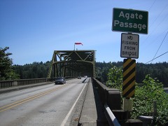
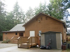
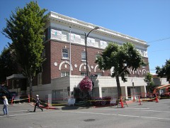
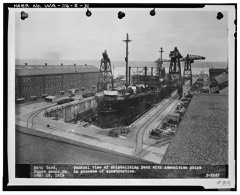
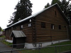
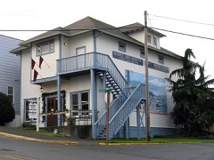
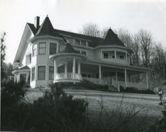
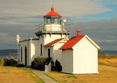
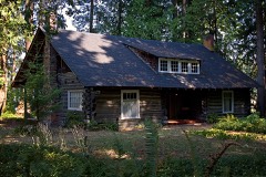
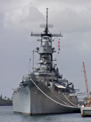
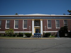
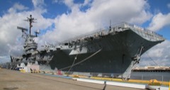
23 National Register listings published here, 3 of them National Historic Landmarks.
Sources: the National Register database, National Park Service
115 topographic sheets cover 123 settlements here, and 23 properties are on the National Register of Historic Places.
23 National Register listings published here, 3 of them National Historic Landmarks.
Sources: the National Register database, National Park Service
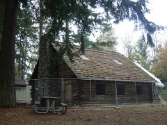
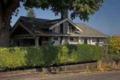
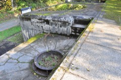
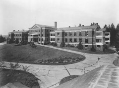
Every property in this county listed on the National Register of Historic Places, with the year it was listed and the federal nomination document.
Every wildfire the federal occurrence database records inside this county: 75 of them, burning about 90 acres. 3 started naturally and 5 were recorded as arson. Each settlement page carries the fires within five miles of it.
| Reported cause | Fires |
|---|---|
| Missing data/not specified/undetermined | 17 |
| Debris and open burning | 14 |
| Recreation and ceremony | 13 |
| Smoking | 8 |
| Arson/incendiarism | 5 |
| Fireworks | 5 |
| Misuse of fire by a minor | 4 |
| Natural | 3 |
| Equipment and vehicle use | 3 |
| Railroad operations and maintenance | 1 |
| Other causes | 1 |
| Power generation/transmission/distribution | 1 |
The five largest, by the area the report gives. One of them was set deliberately.
| Date | Cause | Size | Reported by | Name on the report |
|---|---|---|---|---|
| 10 June 2019 | Missing data/not specified/undetermined | 26 acres | Washington State Department of Natural Resources Headquarters | BEAR CREEK |
| 12 September 2012 | Arson/incendiarism | 5.0 acres | Washington State Department of Natural Resources Headquarters | CARNEY LAKE |
| 18 November 2002 | Missing data/not specified/undetermined | 5.0 acres | Puget Sound Agency | AGATE PASS |
| 18 July 2018 | Equipment and vehicle use | 4.3 acres | Washington State Department of Natural Resources Headquarters | WERNER RD |
| 7 August 2008 | Smoking | 4.0 acres | Washington State Department of Natural Resources Headquarters | BIO |
| 6 September 2003 | Recreation and ceremony | 4.0 acres | Washington State Department of Natural Resources Headquarters | not named |
| 29 August 2002 | Smoking | 2.5 acres | Washington State Department of Natural Resources Headquarters | not named |
| 17 August 1996 | Recreation and ceremony | 2.5 acres | Washington State Department of Natural Resources Headquarters | not named |
Every settlement page carries the fires within five miles of it - see the settlement index below.
The NOAA Storm Events Database holds 17 reports for this county, causing 1 death, 5 injuries and about $34,095,000 in recorded property damage. Each settlement page carries the reports that name it.
| Kind of event | Reports |
|---|---|
| Heavy Rain | 8 |
| Tornado | 2 |
| Lightning | 2 |
| Thunderstorm Wind | 2 |
| Funnel Cloud | 1 |
| Debris Flow | 1 |
| Flood | 1 |
The most serious of them, by death, then injury, then recorded damage. The accounts are quoted exactly as the forecast office filed them.
| When | Event | Place named | Harm | What the report says |
|---|---|---|---|---|
| December 2010 | Thunderstorm Wind | Harper | 1 killed, $25,000 | A woman living in the Harper area was killed when a tree fell onto her home around 1230 am. |
| March 1997 | Heavy Rain | Bremerton | 3 hurt, $750,000 | no account filed |
| May 2013 | Thunderstorm Wind | Silverdale | 1 hurt, $30,000 | In Silverdale, a tree crashed onto a home injuring the occupant. There were power outages on other parts of the Kitsap peninsula. |
| July 1999 | Lightning | Bremerton | 1 hurt | A woman was injured after being struck by lightning. She was released from the hospital the next day with an aching arm and a headache. |
| December 2007 | Heavy Rain | Port Orchard | $30,000,000 | Heavy rains caused officials to close or restrict nearly 200 roads, including major commuter paths such as Highway 3. A large sinkhole developed near the High Point Shopping Center in Port Orchard. About 300 structures throughout the county were damaged. Several stores in Silverdale suffered water damage. |
| December 2018 | Tornado (EF2) | Port Orchard | $1,180,000 | At 1350PST, a tornado touched down near Port Orchard, WA. This tornado continued on the ground in a northeast direction for approximately 5 minutes. Significant structure damage was evident in the damage path, including one home where the roof was completely removed. Ultimately, 300 homes and businesses were impacted by the tornado. It resulted in 25 red-tagged (uninhabitable), and 20 yellow-tagged (habitable at own risk) homes. |
| December 2010 | Flood | Port Orchard | $1,000,000 | About 200 people were trapped near Port Orchard when Hunter road was washed out by a raging creek - it is the only road in and out of a neighborhood. Lake Flora Rd was also closed near highway 3 where it was washed out. |
| January 2006 | Heavy Rain | Countywide | $700,000 | no account filed |
| October 2003 | Heavy Rain | Countywide | $200,000 | no account filed |
| August 1999 | Lightning | Silverdale | $150,000 | Lightning started a fire which damaged a home. |
| February 1999 | Heavy Rain | Silverdale | $35,000 | no account filed |
| April 1991 | Tornado (F0) | not stated | $25,000 | no account filed |
| August 2001 | Heavy Rain | Countywide | - | no account filed |
| November 2001 | Heavy Rain | Countywide | - | no account filed |
| January 1999 | Heavy Rain | Brownsville | - | no account filed |
| January 1997 | Debris Flow | Bremerton | - | no account filed |
| October 1996 | Funnel Cloud | Silverdale | - | no account filed |
The Survey's mineral resources record lists 97 workings inside this county. 10 still produce and 87 are closed or unrecorded. Each settlement page carries the workings within five miles of it.
| Commodity | Workings |
|---|---|
| Sand and Gravel, Construction | 80 |
| Stone, Crushed/Broken | 10 |
| Clay | 2 |
| Granite | 2 |
| Diatomite | 1 |
| Cobalt | 1 |
| Tungsten, Tin, Silver, Gold, Copper | 1 |
| Stone | 1 |
The least common of them first, because a county's hundredth gravel pit says nothing its first ten did not.
| Where | Site | Commodity | Status | Recorded |
|---|---|---|---|---|
| Chico | Tungsten, Tin, Silver, Gold, Copper | Prospect | ||
| Elmer Nelson Property | Cobalt | Unknown | ||
| Harper | Diatomite | Occurrence | ||
| Kitsap Quarry | Stone | Producer | ||
| Camp Union Quarry | Granite, Stone, Crushed/Broken | Past Producer | ||
| Green Mountain Quarry | Granite | Past Producer | ||
| Harper | Clay | Past Producer | ||
| Port Orchard | Clay | Past Producer | ||
| Bourn Quarry | Stone, Crushed/Broken | Past Producer | ||
| Charleston Quarry | Stone, Crushed/Broken | Past Producer | ||
| Olsen Quarry | Stone, Crushed/Broken | Past Producer | ||
| Pioneer Quarry | Stone, Crushed/Broken | Past Producer | ||
| Reynolds Quarry | Stone, Crushed/Broken | Past Producer | ||
| Unnamed Quarry | Stone, Crushed/Broken | Past Producer | ||
| Unnamed Quarry | Stone, Crushed/Broken | Past Producer | ||
| Waterman Quarry | Stone, Crushed/Broken | Past Producer | ||
| Wilson Quarry | Stone, Crushed/Broken | Past Producer | ||
| Ace Paving Co. Pit | Sand and Gravel, Construction | Producer | ||
| Ace Paving Dickey Pit | Sand and Gravel, Construction | Producer | ||
| Albright Pit | Sand and Gravel, Construction | Past Producer | ||
| Allen Pit | Sand and Gravel, Construction | Past Producer | ||
| Barker Creek Pit | Sand and Gravel, Construction | Past Producer | ||
| Bethel Pit | Sand and Gravel, Construction | Past Producer | ||
| Blossom Brothers Pit | Sand and Gravel, Construction | Past Producer | ||
| Blossom Construction Co. Sand Pit | Sand and Gravel, Construction | Past Producer | ||
| Bowling Pit | Sand and Gravel, Construction | Past Producer | ||
| Breidabuck Pit | Sand and Gravel, Construction | Past Producer | ||
| Butler Pit | Sand and Gravel, Construction | Past Producer | ||
| Camp Union Pit | Sand and Gravel, Construction | Past Producer | ||
| Chico Hill Pit | Sand and Gravel, Construction | Past Producer | ||
| Chico Pit | Sand and Gravel, Construction | Producer | ||
| Collins Pit | Sand and Gravel, Construction | Past Producer | ||
| Danielson Pit | Sand and Gravel, Construction | Past Producer | ||
| Gravel Pit | Sand and Gravel, Construction | Past Producer | ||
| Gravel Pit | Sand and Gravel, Construction | Past Producer | ||
| Gravel Pit | Sand and Gravel, Construction | Past Producer | ||
| Gravel Pit | Sand and Gravel, Construction | Past Producer | ||
| Holly Pit | Sand and Gravel, Construction | Past Producer | ||
| Holmberg Pit | Sand and Gravel, Construction | Past Producer | ||
| I-86 Pit | Sand and Gravel, Construction | Producer | ||
| I-86 Union River | Sand and Gravel, Construction | Past Producer | ||
| Island Pit N-2 | Sand and Gravel, Construction | Producer | ||
| Jameson Pit | Sand and Gravel, Construction | Past Producer | ||
| Kitsap Lake Pit | Sand and Gravel, Construction | Past Producer | ||
| Lynwood Sand Pit | Sand and Gravel, Construction | Past Producer | ||
| Midway Pit | Sand and Gravel, Construction | Past Producer | ||
| Navy Yard | Sand and Gravel, Construction | Past Producer | ||
| North End Pit | Sand and Gravel, Construction | Past Producer | ||
| Paddock Pit | Sand and Gravel, Construction | Past Producer | ||
| Pine Hill Pit | Sand and Gravel, Construction | Past Producer | ||
| Pioneer Quarry Site | Sand and Gravel, Construction | Past Producer | ||
| Port Orchard Airport Pit | Sand and Gravel, Construction | Producer | ||
| Purdy Pit | Sand and Gravel, Construction | Past Producer | ||
| Riley Pit | Sand and Gravel, Construction | Past Producer | ||
| Seabeck Hill Pit | Sand and Gravel, Construction | Past Producer | ||
| Seabheck Pit | Sand and Gravel, Construction | Past Producer | ||
| Seal Rock | Sand and Gravel, Construction | Occurrence | ||
| Settle Pit | Sand and Gravel, Construction | Past Producer | ||
| Sheridan Pit | Sand and Gravel, Construction | Past Producer | ||
| Sicard Pit | Sand and Gravel, Construction | Past Producer | ||
| Unnamed Pit | Sand and Gravel, Construction | Past Producer | ||
| Unnamed Pit | Sand and Gravel, Construction | Past Producer | ||
| Unnamed Pit | Sand and Gravel, Construction | Past Producer | ||
| Unnamed Pit | Sand and Gravel, Construction | Past Producer | ||
| Unnamed Pit | Sand and Gravel, Construction | Past Producer | ||
| Unnamed Pit | Sand and Gravel, Construction | Past Producer | ||
| Unnamed Pit | Sand and Gravel, Construction | Past Producer | ||
| Unnamed Pit | Sand and Gravel, Construction | Past Producer | ||
| Unnamed Pit | Sand and Gravel, Construction | Past Producer | ||
| Unnamed Pit | Sand and Gravel, Construction | Past Producer | ||
| Unnamed Pit | Sand and Gravel, Construction | Past Producer | ||
| Unnamed Pit | Sand and Gravel, Construction | Past Producer | ||
| Unnamed Pit | Sand and Gravel, Construction | Past Producer | ||
| Unnamed Pit | Sand and Gravel, Construction | Past Producer | ||
| Unnamed Pit | Sand and Gravel, Construction | Past Producer | ||
| Unnamed Pit | Sand and Gravel, Construction | Past Producer | ||
| Unnamed Pit | Sand and Gravel, Construction | Past Producer | ||
| Unnamed Pit | Sand and Gravel, Construction | Past Producer | ||
| Unnamed Pit | Sand and Gravel, Construction | Past Producer | ||
| Unnamed Pit | Sand and Gravel, Construction | Past Producer | ||
| Unnamed Pit | Sand and Gravel, Construction | Past Producer | ||
| Unnamed Pit | Sand and Gravel, Construction | Past Producer | ||
| Unnamed Pit | Sand and Gravel, Construction | Past Producer | ||
| Unnamed Pit | Sand and Gravel, Construction | Past Producer | ||
| Unnamed Pit | Sand and Gravel, Construction | Past Producer | ||
| Unnamed Pit | Sand and Gravel, Construction | Past Producer | ||
| Unnamed Pit | Sand and Gravel, Construction | Past Producer | ||
| Unnamed Pit | Sand and Gravel, Construction | Past Producer | ||
| Unnamed Pit | Sand and Gravel, Construction | Producer | ||
| Unnamed Pit | Sand and Gravel, Construction | Producer | ||
| Unnamed Pit | Sand and Gravel, Construction | Past Producer | ||
| Unnamed Pit | Sand and Gravel, Construction | Past Producer | ||
| Unnamed Pit | Sand and Gravel, Construction | Past Producer | ||
| Unnamed Pit | Sand and Gravel, Construction | Past Producer | ||
| Unnamed Pit | Sand and Gravel, Construction | Past Producer | ||
| Unnamed Pit | Sand and Gravel, Construction | Past Producer | ||
| Upper Dickey Pit | Sand and Gravel, Construction | Producer |
Named settlements recorded in the Geographic Names Information System, each with the topographic sheets covering it. Villages, hamlets and abandoned places alike. Each is shown with the nearest named watercourse or landform and the survey quadrangle it falls on.
Bainbridge Island census division · 98110 · Near Treasure Island · Suquamish quadrangle
15 sheets, 1937 to 1997
Port Orchard census division · 98366 · On Blackjack Creek · Bremerton East quadrangle
13 sheets, 1937 to 1992
Bainbridge Island census division · 98110 · On Bainbridge Island · Suquamish quadrangle
15 sheets, 1937 to 1997
Bainbridge Island census division · 98110 · Near Bainbridge Island · Suquamish quadrangle
15 sheets, 1937 to 1997
Bainbridge Island census division · 98110 · Suquamish quadrangle
15 sheets, 1937 to 1997
Port Orchard census division · 98367 · On Wilson Creek · Olalla quadrangle
14 sheets, 1942 to 1991
Bainbridge Island census division · 98110 · On Miemois Creek · Suquamish quadrangle
15 sheets, 1937 to 1997
Port Orchard census division · 98367 · On Ruby Creek · Burley quadrangle
15 sheets, 1942 to 1999
Poulsbo census division · 98370 · On Jump Off Creek · Lofall quadrangle
14 sheets, 1937 to 1992
Bremerton census division · 98312 · On Heins Creek · Bremerton West quadrangle
14 sheets, 1937 to 1992
Poulsbo census division · 98370 · On Crouch Creek · Suquamish quadrangle
15 sheets, 1937 to 1997
Port Orchard census division · 98367 · On Burley Creek · Burley quadrangle
15 sheets, 1942 to 1999
Poulsbo census division · 98370 · On Hoot Creek · Poulsbo quadrangle
13 sheets, 1937 to 1992
Bremerton census division · 98312 · On Chico Creek · Bremerton West quadrangle
14 sheets, 1937 to 1992
Port Orchard census division · 98366 · On Curley Creek · Bremerton East quadrangle
13 sheets, 1937 to 1992
Port Orchard census division · 98366 · On Curley Creek · Bremerton East quadrangle
13 sheets, 1937 to 1992
Port Orchard census division · 98366 · Bremerton East quadrangle
13 sheets, 1937 to 1992
Bremerton census division · 98312 · On Kitsap Creek · Bremerton West quadrangle
14 sheets, 1937 to 1992
Bainbridge Island census division · 98110 · Bremerton East quadrangle
13 sheets, 1937 to 1992
Bainbridge Island census division · 98110 · On Illahee Creek · Bremerton East quadrangle
13 sheets, 1937 to 1992
Bainbridge Island census division · 98110 · Bremerton East quadrangle
13 sheets, 1937 to 1992
Bremerton census division · 98310 · Bremerton West quadrangle
14 sheets, 1937 to 1992
Port Orchard census division · 98366 · On Blackjack Creek · Bremerton East quadrangle
13 sheets, 1937 to 1992
Bremerton census division · 98311 · On Mosher Creek · Bremerton West quadrangle
14 sheets, 1937 to 1992
Kingston census division · 98346 · On Silver Creek · Port Gamble quadrangle
15 sheets, 1937 to 1997
Bremerton census division · 98312 · On Chico Creek · Bremerton West quadrangle
14 sheets, 1937 to 1992
Bremerton census division · 98310 · On Enetai Creek · Bremerton East quadrangle
13 sheets, 1937 to 1992
Bremerton census division · 98312 · On Chico Creek · Bremerton West quadrangle
14 sheets, 1937 to 1992
Bremerton census division · 98311 · On Pahrmann Creek · Bremerton West quadrangle
14 sheets, 1937 to 1992
Port Orchard census division · 98367 · On Ruby Creek · Bremerton West quadrangle
14 sheets, 1937 to 1992
Bainbridge Island census division · 98110 · On Issei Creek · Suquamish quadrangle
15 sheets, 1937 to 1997
Bainbridge Island census division · 98110 · Near Orchard Rocks · Bremerton East quadrangle
13 sheets, 1937 to 1992
Poulsbo census division · 98370 · On Jump Off Creek · Lofall quadrangle
14 sheets, 1937 to 1992
Port Orchard census division · 98367 · On Fragaria Creek · Olalla quadrangle
14 sheets, 1942 to 1991
Bremerton census division · 98311 · On Crouch Creek · Suquamish quadrangle
15 sheets, 1937 to 1997
Port Orchard census division · 98312 · On Gorst Creek · Bremerton West quadrangle
14 sheets, 1937 to 1992
Port Orchard census division · 98366 · On Curley Creek · Bremerton East quadrangle
13 sheets, 1937 to 1992
Bremerton census division · 98380 · On Anderson Creek · Holly quadrangle
17 sheets, 1936 to 1992
Bremerton census division · 98311 · On Hoot Creek · Poulsbo quadrangle
13 sheets, 1937 to 1992
Bremerton census division · 98311 · On Illahee Creek · Bremerton East quadrangle
13 sheets, 1937 to 1992
Bremerton census division · 98312 · On Kitsap Creek · Bremerton West quadrangle
14 sheets, 1937 to 1992
Bremerton census division · 98311 · On Pinsch Creek · Poulsbo quadrangle
13 sheets, 1937 to 1992
Bremerton census division · 98311 · On Illahee Creek · Suquamish quadrangle
15 sheets, 1937 to 1997
Poulsbo census division · 98370 · On Bjorgen Creek · Suquamish quadrangle
15 sheets, 1937 to 1997
Kingston census division · 98346 · On Whisper Creek · Edmonds West quadrangle
26 sheets, 1895 to 1997
Bremerton census division · 98312 · On Kitsap Creek · Bremerton West quadrangle
14 sheets, 1937 to 1992
Bremerton census division · 98380 · On Big Beef Creek · Seabeck quadrangle
16 sheets, 1936 to 1997
Poulsbo census division · 98370 · On Bjorgen Creek · Suquamish quadrangle
15 sheets, 1937 to 1997
Poulsbo census division · 98370 · Near Big Valley · Suquamish quadrangle
15 sheets, 1937 to 1997
Kingston census division · 98346 · By Teekalet Bluff · Port Gamble quadrangle
15 sheets, 1937 to 1997
Poulsbo census division · 98370 · On Jump Off Creek · Lofall quadrangle
14 sheets, 1937 to 1992
Bainbridge Island census division · 98110 · Bremerton East quadrangle
13 sheets, 1937 to 1992
Bainbridge Island census division · 98110 · On Manzanita Creek · Suquamish quadrangle
15 sheets, 1937 to 1997
Port Orchard census division · 98366 · On Beaver Creek · Bremerton East quadrangle
13 sheets, 1937 to 1992
Bremerton census division · 98310 · On Enetai Creek · Bremerton East quadrangle
13 sheets, 1937 to 1992
Bainbridge Island census division · 98110 · Suquamish quadrangle
15 sheets, 1937 to 1997
Bainbridge Island census division · 98110 · On Manzanita Creek · Suquamish quadrangle
15 sheets, 1937 to 1997
Port Orchard census division · 98359 · On Olalla Creek · Olalla quadrangle
14 sheets, 1942 to 1991
Port Orchard census division · 98366 · Bremerton East quadrangle
13 sheets, 1937 to 1992
Port Orchard census division · 98366 · On Blackjack Creek · Bremerton East quadrangle
13 sheets, 1937 to 1992
Bremerton census division · 98311 · On Hoot Creek · Poulsbo quadrangle
13 sheets, 1937 to 1992
Poulsbo census division · 98370 · On Bjorgen Creek · Poulsbo quadrangle
13 sheets, 1937 to 1992
Bainbridge Island census division · 98110 · Bremerton East quadrangle
13 sheets, 1937 to 1992
Bainbridge Island census division · 98110 · Bremerton East quadrangle
13 sheets, 1937 to 1992
Poulsbo census division · 98370 · By Teekalet Bluff · Port Gamble quadrangle
15 sheets, 1937 to 1997
Bainbridge Island census division · 98110 · Near Treasure Island · Suquamish quadrangle
15 sheets, 1937 to 1997
Port Orchard census division · 98366 · On Blackjack Creek · Bremerton West quadrangle
14 sheets, 1937 to 1992
Poulsbo census division · 98370 · Near Big Valley · Poulsbo quadrangle
13 sheets, 1937 to 1992
Port Orchard census division · 98366 · On Blackjack Creek · Bremerton East quadrangle
13 sheets, 1937 to 1992
Bremerton census division · 98312 · On Mosher Creek · Bremerton West quadrangle
14 sheets, 1937 to 1992
Kingston census division · 98346 · On Silver Creek · Port Gamble quadrangle
15 sheets, 1937 to 1997
Bremerton census division · 98380 · On Seabeck Creek · Seabeck quadrangle
16 sheets, 1936 to 1997
Bainbridge Island census division · 98110 · Near Treasure Island · Suquamish quadrangle
15 sheets, 1937 to 1997
Bremerton census division · 98312 · On Anderson Creek · Bremerton West quadrangle
14 sheets, 1937 to 1992
Bremerton census division · 98383 · Near Clear Creek Valley · Poulsbo quadrangle
13 sheets, 1937 to 1992
Bainbridge Island census division · 98110 · Near Orchard Rocks · Bremerton East quadrangle
13 sheets, 1937 to 1992
Port Orchard census division · 98366 · On Curley Creek · Bremerton East quadrangle
13 sheets, 1937 to 1992
Bremerton census division · 98383 · On Anderson Creek · Poulsbo quadrangle
13 sheets, 1937 to 1992
Bainbridge Island census division · 98110 · On Miemois Creek · Suquamish quadrangle
15 sheets, 1937 to 1997
Bremerton census division · 98311 · On Mosher Creek · Bremerton West quadrangle
14 sheets, 1937 to 1992
Bremerton census division · 98311 · On Illahee Creek · Suquamish quadrangle
15 sheets, 1937 to 1997
Kingston census division · 98340 · By Foulweather Bluff · Hansville quadrangle
13 sheets, 1937 to 1997
Bainbridge Island census division · 98110 · On Miemois Creek · Suquamish quadrangle
15 sheets, 1937 to 1997
Poulsbo census division · 98370 · On Bjorgen Creek · Poulsbo quadrangle
13 sheets, 1937 to 1992
Bremerton census division · 98383 · On Anderson Creek · Seabeck quadrangle
16 sheets, 1936 to 1997
Port Orchard census division · 98366 · On Enetai Creek · Bremerton East quadrangle
13 sheets, 1937 to 1992
Port Orchard census division · 98366 · On Beaver Creek · Bremerton East quadrangle
13 sheets, 1937 to 1992
Port Orchard census division · 98366 · Near Orchard Rocks · Bremerton East quadrangle
13 sheets, 1937 to 1992
Bainbridge Island census division · 98110 · Near Orchard Rocks · Bremerton East quadrangle
13 sheets, 1937 to 1992
Bainbridge Island census division · 98110 · Near Treasure Island · Suquamish quadrangle
15 sheets, 1937 to 1997
Bainbridge Island census division · 98110 · On Illahee Creek · Bremerton East quadrangle
13 sheets, 1937 to 1992
Port Orchard census division · 98367 · On Square Creek · Burley quadrangle
15 sheets, 1942 to 1999
Bainbridge Island census division · 98110 · Shilshole Bay quadrangle
32 sheets, 1894 to 1992