 Block
From the record
One of 23 National Register listings published here for Kitsap County · listed in 2010 · category: Building · built in 1908.
Sources: the case file at the National Archives · the National Register database, National Park Service
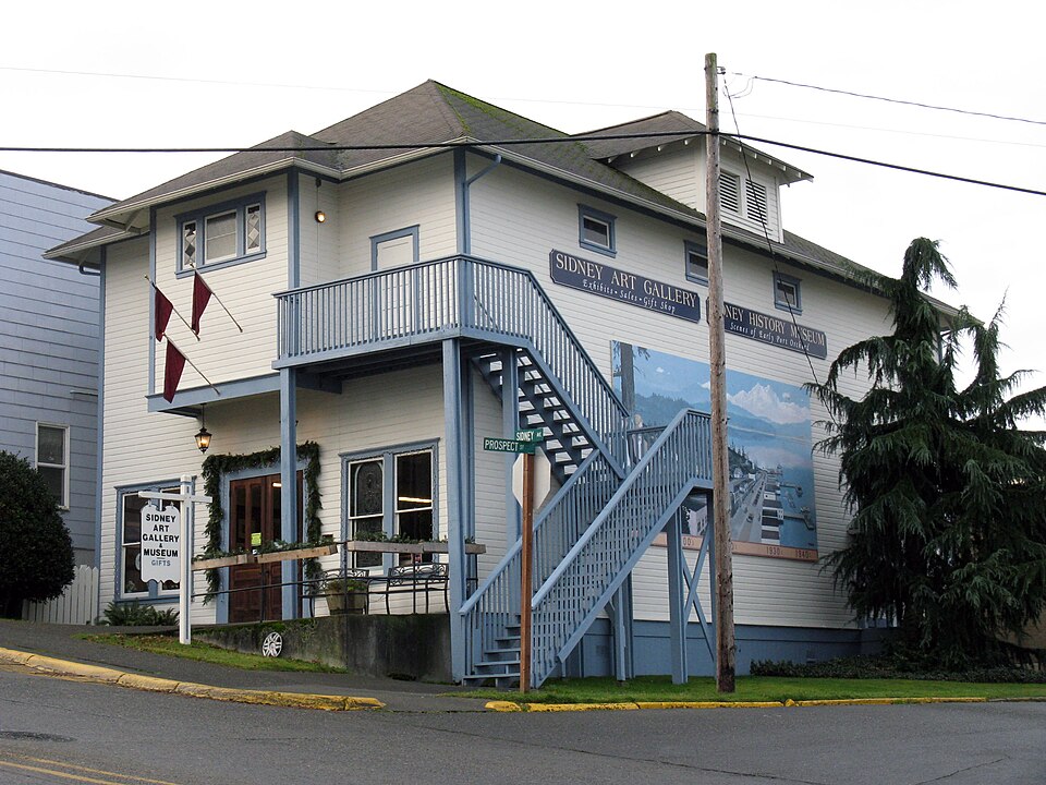
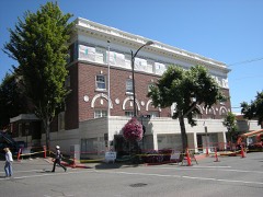
Built in 1908. Listed on the National Register of Historic Places in 2010.
One of 23 National Register listings published here for Kitsap County · listed in 2010 · category: Building · built in 1908.
Sources: the case file at the National Archives · the National Register database, National Park Service
Regional context, not property-specific evidence. The federal wildfire occurrence database lists 8 fires within 5 miles of Masonic Hall- Port Orchard between 1994 and 2018, burning about 11 acres in total. None started naturally. None was recorded as arson. Distance is straight-line from the map coordinates, so a fire counted here may appear on a neighbouring settlement's page as well.
| Reported cause | Fires |
|---|---|
| Missing data/not specified/undetermined | 2 |
| Smoking | 2 |
| Equipment and vehicle use | 2 |
| Recreation and ceremony | 1 |
| Misuse of fire by a minor | 1 |
The most recent of them, most recent first, with the day each was reported and the service that recorded it.
| Date | Cause | Size | Reported by | Name on the report |
|---|---|---|---|---|
| 30 August 2017 | Equipment and vehicle use | under an acre | Washington State Department of Natural Resources Headquarters | DOWN TIMBER |
| 3 August 2009 | Missing data/not specified/undetermined | 1.0 acres | Washington State Department of Natural Resources Headquarters | SUNNY SLOPE |
| 29 August 2002 | Smoking | 2.5 acres | Washington State Department of Natural Resources Headquarters | not named |
| 21 August 2002 | Misuse of fire by a minor | 1.5 acres | Washington State Department of Natural Resources Headquarters | not named |
| 12 August 1994 | Smoking | under an acre | Washington State Department of Natural Resources Headquarters | not named |
| 24 July 2014 | Recreation and ceremony | under an acre | Washington State Department of Natural Resources Headquarters | SPACE BLANKET |
| 18 July 2018 | Equipment and vehicle use | 4.3 acres | Washington State Department of Natural Resources Headquarters | WERNER RD |
| 15 June 2009 | Missing data/not specified/undetermined | 1.0 acres | Washington State Department of Natural Resources Headquarters | VICTORY |
Regional context, not property-specific evidence. The federal mineral resources record lists 21 workings within 5 miles of Masonic Hall- Port Orchard: 18 past producers, 3 producers. 3 still produce. What was taken out: Sand and Gravel, Construction, Stone, Crushed/Broken, Clay, Stone. Distance is straight-line from the map coordinates, so a quarry counted here may appear on a neighbouring settlement's page as well.
| Where | Site | Commodity | Status | Recorded |
|---|---|---|---|---|
| Kitsap Quarry | Stone | Producer | ||
| Port Orchard | Clay | Past Producer | ||
| Bourn Quarry | Stone, Crushed/Broken | Past Producer | ||
| Charleston Quarry | Stone, Crushed/Broken | Past Producer | ||
| Olsen Quarry | Stone, Crushed/Broken | Past Producer | ||
| Pioneer Quarry | Stone, Crushed/Broken | Past Producer | ||
| Reynolds Quarry | Stone, Crushed/Broken | Past Producer | ||
| Waterman Quarry | Stone, Crushed/Broken | Past Producer | ||
| Wilson Quarry | Stone, Crushed/Broken | Past Producer | ||
| Allen Pit | Sand and Gravel, Construction | Past Producer |
Regional context, not property-specific evidence. The National Weather Service names Port Orchard, the town this property stands in, in 3 storm reports between 2007 and 2018: 1 heavy rain, 1 flood, 1 tornado. No death or injury is recorded in these reports. Each account below is quoted exactly as the forecast office filed it, from the NOAA Storm Events Database, and each date opens the federal record of that event.
| When | Event | Place named | Harm | What the report says |
|---|---|---|---|---|
| December 2007 | Heavy Rain | Port Orchard | $30,000,000 | Heavy rains caused officials to close or restrict nearly 200 roads, including major commuter paths such as Highway 3. A large sinkhole developed near the High Point Shopping Center in Port Orchard. About 300 structures throughout the county were damaged. Several stores in Silverdale suffered water damage. |
| December 2018 | Tornado (EF2) | Port Orchard | $1,180,000 | At 1350PST, a tornado touched down near Port Orchard, WA. This tornado continued on the ground in a northeast direction for approximately 5 minutes. Significant structure damage was evident in the damage path, including one home where the roof was completely removed. Ultimately, 300 homes and businesses were impacted by the tornado. It resulted in 25 red-tagged (uninhabitable), and 20 yellow-tagged (habitable at own risk) homes. |
| December 2010 | Flood | Port Orchard | $1,000,000 | About 200 people were trapped near Port Orchard when Hunter road was washed out by a raging creek - it is the only road in and out of a neighborhood. Lake Flora Rd was also closed near highway 3 where it was washed out. |
No historic map-sheet match is published for this property yet. That does not mean no map exists. This record needs a coordinate-quality review before it can be joined to a sheet boundary. Browse the county's mapped places while that work is pending.
Other National Register properties close enough to walk or drive between, ordered by distance from this one. Both positions come from the same geocoding pass that matched these properties to their map sheets.
| Photograph | Property | Distance | Listed |
|---|---|---|---|
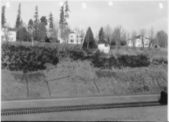 | Officers' Row Historic District | 1.4 miles | 1990 |
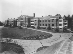 | Hospital Reservation Historic District | 1.5 miles | 1990 |
| Puget Sound Radio Station Historic District | 1.6 miles | 1990 | |
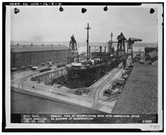 | Building 50 | 1.6 miles | 1992 |
| Marine Reservation Historic District | 1.6 miles | 1990 | |
 | Bremerton Elks Temple Lodge No. 1181 Building | 1.8 miles | 1995 |
| National Archives record | The nomination case file for reference 10000254 in Record Group 79. |
| Kitsap County | All 23 listed properties in this county. |