Block
From the record
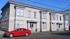
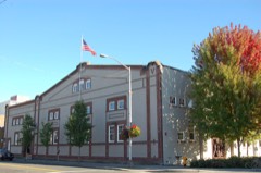
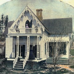
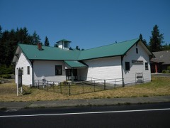
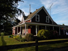
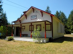
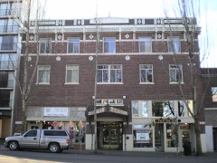
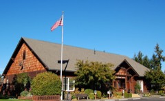
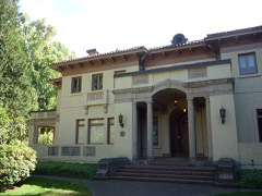
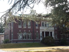
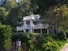
68 National Register listings published here.
Sources: the county history on the Internet Archive · the National Register database, National Park Service
112 topographic sheets cover 59 settlements here, and 68 properties are on the National Register of Historic Places.
68 National Register listings published here.
Sources: the county history on the Internet Archive · the National Register database, National Park Service
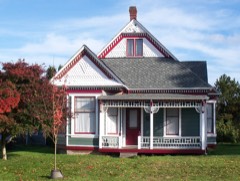
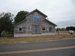
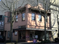
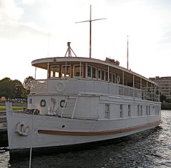
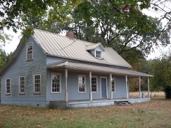
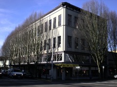
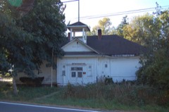
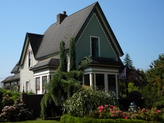
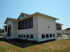
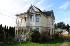
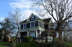
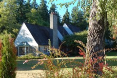
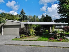
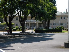
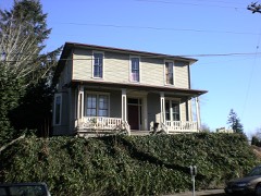
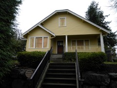
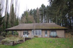
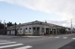
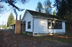
Every property in this county listed on the National Register of Historic Places, with the year it was listed and the federal nomination document.
Every wildfire the federal occurrence database records inside this county: 1,247 of them, burning about 2,120 acres. 19 started naturally and 51 were recorded as arson. Each settlement page carries the fires within five miles of it.
| Reported cause | Fires |
|---|---|
| Missing data/not specified/undetermined | 343 |
| Debris and open burning | 294 |
| Recreation and ceremony | 238 |
| Misuse of fire by a minor | 76 |
| Fireworks | 73 |
| Equipment and vehicle use | 62 |
| Arson/incendiarism | 51 |
| Smoking | 33 |
| Railroad operations and maintenance | 33 |
| Natural | 19 |
| Other causes | 13 |
| Power generation/transmission/distribution | 12 |
The five largest, by the area the report gives. None of them was recorded as arson.
| Date | Cause | Size | Reported by | Name on the report |
|---|---|---|---|---|
| 22 August 2017 | Missing data/not specified/undetermined | 384 acres | Washington State Department of Natural Resources Headquarters | SCATTER CREEK |
| 8 September 2020 | Missing data/not specified/undetermined | 268 acres | Washington State Department of Natural Resources Headquarters | MIMA ROAD |
| 5 August 1998 | Recreation and ceremony | 140 acres | Washington State Department of Natural Resources Headquarters | not named |
| 9 June 1992 | Debris and open burning | 96 acres | Washington State Department of Natural Resources Headquarters | not named |
| 2 September 2005 | Debris and open burning | 50 acres | Washington State Department of Natural Resources Headquarters | NURSERY |
| 21 September 2000 | Recreation and ceremony | 44 acres | Washington State Department of Natural Resources Headquarters | not named |
| 2 August 2017 | Misuse of fire by a minor | 33 acres | Washington State Department of Natural Resources Headquarters | GRAND MOUND |
| 21 July 2004 | Missing data/not specified/undetermined | 33 acres | Washington State Department of Natural Resources Headquarters | PIT STOP 2 |
Every settlement page carries the fires within five miles of it - see the settlement index below.
The NOAA Storm Events Database holds 28 reports for this county, causing no deaths, 2 injuries and about $25,582,000 in recorded property damage. Each settlement page carries the reports that name it.
| Kind of event | Reports |
|---|---|
| Heavy Rain | 9 |
| Tornado | 5 |
| Flood | 4 |
| Hail | 3 |
| Funnel Cloud | 3 |
| Lightning | 3 |
| Thunderstorm Wind | 1 |
The most serious of them, by death, then injury, then recorded damage. The accounts are quoted exactly as the forecast office filed them.
| When | Event | Place named | Harm | What the report says |
|---|---|---|---|---|
| May 2003 | Lightning | Nisqually | 1 hurt, $1,000 | Lightning struck just outside a mobile home, causing a little damage to it and to a nearby tree. A woman inside the home was temporarily paralyzed from the waist down. |
| June 2002 | Lightning | Lacey | 1 hurt | A 17 year old was struck by lightning while he was working outside. He sustained minor burns, some hearing loss and a headache. The tree next to him was stripped of its bark. |
| December 2007 | Heavy Rain | Tumwater | $14,000,000 | A few homes had up to 3 inches of water in their basements. Flood waters from Swift Creek washed away part of Cedar Flat Road cutting off about 250 homes from vehicular traffic. |
| March 1999 | Heavy Rain | Countywide | $7,000,000 | no account filed |
| January 2009 | Flood | Bucoda | $3,200,000 | There was flooding along the Skookumchuck River, dozens of homes in Bucoda flooded. Several roads in the area were also flooded, including SR 507. |
| May 2017 | Thunderstorm Wind | Yelm | $700,000 | Severe thunderstorm wind gusts peaked around 70 mph during the event between 3 and 5 PM, knocking down trees and power lines leaving nearly 50,000 without power. Several homes had trees fall on them. |
| January 2006 | Heavy Rain | Countywide | $200,000 | no account filed |
| November 2006 | Flood | Bucoda | $100,000 | Record flooding occurred on the Cowlitz, Nooksack, Puyallup, Nisqually, |Skykomish, Stillaguamish, Carbon, Snoqualmie, and Bogachiel. Major flooding occurred on the Tolt, Snohomish, Skokomish, Skagit, and White rivers. Other rivers flooding were the Satsop, Cedar, Wynoochee, Elwha, Deschutes, Dungeness, Skookumchuck, and Chehalis. |
| October 2003 | Heavy Rain | Countywide | $100,000 | no account filed |
| January 2021 | Flood | Plumb | $63,000 | The Skookumchuck River near Bucoda and Chehalis River near Grand Mound exceeded moderate flood stage. Urban and small stream flooding occurred as well. |
| January 2021 | Flood | Rochester R And K Ar | $63,000 | The Chehalis River near Grand Mound and Skookumchuck River near Bucoda crested above moderate flood. Urban and small stream flooding occurred as well. |
| May 2004 | Tornado (F1) | Tenino | $50,000 | A tornado damaged a barn, some trees, and a nearby apartment. |
| April 1994 | Tornado (F0) | Bucoda | $50,000 | A tornado touched down near the main street of Bucoda. Several buildings sustained damage. Damage included aluminum sheds blown over or moved, rain gutters torn off buildings, and a twisted street sign. A piece of one aluminum shed was seen 80 feet above the ground caught in a tree. |
| January 2006 | Heavy Rain | Olympia | $30,000 | no account filed |
| September 2002 | Lightning | Lacey | $20,000 | Lightning struck a garage, a DOT building and a tree in the Olympia area. The garage, filled with antiques, was destroyed. The DOT building lost power and the tree was split. |
| October 2003 | Tornado (F0) | Yelm | $5,000 | A weak tornado, on the ground for less than a minute, damaged a few power lines and knocked down some tree limbs. |
| December 2023 | Heavy Rain | (Olm)Olympia Arpt | - | A record rainfall of 2.96 inches was recorded at the Olympia airport. This broke the previous daily record of 2.18 inches in 1970. |
| December 2023 | Heavy Rain | (Olm)Olympia Arpt | - | A record high temperature of 62 degrees was recorded at Olympia airport. This broke the previous daily record of 56 degrees set in 2020. |
| October 2019 | Tornado (EFU) | Plumb | - | On 10/04/2019 a brief weak tornado was confirmed by video and fire/rescue report near Tenino, WA. No impacts or damage were observed. |
| November 2008 | Funnel Cloud | Vail | - | A funnel cloud was spotted 2 miles northwest of Lake Lawrence. It lasted for a few minutes. |
| January 2006 | Tornado (F0) | Lacey | - | On the ground for less than 2 minutes. |
| June 2005 | Funnel Cloud | Lacey | - | A funnel cloud descended 1/3 way to ground. |
| September 1997 | Hail | Yelm | - | A thunderstorm with golf ball sized hail broke car windshields in Yelm. |
| May 2001 | Funnel Cloud | Olympia | - | no account filed |
| August 2001 | Heavy Rain | Countywide | - | no account filed |
| November 2001 | Heavy Rain | Countywide | - | no account filed |
| August 1983 | Hail | not stated | - | no account filed |
| August 1983 | Hail | not stated | - | no account filed |
The Survey's mineral resources record lists 103 workings inside this county. 9 still produce and 94 are closed or unrecorded. Each settlement page carries the workings within five miles of it.
| Commodity | Workings |
|---|---|
| Sand and Gravel, Construction | 86 |
| Stone, Crushed/Broken | 10 |
| Flagstone | 2 |
| Clay | 1 |
| Peat | 1 |
| Stone | 1 |
| Copper | 1 |
| Stone, Dimension | 1 |
| Diatomite | 1 |
| Iron | 1 |
The least common of them first, because a county's hundredth gravel pit says nothing its first ten did not.
| Where | Site | Commodity | Status | Recorded |
|---|---|---|---|---|
| Bucoda Pit | Clay, Peat | Past Producer | ||
| Skookumchuck | Copper | Occurrence | ||
| Skookumchuck Pit | Stone | Producer | ||
| Spencer Deposit | Diatomite | Occurrence | ||
| St. Clair Lake | Iron | Prospect | ||
| Tumwater Sand & Gravel Pit | Stone, Dimension, Stone, Crushed/Broken | Past Producer | ||
| Hercules Quarry | Flagstone | Past Producer | ||
| Western Quarry | Flagstone | Past Producer | ||
| 14-B Pit | Stone, Crushed/Broken | Past Producer | ||
| Army Quarry | Stone, Crushed/Broken | Past Producer | ||
| Columbia Quarry | Stone, Crushed/Broken | Past Producer | ||
| County Line Quarry | Stone, Crushed/Broken | Past Producer | ||
| Delphi Quarry | Stone, Crushed/Broken | Past Producer | ||
| Gate Quarry | Stone, Crushed/Broken | Past Producer | ||
| Jones Quarry | Stone, Crushed/Broken | Producer | ||
| Mottman Quarry | Stone, Crushed/Broken | Past Producer | ||
| Webber Quarry | Stone, Crushed/Broken | Past Producer | ||
| 29th Street Pit | Sand and Gravel, Construction | Past Producer | ||
| Ames Huntly Road Pit | Sand and Gravel, Construction | Past Producer | ||
| Apple Avenue Pit | Sand and Gravel, Construction | Past Producer | ||
| Bardeaux Pit | Sand and Gravel, Construction | Past Producer | ||
| Capital Sand & Gravel Pit | Sand and Gravel, Construction | Past Producer | ||
| Capitol Lake Pit | Sand and Gravel, Construction | Past Producer | ||
| Case Road Pit | Sand and Gravel, Construction | Past Producer | ||
| Crescent Well Pit | Sand and Gravel, Construction | Past Producer | ||
| Crowder Pit | Sand and Gravel, Construction | Past Producer | ||
| Decatur St. Pit | Sand and Gravel, Construction | Past Producer | ||
| Delaney Pit | Sand and Gravel, Construction | Past Producer | ||
| Deschutes Pit | Sand and Gravel, Construction | Producer | ||
| Duval Pit | Sand and Gravel, Construction | Past Producer | ||
| Fleetwood Pit | Sand and Gravel, Construction | Past Producer | ||
| Gehrke Pit | Sand and Gravel, Construction | Past Producer | ||
| Gleason Kearney Pit | Sand and Gravel, Construction | Past Producer | ||
| Grand Mound Pit and Mill | Sand and Gravel, Construction | Past Producer | ||
| Grand Mound Pit and Plant | Sand and Gravel, Construction | Past Producer | ||
| Gravel Pit | Sand and Gravel, Construction | Past Producer | ||
| Gravel Pit | Sand and Gravel, Construction | Past Producer | ||
| Gravel Pit | Sand and Gravel, Construction | Past Producer | ||
| Gravel Pit | Sand and Gravel, Construction | Past Producer | ||
| Gravel Pit | Sand and Gravel, Construction | Past Producer | ||
| Grove Pit | Sand and Gravel, Construction | Past Producer | ||
| Hanna Pit | Sand and Gravel, Construction | Producer | ||
| Jackson's Meadow Tracts Pit | Sand and Gravel, Construction | Past Producer | ||
| Jamerson Gravel Co. Pit | Sand and Gravel, Construction | Past Producer | ||
| Johnson Pit | Sand and Gravel, Construction | Past Producer | ||
| Jones Road Pit | Sand and Gravel, Construction | Past Producer | ||
| Junction Pit | Sand and Gravel, Construction | Past Producer | ||
| Lacey Pit | Sand and Gravel, Construction | Producer | ||
| Little Rock Pit | Sand and Gravel, Construction | Past Producer | ||
| Longmire Pit | Sand and Gravel, Construction | Past Producer | ||
| Martin Sand & Gravel Co. Pit | Sand and Gravel, Construction | Producer | ||
| Maytown Pit | Sand and Gravel, Construction | Past Producer | ||
| Mcconnell Pit | Sand and Gravel, Construction | Past Producer | ||
| Mima Pit | Sand and Gravel, Construction | Past Producer | ||
| Mima Pit | Sand and Gravel, Construction | Past Producer | ||
| Mottman Pit | Sand and Gravel, Construction | Past Producer | ||
| Nisqually Pit | Sand and Gravel, Construction | Producer | ||
| O & K Trucking Co. Pit | Sand and Gravel, Construction | Past Producer | ||
| Olsen Pit | Sand and Gravel, Construction | Past Producer | ||
| Olympia Sand & Gravel Co. Pit | Sand and Gravel, Construction | Producer | ||
| Page Pit | Sand and Gravel, Construction | Past Producer | ||
| Peterson Pit | Sand and Gravel, Construction | Past Producer | ||
| Pit No. 3 | Sand and Gravel, Construction | Past Producer | ||
| Price Pit | Sand and Gravel, Construction | Past Producer | ||
| Rainier Pit | Sand and Gravel, Construction | Producer | ||
| Sandymere Pit | Sand and Gravel, Construction | Past Producer | ||
| Scatter Creek Pit | Sand and Gravel, Construction | Past Producer | ||
| South Mottman Road Pit | Sand and Gravel, Construction | Past Producer | ||
| Spurgeon Pit | Sand and Gravel, Construction | Past Producer | ||
| Squires Pit | Sand and Gravel, Construction | Past Producer | ||
| Steilacoom Quarry | Sand and Gravel, Construction | Past Producer | ||
| Stevens Pit | Sand and Gravel, Construction | Past Producer | ||
| Sundberg Pit | Sand and Gravel, Construction | Past Producer | ||
| Tallheimer Pit | Sand and Gravel, Construction | Past Producer | ||
| Tom Martin Pit | Sand and Gravel, Construction | Past Producer | ||
| Tom Martin Pit | Sand and Gravel, Construction | Past Producer | ||
| Tono A Deposit | Sand and Gravel, Construction | Occurrence | ||
| Tono B Deposit | Sand and Gravel, Construction | Occurrence | ||
| Tumwater Sand & Gravel Pit | Sand and Gravel, Construction | Past Producer | ||
| Tumwater Sand & Gravel Pit | Sand and Gravel, Construction | Past Producer | ||
| Unnamed Pit | Sand and Gravel, Construction | Past Producer | ||
| Unnamed Pit | Sand and Gravel, Construction | Past Producer | ||
| Unnamed Pit | Sand and Gravel, Construction | Past Producer | ||
| Unnamed Pit | Sand and Gravel, Construction | Past Producer | ||
| Unnamed Pit | Sand and Gravel, Construction | Past Producer | ||
| Unnamed Pit | Sand and Gravel, Construction | Past Producer | ||
| Unnamed Pit | Sand and Gravel, Construction | Past Producer | ||
| Unnamed Pit | Sand and Gravel, Construction | Past Producer | ||
| Unnamed Pit | Sand and Gravel, Construction | Past Producer | ||
| Unnamed Pit | Sand and Gravel, Construction | Past Producer | ||
| Unnamed Pit | Sand and Gravel, Construction | Past Producer | ||
| Unnamed Pit | Sand and Gravel, Construction | Past Producer | ||
| Unnamed Pit | Sand and Gravel, Construction | Past Producer | ||
| Unnamed Pit | Sand and Gravel, Construction | Past Producer | ||
| Unnamed Pit | Sand and Gravel, Construction | Past Producer | ||
| Unnamed Pit | Sand and Gravel, Construction | Past Producer | ||
| Unnamed Pit | Sand and Gravel, Construction | Past Producer | ||
| Unnamed Pit | Sand and Gravel, Construction | Past Producer | ||
| Unnamed Pit | Sand and Gravel, Construction | Past Producer | ||
| Vail Pit | Sand and Gravel, Construction | Past Producer | ||
| Vincent Pit | Sand and Gravel, Construction | Past Producer | ||
| Western Junction Pit | Sand and Gravel, Construction | Past Producer | ||
| Yelm Pit | Sand and Gravel, Construction | Past Producer |
The part of each published history that is about one town: 1 chapter, each reproduced complete.
| Town | Chapter | From | Length |
|---|---|---|---|
| Olympia | Olympia, the Capital City of the State of Washington, and the Seat of | Olympia, the Capital City of the State of Washington, and the Seat of Government of Thurston County .. (1905) | 11,947 words |
One book written about this county, cut here where the book itself is cut, at its printed chapters: 1 chapter in all. Every chapter is public domain, machine-read from the scan and reproduced complete. A chapter already given under one of the county's towns is not repeated in this list.
| Chapter | Length |
|---|---|
| The whole text | 129,576 words in 9 parts |
Named settlements recorded in the Geographic Names Information System, each with the topographic sheets covering it. Villages, hamlets and abandoned places alike. Each is shown with the nearest named watercourse or landform and the survey quadrangle it falls on.
Olympia census division · 98516 · On McAllister Creek · Nisqually quadrangle
17 sheets, 1940 to 1997
Olympia West census division · 98512 · On Mill Creek · Littlerock quadrangle
14 sheets, 1941 to 1992
No longer a settlement
Olympia West census division · 98502 · Near Steamboat Island · Squaxin Island quadrangle
16 sheets, 1937 to 1997
Thurston South census division · 98589 · Near Rocky Prairie · East Olympia quadrangle
21 sheets, 1916 to 1990
Olympia West census division · 98512 · On Beatty Creek · Littlerock quadrangle
14 sheets, 1941 to 1992
Olympia census division · 98501 · On Spurgeon Creek · East Olympia quadrangle
21 sheets, 1916 to 1990
Olympia West census division · 98502 · Squaxin Island quadrangle
16 sheets, 1937 to 1997
Olympia West census division · 98502 · Squaxin Island quadrangle
10 sheets, 1939 to 1988
Thurston South census division · 98579 · Near Grand Mound · Rochester quadrangle
14 sheets, 1941 to 1992
Olympia East census division · 98597 · Near Hammersmith Hill · McKenna quadrangle
19 sheets, 1916 to 1990
Olympia East census division · 98597 · Near Hammersmith Hill · McKenna quadrangle
19 sheets, 1916 to 1990
Thurston South census division · 98531 · On Grand Mound · Rochester quadrangle
14 sheets, 1941 to 1992
Thurston South census division · 98579 · On Scatter Creek · Rochester quadrangle
14 sheets, 1941 to 1992
Olympia census division · 98503 · Near Woods Prairie · Lacey quadrangle
18 sheets, 1937 to 1997
Thurston South census division · 98512 · On Waddell Creek · Littlerock quadrangle
14 sheets, 1941 to 1992
Olympia West census division · 98502 · On Simmons Creek · Summit Lake quadrangle
10 sheets, 1939 to 1988
Olympia census division · 98502 · On Schneider Creek · Tumwater quadrangle
18 sheets, 1937 to 1997
No longer a settlement
Thurston South census division · 98512 · On Allen Creek · Maytown quadrangle
21 sheets, 1916 to 1990
Thurston South census division · 98589 · Near Crawford Mountain · Bucoda quadrangle
21 sheets, 1916 to 1990
Thurston South census division · 98579 · On Michigan Hill · Rochester quadrangle
14 sheets, 1941 to 1992
Thurston South census division · 98512 · On Mima Creek · Rochester quadrangle
14 sheets, 1941 to 1992
Olympia East census division · 98503 · Near Hawks Prairie · Lacey quadrangle
18 sheets, 1937 to 1997
Olympia East census division · 98513 · On Medicine Creek · Nisqually quadrangle
17 sheets, 1940 to 1997
Olympia census division · 98506 · On Woodard Creek · Tumwater quadrangle
18 sheets, 1937 to 1997
Olympia East census division · 98597 · Near Yelm Prairie · McKenna quadrangle
19 sheets, 1916 to 1990
Thurston South census division · 98589 · East Olympia quadrangle
21 sheets, 1916 to 1990
Olympia census division · 98501 · On Moxlie Creek · Tumwater quadrangle
18 sheets, 1937 to 1997
Thurston South census division · 98579 · Rochester quadrangle
14 sheets, 1941 to 1992
Thurston South census division · 98576 · Tenalquot Prairie quadrangle
19 sheets, 1916 to 1990
Thurston South census division · 98579 · Near Baker Prairie · Rochester quadrangle
14 sheets, 1941 to 1992
Olympia West census division · 98502 · Near Schneider Prairie · Summit Lake quadrangle
10 sheets, 1939 to 1988
Thurston South census division · 98589 · East Olympia quadrangle
21 sheets, 1916 to 1990
Olympia census division · 98506 · On Woodland Creek · Lacey quadrangle
18 sheets, 1937 to 1997
Thurston South census division · 98589 · Near Violet Prairie · Violet Prairie quadrangle
20 sheets, 1916 to 1990
Olympia West census division · 98502 · On Simmons Creek · Tumwater quadrangle
18 sheets, 1937 to 1997
Olympia census division · 98503 · Near Hawks Prairie · Lacey quadrangle
18 sheets, 1937 to 1997
Thurston South census division · 98589 · Near Lemon Hill · Bucoda quadrangle
21 sheets, 1916 to 1990
Olympia census division · 98516 · Near Hawks Prairie · Lacey quadrangle
18 sheets, 1937 to 1997
Olympia census division · 98512 · On Deschutes River · Tumwater quadrangle
18 sheets, 1937 to 1997
Olympia census division · 98503 · Near Holmes Island · Lacey quadrangle
18 sheets, 1937 to 1997
Thurston South census division · 98576 · Near Ruth Prairie · Vail quadrangle
18 sheets, 1916 to 1990
Thurston South census division · 98589 · East Olympia quadrangle
21 sheets, 1916 to 1990
Olympia East census division · 98597 · On Yelm Prairie · McKenna quadrangle
19 sheets, 1916 to 1990
The vanished settlements of Thurston County: the places named above that are no longer on the map.