Block
From the record
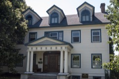
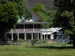
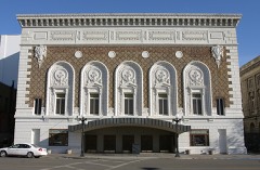
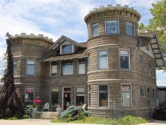
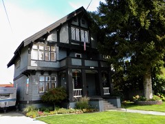
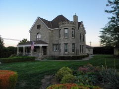
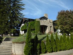
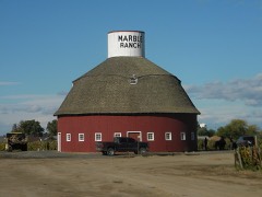
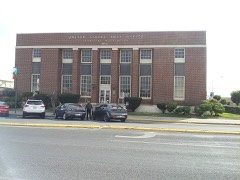
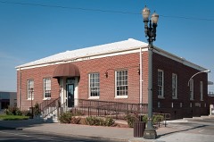
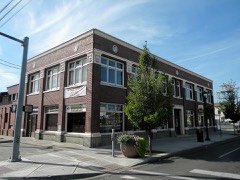
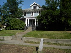
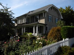
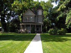
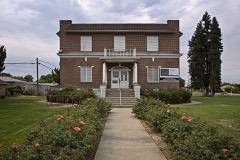
73 National Register listings published here.
Sources: the county history on the Internet Archive · the National Register database, National Park Service
153 topographic sheets cover 75 settlements here, and 73 properties are on the National Register of Historic Places.
73 National Register listings published here.
Sources: the county history on the Internet Archive · the National Register database, National Park Service
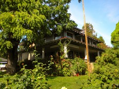
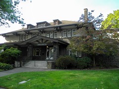
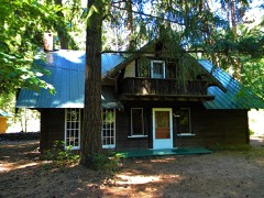
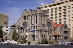
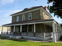
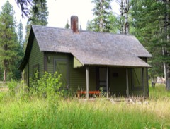
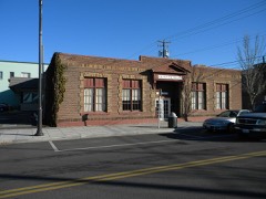
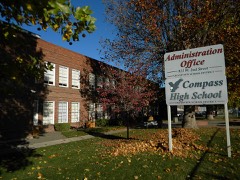
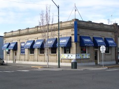
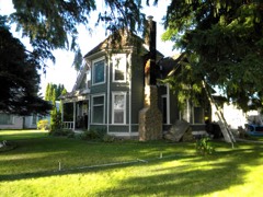
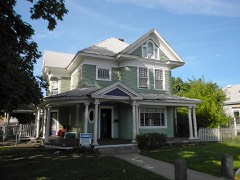
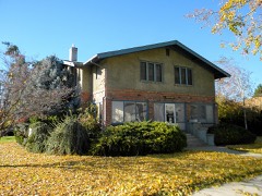
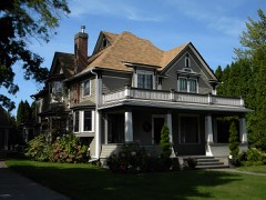
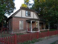
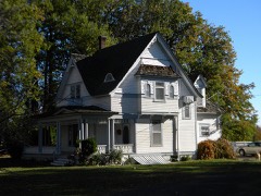
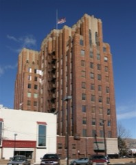
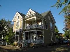
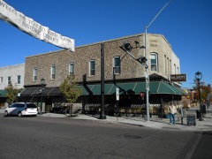
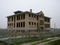
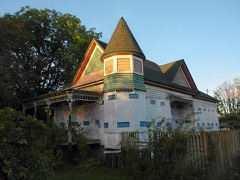
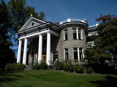
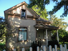
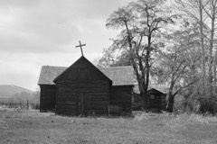
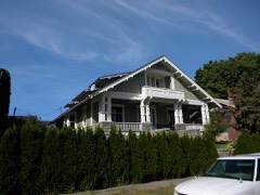
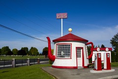
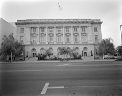
Every property in this county listed on the National Register of Historic Places, with the year it was listed and the federal nomination document.
Every wildfire the federal occurrence database records inside this county: 3,448 of them, burning about 1,003,401 acres. 695 started naturally and 264 were recorded as arson. Each settlement page carries the fires within five miles of it.
| Reported cause | Fires |
|---|---|
| Natural | 695 |
| Recreation and ceremony | 552 |
| Debris and open burning | 544 |
| Missing data/not specified/undetermined | 540 |
| Fireworks | 474 |
| Arson/incendiarism | 264 |
| Equipment and vehicle use | 208 |
| Smoking | 67 |
| Power generation/transmission/distribution | 46 |
| Misuse of fire by a minor | 23 |
| Other causes | 21 |
| Firearms and explosives use | 10 |
| Railroad operations and maintenance | 4 |
The five largest, by the area the report gives. None of them was recorded as arson.
| Date | Cause | Size | Reported by | Name on the report |
|---|---|---|---|---|
| 30 July 2016 | Equipment and vehicle use | 171,915 acres | Hanford Reach National Monument | RANGE 12 |
| 31 August 2020 | Missing data/not specified/undetermined | 74,800 acres | Washington State Department of Natural Resources Headquarters | EVANS CANYON |
| 16 August 2007 | Missing data/not specified/undetermined | 72,641 acres | Hanford Reach National Monument | WAUTOMA |
| 14 August 1996 | Missing data/not specified/undetermined | 57,520 acres | Spokane District | COLD CREEK |
| 10 August 2015 | Natural | 53,523 acres | Gifford Pinchot National Forest | COUGAR CREEK |
| 11 August 2017 | Missing data/not specified/undetermined | 52,056 acres | Okanogan-Wenatchee National Forest | NORSE PEAK |
| 20 August 2009 | Natural | 48,902 acres | Spokane District | DRY CREEK |
| 23 August 2000 | Natural | 46,802 acres | Yakama Agency | MULE DRY |
Every settlement page carries the fires within five miles of it - see the settlement index below.
The NOAA Storm Events Database holds 117 reports for this county, causing no deaths, 5 injuries and about $3,088,500 in recorded property damage. Each settlement page carries the reports that name it.
| Kind of event | Reports |
|---|---|
| Flood | 33 |
| Thunderstorm Wind | 22 |
| Hail | 22 |
| Flash Flood | 14 |
| Tornado | 8 |
| Lightning | 5 |
| Wildfire | 5 |
| Funnel Cloud | 3 |
| Dust Devil | 2 |
| Heavy Rain | 2 |
| Strong Wind | 1 |
The most serious of them, by death, then injury, then recorded damage. The accounts are quoted exactly as the forecast office filed them.
| When | Event | Place named | Harm | What the report says |
|---|---|---|---|---|
| May 2019 | Dust Devil | Zillah | 5 hurt | According to media reports a bounce house was lofted up to 20 feet in the air and thrown up to 240 feet from its original position by localized strong winds. Video from the aftermath shows a dust devil in the background. Winds from a nearby mesonet station were less than 20 mph. Five youths inside the bounce house were injured, 1 critically. |
| January 2009 | Flood | Wapato | $1,570,000 | no account filed |
| August 2000 | Lightning | Mabton | $900,000 | no account filed |
| March 2016 | Flood | Harwood | $300,000 | no account filed |
| June 2001 | Hail | Buena | $200,000 | no account filed |
| May 2006 | Lightning | Yakima | $35,000 | Lightning struck a weather vane on top of a barn and sparked a fire that destroyed the barn roof. |
| March 2017 | Flood | Henrybro | $20,000 | Substantial snow pack was remained in the foothills and lower elevations of the Washington Cascades at the beginning of March. Temperatures started to moderate during the first week of the month with several nights of temperatures above freezing occurring on the 8th and 9th. Flooding was reported along Wide Hollow and Cottonwood creeks from about 9 miles west of Yakima through the city of Yakima as rapid snow melt was occurring in the foothills west of Yakima. Water flowed through the Meadowbrook Mobile Home Park, and there were numerous reports of damaged driveways as culverts were overwhelmed with mud and other debris. Along Ahtanum Creek, there was standing water in fields, with water from roadside ditches spilling over the road in places. |
| July 2012 | Thunderstorm Wind | Harrah Arpt | $20,000 | A tree was downed on Zier Road and hit a house. |
| June 2001 | Thunderstorm Wind | Grandview | $15,000 | A spotter reported that strong winds blew the doors off a warehouse. |
| July 2012 | Thunderstorm Wind | (Ykm)Yakima Air Term | $10,000 | Strong gusty winds downed power lines and trees. Heavy rainfall caused minor flooding. |
| August 1999 | Thunderstorm Wind | Yakima | $5,000 | Strong winds from thunderstorms blew down around 100 trees along Highway 410 one mile west of the junction with Highway 12. Power lines were also downed. At the same time high winds peeled back a metal roof 9 miles west of the Highway 12 intersection. |
| May 2005 | Flash Flood | Yakima | $3,000 | no account filed |
| April 1957 | Tornado (F2) | not stated | $2,500 | no account filed |
| May 2004 | Flash Flood | Selah | $2,000 | A nearly stationary thunderstorm caused flash flooding at the Yakima Army Training Center. This heavy rain led to minor damage of a gravel road, with the property damage estimated to be $2,000. |
| August 2003 | Thunderstorm Wind | Yakima | $2,000 | Strong winds associated with a thunderstorm knocked down several trees, and knocked out power to about 750 customers. A weather spotter five miles east of Yakima reported a wind gust to 55 MPH at 4:59 PM PST. The Yakima ASOS at the Yakima airport reported a peak wind gust to 53 MPH at 4:54 PM PST. The property damage from this event is estimated at $2,000. |
| May 2005 | Flash Flood | Sunnyside | $2,000 | no account filed |
| January 2011 | Flood | Priest Rapids | $1,000 | In Yakima County, the flooding was contained to the low areas along the Yakima River including the Selah Golf Course and the Yakima Greenway. The Yakima River at Parker crested at 12.2 feet just after midnight on January 18th, 2.2 feet above flood stage. |
| February 2003 | Dust Devil | Sunnyside | $1,000 | A dust devil led to some damage of a winery. The dust devil lifted a roof off of the walls of the winery, and lifted some of the cinder blocks of the building, sending them to the ground. |
| February 2020 | Flood | Cliffdell | - | Naches near Clifdell- Flood stage is 31.0 feet. The river rose above flood stage on February 7th, 4am, crested at 31.4 feet on February 7th at 1145 am, then fell below flood stage on February 7th at 1130 pm. Minor flooding was observed in low areas along river. |
| February 2020 | Flood | Naches | - | Naches near Naches- Flood stage is 17.8 feet. The river rose above flood stage on February 7, 4 am, crested at 18.6 feet on February 7th at 130 pm, then fell below flood stage on February 8th at 430 am. Minor flooding was observed in low areas along river. |
| February 2020 | Flood | Parker | - | Yakima near Parker Flood stage is 10.0 feet. The river rose above flood stage on February 7th, 8 pm, crested at 10.4 feet on February 8th, 245 am, then fell below flood stage on February 8th, 6pm. Minor flooding was observed in low areas along river. |
| May 2020 | Thunderstorm Wind | Union Gap | - | Numerous trees down. |
| March 2017 | Flood | Tieton | - | More flooding was reported along Wide Hollow and Cottonwood creeks, as well as Cowiche and Ahtanum creeks, through the city of Yakima, then southeast into the lower Yakima valley. Rapid snow melt occurred in the foothills west of Yakima. Water from roadside ditches spilled over various road in places. ||Along Toppenish and Satus Creeks, in the lower valley, water over roads and field flooding were reported along the main branches of the creeks as well as the numerous tributaries to these creeks. A number of roads remained closed due to high water through the rest of March. |
| March 2017 | Flood | Brace | - | On March 15th, high flows on Cowiche Creek caused a section of a levee that had previously been damaged to breech, opening a 20 foot wide gap. The water followed along Highway 12 with the bulk of the water flowing into an irrigation canal. On March 16th, water inundated the intersection of North 40th and Fruitvale Boulevard, flooding a number of businesses and parking lots and the Riverview Mobile Home Park. Public Works tried to divert the water into Myron Lake, with a channel expected to take the water back from the lake to the Naches River. Instead, the water overflowed from Myron Lake into Willow Lake and then Aspen Lake, where it overflowed into neighborhoods surrounding the lakes. |
| May 2017 | Flood | Naches | - | On May 30th, warm temperatures lead to increased snow melt with the Naches River rising briefly to the flood stage of 17.8 feet. |
| May 2017 | Flood | Naches | - | Increased snow melt resulted in minor flooding of the Naches River near Naches. On May 5th the river crested at 18.25 feet, flood stage is 17.8 feet. |
| February 2017 | Flood | Tampico | - | After a brief warm up on 2/9/2017, an ice jam formed and broke loose on the North Fork of the Ahtanum Creek in central Yakima county. The ice moved downstream damaging five homes with water and structural damage. One family was displaced. |
| May 2015 | Flash Flood | Selah | - | Flooding in streets, 911 had some people evacuate buildings in fear of roof collapse. Police set up barricades to help divert drivers from flooded roadways, flooding in some homes. A few places lost power. |
| May 2015 | Hail | South Broadway | - | Social Media reported the hail with the thunderstorm. |
| May 2015 | Flash Flood | Rimrock | - | Debris flow just east of Rimrock Lake, reported by the Yakima Herald. |
| May 2015 | Thunderstorm Wind | South Broadway | - | Public reported trees uprooted 3 miles east of Ahtanum. |
| August 2014 | Flash Flood | Roza | - | Yakima Herald news story reported the event that occurred in a remote area of Yakima county. But still blocked a significant state highway for rural travelers. |
| June 2013 | Thunderstorm Wind | Harwood | - | Yakima Herold reported to NWS that a blue spruce tree fell to the ground in West Valley with flooding along a pasture. Another car nearby was smashed by a falling tree. Several power outages were observed. |
| June 2013 | Flash Flood | Harwood | - | Very heavy rain caused flooding along N 101st Ave. and Summitview Ave. |
| June 2013 | Thunderstorm Wind | North Prosser | - | Local news reported trees and power lines down on cars and homes in a mobile home park near East 3rd St. and East E St. |
| June 2013 | Thunderstorm Wind | Sunnyside Mun Arpt | - | Spotter reported that shingles were blown off of the roof and a tree was down in the front yard. |
| June 2013 | Thunderstorm Wind | Sunnyside | - | News reported that power lines were down near the local Bi-Mart. |
| September 2013 | Thunderstorm Wind | Wenas | - | Trees down. |
| June 2012 | Flood | Naches | - | The Yakima River at Naches crested on June 18 11 pm at 16.64 feet. Flood stage is 16.0 feet. |
| July 2012 | Flash Flood | Sunnyside Broadview | - | Unoccupied mobile home washed away. Six mile stretch of Highway 241 closed until 7 pm. |
| June 2012 | Flood | Naches | - | The Yakima River at Naches crested at 16.44 feet at 5:15 pm on June 6th. Flood stage is 16.0 feet. |
| July 2012 | Hail | Sunnyside | - | Hail accompanied by heavy rainfall. |
| March 2012 | Flood | Satus | - | Water from Satus Creek was over the West Satus Road and Marion Drain Road near Highway 22. |
| April 2012 | Flood | Naches | - | The Naches River at Naches crested at 18.27 feet on April 25 at 1 am. Flood stage is 17.8 feet. |
| April 2012 | Flood | Parker | - | The Yakima River at Parker crested at 10.19 feet on April 25 at 2:15 pm. Flood stage is 10 feet. |
| March 2011 | Flood | Tieton | - | The Naches River at Naches crested .2 feet above normal. |
| May 2011 | Flood | Cliffdell | - | Flooding closed sections of Highway 410 and other roads along the Naches River from Cliffdell to Yakima. High water and large debris damaged bridges. The Naches River crested at 20.4 on May 15th, which was 3.4 feet above flood stage. At Cliffdell, the river crested at 32.2 feet on May 15th, which was 1.3 feet above normal. |
| May 2011 | Flood | Pomona | - | The Yakima River at Umtanum crested at 36.5 feet on May 16th, which was 1 foot above flood stage. At Parker the crest was 13.2 feet on May 16th, which was 3.2 feet above flood stage. Reported rainfall amounts on May 14-15 were between 3 and 4 inches. |
| April 2011 | Flood | Union Gap | - | The river gage at Parker crested 1.3 feet above flood stage. |
| April 2011 | Flood | Naches | - | Continuing from March 31, the river gage at Naches crested at .2 feet above flood stage. |
| July 2010 | Flash Flood | Rimrock | - | Heavy rainfall from thunderstorms caused a large volume of mud and water in Indian Creek to overwhelm a culvert and block Forest Service Road 1308 about 2 miles northwest of the junction of Highway 12. |
| July 2010 | Heavy Rain | Selah Hgts | - | CoCoRaHS observer reported 1.31 inches of rainfall with strong thunderstorm. |
| July 2010 | Hail | Yakima | - | Observer reported 1/2 to 3/4 inch hail. |
| July 2010 | Hail | Ahtanum | - | Spotter reported thunderstorm with heavy rainfall and hail to nickel size. |
| July 2010 | Flash Flood | Crewport | - | Thunderstorm produced heavy rainfall, flash flooding, and pea size hail. Hail damaged the apple crop. Water runoff from field flowed over an irrigation canal and onto adjacent field. Drains and culverts became blocked resulting in ditches filling up, overflowing, and eroding the draing ditches. Water flow was up to 3 feet deep in spots and flowed over the paved roads. Rainfall of 1.25 inches was reported in 20 minutes. |
| July 2010 | Hail | Brownstown | - | One inch hail reported by spotter. |
| July 2010 | Hail | Yakima | - | Yakima Sheriff Dispatch reported 1 inch diameter hail. |
| July 2010 | Hail | Rimrock Tieton Arpt | - | Fire crews reported 1 inch diameter hail. |
| January 2009 | Flood | Naches | - | Naches River was .9 foot above flood stage. |
| January 2009 | Flood | Pomona | - | The Yakima River rose to 2.8 feet above flood stage at Umtanum. |
The Survey's mineral resources record lists 243 workings inside this county. 8 still produce and 235 are closed or unrecorded. Each settlement page carries the workings within five miles of it.
| Commodity | Workings |
|---|---|
| Sand and Gravel, Construction | 95 |
| Gold | 29 |
| Silver | 29 |
| Copper | 20 |
| Stone, Crushed/Broken | 16 |
| Pumice | 9 |
| Mercury | 8 |
| Clay | 7 |
| Bentonite | 7 |
| Tungsten | 5 |
| Silica | 5 |
| Zinc | 4 |
| Silver, Gold | 4 |
| Diatomite | 4 |
The least common of them first, because a county's hundredth gravel pit says nothing its first ten did not.
| Where | Site | Commodity | Status | Recorded |
|---|---|---|---|---|
| Ahtanum Creek | Gypsum-Anhydrite | Occurrence | ||
| Alpine 1 and 2 | Antimony, Silver | Prospect | ||
| Apex | Zinc, Silver, Lead, Gold, Copper | Occurrence | ||
| B & M Group | Gold, Zinc, Silver | Prospect | ||
| Bird | Molybdenum, Tungsten, Copper | Past Producer | Underground | |
| Bumping Lake Mineral Spring | Calcium, Lithium, Copper, Uranium, Manganese, Magnesite, Chlorine, Boron-Borates | Producer | ||
| Chinook | Copper, Silver, Gold, Molybdenum, Lead, Arsenic, Zinc | Occurrence | Chalcopyrite, Galena, Molybdenite, Pyrite, Sphalerite | |
| Chinook | Copper, Gold, Silver | Occurrence | ||
| Copper Mining Co. | Copper, Tungsten, Silver, Gold, Molybdenum | Past Producer | Bornite, Chalcopyrite, Malachite, Molybdenite, Pyrite, Scheelite | |
| Dog Lake Stone | Volcanic Materials | Producer | ||
| Elizabeth Gold Hill | Gold, Copper, Lead, Silver | Prospect | ||
| Gold Hill | Gold, Lead, Zinc, Tungsten, Copper | Prospect | ||
| K.B. Group | Gold, Copper, Silver | Prospect | ||
| Keystone | Gold, Silver, Copper, Tungsten, Lead | Occurrence | 1913 | |
| Keystone Claims | Silver, Copper, Gold, Tungsten, Arsenic | Past Producer | ||
| Morse Creek Copper | Copper, Gold | Prospect | ||
| Mount Adams Fumarole | Potassium, Gypsum-Anhydrite, Sulfur | Prospect | ||
| Mount Adams Perlite Deposit | Perlite | Occurrence | ||
| New Find | Silver, Tungsten, Copper, Gold | Occurrence | ||
| New Find | Copper, Tungsten, Silver | Prospect | ||
| Nicolai Spring | Geothermal | Prospect | ||
| Pasco | Copper, Lead, Silver, Tungsten | Prospect | ||
| Red Bird | Tungsten, Copper | Occurrence | ||
| Red Bird | Tungsten, Copper, Molybdenum, Arsenic | Occurrence | Chalcopyrite, Molybdenite, Pyrite, Scheelite | |
| Richmond | Lead, Zinc, Silver, Copper, Antimony, Gold, Arsenic | Occurrence | 1917 | |
| Richmond Mine | Zinc, Silver, Lead, Copper | Prospect | ||
| Sphalerite of Sphalerite | Lead, Zinc, Copper | Unknown | ||
| Sunnyside | Semiprecious Gemstone | Occurrence | ||
| Unnamed Pit | Stone | Past Producer | ||
| Bumping Lake | Graphite | Occurrence | ||
| Clara | Copper, Tungsten, Silver, Molybdenum, Gold | Prospect | ||
| Copper Creek Group | Uranium, Gold, Silver | Prospect | ||
| Copper Mining Co. | Copper, Tungsten, Silver, Molybdenum, Gold | Past Producer | ||
| Fig | Manganese | Past Producer | Unknown | |
| Fig | Manganese | Past Producer | ||
| Indian Creek Cinnabar Property | Mercury, Nickel | Occurrence | 1951 | |
| Mcgriff Native Stone | Stone, Dimension | Past Producer | ||
| Naches River | Graphite | Occurrence | ||
| Sheet Rock Patented Claim | Stone, Dimension | Past Producer | ||
| Sunnyside-White Bluffs Road | Gemstone | Occurrence | ||
| Unnamed Prospect | Uranium | Prospect | ||
| Wildcat Creek | Mercury, Nickel | Occurrence | 1941 | |
| Yakima | Gemstone | Occurrence | ||
| Black Jack | Zinc, Lead, Copper | Prospect | ||
| Blackjack Group | Zinc, Lead, Copper | Occurrence | 1906 | |
| D.D. Allen | Molybdenum | Occurrence | ||
| Mesatchee Creek Prospects | Copper, Gold, Silver | Occurrence | 1895 | |
| Moly Nos. 1-5 | Molybdenum | Prospect | ||
| Ms 1-4 | Molybdenum, Lead, Copper | Prospect | ||
| Rocket Group | Mercury, Gold, Silver | Prospect | Surface | |
| Chinook | Copper, Silver, Gold | Past Producer | ||
| Gleed | Diatomite | Occurrence | ||
| Hidden Treasure | Copper, Silver, Gold | Prospect | ||
| Maple Grove | Diatomite | Occurrence | ||
| Morse Creek | Silver, Gold | Occurrence | ||
| Selah Tunnel | Diatomite | Occurrence | ||
| Sunnyside | Diatomite | Occurrence | ||
| Unnamed Prospect | Copper, Silver, Gold | Prospect | ||
| Garibaldi | Tungsten | Prospect | ||
| Lakeview | Tungsten, Gold | Prospect | ||
| Mabton Hill | Silica | Occurrence | ||
| Red Bird | Copper, Tungsten | Prospect | ||
| Selah | Silica | Occurrence | ||
| Snipes Mountain | Silica | Occurrence | ||
| Top Snipes Mountain | Silica | Prospect | ||
| Toppenish Ridge | Silica | Occurrence | ||
| Deaver | Clay | Past Producer | ||
| Granger Clay Products Co. | Clay, Bentonite | Past Producer | ||
| Granger Pit | Bentonite | Past Producer | ||
| Hutchinson | Bentonite | Prospect | ||
| Kaiser | Clay | Past Producer | ||
| Pacific Clay | Clay | Occurrence | ||
| Parker Heights | Clay | Past Producer | ||
| Russell Ridge | Bentonite | Occurrence | ||
| Tieton No. 1 | Bentonite | Prospect | ||
| Tietonite Mines Inc. | Bentonite | Past Producer | ||
| Unnamed Clay Deposit | Bentonite | Past Producer | ||
| W.I. Wendt | Clay | Past Producer | ||
| Yakima | Clay | Past Producer | ||
| Clear Lake | Mercury | Occurrence | Cinnabar | |
| Little Giant Group | Mercury, Gold | Prospect | ||
| Quicksilver, Cinnabar, Quartz Lode | Mercury | Occurrence | ||
| Red Spur | Mercury | Past Producer | 1941 | |
| Witch | Silver, Mercury | Prospect | Surface | |
| Army | Pumice | Past Producer | 1957 | |
| Horse Heaven Hills | Pumice | Occurrence | ||
| Moxee City | Pumice | Occurrence | ||
| Selah No. 1 | Pumice | Occurrence | ||
| Selah No. 2 | Pumice | Occurrence | ||
| Snipes Mountain | Pumice | Occurrence | ||
| Toppenish Ridge | Pumice | Occurrence | ||
| Wenas | Pumice | Occurrence | ||
| Zillah Pit | Pumice | Past Producer | ||
| Fewel-Ennis Quarry | Stone, Crushed/Broken | Past Producer | ||
| Ruddell Quarry | Stone, Crushed/Broken | Past Producer | ||
| Simmons Pit | Sand and Gravel, Construction, Stone, Crushed/Broken | Past Producer | ||
| Stephens Quarry | Stone, Crushed/Broken | Past Producer | ||
| Summit View Quarry | Stone, Crushed/Broken | Past Producer | ||
| Union Gap Quarry | Stone, Crushed/Broken | Past Producer | ||
| Unnamd Quarry | Stone, Crushed/Broken | Past Producer | ||
| Unnamed Quarry | Stone, Crushed/Broken | Past Producer | ||
| Unnamed Quarry | Stone, Crushed/Broken | Past Producer | ||
| Unnamed Quarry | Stone, Crushed/Broken | Past Producer | ||
| Unnamed Quarry | Stone, Crushed/Broken | Past Producer | ||
| Unnamed Quarry | Stone, Crushed/Broken | Past Producer | ||
| Unnamed Quarry | Stone, Crushed/Broken | Past Producer | ||
| Unnamed Quarry | Stone, Crushed/Broken | Past Producer | ||
| Unnamed Quarry | Stone, Crushed/Broken | Past Producer | ||
| Zirkle Quarry | Stone, Crushed/Broken | Past Producer | ||
| 17th of Ireland | Silver, Copper | Prospect | ||
| Butler | Silver, Copper | Prospect | ||
| Lewis | Copper | Prospect | ||
| Mesatchee Creek Area | Copper | Prospect | ||
| Silver Bell-Venice Groups | Silver, Copper | Occurrence | ||
| Sunset | Copper | Prospect | ||
| Unnamed | Copper | Prospect | ||
| Unnamed Prospect | Copper | Prospect | ||
| Unnamed Prospect | Copper | Prospect | ||
| Unnamed Prospect | Copper | Prospect | ||
| B.F.W. | Silver | Prospect | ||
| Bob's Mine | Gold | Prospect | ||
| Boston Claim | Gold, Silver | Prospect | ||
| Comstock Claim | Gold | Prospect | ||
| Crown Point | Gold, Silver | Prospect | ||
| Damfino | Gold, Silver | Prospect | ||
| Deep Creek | Silver | Prospect | ||
| Dry Spring | Gold, Silver | Prospect | ||
| Elizabeth Placer | Gold | Prospect | ||
| Eva | Gold, Silver | Occurrence | ||
| Fife | Gold, Silver | Past Producer | ||
| Frederick | Silver | Prospect | ||
| Gold Hill Placer | Gold | Past Producer | ||
| Gold Links Placer | Gold | Occurrence | ||
| Highland | Gold, Silver | Occurrence | ||
| Lolette | Gold, Silver | Occurrence | ||
| Lynnwood | Gold, Silver | Prospect | ||
| Nettie K. | Gold, Silver | Occurrence | ||
| Rattlesnake Placer | Gold | Occurrence | ||
| Schreiber Group | Silver | Prospect | ||
| Scout Claim | Gold, Silver | Occurrence | ||
| Stump | Silver | Prospect | ||
| Surprise Mine | Silver | Prospect | ||
| Surveyors Creek Placer | Gold | Prospect | ||
| Unnamed Prospect | Gold, Silver | Prospect | ||
| Unnamed Prospect | Silver | Occurrence | ||
| Unnamed Prospect | Gold, Silver | Occurrence | ||
| Unnamed Prospect | Gold, Silver | Prospect | ||
| Unnamed Prospect | Gold, Silver | Prospect | ||
| Willow Springs No. 3 | Gold, Silver | Prospect | ||
| Ashue Pit | Sand and Gravel, Construction | Past Producer | ||
| Beal Pit | Sand and Gravel, Construction | Past Producer | ||
| Bond Pit | Sand and Gravel, Construction | Past Producer | ||
| Borrow Pit | Sand and Gravel, Construction | Producer | ||
| Bruenig Pit | Sand and Gravel, Construction | Past Producer | ||
| Calvert Pit | Sand and Gravel, Construction | Past Producer | ||
| Clarke Pit | Sand and Gravel, Construction | Past Producer | ||
| Dunn's Ranch Pit | Sand and Gravel, Construction | Past Producer | ||
| Emerald Pit | Sand and Gravel, Construction | Past Producer | ||
| Emerald Pit | Sand and Gravel, Construction | Past Producer | ||
| Granger Pit | Sand and Gravel, Construction | Past Producer | ||
| Gravel Pit | Sand and Gravel, Construction | Past Producer | ||
| Gravel Pit | Sand and Gravel, Construction | Past Producer | ||
| Gravel Pit | Sand and Gravel, Construction | Past Producer | ||
| Harrah Pit | Sand and Gravel, Construction | Past Producer | ||
| Hill Pit | Sand and Gravel, Construction | Past Producer | ||
| Hypotheek Pit | Sand and Gravel, Construction | Past Producer | ||
| Keller Pit | Sand and Gravel, Construction | Past Producer | ||
| Levold Pit | Sand and Gravel, Construction | Past Producer | ||
| Luther Pit | Sand and Gravel, Construction | Producer | ||
| Mabton Pit | Sand and Gravel, Construction | Past Producer | ||
| Medin Pit | Sand and Gravel, Construction | Past Producer | ||
| Meyers Pit | Sand and Gravel, Construction | Past Producer | ||
| Miller Pit | Sand and Gravel, Construction | Past Producer | ||
| Newland Pit | Sand and Gravel, Construction | Past Producer | ||
| Outlook Pit | Sand and Gravel, Construction | Past Producer | ||
| Patch Pit | Sand and Gravel, Construction | Past Producer | ||
| S. Naches Pit | Sand and Gravel, Construction | Past Producer | ||
| Sand Pit | Sand and Gravel, Construction | Past Producer | ||
| Sand Pit | Sand and Gravel, Construction | Past Producer | ||
| Sand Pit | Sand and Gravel, Construction | Past Producer | ||
| Selah Pit | Sand and Gravel, Construction | Past Producer | ||
| Sheller Pit | Sand and Gravel, Construction | Past Producer | ||
| Snipes Mountain Gravel | Sand and Gravel, Construction | Past Producer | ||
| Snipes Mountain Gravel | Sand and Gravel, Construction | Past Producer | ||
| So Happy Pit & Plant | Sand and Gravel, Construction | Producer | ||
| Stevens Pit | Sand and Gravel, Construction | Past Producer | ||
| Tim Ponds | Sand and Gravel, Construction | Past Producer | ||
| Tolley Pit | Sand and Gravel, Construction | Past Producer | ||
| Union Gap Pit | Sand and Gravel, Construction | Past Producer | ||
| Unnamed It | Sand and Gravel, Construction | Past Producer | ||
| Unnamed Pit | Sand and Gravel, Construction | Past Producer | ||
| Unnamed Pit | Sand and Gravel, Construction | Past Producer | ||
| Unnamed Pit | Sand and Gravel, Construction | Past Producer | ||
| Unnamed Pit | Sand and Gravel, Construction | Past Producer | ||
| Unnamed Pit | Sand and Gravel, Construction | Past Producer | ||
| Unnamed Pit | Sand and Gravel, Construction | Past Producer | ||
| Unnamed Pit | Sand and Gravel, Construction | Past Producer | ||
| Unnamed Pit | Sand and Gravel, Construction | Past Producer | ||
| Unnamed Pit | Sand and Gravel, Construction | Past Producer | ||
| Unnamed Pit | Sand and Gravel, Construction | Past Producer | ||
| Unnamed Pit | Sand and Gravel, Construction | Past Producer | ||
| Unnamed Pit | Sand and Gravel, Construction | Past Producer | ||
| Unnamed Pit | Sand and Gravel, Construction | Past Producer | ||
| Unnamed Pit | Sand and Gravel, Construction | Past Producer | ||
| Unnamed Pit | Sand and Gravel, Construction | Producer | ||
| Unnamed Pit | Sand and Gravel, Construction | Past Producer | ||
| Unnamed Pit | Sand and Gravel, Construction | Past Producer | ||
| Unnamed Pit | Sand and Gravel, Construction | Past Producer | ||
| Unnamed Pit | Sand and Gravel, Construction | Past Producer | ||
| Unnamed Pit | Sand and Gravel, Construction | Past Producer | ||
| Unnamed Pit | Sand and Gravel, Construction | Past Producer | ||
| Unnamed Pit | Sand and Gravel, Construction | Past Producer | ||
| Unnamed Pit | Sand and Gravel, Construction | Past Producer | ||
| Unnamed Pit | Sand and Gravel, Construction | Past Producer | ||
| Unnamed Pit | Sand and Gravel, Construction | Past Producer | ||
| Unnamed Pit | Sand and Gravel, Construction | Past Producer | ||
| Unnamed Pit | Sand and Gravel, Construction | Past Producer | ||
| Unnamed Pit | Sand and Gravel, Construction | Past Producer | ||
| Unnamed Pit | Sand and Gravel, Construction | Past Producer | ||
| Unnamed Pit | Sand and Gravel, Construction | Past Producer | ||
| Unnamed Pit | Sand and Gravel, Construction | Past Producer | ||
| Unnamed Pit | Sand and Gravel, Construction | Past Producer | ||
| Wachsmith Pit | Sand and Gravel, Construction | Past Producer | ||
| Wapato Pit | Sand and Gravel, Construction | Past Producer | ||
| Welcome Pit | Sand and Gravel, Construction | Past Producer | ||
| Wheeler Pit | Sand and Gravel, Construction | Past Producer | ||
| Yakima Cement Pit | Sand and Gravel, Construction | Past Producer | ||
| Yakima Pit | Sand and Gravel, Construction | Producer | ||
| Zillah Bridge Pit | Sand and Gravel, Construction | Past Producer | ||
| Zillah Pit | Sand and Gravel, Construction | Past Producer |
The part of each published history that is about one town: 3 chapters, each reproduced complete.
| Town | Chapter | From | Length |
|---|---|---|---|
| Sunnyside | An Illustrated History of Klickitat, Yakima and Kittitas Counties; Wit | An Illustrated History of Klickitat, Yakima and Kittitas Counties; with an Outline of the Early History of the State of Washington (1904) | 8,177 words |
| Toppenish | An Illustrated History of Klickitat, Yakima and Kittitas Counties; Wit | An Illustrated History of Klickitat, Yakima and Kittitas Counties; with an Outline of the Early History of the State of Washington (1904) | 2,966 words |
| Yakima | An Illustrated History of Klickitat, Yakima and Kittitas Counties; Wit | An Illustrated History of Klickitat, Yakima and Kittitas Counties; with an Outline of the Early History of the State of Washington (1904) | 1,319 words |
One book written about this county, cut here where the book itself is cut, at its printed chapters: 10 chapters in all. Every chapter is public domain, machine-read from the scan and reproduced complete. A chapter already given under one of the county's towns is not repeated in this list.
| Chapter | Length |
|---|---|
| Chapter 9: The Yakima War | 25,933 words in 2 parts |
| Chapter 1: Current History - 1860-1877 | 10,768 words |
| Chapter 2: The Perkins Murder and Moses Demonstration | 10,277 words |
| Chapter 3: Current History | 8,498 words |
| Chapter 4: Current History | 16,774 words in 2 parts |
| Chapter 5: Political | 5,413 words |
| Chapter 2: Educational | 5,551 words |
| Chapter 3: The Press of Central Washington | 7,601 words |
| Chapter 4: The Yakima Indians | 10,995 words |
| Chapter 5: Reminiscent | 16,387 words in 2 parts |
Named settlements recorded in the Geographic Names Information System, each with the topographic sheets covering it. Villages, hamlets and abandoned places alike. Each is shown with the nearest named watercourse or landform and the survey quadrangle it falls on.
Northwest Yakima census division · 98937 · On American River · Old Scab Mountain quadrangle
18 sheets, 1902 to 2000
Northeast Yakima census division · 98936 · Near Washout Gulch · Elephant Mountain quadrangle
14 sheets, 1936 to 1961
Northeast Yakima census division · 98901 · Near Moxee Valley · Yakima East quadrangle
14 sheets, 1936 to 1961
Northeast Yakima census division · 98936 · Cairn Hope Peak quadrangle
13 sheets, 1917 to 1979
No longer a settlement
Yakima census division · 98908 · Near Cowiche Canyon · Selah quadrangle
16 sheets, 1899 to 1961
Northwest Yakima census division · 98937 · Raven Roost quadrangle
15 sheets, 1901 to 1989
Yakima census division · 98908 · Near Cottonwood Canyon · Wiley City quadrangle
15 sheets, 1899 to 1961
Sunnyside census division · 98944 · Near Snipes Mountain · Sunnyside quadrangle
12 sheets, 1910 to 1979
Northwest Yakima census division · 98908 · Near Upper Naches Valley · Naches quadrangle
14 sheets, 1899 to 1961
Yakima census division · 98902 · Near Pecks Canyon · Yakima West quadrangle
17 sheets, 1899 to 1961
Northwest Yakima census division · 98937 · On Thunder Creek · Goose Prairie quadrangle
19 sheets, 1902 to 2000
Yakima census division · 98908 · Near Cottonwood Canyon · Wiley City quadrangle
15 sheets, 1899 to 1961
Sunnyside census division · 98944 · Near Peanut Hump · Sunnyside quadrangle
12 sheets, 1910 to 1979
Northeast Yakima census division · 98936 · Yakima East quadrangle
14 sheets, 1936 to 1961
Northwest Yakima census division · 98937 · On Dry Creek · Nile quadrangle
15 sheets, 1899 to 2000
Sunnyside census division · 98938 · Near Snipes Mountain · Sunnyside quadrangle
12 sheets, 1910 to 1979
South Yakima census division · On Bacon Creek · Glenwood quadrangle
13 sheets, 1904 to 1970
Northeast Yakima census division · 98901 · On Wenas Creek · Pomona quadrangle
15 sheets, 1936 to 1961
Northwest Yakima census division · 98937 · On Wildcat Creek · Tieton Basin quadrangle
19 sheets, 1902 to 2000
Toppenish-Wapato census division · 98933 · Near Yakima Valley · White Swan quadrangle
13 sheets, 1937 to 1979
Yakima census division · 98942 · Near Crusher Canyon · Selah quadrangle
16 sheets, 1899 to 1961
Northwest Yakima census division · 98937 · On Andy Creek · Rimrock Lake quadrangle
19 sheets, 1902 to 2000
Yakima census division · 98903 · On Spring Creek · Yakima West quadrangle
17 sheets, 1899 to 1961
Yakima census division · 98908 · Near Cottonwood Canyon · Wiley City quadrangle
15 sheets, 1899 to 1961
Sunnyside census division · 98944 · On Sulphur Creek · Sunnyside quadrangle
12 sheets, 1910 to 1979
Northwest Yakima census division · 98903 · On South Fork Ahtanum Creek · Tampico quadrangle
14 sheets, 1899 to 1971
Yakima census division · 98947 · Near French Canyon · Tieton quadrangle
14 sheets, 1899 to 1971
Yakima census division · 98903 · On Wide Hollow Creek · Yakima East quadrangle
14 sheets, 1936 to 1961
Yakima census division · 98908 · On North Fork Cowiche Creek · Naches quadrangle
14 sheets, 1899 to 1961
Northwest Yakima census division · 98942 · On North Fork Wenas Creek · Milk Canyon quadrangle
14 sheets, 1899 to 1971
Toppenish-Wapato census division · 98948 · Toppenish quadrangle
13 sheets, 1910 to 1979
Yakima census division · 98908 · Near Wide Hollow · Yakima West quadrangle
17 sheets, 1899 to 1961
South Yakima census division · 98952 · On Agency Creek · White Swan quadrangle
13 sheets, 1937 to 1979
South Yakima census division · 98952 · Willy Dick Canyon quadrangle
12 sheets, 1937 to 1979
The vanished settlements of Yakima County: the places named above that are no longer on the map.