 Block
Cheney, Washington
9 topographic sheets cover this place, the earliest surveyed in 1954 and the latest in 1984. It stands in the Cheney-Medical Lake census division. It lies in ZIP code area 99004. The Survey maps it on the Cheney quadrangle. 13,255 people lived here at the 2020 count. It stands 2,352 feet above sea level.
On record in Cheney
Buildings and businesses the archive holds for this place. Each opens its own page, with the source record it came from.
On the National Register 8 records
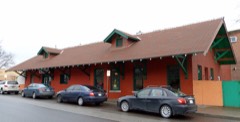 Cheney Interurban Depotlisted 1979
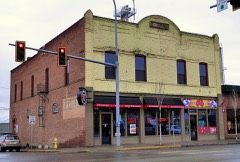 Cheney Odd Fellows Halllisted 1990
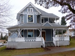 David Lowe Houselisted 1983
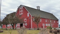 Sutton Barnlisted 1975
- City of Cheney Historic Districtlisted 2001
- Dybdall Gristmilllisted 1976
- Italian Rock Ovenslisted 1976
- Washington State Normal School at Cheney Historic Districtlisted 1992
Population over time
2 figuresCheney grew from 10,590 to 13,255 between 2010 and 2020. These are the recorded population figures Wikidata holds for this place, reached through the Geographic Names Information System number this page is keyed on rather than by name, so they belong to this place and not to another of the same name. Most are census counts, but not all are: an early figure may be a founding or settlement estimate, and an estimate published within five years of a census is left out. The change column is computed, and is left blank where more than 20 years separate a figure from the one before it, because a gap that long is not a change between two counts.
| Year | People | Change |
|---|---|---|
| 2010 | 10,590 | |
| 2020 | 13,255 | +2,665 (+25%) |
Topographic sheets covering this place
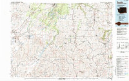
5 surveys from 9 printed sheetsMatched by testing this settlement's coordinate against the published boundary of every sheet in the United States Geological Survey's historical collection. Each opens the scanned sheet at the Survey.
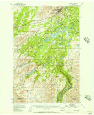
- 1954 USGS Cheney quadrangle1:62500, 3 printings
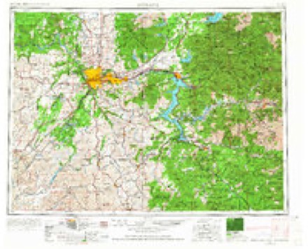
- 1955 USGS Spokane quadrangle1:250000, 2 printings
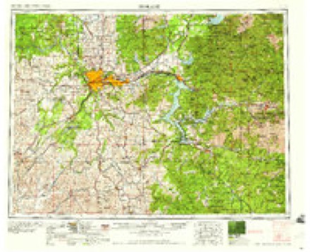
- 1958 USGS Spokane quadrangle1:250000
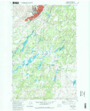
- 1980 USGS Cheney quadrangle1:24000, 2 printings
- 1984 USGS Rosalia quadrangle1:100000
What the histories say of this town
2,131 words1 chapter about Cheney from the published histories of the county, public domain and reproduced complete.
| Chapter | From | Length |
|---|---|---|
| An Illustrated History of Spokane County, State of Washington | An Illustrated History of Spokane County, State of Washington (1900) | 2,131 words |
Fires near this place
194 since 1992Regional context, not property-specific evidence. The federal wildfire occurrence database lists 194 fires within 5 miles of Cheney between 1992 and 2020, burning about 1,347 acres in total. 30 started naturally. 16 were recorded as arson. Distance is straight-line from the map coordinates, so a fire counted here may appear on a neighbouring settlement's page as well.
| Reported cause | Fires |
|---|---|
| Missing data/not specified/undetermined | 43 |
| Recreation and ceremony | 34 |
| Natural | 30 |
| Debris and open burning | 22 |
| Arson/incendiarism | 16 |
| Equipment and vehicle use | 16 |
| Railroad operations and maintenance | 13 |
| Power generation/transmission/distribution | 8 |
| Fireworks | 4 |
| Misuse of fire by a minor | 3 |
| Other causes | 3 |
| Smoking | 2 |
The most recent of them, most recent first, with the day each was reported and the service that recorded it.
| Date | Cause | Size | Reported by | Name on the report |
|---|---|---|---|---|
| 6 September 2012 | Missing data/not specified/undetermined | 4.5 acres | Washington State Department of Natural Resources Headquarters | MT CARMEL |
| 5 September 2016 | Missing data/not specified/undetermined | under an acre | Turnbull National Wildlife Refuge | CURTIS RD. |
| 5 September 2016 | Missing data/not specified/undetermined | under an acre | Washington State Department of Natural Resources Headquarters | CURTIS ROAD |
| 5 September 2013 | Natural | under an acre | Turnbull National Wildlife Refuge | NORTH BOUNDARY |
| 5 September 2013 | Natural | under an acre | Washington State Department of Natural Resources Headquarters | SPOTTED STRIKEOUT |
| 4 September 2013 | Natural | under an acre | Washington State Department of Natural Resources Headquarters | SPOTTED STRIKE |
| 4 September 1995 | Debris and open burning | 1.0 acres | Washington State Department of Natural Resources Headquarters | not named |
| 30 September 1999 | Recreation and ceremony | under an acre | Washington State Department of Natural Resources Headquarters | not named |
Settlements close enough to share some of these fires:
Mines and quarries near this place
10 of 21 shownRegional context, not property-specific evidence. The federal mineral resources record lists 21 workings within 5 miles of Cheney: 16 past producers, 4 occurrences, 1 producer. 1 still produces. What was taken out: Sand and Gravel, Construction, Stone, Crushed/Broken, Fire Clay (Refractory), Gemstone. Distance is straight-line from the map coordinates, so a quarry counted here may appear on a neighbouring settlement's page as well.
| Where | Site | Commodity | Status | Recorded |
|---|---|---|---|---|
| Cheney Quarry | Stone | Producer | ||
| Fish Lake | Gemstone | Occurrence | ||
| Fish Lake | Slate, Dimension | Past Producer | ||
| Fish Lake | Uranium | Occurrence | ||
| Fish Lake Pegmatite | Feldspar | Occurrence | ||
| Cheney | Fire Clay (Refractory) | Past Producer | ||
| Wellsandt | Fire Clay (Refractory) | Occurrence | ||
| Cheney Quarry | Stone, Crushed/Broken | Past Producer | ||
| Unnamed Quarry | Stone, Crushed/Broken | Past Producer | ||
| Unnamed Quarry | Stone, Crushed/Broken | Past Producer |
Storms near this place
9 since 1997Regional context, not property-specific evidence. The National Weather Service names Cheney in 9 storm reports between 1997 and 2020: 5 thunderstorm wind, 2 hail, 1 lightning, 1 funnel cloud. The reports record 4 injuries. Each account below is quoted exactly as the forecast office filed it, from the NOAA Storm Events Database, and each date opens the federal record of that event.
| When | Event | Place named | Harm | What the report says |
|---|---|---|---|---|
| July 2014 | Thunderstorm Wind | South Cheney | 4 hurt, $4,000,000 | A wet microburst brought sustained winds of 35 to 50 mph with gusts 60 to 70 mph across Spokane County. The winds descended near Cheney and peaked while passing through Airway Heights, Northwestern Spokane, and Deer Park. Hundreds of Ponderosa Pines were snapped and downed from Northwestern Spokane to Deer Park. Downed trees led to widespread structural damage, blocked roads, power outages, and injuries. Significant damage was observed at the Riverside Village Mobile Home Park from trees falling on mobile homes prompting a search and rescue. One woman was trapped but was not injured. At least 40 mobile homes and cars in the park were severely damaged. Forty eight trees were knocked down at a resort on Lake Eloika. Trees fell on six RVs and the resort's oldest cabin forcing the owners to close their doors for a short period of time. One person was injured when a tree landed on his vehicle while driving along Lakeside Dr near Reflection Lake in Elk, WA. A tree branch flew through his windshield and drove him off the road severing his arm and impaling his hip. He eventually lost his arm in the accident. Three other people were injured near the Spokane Courthouse by falling tree branches. Over 30,000 people lost power during the event. Because of the extent of damage, some residents and businesses remained in the dark for up to four days. Downed power poles and lightning strikes sparked several new wildfires which quickly grew due to the strong winds. The winds completely damaged a airport hanger and caused between ten to twelve thousand dollars worth of damage to planes. |
| January 2000 | Thunderstorm Wind | Cheney | $20,000 | Downed tree on to car |
| May 2020 | Thunderstorm Wind | South Cheney | $10,000 | A utility company reported approximately 45,000 customers without power, mainly in the Cheney and southwest Spokane area, due to branches falling on the power lines. |
| March 2014 | Thunderstorm Wind | Cheney | $5,000 | A forty-foot tree fell on a house from winds behind the squall line. Damage costs were estimated. |
| March 2016 | Funnel Cloud | Cheney | - | Numerous individuals observed a cold core funnel cloud near Cheney, WA near 2:45 PM PDT. A local weather reported posted photos of the funnel cloud to his social media accounts. |
| April 2001 | Lightning | Cheney | - | An unusual thunderstorm with frequent lightning moved across Spokane. Cloud-to-ground lightning hit two electric substations on the north side of Spokane, knocking out power to 15,000 residences for up to two hours. |
| July 1997 | Hail | Cheney | - | 1 inch hail reported by a spotter |
| May 1997 | Hail | Cheney | - | 3/4 inch hail |
| April 2003 | Thunderstorm Wind | Cheney | - | no account filed |
Nearest settlements
The eight closest, with where each one stands in the county. Distances are straight-line, computed from the Geographic Names Information System coordinates.
| Map | Place | Distance | Sheets |
|---|---|---|---|
| South Cheney | 1.5 miles | 9 | |
| Babb | 4.8 miles | 8 | |
| Four Lakes | 5.2 miles | 11 | |
| East Cheney | 5.2 miles | 9 | |
| Geib | 5.8 miles | 8 | |
| Silver Lake | 6.0 miles | 13 | |
| Scribner | 6.1 miles | 11 | |
| Dynamite | 6.6 miles | 11 |
Elsewhere
Matched on this settlement's Geographic Names Information System number rather than its name, so it cannot be a different place of the same name in another state.
| Wikipedia article on Cheney | An encyclopaedic summary. Its text is share-alike, so it is linked here rather than copied. |
| Wikidata item Q1065488 | The structured record the population and elevation above come from. Public domain (CC0). |
Provenance
This settlement is recorded in the Geographic Names Information System as feature 1531416. The sheet list is computed by point-in-boundary test against the United States Geological Survey's historical topographic inventory. Both are works of the United States government and carry no copyright under 17 U.S.C. 105.
Wildfire. Short, Karen C. 2022. Spatial wildfire occurrence data for the United States, 1992-2020 [FPA_FOD_20221014]. 6th Edition. Fort Collins, CO: Forest Service Research Data Archive. https://doi.org/10.2737/RDS-2013-0009.6 Collected with United States Government funding and usable without additional permissions or fees.
Mines and quarries. USGS Mineral Resources Data System (MRDS) https://mrdata.usgs.gov/mrds/ A work of the United States government, no copyright under 17 U.S.C. 105.
Storms. NOAA National Centers for Environmental Information, Storm Events Database https://www.ncei.noaa.gov/stormevents/ A work of the United States government, no copyright under 17 U.S.C. 105. Narratives are quoted verbatim from the National Weather Service report and are not edited or summarised.