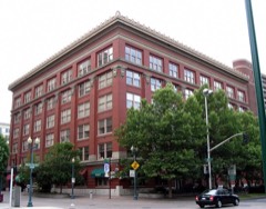
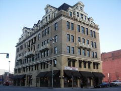
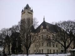
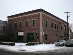
BlockBefore

Spokane County, Washington

146 topographic sheets cover 103 settlements here, and 159 properties are on the National Register of Historic Places.

Research this county

From the record

159 National Register listings published here · the county-history sources tell 3 stories and name 636 people · people the book names include Colonel William R. Abercrombie (Spokane, 1912) (machine-read).

Sources: the county history on the Internet Archive · the National Register database, National Park Service

Washington within the United States
Spokane County within Washington

What the record shows

  • 1,486 topographic sheet readings cover the county's settlements.
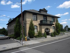
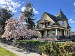
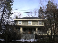
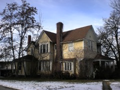
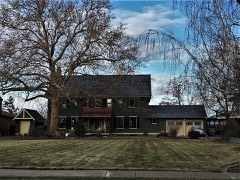
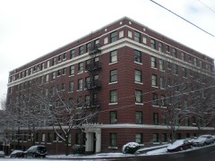
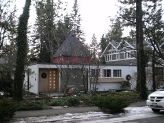
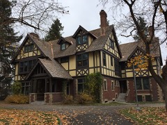
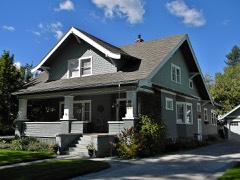
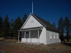
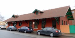
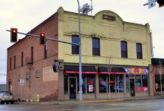
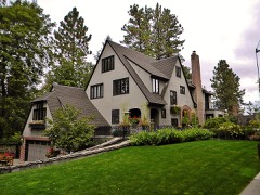
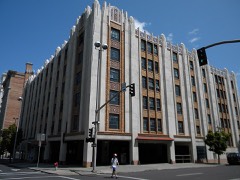
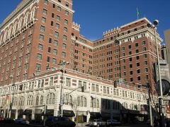
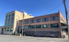
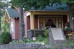
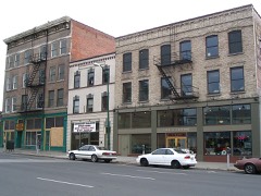
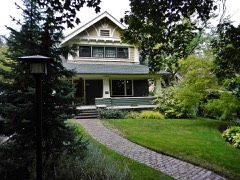
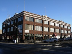
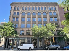
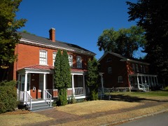
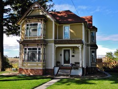
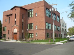
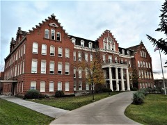
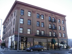
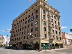
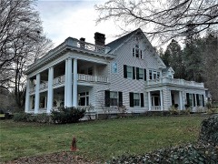
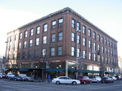
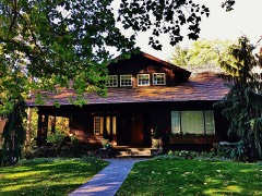
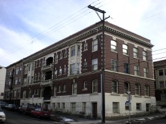
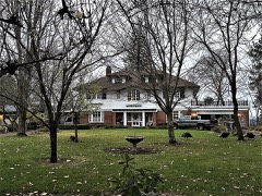
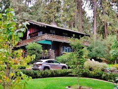
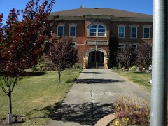
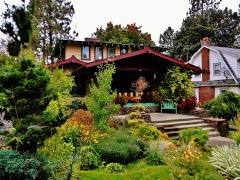
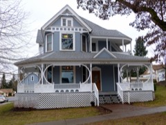
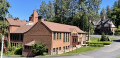
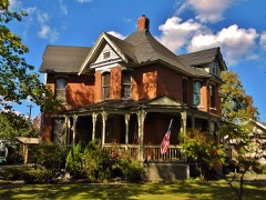
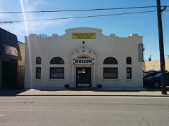
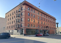
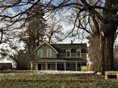
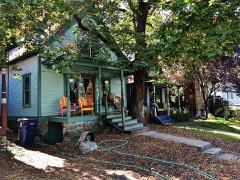
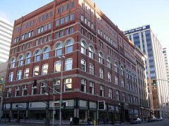
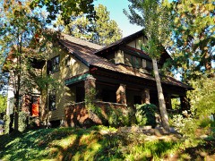
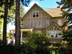
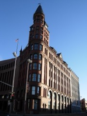
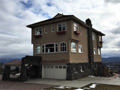
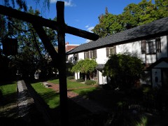
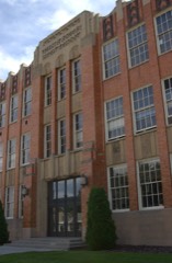
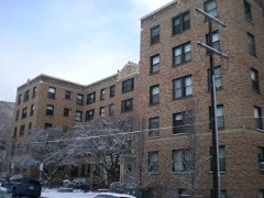
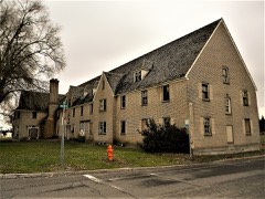
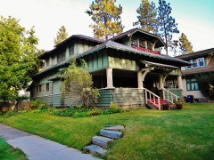
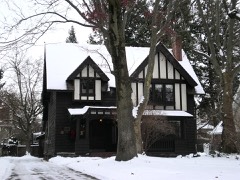
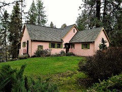
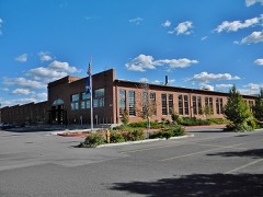
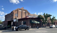
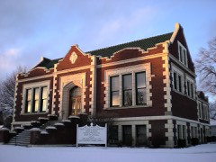
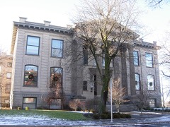
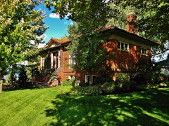
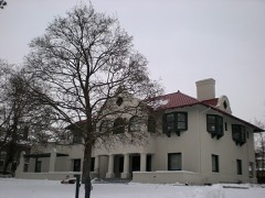
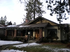
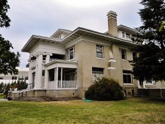
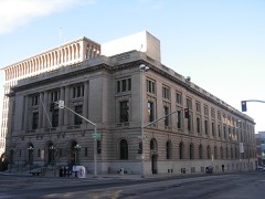
  • 159 properties here are on the National Register of Historic Places: 125 buildings, 23 districts, 7 structures, 3 sites and 1 object.
  • 27 of the 159 listings were added during the 1970s.
  • The Geographic Names Information System records 103 populated places in this county; 103 are covered by at least one topographic sheet.

What happened here

3 accounts

Among them: Spokane And The Inland Empire 581; Wilson S. Swain; Spokane And The Inland Empire 57. These passages come from the identified county-history source books. Each inset names its own source and opens the exact section it comes from.

From History of the City of Spokane and Spokane County, Washington : from Its Earliest Settlement to the Present Time, published 1912 - Spokane

Spokane And The Inland Empire 581

Ritzville fire department. In November, 1908, he was elected sheriff of Adams county for the years 1909 and 1910 and in the fall of 1910 was reelected without opposition for the term of 1911-12. He has brought to justice a number of murderers and has also broken up a "black hand" band, compelling them to cease operations in Adams county.

Read the rest of this passage

From History of the City of Spokane and Spokane County, Washington : from Its Earliest Settlement to the Present Time, published 1912 - Spokane

Wilson S. Swain

Wilson S. Swain, who is president and manager of the Swain Detective Agency whose offices are located in the Empire State building, was born in Princeton, Illinois, on the 31st of March, 1856, his parents being William T. and Martha E. (Simmons) Swain. The father was a member of the Twelfth Illinois Regiment in the Civil war and was killed in the battle of Shiloh.

Read the rest of this passage

From History of the City of Spokane and Spokane County, Washington : from Its Earliest Settlement to the Present Time, published 1912 - Spokane

Spokane And The Inland Empire 57

Squadron on board the United States gunboat Chicopee and was one of the men that volunteered to accompany Lieutenant Gushing when he blew up the rebel ram Albemarle. At the capture of Plymouth, North Carolina, Mr. Scott was severely wounded. Following the close of the war he engaged in mining in Colorado, New Mexico and Washington and was at one time connected with the United States mail service, being United States mail agent from Chicago, Illinois, to Danville, at the time of the historic republican convention held in Chicago in 1880.

Read the rest of this passage

Places on the National Register

159

Every property in this county listed on the National Register of Historic Places, with the year it was listed and the federal nomination document.

Photograph PropertyType ListedReference
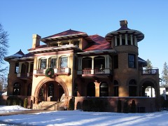
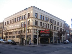
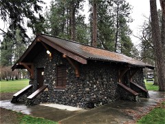
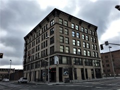
American Firebrick Companydistrict198282004289
American Legion Cenotaph - Riverside Park Cemeterystructure2024100010340
Ammanbuilding198787000086
Louise Chandler Anderson Housebuilding201313001030
Alonzo and Louise Barnett Housebuilding200303000809
Harvey and Mary Bauer Housebuilding201313001031
Dr. Robert and Jessie Bell Housebuilding200505000921
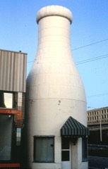
Benewah Milk Bottlebuilding198686001521
J. W. Binkley Housebuilding198989000211
Harry and Catherine Bleeker Housebuilding2019100004787
Breslinbuilding198787000095
Kenneth and Edna Brooks Housebuilding200404001006
Browne's Addition Historic Districtdistrict197676001916
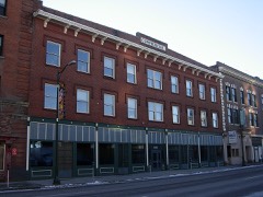
Bump Block-Bellevue House-Hawthorne Hotelbuilding200000000977
California Ranchbuilding198080004010
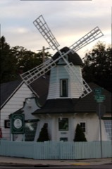
Cambern Dutch Shop Windmillbuilding198989000213
Campbell Housebuilding197474001979
Canfield, George and Nellie. Housebuilding201414001109
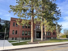
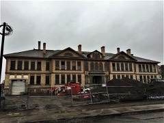
Central Schoolhouse (District No. 49)building199292001040
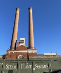
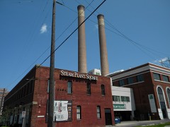
Central Steam Heat Plantbuilding199696001492
Cheney Interurban Depotbuilding197979002555
Cheney Odd Fellows Hallbuilding199090001639
George and Blanche Christiansen Housebuilding201515000881
City Ramp Garagebuilding201212001099
City of Cheney Historic Districtdistrict200101000062
Clark Mansionbuilding197575001873
Clemmer Theaterbuilding198888002758
Coeur d'Alene Parksite2018100003228
Columbia Buildingbuilding2020100004960
Commercial Blockbuilding199393001103
Coolidge-Rising Housebuilding198888000598
Corbet-Aspray Housebuilding199999001454
Corbin Park Historic Districtdistrict199292001584
Daniel C. and Anna Corbin Housebuilding200404000157
Courthouse and Federal Office Buildingbuilding2024100010892
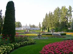
Cowley Parksite197373001891
Davenport Hotelbuilding197575001874
Desmet Avenue Warehouse Historic Districtdistrict199797000450
Dodd Housebuilding201010000417
Dodson Buildingbuilding2021100006068
Dybdall Gristmillbuilding197676001913
East Downtown Historic Districtdistrict200303000860
Gus and Florence Ehrenberg Housebuilding200707000832
Eldridge Buildingbuilding199292001588
Empire State Buildingbuilding197777001361
Felts Field Historic Districtdistrict199191001442
Finch Housebuilding197676001917
John A. Finch Memorial Nurses Homebuilding199191000631
John A. Finch Schoolbuilding201413001061
First Congregational Church of Spokanebuilding197878002775
Five Mile Prairie Schoolbuilding200404000952
Fort George Wright Historic Districtdistrict197676001918
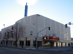
Fox Theaterbuilding200101001287
Franklin Elementary Schoolbuilding2017100000946
Frequency Changing Stationbuilding197979002556
Fuller, W. P., and Company Warehousebuilding199695001529
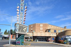
Garland Theaterbuilding201313000999
Germond Blockbuilding201413001062
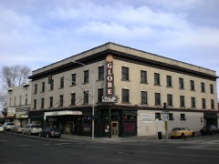
Globe Hotel, Thebuilding199897001080
Glover Housebuilding197373001892
Grace Baptist Churchbuilding199292001289
Hallett Housebuilding197676001915
Ham-McEachern Housebuilding197878002774
Hill-Hilscher Housebuilding201413001063
Hillyard High Schoolbuilding200505000920
Hillyard Historic Business Districtdistrict200202000860
Holley-Mason Buildingbuilding198383004262
Holy Names Academy Buildingbuilding198686000959
Hotel Collinsbuilding2025100011857
Hotel Uptonbuilding199494000798
Hutton Buildingbuilding198383004037
Hutton Settlementdistrict197676001919
Hutton Settlement District (Boundary Increase)district199494000750
Levi and May Arkwright Hutton Housebuilding200202000088
Italian Rock Ovensstructure197676001914
Kemp & Hebert Buildingbuilding199494000660
Kiesow-Gentsch Housebuilding201514001144
Knickerbockerbuilding198787000096
Knight Housebuilding199999001459
Koerner Housebuilding199999000915
Latah Schoolbuilding200202001489
Levesque-Majer Housebuilding201514001162
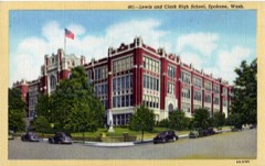
Lewis & Clark High Schoolbuilding199090001860
Lewis and Clark High School (Boundary Decrease)building200101001288
Littlebrookbuilding199696000840
David Lowe Housebuilding198383004264
Manito Park and Boulevarddistrict201515000909
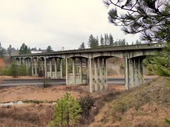
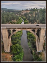
Marshall Bridgestructure199595000631
Marycliff-Cliff Park Historic Districtdistrict197979002557
Masonic Templebuilding197676001921
McKinley Schoolbuilding2018100003257
McMillen-Dyar Housebuilding2019100004330
Gustav Meese Buildingbuilding199696000049
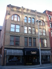
Miller Blockbuilding199898000370
Millwood Historic Districtdistrict200101000064
Mission Avenue Historic Districtdistrict198686002644
Dr. Hans & Rosaleen Moldenhauer Housebuilding2024100010388
Monroe Street Bridgestructure197676001920
Montvale Blockbuilding199898000369
Mount Saint Michaeldistrict200000000456
Mount Spokane Vista Housebuilding2018100003229
Muzzy-Shine Housebuilding201010001045
Natatorium Carouselobject197777001362
Nettleton's Addition Historic Districtdistrict200606000176
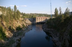
Nine Mile Hydroelectric Power Plant Historic Districtdistrict199090001861
Ninth Avenue Historic Districtdistrict199494000679
Opportunity Township Hallbuilding200505000190
Otis Hotelbuilding199898001227
Eben and Cynthia Palmer Farmsteadbuilding201514001163
Parkadebuilding2025100012444
Peaceful Valley Historic Districtdistrict198484003617
Peyton Building and Peyton Annexbuilding200505000191
Victor & Jean Piollet Housebuilding201010001019
John and Mary Ralston Housebuilding200202001488
Review Buildingbuilding197575001875
Royal Riblet Housebuilding197979002558
Richardson-Jackson Housesite200606000178
Ridpath Hotelbuilding201313001000
Robinwood Aparmentsbuilding200505000248
Rockwood Historic Districtdistrict199797000320
John R. Rogers High Schoolbuilding201010001104
Roosevelt Apartmentsbuilding200000000969
Roosevelt Hallbuilding199797001084
Rosebush Housebuilding200000001446
Salvation Army Buildingbuilding200000001445
San Marcobuilding198787000090
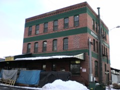
Schade Brewerybuilding199494001441
Sears, Roebuck Department Storebuilding199191000629
Seehorn-Lang Buildingbuilding199897001674
William O. and Stella M. Seligman Housebuilding201414001054
Edwin A. Smith Housebuilding198585001808
William and Margaret Solby Housebuilding200707000831
Spokane & Inland Empire Railroad Car Facilitybuilding201010000749
Spokane City Hall Buildingbuilding198585000350
Spokane Club Building-Legion Buildingbuilding199494000800
Spokane County Courthousebuilding197474001980
Spokane Fire Station No. 3building199494001439
Spokane Flour Millbuilding197878002778
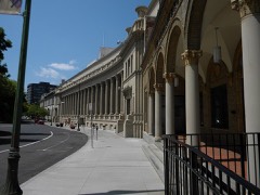
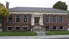
Spokane Public Librarybuilding198282004291
Spokane Public Librarybuilding198282004910
Spokane Public Librarybuilding198282004290
Spokane Public Librarybuilding198282004292
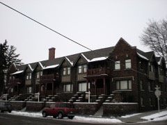
Spokane Sash and Door Company Flatsbuilding200505000924
Sunset Boulevard Bridgestructure198282004293
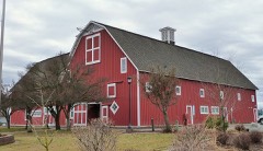
Sutton Barnbuilding197575001871
Dr. Charles and Elsie Thomas Housebuilding200707000834
Frank and Maude Tuell Housebuilding200606000702
Luther P. and Jane Marie Turner Housebuilding200303001343
US Post Office, Courthouse, and Custom Housebuilding198383004269
William and Ella Warner Housebuilding2019100004788
Washington State Normal School at Cheney Historic Districtdistrict199292001287
Washington Street Bridgestructure198282004294
Lawrence and Lydia Weaver Housebuilding200202000186
West Downtown Historic Transportation Corridordistrict199999001631
West Valley High Schoolbuilding199191001736
Whitten Blockbuilding199393000362
Ralston and Sarah Wilbur Housebuilding200606000136
James and Corinne Williams Housebuilding200303001344

Wildfire, 1992 to 2020

3,574 fires

Every wildfire the federal occurrence database records inside this county: 3,574 of them, burning about 41,428 acres. 424 started naturally and 207 were recorded as arson. Each settlement page carries the fires within five miles of it.

Reported cause Fires
Missing data/not specified/undetermined733
Debris and open burning662
Recreation and ceremony640
Natural424
Misuse of fire by a minor267
Arson/incendiarism207
Equipment and vehicle use163
Power generation/transmission/distribution128
Fireworks119
Other causes86
Smoking78
Railroad operations and maintenance65
Firearms and explosives use2

The five largest, by the area the report gives. One of them was set deliberately.

DateCause SizeReported by Name on the report
7 September 2020Missing data/not specified/undetermined15,269 acresNortheast Region-Department of Natural ResourcesBABB
21 August 2016Missing data/not specified/undetermined6,017 acresWashington State Department of Natural Resources HeadquartersYALE
11 August 1996Debris and open burning3,020 acresWashington State Department of Natural Resources Headquartersnot named
20 July 2003Smoking1,073 acresWashington State Department of Natural Resources Headquartersnot named
10 July 2008Missing data/not specified/undetermined1,006 acresNortheast Region-Department of Natural ResourcesSPOKANE VALLEY
14 August 1997Recreation and ceremony772 acresWashington State Department of Natural Resources Headquartersnot named
11 July 1994Arson/incendiarism680 acresWashington State Department of Natural Resources Headquartersnot named
31 July 2015Missing data/not specified/undetermined425 acresWashington State Department of Natural Resources HeadquartersLONG LAKE

Every settlement page carries the fires within five miles of it - see the settlement index below.

Storms, 1954 to 2025

60 of 249 shown

The NOAA Storm Events Database holds 249 reports for this county, causing no deaths, 30 injuries and about $28,785,660 in recorded property damage. Each settlement page carries the reports that name it.

Kind of event Reports
Thunderstorm Wind107
Hail44
Flood33
Tornado16
Flash Flood15
Heavy Rain11
Lightning11
Funnel Cloud6
Debris Flow4
Wildfire1
Dust Devil1

The most serious of them, by death, then injury, then recorded damage. The accounts are quoted exactly as the forecast office filed them.

WhenEvent Place namedHarm What the report says
June 2005Thunderstorm WindSpokane12 hurtno account filed
September 2003HailSpokane10 hurt, $50,000During the afternoon of September 19th an isolated rain shower with small hail moved over the Spokane area. On the westbound lane of Interstate 90 drivers were blinded by the low sun shining in their eyes while small hail created slippery conditions. Over 50 cars and trucks were involved in numerous accidents and pileups along a four mile stretch of westbound I-90 in the city of Spokane.
July 2014Thunderstorm WindSouth Cheney4 hurt, $4,000,000A wet microburst brought sustained winds of 35 to 50 mph with gusts 60 to 70 mph across Spokane County. The winds descended near Cheney and peaked while passing through Airway Heights, Northwestern Spokane, and Deer Park. Hundreds of Ponderosa Pines were snapped and downed from Northwestern Spokane to Deer Park. Downed trees led to widespread structural damage, blocked roads, power outages, and injuries. Significant damage was observed at the Riverside Village Mobile Home Park from trees falling on mobile homes prompting a search and rescue. One woman was trapped but was not injured. At least 40 mobile homes and cars in the park were severely damaged. Forty eight trees were knocked down at a resort on Lake Eloika. Trees fell on six RVs and the resort's oldest cabin forcing the owners to close their doors for a short period of time. One person was injured when a tree landed on his vehicle while driving along Lakeside Dr near Reflection Lake in Elk, WA. A tree branch flew through his windshield and drove him off the road severing his arm and impaling his hip. He eventually lost his arm in the accident. Three other people were injured near the Spokane Courthouse by falling tree branches. Over 30,000 people lost power during the event. Because of the extent of damage, some residents and businesses remained in the dark for up to four days. Downed power poles and lightning strikes sparked several new wildfires which quickly grew due to the strong winds. The winds completely damaged a airport hanger and caused between ten to twelve thousand dollars worth of damage to planes.
August 2005Thunderstorm WindMead2 hurt, $100,000no account filed
April 2000Thunderstorm WindAirway Hgts1 hurt, $80,000Several trees were uprooted due to strong winds. One of which fell on a young girl and injured her. She was sent to the hospital and survived.
August 2004LightningSpokane1 hurtno account filed
March 2017FloodHite$8,000,000A series of rain storms and low elevation snow melt caused saturated soil conditions through out Spokane County through the second half of March. These conditions lead to numerous small stream and field flooding issues through out the county. Homes and buildings along the shore of Williams Lake and Newman Lake experienced flooding from high lake levels. In Mead a hillside began slowly sliding in a residential area necessitating the evacuation of two homes. Spokane County was included in a State of Emergency declaration issued by the state Governor. ||Twenty two roads in the county were washed out or at least temporarily closed due to flooding.
May 2016Thunderstorm WindSpokane$4,800,000A member of the public reported power lines down near Sharp and Atlantic in downtown Spokane, Washington.
August 2014Thunderstorm WindHite$2,000,000Numerous trees were downed or snapped across Northern Spokane County including the communities of Deer Park, Chattaroy, Colbert, Mead, Nine Miles Falls, and Spokane north of Interstate 90 due to a west to east tracking outflow boundary. A second cell developed along the boundary producing quarter size hail over Five Mile Prairie and sent an outflow boundary north to south across the South Hill and Spokane Valley roughly thirty minutes after the initial gust front went through. A NWS employee stated winds associated with this boundary were less than 25 mph but witnessed a tree fall down. Due to its isolated nature, it is assumed that this tree was damaged from a storm two weeks earlier. Significant damage was observed from northwestern Spokane to Chattaroy to the Pend Oreille County border. The Riverside Mobile Home Park was hit hard for a second time in as many weeks and forced to evacuate. Numerous trees fell on homes. One home on North Echo Road suffered major structural damage. The nearby Eloika Lake Resort lost eight trees in the storm. The trees damaged a home, RVs, and vehicle. The resort which lost 48 trees in a storm ten days earlier was forced to shut down for the remainder of the summer.
February 2014FloodCoey$2,000,000Numerous areas across Spokane County experienced flooding on the 12th of February. Due to frozen grounds, the flood problems persisted through the 14th in some cases. A small ice jam on Coulee Heights Creek caused the creek to become diverted and flow into a private residence. Water was approximately five feet deep in the garage and surrounding home. A NWS employee observed up to two inches of water with some mud and small debris flowing down Rambo Road just north of the Forecast Office. Water was over a foot deep along the shoulders. The swift water washed out portions of the shoulder and foundation to the edges of the pavement. A few blocks away from the Forecast Office, water flooded the West Prairie Village Mobile home park located on the corner of Craig and Haid Lane. It was estimated that one to two feet of water filled sections of the park. In southern sections of the county, many secondary roads were flooded in low crossings. State route 27 just north of Latah near milepost 58 was impassible for a period of time due to water over the road. Water was also over the roadway along SR 2 two miles west of Airway Heights. Damage extended into the Spokane Valley with damage or flooding observed near the intersection of Sanson and MacDonald, Crown Street at Forker Draw, Ridgemont Estates on Shamrock Street, and Thorpe Road at Chester Creek.
February 2017FloodAmber$1,000,000Heavy rain and snow melt occurring February 15th and 16th produced numerous small stream and field flooding issues around Spokane County. Thirteen roads around the region were closed due to flooding and washouts on the road ways and the Spokane City Council declared a state of emergency to allow highway crews access to more resources to deal with the flooding repair and mitigation. The flooding persisted for at least the next week around the region.
May 2008FloodPeone$1,000,000no account filed
August 1997WildfireSpokane$800,0002000 acre fire in sw spokane exacerbated by dry conditions and wind gusts to 30 mph. This was a Type II fire. Cost includes fire suppression...
March 2014FloodEspanola$600,000Heavy rain and low elevation snow melt led to standing water in low lying areas, flooding along small streams and creeks, road washouts and isolated reports of some basement flooding. Spangle Creek flowed out of its banks resulting in water surrounding homes with basement flooding along a three block stretch. A vehicle became stuck on a flooded road and had to be saved by rescue personnel. There were reports of flooding in fields in Cheney and in Elk. State Route 231 between milepost 0 and 28 was closed due to water and mud over the roadway. Flood waters over Jackson Road took out an eight foot culvert and a portion of the road above the culvert. A small creek near Shady Slope and Little Spokane Drive came out of its banks resulting in minor flooding. Damage costs for the event were estimated.
April 2017FloodHite$500,000Saturated soil conditions brought about by spring snow melt in March and periodic heavy rain in March and early April resulted in areas of small stream, field and basement flooding over parts of Spokane County. Numerous secondary roads were closed due to flooding on the roads and damage to the road beds.
February 1999Flash FloodDartford$500,000Heavy rain in addition to snowmelt produced high water levels on the Little Spokane River, where flooding was pronounced near Dartford at the Pine River Park and several roads were under water. Other small streams were running at bankfull, including Rock Creek at Rockford, Hangman Creek and Money Creek near Deer Park.
August 2014Thunderstorm WindSpring Vly$350,000Numerous power lines were knocked down between Spokane and Chattaroy due to winds sustained between 25 and 35 mph with gusts 45 to 55 mph. A brush fire destroyed three outbuildings and damaged a house near Mt Spokane Park Drive and Peone Road.
May 1997Tornado (F1)Deer Park$350,000nws survey team concluded f1 tornado touched down and pulled up numerous times as it traveled from Pruffer and Wallbridge in se stevens county to near riverside in spokane county
August 2022HailLatah$200,000A strong thunderstorm dropped hail ranging from half an inch to 2.75. Most hail reports ranged from 0.75 to 1.5. A 2.75 size was reported around Newman Lake at 1700PST. It traveled from Albion WA to Newman Lake WA around 1525PST to 1715PST. It damaged at least 15000 acres of crops, broke windows and damaged siding of homes in Liberty Lake, and dented numerous vehicles.
July 2019LightningSpokane$200,000Lightning striking a power line caused a fire which spread to a nearby house, gutting it and damaging another neighboring house. Time estimated from radar data.
March 2017FloodLiberty Lake$200,000The Spokane River at Spokane River Gage recorded a rise above the Flood Stage of 27.0 feet at 10:00 AM PST on March 18th. The river crested at 28.7 feet at 8:30 PM on the 23rd. The river slowly receded but remained above Flood Stage through the end of March and into April. Extensive flooding of fields and park land along the river occurred as well as basement flooding of some homes and businesses.
June 2015Flash FloodWayside$200,000An NWS Storm Survey noted significant damage to approximately 5 miles of road including North Hazard Road, West Ballard Road, and West Hazard Road. Road closures are in effect until further notice. Time of damage estimated based on Radar. Estimated cost to repair roads at $200,000.
June 2015Flash FloodWayside$200,000Local broadcast media shared photos on social media of water, mud, and rocks over Hazard Road near Suncrest, Washington.
June 2011Flash FloodCountry Homes$200,000A strong thunderstorm produced in the neighborhood of one inch of rain and large amounts of pea size hail over portions of Northwest Spokane between 1900PDT and 2000PDT. The bulk of the precipitation fell within 30 to 45 minutes causing drainage systems to become overwhelmed. This resulted in several low crossings of highway 291 between Division Street and Nine Mile Road to quickly flood with anywhere from six inches to a foot and a half of water. Roughly forty basements in the area also became flooded with several inches of water. In the Indian Trails area where the terrain is steep, as much as three inches of water was observed flowing down the streets and carved out two to four foot trenches on a steep embankment going through the neighborhood park. According to city officials, the city's sewer infrastructure did not sustain any damage however several public properties submitted claims due to water damage in their basements. Twenty-five residents submitted claims with the city with an additional ten to twenty properties assumed to have gone through private insurance companies.
March 1999Flash FloodDartford$200,000Heavy rain in addition to snow melt lead to another rise of the Little Spokane River near Dartford where the stage reached 6.9 feet. The area with the most impact was Pine River Park along with several roads in this vicinity which were flooded.
June 2022Flash FloodSpokane$180,000Numerous roads flooded in south hill and along and near the i-90 corridor. Several reports of basement flooding with some residences seeing water approach the doors. Multiple vehicles stalled in water, and one driver required assistance in being evacuated. Some neighborhood roads were temporarily closed and had standing water for hours.
March 2017FloodNine Mile Falls$100,000The Little Spokane River Gage at Dartford recorded a rise above the Flood Stage of 6.5 feet at 2:45 PM PST March 15th. The river fluctuated slightly above and below Flood Stage before rising again and cresting 6.8 feet at 11:15 AM on March 19th. The river then slowly receded, dropping below Flood Stage at 2:15 AM March 20th.
August 2013Thunderstorm WindAmber$80,000The Spokane NWS clocked a wind gust of 62 mph on the RSOIS. Numerous trees, some large, were downed in Nine Mile Falls area, especially along West Charles Road. Some trees were uprooted and other were snapped halfway up the trunk. Trees fell on a combination of roofs, outbuildings, fences, and power lines resulting in multiple power outages. A large tree was uprooted along Highway 2 in the Deep Creek community. A large tree fell on a power line in Chattaroy leading to 178 power outages.
April 2000Flash FloodDartford$60,000Heavy rainfall and mountain snowmelt lead to rapid rises on the Little Spokane River near Dartford. Much of this annual flooding was restricted to flooded basements, minor road damage and flooding a county park.
June 2017Thunderstorm WindDeer Park$50,000A tree was blown down onto a house near Deer Park.
March 2013Thunderstorm WindNewman Lake$50,000A squall line moving across the Newman Lake area destroyed a barn before pushing into the Idaho Panhandle. Wind speeds were estimated to up to between 55 and 60 miles per hour. A rough damage estimate was used for the event.
July 1995Thunderstorm Windnot stated$50,000Thunderstorm winds and hail knocked out $50,000 worth of glass panes in a large greenhouse in the city of Spokane. Downed power lines blocked traffic on Interstate 90 and power was out at times for 100,000 customers. WEST VIRGINIA, Northern
May 2022Tornado (EF0)Glenrose$40,000Tornado generated a discontinuous line of damage first observed near the intersection of E. 9th Avenue and S. Cuba St. Video footage confirms a funnel cloud lowered at times and was disorganized as it moved from west to east. A second area of more significant damage was observed along 6th Avenue that included roof damage and many trees uprooted or snapped at the base. The third and longest track of damage began near E. 5th Ave and S. McKinnon Rd and included significant damage to trees and unsecured items along E 4th Avenue. The most noteworthy damage along E. 4th Ave was to a line of travel trailers, vehicles, and boats, several of which were tossed or displaced. Numerous large ponderosa pine trees were uprooted or snapped along E. 4th Avenue before the tornado again lifted. The final isolated area of damage was located along E. 5th Avenue between S. Coleman Rd and S Grand Rd. Security camera footage confirmed brief circulation at the surface along with two downed trees along the southern edge of the track before the tornado lifted for the final time.
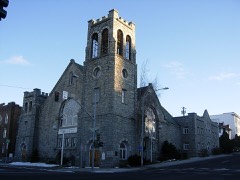
January 2000Thunderstorm WindSpokane$40,000Downed trees into a greenhouse and church.
June 2017Debris FlowTrentwood$25,000A slow moving mud slide occurred at the base of a hill at the end of the 12700 block of East Sanson Avenue. The slide destroyed one outbuilding and flooded the basement of a home.
June 2017Thunderstorm WindLinwood$25,000A member of the public near Whitworth College tweeted a photo of a large tree blown down onto his car.
May 2011FloodGreen Bluff$25,000State Route 206 was undercut by Deadman Creek at mile post 14.5, which forced a temporary closure of the road. Only damage that occurred was along the shoulder of the roadway. Damage costs were estimated.
April 1984Tornado (F1)not stated$25,000no account filed
October 1983Tornado (F1)not stated$25,000no account filed
June 1954Tornado (F2)not stated$25,000no account filed
March 2020Thunderstorm WindCountry Homes$20,000A member of the public reported a tree downed on a house on Indian Trail Road in Northwest Spokane.
July 2019Thunderstorm WindSpokane$20,000Multiple reports were received of downed trees, power outages and damaged vehicles from thunderstorm winds in the South Hill neighborhood of Spokane.
July 2019Thunderstorm WindSpokane$20,000City of Spokane crews removed 26 downed trees from residential city streets and one arterial as a result of thunderstorm winds that measured at 60 mph at the Spokane Airport.
May 2019FloodLinwood$20,000Water over a foot deep at the intersection of Francis Road and Cannon street stalled cars in the intersection and disrupted traffic.
January 2000Thunderstorm WindCheney$20,000Downed tree on to car
July 1998Flash FloodSpokane$20,000standing water and flooding on I90 near the Thor/Freya exit
May 1997HailDartford$20,0001 inch hail, paint stripped off home
May 1997Heavy RainDartford$20,0006 foot diameter culvert pipe washed out from dirt road
June 2017Thunderstorm WindSpangle Arpt$15,000A member of the public reported a tree split apart with half of it falling on a house near the town of Spangle.
July 2002LightningMillwood$15,000Lightning struck the roof of an apartment building north of the intersection of Sprague and Argonne, igniting a fire that burned a 6-by-22 foot hole in the roof of the apartment. The residents of the apartment escaped without injury.
June 2014Heavy RainSpokane$13,000Several businesses along Howard Street near the intersection of 2nd Avenue were flooded when heavy rain overwhelmed the city's storm drains. Water was spilling back into buildings through toilets and drain pipes. Among the businesses were The Interplayers Theatre and Howard Street Boxing.
October 2025Thunderstorm WindSpokane$12,000Extremely localized swath of wind speeds estimated at 55-68 mph resulted in several trees uprooted/blown down in Audubon neighborhood including Audubon Elem, through intersection of Chelan Ave/Ash Street with minor damage noted. Spokane Airport recorded a gusts of 49 mph at 1535 PST.
June 2023Thunderstorm WindChattaroy$10,000Downed power lines and outages in Spokane County 4 Miles SW of Chattaroy.
May 2022Tornado (EF0)(Geg)Spokane Intl Ar$10,000Tornado followed a due west-to-east path along W. Greenwood Road. The damage indicators along the road mainly consisted of trees that were uprooted or snapped. Several powerline poles were brought down by fallen trees toward the middle of the damage path. No substantial damage was noted to structures along the path. A video that was shared by a resident near N. Kynan Rd. showed a very weak circulation moving due east along W. Greenwood Rd. This video footage confirms the timing and width of the tornado. Residents in the vicinity of Russell Rd. confirmed no further damage beyond this point.
June 2022Flash FloodElk$10,000Flash flooding on Bruce Road, with portions of the road washed out. time estimated from radar.
June 2022FloodPeone$10,000Recent rains have caused part of the road to wash away and currently one lane is open.
May 2020Thunderstorm WindSouth Cheney$10,000A utility company reported approximately 45,000 customers without power, mainly in the Cheney and southwest Spokane area, due to branches falling on the power lines.
June 2015Flash FloodHamann Corner$10,000An NWS Storm Survey noted damage to private property along West Ballard Road between Austin Road and Highway 395. Damage to driveways was observed on multiple properties.
March 2014Debris FlowPlaza$10,000A rock slide blocked State Route 195 at milepost 68 between Rosalia and Plaza. One vehicle was struck by some of the rocks. Damage costs were estimated.
March 2001Thunderstorm WindSpokane$10,000Several portable business signs in Cheney were blown over. In Spokane, large tree limbs were blown down into Grand Boulevard near Manito Park, blocking traffic for a time. Further east, several trees were blown down throughout the Spokane Valley. One tree fell into Bigelow Gulch Road, blocking traffic there for a time. A trained spotter in Otis Orchards measured a wind gust to 61 mph (53 knots) with several larger tree limbs down in that area. Avista Utilities reported about three dozen power outages caused by either trees blowing into power lines or wind blowing over power lines.

Mines and quarries

371 recorded

The Survey's mineral resources record lists 371 workings inside this county. 11 still produce and 360 are closed or unrecorded. Each settlement page carries the workings within five miles of it.

Commodity Workings
Sand and Gravel, Construction177
Stone, Crushed/Broken65
Uranium36
Fire Clay (Refractory)27
Clay16
Silica11
Granite8
Mica5
Aluminum4
Feldspar3
Tin, Tungsten2
Graphite2
Beryllium2
Stone2

The least common of them first, because a county's hundredth gravel pit says nothing its first ten did not.

Where SiteCommodity StatusRecorded
DahlUranium, ThoriumOccurrence
DartfordManganeseOccurrence1943
DenisonMica, QuartzOccurrence
Empire Granite QuarryGranite, Silica, Stone, Crushed/BrokenPast Producer
Evergreen QuarryStone, DimensionPast Producer
ExcelsiorTitanium, ClayProspect
Excelsior Clay DepositTitanium, MetalOccurrenceClay, Ilmenite
Fish LakeGemstoneOccurrence
Fish LakeSlate, DimensionPast Producer
Jansen Iron ProspectIronOccurrence
Jordan RanchGalliumOccurrence
MeadPumicePast Producer
Mead Reduction PlantAluminum, Contained or MetalProducer1942
MilanDiatomiteOccurrence
Silver HillTin, Tungsten, Silver, LeadOccurrence
Silver HillTungsten, TinOccurrence
Silver HillTin, Tungsten, Lead, Silver, GraphitePast Producer1906, 1907
Silver LakeTravertineProspect
Sumers Clay PitKaolinPast Producer
Cheney QuarryStoneProducer
Cleveland QuarryStonePast Producer
Greenland ProspectBerylliumProspect
Sheep Mountain GraphiteGraphiteOccurrence
Silver HillTin, TungstenOccurrenceCassiterite, Scheelite, Wolframite
Tower MountainBerylliumOccurrence
Chester PegmatiteFeldsparOccurrence
Fish Lake PegmatiteFeldsparOccurrence
Mica PeakFeldsparOccurrence
Deadman CreekAluminumProspect
Deer ParkAluminumOccurrence
Mica AreaAluminum, SilicaProspect
MilanAluminumOccurrence
Elk-Mica Silica DepoistMica, SilicaUnknown
Freeman-Mica AreaMicaProspect
Gladding, Mcbean Silica QuarrySilica, MicaPast Producer
Mount Spokane Mica DepositsMicaOccurrence
Fairfield QuarryGranitePast Producer
Giles & Peat QuarryGranitePast Producer
Keene QuarryGranitePast Producer
Little Spokane River QuarryGranitePast Producer
Medical Lake, County QuarryGranitePast Producer
Moab QuarryGranitePast Producer
Washington Monument & Cut Stone Co.GranitePast Producer
DishmanSilicaOccurrence
GlanderSilicaOccurrence
McKinleySilicaProspect
MeadSilicaPast Producer
Moran Prairie Silica DepositSilicaOccurrence
Quartz MountainSilicaPast Producer
Spokane Silica Sand DepositSilicaOccurrence
Unnamed Silica DepositSilicaOccurrence
Building Supplies, Inc.ClayPast Producer
Excelsior Nontronite DepositClayOccurrence
Fivemile PrairieClayOccurrence
Fuher ProspectClayOccurrence
H. Seidel Clay Co.ClayPast Producer
Mica CreekClayOccurrence
Mica Mine L PlantClayProducer
Pioneer Brick Co.ClayPast Producer
Pottratz PitClayPast Producer
Saxby-Manito AreaClayProspect
Shelley LakeClayPast Producer
Spokane Area Clay DepositsClayOccurrence
Spokane Nontronite DepositClayOccurrence
TekoaClayOccurrence
BarnhartFire Clay (Refractory)Occurrence
Bigelow GulchFire Clay (Refractory)Occurrence
California CreekFire Clay (Refractory)Occurrence
CheneyFire Clay (Refractory)Past Producer
Conlan PitFire Clay (Refractory)Past Producer
Conner PitFire Clay (Refractory)Past Producer
FairfieldFire Clay (Refractory)Occurrence
FitzgeraldFire Clay (Refractory)Occurrence
FreemanFire Clay (Refractory)Past Producer
Gladding, Mcbean & Co.Fire Clay (Refractory)Past Producer
LatahFire Clay (Refractory)Past Producer
LockwoodFire Clay (Refractory)Occurrence
Manito StationFire Clay (Refractory)Occurrence
Mason PitFire Clay (Refractory)Past Producer
Mica PitFire Clay (Refractory)Producer
Moran PrairieFire Clay (Refractory)Past Producer
Murphy CreekFire Clay (Refractory)Prospect
NessleyFire Clay (Refractory)Occurrence
NoydFire Clay (Refractory)Past Producer
Olson PitFire Clay (Refractory)Past Producer
Redlin SidingFire Clay (Refractory)Occurrence
Saltese CreekFire Clay (Refractory)Occurrence
SkattumFire Clay (Refractory)Occurrence
Sommer PitFire Clay (Refractory)Past Producer
ThompsonFire Clay (Refractory)Occurrence
WellsandtFire Clay (Refractory)Occurrence
Affiliated Mines, Inc.UraniumOccurrence
Anaconda UraniumUraniumOccurrence
Bear Creek ProspectUraniumOccurrence
C. I. SmithUraniumOccurrence
CarbonUraniumOccurrence
Columbia EnterprisesUraniumProspect
CurtinUraniumProspect
DahlUraniumPast Producer
Dahl Ranch-Daybreak MineUraniumOccurrence
Dahl Uranium Mines, Inc.UraniumPast Producer
DawnUraniumOccurrence
Dawn Uranium & OilUraniumProspect
DaybreakUraniumOccurrence
Elk UraniumUraniumUnknown
Fish LakeUraniumOccurrence
GrahamUraniumProspect
Herem-MooreUraniumOccurrence
HuffmanUraniumOccurrence
Kit Carson UraniumUraniumProspect
MinerUraniumOccurrence
Morning Sun UraniumUraniumOccurrence
Mt Spokane Area Daybreak MineUraniumOccurrence
Mudhile Exploration, Inc.UraniumProspect
North Star Uranium PropertyUraniumPast Producer
Painted DesertUraniumProspect
SchaeferUraniumOccurrence
Section 21UraniumOccurrence
Section 32UraniumOccurrence
SmithUraniumPast Producer
StapletonUraniumProspect
ThompsonUraniumOccurrence
Tungsten Uranium MinesUraniumProspect
Airway Heights QuarryStone, Crushed/BrokenPast Producer
Bartlett QuarryStone, Crushed/BrokenPast Producer
Borrow PitStone, Crushed/BrokenPast Producer
Burlington Northern QuarryStone, Crushed/BrokenPast Producer
Center and Perry St. PitStone, Crushed/BrokenPast Producer
Cheney Plaza Quarry #12-8Stone, Crushed/BrokenPast Producer
Cheney QuarryStone, Crushed/BrokenPast Producer
Conrad QuarryStone, Crushed/BrokenPast Producer
Dorsey QuarryStone, Crushed/BrokenPast Producer
Elk QuarryStone, Crushed/BrokenPast Producer
Fieser PitStone, Crushed/BrokenPast Producer
Geiger Field QuarryStone, Crushed/BrokenPast Producer
Gravel PitStone, Crushed/BrokenPast Producer
Hansen QuarryStone, Crushed/BrokenPast Producer
Harris QuarryStone, Crushed/BrokenPast Producer
Havana and 10th QuarryStone, Crushed/BrokenPast Producer
Highland QuarryStone, Crushed/BrokenPast Producer
Latah QuarryStone, Crushed/BrokenPast Producer
Mica QuarryStone, Crushed/BrokenPast Producer
Mount Spokane QuarryStone, Crushed/BrokenPast Producer
Norlite PitStone, Crushed/BrokenPast Producer
Roberts QuarryStone, Crushed/BrokenPast Producer
Spokane CountyStone, Crushed/BrokenUnknown
Unnamed QuarryStone, Crushed/BrokenPast Producer
Wallace QuarryStone, Crushed/BrokenPast Producer
Weinandy QuarryStone, Crushed/BrokenPast Producer
Ace PitSand and Gravel, ConstructionPast Producer
Acme Concrete PitSand and Gravel, ConstructionPast Producer
Acme PitSand and Gravel, ConstructionPast Producer
Ajax PitSand and Gravel, ConstructionPast Producer
Big Gulch PitSand and Gravel, ConstructionPast Producer
Borrow PitSand and Gravel, ConstructionPast Producer
Bpa MeadSand and Gravel, ConstructionPast Producer
Broadway Ave. PitSand and Gravel, ConstructionPast Producer
Brown PitSand and Gravel, ConstructionPast Producer
Burgett PitSand and Gravel, ConstructionPast Producer
Carbon PitSand and Gravel, ConstructionPast Producer
Chester PitSand and Gravel, ConstructionPast Producer
Cochrane PitSand and Gravel, ConstructionPast Producer
Cramer PitSand and Gravel, ConstructionPast Producer
Crestline PitSand and Gravel, ConstructionProducer
Cunningham PitSand and Gravel, ConstructionPast Producer
Curkeet PitSand and Gravel, ConstructionPast Producer
Deep Creek PitSand and Gravel, ConstructionPast Producer
Edgecliff PitSand and Gravel, ConstructionPast Producer
Foley PitSand and Gravel, ConstructionPast Producer
Fort George Wright PitSand and Gravel, ConstructionProducer
Four Lakes PitSand and Gravel, ConstructionPast Producer
Freise PitSand and Gravel, ConstructionPast Producer
Galena PitSand and Gravel, ConstructionPast Producer
Gravel PitSand and Gravel, ConstructionPast Producer
Grove Road PitSand and Gravel, ConstructionPast Producer
Hangman PitSand and Gravel, ConstructionPast Producer
Hardesty PitSand and Gravel, ConstructionPast Producer
Hayford PitSand and Gravel, ConstructionPast Producer
Hazard PitSand and Gravel, ConstructionPast Producer
Heidenreich PitSand and Gravel, ConstructionPast Producer
Henningsen PitSand and Gravel, ConstructionPast Producer
Hite PitSand and Gravel, ConstructionPast Producer
Indian Prairie PitSand and Gravel, ConstructionPast Producer
Irwin PitSand and Gravel, ConstructionPast Producer
Keuster Lake PitSand and Gravel, ConstructionPast Producer
Liberty Lake PitSand and Gravel, ConstructionPast Producer
Little Spokane Pre-Mix PitSand and Gravel, ConstructionPast Producer
Lunnamed PitSand and Gravel, ConstructionPast Producer
Mead PitSand and Gravel, ConstructionPast Producer
Midway PitSand and Gravel, ConstructionPast Producer
Millwood PitSand and Gravel, ConstructionPast Producer
Moab PitSand and Gravel, ConstructionPast Producer
Nine Mile PitSand and Gravel, ConstructionPast Producer
North Pine PitSand and Gravel, ConstructionPast Producer
Old Corral PitSand and Gravel, ConstructionProducerSand and Gravel
Paradise PitSand and Gravel, ConstructionPast Producer
Park Road PitSand and Gravel, ConstructionProducer
Peters PitSand and Gravel, ConstructionPast Producer
Peterschick PitSand and Gravel, ConstructionPast Producer
Redmon PitSand and Gravel, ConstructionPast Producer
Riblett PitSand and Gravel, ConstructionPast Producer
S and F Construction Co Gravel PitSand and Gravel, ConstructionPast Producer
Saline PitSand and Gravel, ConstructionPast Producer
Sand PitSand and Gravel, ConstructionPast Producer
Sprague PitSand and Gravel, ConstructionPast Producer
Spring Valley PitSand and Gravel, ConstructionPast Producer
Starr Road PitSand and Gravel, ConstructionPast Producer
Sullivan PitSand and Gravel, ConstructionProducer
Sullivan Road PitSand and Gravel, ConstructionProducer
Thierman Road PitSand and Gravel, ConstructionPast Producer
Toner PitSand and Gravel, ConstructionPast Producer
Toner PitSand and Gravel, ConstructionProducer
Trent Road PitSand and Gravel, ConstructionPast Producer
Tyler Road PitSand and Gravel, ConstructionPast Producer
Unamed PitSand and Gravel, ConstructionPast Producer
Unnamed PitSand and Gravel, ConstructionPast Producer
Velox PitSand and Gravel, ConstructionPast Producer
Vican PitSand and Gravel, ConstructionPast Producer
Walters PitSand and Gravel, ConstructionPast Producer
Yardley PitSand and Gravel, ConstructionPast Producer

Town by town, in the county's histories

704,914 words

The part of each published history that is about one town: 9 chapters, each reproduced complete.

TownChapter FromLength
CheneyAn Illustrated History of Spokane County, State of WashingtonAn Illustrated History of Spokane County, State of Washington (1900)2,131 words
LatahAn Illustrated History of Spokane County, State of WashingtonAn Illustrated History of Spokane County, State of Washington (1900)442 words
MeadAn Illustrated History of Spokane County, State of WashingtonAn Illustrated History of Spokane County, State of Washington (1900)1,327 words
Medical LakeAn Illustrated History of Spokane County, State of WashingtonAn Illustrated History of Spokane County, State of Washington (1900)2,221 words
RockfordAn Illustrated History of Spokane County, State of WashingtonAn Illustrated History of Spokane County, State of Washington (1900)954 words
SpangleAn Illustrated History of Spokane County, State of WashingtonAn Illustrated History of Spokane County, State of Washington (1900)1,133 words
SpokaneHistory, 1912History of the City of Spokane and Spokane County, Washington : from Its Earliest Settlement to the Present Time (1912)359,914 words in 23 parts
SpokaneHistory, 1912History of the City of Spokane and Spokane Country, Washington (1912)334,020 words in 22 parts
WaverlyAn Illustrated History of Spokane County, State of WashingtonAn Illustrated History of Spokane County, State of Washington (1900)2,772 words

The county's history books

401,020 words

One book written about this county, cut here where the book itself is cut, at its printed chapters: 32 chapters in all. Every chapter is public domain, machine-read from the scan and reproduced complete. A chapter already given under one of the county's towns is not repeated in this list.

An Illustrated History of Spokane County, State of Washington (1900)

ChapterLength
Chapter 1: Early History of Washington1,558 words
Chapter 2: Pioneer Missionaries2,899 words
Chapter 3: Other Explorers Axd Writers923 words
Chapter 4: Whitmax Mission at Wai-Il-At-Pu1,574 words
Chapter 5: Tile Spokaxes2,625 words
Chapter 6: First Missionaries to the Spokanes2,212 words
Chapter 7: Missiox.\rv Work .\monc. the Spok.\nes4,874 words
Chapter 8: The Genesis of American History in Washington1,454 words
Chapter 9: Settlement of Eastern W.vsil Ington552 words
Chapter 10: Ixdi.\n Wars3,996 words
The Ixlaxd Empire1,752 words
Chapter 12: Spokane Country - How to Spell Spokane with or Without the Final "e1,684 words
Chapter 13: Srok.\ne County2,188 words
Chapter 14: Spok.\ne City to 18805,216 words
Chapter 15: Spokane City, Coxtina'ed 1 S8o to 1 89o5,347 words
Chapter 16: Spokane City, Coxtixff.n 189o to I9oo7,396 words
Chapter 17: Spokane City Government10,109 words
Chapter 18: Spokane As a Commercial Center11,355 words
Chapter 19: Spokane County Public Schools2,806 words
Chapter 20: The I'lblic Schools of Spok.^ne4,689 words
Chapter 21: Hi.story of the Catholic Church in Spokane County13,047 words
Chapter 22: Religious Work in the County17,234 words in 2 parts
Chapter 23: Other Religious Organizations4,918 words
Chapter 24: Vi^omen S Organizations6,447 words
Chapter 25: The Spok.\ne Press3,402 words
Chapter 26: Fraternal Organizations17,189 words in 2 parts
Chapter 27: Trades Unions and Labor Organizations2,040 words
Chapter 28: I-Hilaxthropic and Other Organizations1,736 words
Chapter 29: Miscell.\nf.ous Org.^nizations, In.stituti0ns, Etc10,674 words
Chapter 31: Political History of Spokane County731 words
Chapter 32: Pioneer Reminiscences8,176 words
Biographical sketches240,217 words in 16 parts

The people it describes

636 named

Everyone An Illustrated History of Spokane County, State of Washington stops to write about, with the section that describes them. Among them are the men who founded the place and governed the Territory. Each name opens the passage itself, in the words of 1900.

Every populated place in the county

103

Named settlements recorded in the Geographic Names Information System, each with the topographic sheets covering it. Villages, hamlets and abandoned places alike. Each is shown with the nearest named watercourse or landform and the survey quadrangle it falls on.

The vanished settlements of Spokane County: the places named above that are no longer on the map.

Provenance

  • Topographic sheets. USGS Historical Topographic Map Collection, county index, measured from the bulk metadata.
  • Fire insurance maps. Library of Congress Sanborn collection, faceted to this county.
  • Photographs. Each place queried individually against the Library of Congress Prints and Photographs search.
  • Wildfire. Short, Karen C. 2022. Spatial wildfire occurrence data for the United States, 1992-2020 [FPA_FOD_20221014]. 6th Edition. Fort Collins, CO: Forest Service Research Data Archive. https://doi.org/10.2737/RDS-2013-0009.6 Collected with United States Government funding and usable without additional permissions or fees.
  • Mines and quarries. USGS Mineral Resources Data System (MRDS) https://mrdata.usgs.gov/mrds/ A work of the United States government, no copyright under 17 U.S.C. 105.
  • Storms. NOAA National Centers for Environmental Information, Storm Events Database https://www.ncei.noaa.gov/stormevents/ A work of the United States government, no copyright under 17 U.S.C. 105. Narratives are quoted verbatim from the National Weather Service report and are not edited or summarised.