 Block
Fremont, Washington
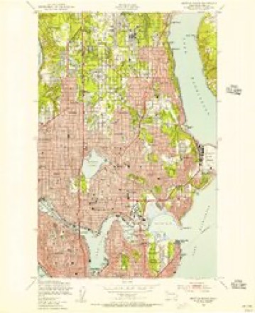
31 topographic sheets cover this place, the earliest surveyed in 1894 and the latest in 1992. It stands in the Seattle census division. It lies in ZIP code area 98103. It lies near Phinney Ridge. The Survey maps it on the Seattle North quadrangle.
On record in Fremont
Buildings and businesses the archive holds for this place. Each opens its own page, with the source record it came from.
On the National Register within a mile 9 records
The National Register names another town for these. They stand within one mile of this settlement's coordinate.
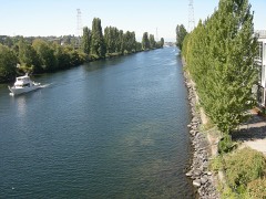 Chittenden Locks and Lake Washington Ship Canallisted 1978 · 0.4 miles away
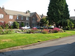 Hawthorne Squarelisted 2012 · 0.5 miles away
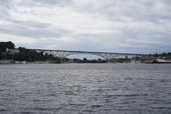 Aurora Avenue Bridgelisted 1982 · 0.7 miles away
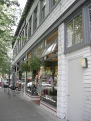 Fremont Buildinglisted 1992 · 0.7 miles away
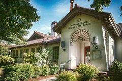 Seattle Public Librarylisted 1982 · 0.7 miles away
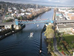 Fremont Bridgelisted 1982 · 0.9 miles away
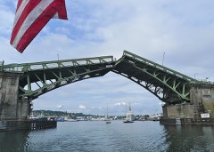 Ballard Bridgelisted 1982 · 0.9 miles away
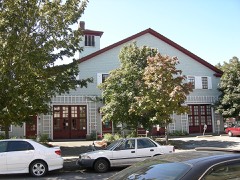 Wallingford Fire and Police Stationlisted 1983 · 0.9 miles away
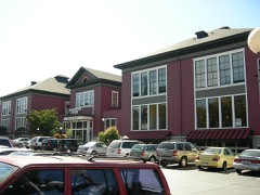 Interlake Public Schoollisted 1983 · 1.0 miles away
Topographic sheets covering this place
13 surveys from 31 printed sheetsMatched by testing this settlement's coordinate against the published boundary of every sheet in the United States Geological Survey's historical collection. Each opens the scanned sheet at the Survey.
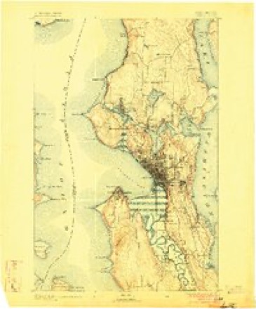
- 1894 USGS Seattle quadrangle1:62500, 2 printings
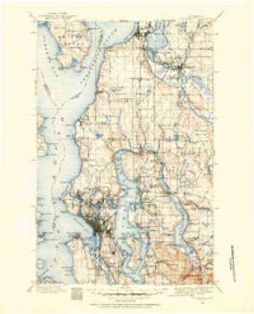
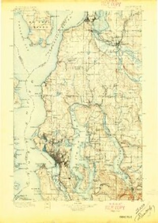
- 1895 USGS Snohomish quadrangle1:125000
- 1897 USGS Seattle quadrangle1:125000, 5 printings
- 1897 USGS Snohomish quadrangle1:125000, 5 printings
- 1908 USGS Seattle quadrangle1:62500, 2 printings
- 1909 USGS Seattle quadrangle1:62500, 2 printings
- 1909 USGS Seattle Special quadrangle1:62500, 2 printings
- 1949 USGS Seattle North quadrangle1:24000, 3 printings
- 1958 USGS Seattle quadrangle1:250000, 3 printings
- 1962 USGS Seattle quadrangle1:250000
- 1975 USGS Seattle quadrangle1:100000
- 1983 USGS Seattle North quadrangle1:25000, 2 printings
- 1992 USGS Seattle quadrangle1:100000, 2 printings
Mines and quarries near this place
2 within 5 milesRegional context, not property-specific evidence. The federal mineral resources record lists 2 workings within 5 miles of Fremont: 2 past producers. None of them still produces. What was taken out: Sand and Gravel, Construction. Distance is straight-line from the map coordinates, so a quarry counted here may appear on a neighbouring settlement's page as well.
| Where | Site | Commodity | Status | Recorded |
|---|---|---|---|---|
| Unnamed Pit | Sand and Gravel, Construction | Past Producer | ||
| Unnamed Pit | Sand and Gravel, Construction | Past Producer |
Storms near this place
3 since 2014Regional context, not property-specific evidence. The National Weather Service names Fremont in 3 storm reports between 2014 and 2022: 2 heavy rain, 1 lightning. The reports record 1 injury. Each account below is quoted exactly as the forecast office filed it, from the NOAA Storm Events Database, and each date opens the federal record of that event.
| When | Event | Place named | Harm | What the report says |
|---|---|---|---|---|
| January 2022 | Heavy Rain | Fremont | 1 hurt, $1,520,000 | Heavy rain on top of saturated soils triggered a landslide that knocked a house off it's foundation, collapsing one level - destroying it and trapping the inhabitants. One man was trapped under debris and injured and had to be extricated by Seattle Fire Department. A woman was also pinned under debris but was able to escape. One dog was killed and another was found a week later in the debris and extricated. At the time, 1 to 2 inches of rain had fallen in the area in the previous 48 hours with the Seattle Antecedent Rainfall Index already high, above the threshold for heavy rain-induced landslides. |
| February 2017 | Heavy Rain | Fremont | $33,000,000 | Heavy rain and storm runoff damaged the West Point sewage treatment plant in Seattle. King county dumped an estimated 235 million gallons of untreated wastewater - including 30 million gallons of raw sewage - into Puget Sound because of damage to the plant. The plant could not perform full wastewater treatment as required by the state permit until May 9th, as reported by the Seattle Times. |
| August 2014 | Lightning | Fremont | $30,000 | Storms moving through Western Washington brought lightning, heavy rain and hail. Lightning hit trees in the Fremont and Green Lake neighborhoods, in one case sparking a garage fire. Power was knocked out to about 2000 customers in northeast Seattle and crews worked to replace 24 transformers damaged by lightning. |
Nearest settlements
The eight closest, with where each one stands in the county. Distances are straight-line, computed from the Geographic Names Information System coordinates.
| Map | Place | Distance | Sheets |
|---|---|---|---|
| West Woodland | 0.8 miles | 31 | |
| Ross (historical) | 0.9 miles | 31 | |
| Phinney Ridge | 0.9 miles | 31 | |
| Edgewater (historical) | 0.9 miles | 31 | |
| Meridian | 1.6 miles | 31 | |
| Wallingford | 1.6 miles | 31 | |
| Queen Anne | 1.7 miles | 31 | |
| Adams | 1.8 miles | 32 |
Provenance
This settlement is recorded in the Geographic Names Information System as feature 1512228. The sheet list is computed by point-in-boundary test against the United States Geological Survey's historical topographic inventory. Both are works of the United States government and carry no copyright under 17 U.S.C. 105.
Mines and quarries. USGS Mineral Resources Data System (MRDS) https://mrdata.usgs.gov/mrds/ A work of the United States government, no copyright under 17 U.S.C. 105.
Storms. NOAA National Centers for Environmental Information, Storm Events Database https://www.ncei.noaa.gov/stormevents/ A work of the United States government, no copyright under 17 U.S.C. 105. Narratives are quoted verbatim from the National Weather Service report and are not edited or summarised.