 Block
From the record
One of 46 National Register listings published here for Chelan County · listed in 2002 · category: District.
Sources: the case file at the National Archives · the National Register database, National Park Service
Listed on the National Register of Historic Places in 2002.
One of 46 National Register listings published here for Chelan County · listed in 2002 · category: District.
Sources: the case file at the National Archives · the National Register database, National Park Service
Regional context, not property-specific evidence. The federal wildfire occurrence database lists 83 fires within 5 miles of Cottage Avenue Historic District between 1992 and 2020, burning about 13,290 acres in total. 34 started naturally. 1 was recorded as arson. Distance is straight-line from the map coordinates, so a fire counted here may appear on a neighbouring settlement's page as well.
| Reported cause | Fires |
|---|---|
| Natural | 34 |
| Missing data/not specified/undetermined | 18 |
| Recreation and ceremony | 10 |
| Debris and open burning | 9 |
| Fireworks | 5 |
| Other causes | 2 |
| Equipment and vehicle use | 2 |
| Arson/incendiarism | 1 |
| Power generation/transmission/distribution | 1 |
| Misuse of fire by a minor | 1 |
The most recent of them, most recent first, with the day each was reported and the service that recorded it.
| Date | Cause | Size | Reported by | Name on the report |
|---|---|---|---|---|
| 9 September 2012 | Natural | under an acre | Washington State Department of Natural Resources Headquarters | BRISKY CANYON 2 |
| 8 September 2019 | Natural | under an acre | Washington State Department of Natural Resources Headquarters | BURCH MEADOW |
| 8 September 2012 | Natural | 40 acres | Washington State Department of Natural Resources Headquarters | WILLIAMS |
| 8 September 2012 | Natural | 1.5 acres | Washington State Department of Natural Resources Headquarters | JUDGE CANYON |
| 8 September 2012 | Natural | under an acre | Washington State Department of Natural Resources Headquarters | OLLALA CANYON |
| 4 September 2017 | Missing data/not specified/undetermined | 15 acres | Washington State Department of Natural Resources Headquarters | TABER |
| 3 September 2009 | Recreation and ceremony | under an acre | Okanogan-Wenatchee National Forest | HAY |
| 13 September 1996 | Natural | under an acre | Okanogan-Wenatchee National Forest | RATTLER |
Regional context, not property-specific evidence. The federal mineral resources record lists 21 workings within 5 miles of Cottage Avenue Historic District: 14 past producers, 4 occurrences, 2 producers, 1 prospect. 2 still produce. What was taken out: Sand and Gravel, Construction, Copper, Tin, Gold. Distance is straight-line from the map coordinates, so a quarry counted here may appear on a neighbouring settlement's page as well.
| Where | Site | Commodity | Status | Recorded |
|---|---|---|---|---|
| Burch Mtn | Asbestos | Occurrence | ||
| Mac Dougal Canyon | Pumice | Past Producer | ||
| Monitor | Tin | Occurrence | ||
| Radio Claims | Gold, Silver | Prospect | ||
| Riverview Prospect | Copper | Occurrence | ||
| Carey Pit | Sand and Gravel, Construction | Past Producer | ||
| Carter Pit | Sand and Gravel, Construction | Past Producer | ||
| Cashmere | Sand and Gravel, Construction | Occurrence | ||
| Cashmere Pit | Sand and Gravel, Construction | Past Producer | ||
| Hughes Pit | Sand and Gravel, Construction | Past Producer |
Regional context, not property-specific evidence. The National Weather Service names Cashmere, the town this property stands in, in 5 storm reports between 1998 and 2026: 1 flash flood, 1 heavy rain, 1 funnel cloud, 1 debris flow. No death or injury is recorded in these reports. Each account below is quoted exactly as the forecast office filed it, from the NOAA Storm Events Database, and each date opens the federal record of that event.
| When | Event | Place named | Harm | What the report says |
|---|---|---|---|---|
| July 2012 | Debris Flow | Cashmere | $100,000 | At approximately 2000 PDT, torrential rains over the Nahahum Canyon triggered a large debris flow. One resident, located at 8566 Nahahum Canyon Road, received significant damage with minor damage noted at two other residences. Three to four feet of mud, logs, and rocks tore a hole in the side of a three-bay shop then blew out the three front doors and continued down the canyon. The mud lifted a large pickup truck a foot and a half off the ground and carried it from one side of the shop to the other. Three to four feet of mud surrounded the nearby house and filled the crawlspace. Tools and other items from the shop along with landscaping rocks from the property were strewn a half mile down the canyon. |
| December 1998 | Flash Flood | Cashmere | $80,000 | An ice jam on Mission Creek in addition to rapid snow melt caused flooding from Cashmere to Entiat. Several basements of homes and structures were flooded, included a few downtown businesses in Cashmere. Portions of Highway 28 were closed. Douglas Creek also caused some minor flooding. |
| March 2026 | Flood | Cashmere | $10,000 | Mission Creek flooded a residence due to debris from 2025 Labor Mountain fire burn scar causing a backup on the river. Other than this spot, creek was within its banks. Time estimated from river crest. |
| July 2010 | Heavy Rain | Cashmere | $1,000 | no account filed |
| April 2012 | Funnel Cloud | Cashmere | - | A trained spotter observed a funnel cloud to the northwest of Wenatchee toward Cashmere. The funnel cloud lasted a few minutes before dissipating. |
No historic map-sheet match is published for this property yet. That does not mean no map exists. This record needs a coordinate-quality review before it can be joined to a sheet boundary. Browse the county's mapped places while that work is pending.
Other National Register properties close enough to walk or drive between, ordered by distance from this one. Both positions come from the same geocoding pass that matched these properties to their map sheets.
| Photograph | Property | Distance | Listed |
|---|---|---|---|
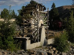 | Burbank Homestead Waterwheel | 0.3 miles | 1973 |
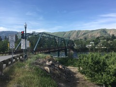 | West Monitor Bridge | 2.2 miles | 1982 |
| Michael Horan House | 7.3 miles | 1992 |
| National Archives record | The nomination case file for reference 02001617 in Record Group 79. |
| Chelan County | All 46 listed properties in this county. |