 Block
From the record
One of 159 National Register listings published here for Spokane County · listed in 2017 · category: Building.
Sources: the National Register database, National Park Service
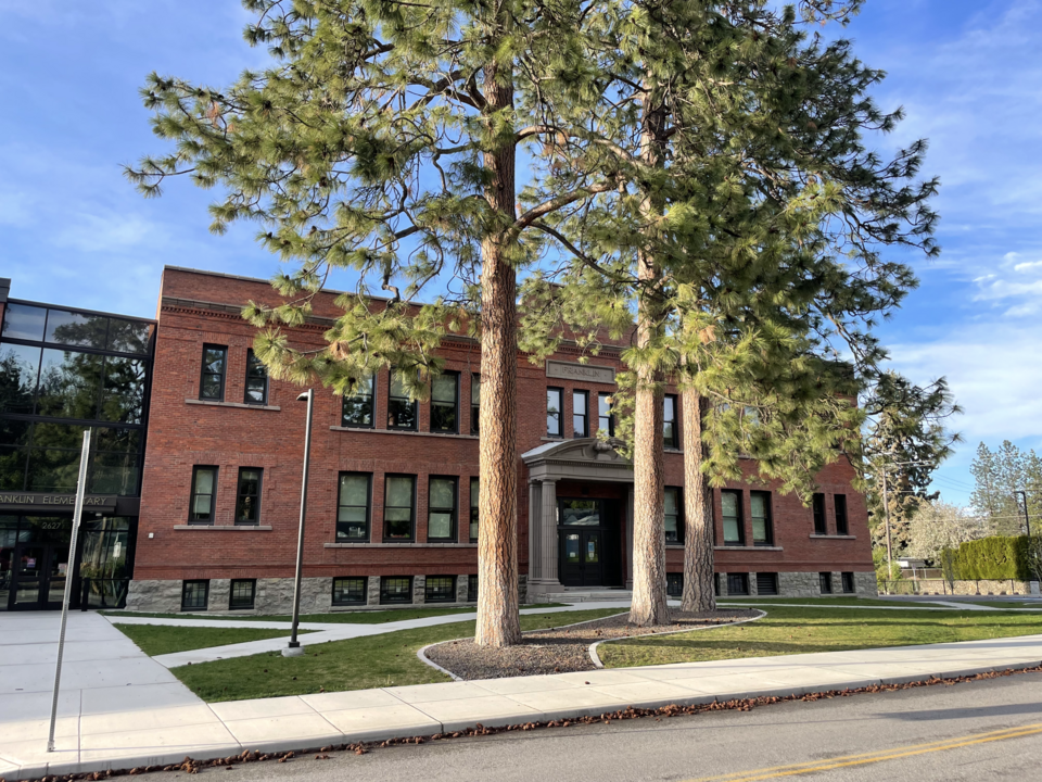
Listed on the National Register of Historic Places in 2017.
One of 159 National Register listings published here for Spokane County · listed in 2017 · category: Building.
Sources: the National Register database, National Park Service
Regional context, not property-specific evidence. The federal wildfire occurrence database lists 335 fires within 5 miles of Franklin Elementary School between 1992 and 2020, burning about 1,713 acres in total. 12 started naturally. 44 were recorded as arson. Distance is straight-line from the map coordinates, so a fire counted here may appear on a neighbouring settlement's page as well.
| Reported cause | Fires |
|---|---|
| Recreation and ceremony | 101 |
| Missing data/not specified/undetermined | 91 |
| Arson/incendiarism | 44 |
| Misuse of fire by a minor | 28 |
| Fireworks | 13 |
| Natural | 12 |
| Debris and open burning | 10 |
| Equipment and vehicle use | 8 |
| Railroad operations and maintenance | 8 |
| Smoking | 8 |
| Other causes | 7 |
| Power generation/transmission/distribution | 5 |
The most recent of them, most recent first, with the day each was reported and the service that recorded it.
| Date | Cause | Size | Reported by | Name on the report |
|---|---|---|---|---|
| 7 September 1996 | Recreation and ceremony | under an acre | Washington State Department of Natural Resources Headquarters | not named |
| 7 September 1994 | Arson/incendiarism | under an acre | Washington State Department of Natural Resources Headquarters | not named |
| 7 September 1994 | Arson/incendiarism | under an acre | Washington State Department of Natural Resources Headquarters | not named |
| 5 September 2018 | Recreation and ceremony | under an acre | Washington State Department of Natural Resources Headquarters | ESMERALDA |
| 5 September 2017 | Arson/incendiarism | under an acre | Washington State Department of Natural Resources Headquarters | COURTLAND |
| 4 September 2009 | Missing data/not specified/undetermined | under an acre | Washington State Department of Natural Resources Headquarters | I 90 |
| 4 September 2006 | Missing data/not specified/undetermined | under an acre | Washington State Department of Natural Resources Headquarters | not named |
| 4 September 1999 | Recreation and ceremony | under an acre | Washington State Department of Natural Resources Headquarters | not named |
Regional context, not property-specific evidence. The federal mineral resources record lists 32 workings within 5 miles of Franklin Elementary School: 26 past producers, 4 occurrences, 2 producers. 2 still produce. What was taken out: Sand and Gravel, Construction, Silica, Stone, Crushed/Broken, Fire Clay (Refractory). Distance is straight-line from the map coordinates, so a quarry counted here may appear on a neighbouring settlement's page as well.
| Where | Site | Commodity | Status | Recorded |
|---|---|---|---|---|
| Empire Granite Quarry | Granite, Silica, Stone, Crushed/Broken | Past Producer | ||
| Moran Prairie | Fire Clay (Refractory) | Past Producer | ||
| Pioneer Brick Co. | Clay | Past Producer | ||
| Center and Perry St. Pit | Stone, Crushed/Broken | Past Producer | ||
| Havana and 10th Quarry | Stone, Crushed/Broken | Past Producer | ||
| Unnamed Quarry | Stone, Crushed/Broken | Past Producer | ||
| Dishman | Silica | Occurrence | ||
| Moran Prairie Silica Deposit | Silica | Occurrence | ||
| Spokane Silica Sand Deposit | Silica | Occurrence | ||
| Unnamed Silica Deposit | Silica | Occurrence |
Regional context, not property-specific evidence. The National Weather Service names Spokane, the town this property stands in, in 51 storm reports between 1994 and 2025: 18 thunderstorm wind, 12 hail, 7 flood, 4 heavy rain. The reports record 23 injuries. Each account below is quoted exactly as the forecast office filed it, from the NOAA Storm Events Database, and each date opens the federal record of that event.
| When | Event | Place named | Harm | What the report says |
|---|---|---|---|---|
| June 2005 | Thunderstorm Wind | Spokane | 12 hurt | no account filed |
| September 2003 | Hail | Spokane | 10 hurt, $50,000 | During the afternoon of September 19th an isolated rain shower with small hail moved over the Spokane area. On the westbound lane of Interstate 90 drivers were blinded by the low sun shining in their eyes while small hail created slippery conditions. Over 50 cars and trucks were involved in numerous accidents and pileups along a four mile stretch of westbound I-90 in the city of Spokane. |
| August 2004 | Lightning | Spokane | 1 hurt | no account filed |
| May 2016 | Thunderstorm Wind | Spokane | $4,800,000 | A member of the public reported power lines down near Sharp and Atlantic in downtown Spokane, Washington. |
| August 1997 | Wildfire | Spokane | $800,000 | 2000 acre fire in sw spokane exacerbated by dry conditions and wind gusts to 30 mph. This was a Type II fire. Cost includes fire suppression... |
| July 2019 | Lightning | Spokane | $200,000 | Lightning striking a power line caused a fire which spread to a nearby house, gutting it and damaging another neighboring house. Time estimated from radar data. |
| June 2022 | Flash Flood | Spokane | $180,000 | Numerous roads flooded in south hill and along and near the i-90 corridor. Several reports of basement flooding with some residences seeing water approach the doors. Multiple vehicles stalled in water, and one driver required assistance in being evacuated. Some neighborhood roads were temporarily closed and had standing water for hours. |
| January 2000 | Thunderstorm Wind | Spokane | $40,000 | Downed trees into a greenhouse and church. |
| July 2019 | Thunderstorm Wind | Spokane | $20,000 | Multiple reports were received of downed trees, power outages and damaged vehicles from thunderstorm winds in the South Hill neighborhood of Spokane. |
| July 2019 | Thunderstorm Wind | Spokane | $20,000 | City of Spokane crews removed 26 downed trees from residential city streets and one arterial as a result of thunderstorm winds that measured at 60 mph at the Spokane Airport. |
| July 1998 | Flash Flood | Spokane | $20,000 | standing water and flooding on I90 near the Thor/Freya exit |
| June 2014 | Heavy Rain | Spokane | $13,000 | Several businesses along Howard Street near the intersection of 2nd Avenue were flooded when heavy rain overwhelmed the city's storm drains. Water was spilling back into buildings through toilets and drain pipes. Among the businesses were The Interplayers Theatre and Howard Street Boxing. |
| October 2025 | Thunderstorm Wind | Spokane | $12,000 | Extremely localized swath of wind speeds estimated at 55-68 mph resulted in several trees uprooted/blown down in Audubon neighborhood including Audubon Elem, through intersection of Chelan Ave/Ash Street with minor damage noted. Spokane Airport recorded a gusts of 49 mph at 1535 PST. |
| March 2001 | Thunderstorm Wind | Spokane | $10,000 | Several portable business signs in Cheney were blown over. In Spokane, large tree limbs were blown down into Grand Boulevard near Manito Park, blocking traffic for a time. Further east, several trees were blown down throughout the Spokane Valley. One tree fell into Bigelow Gulch Road, blocking traffic there for a time. A trained spotter in Otis Orchards measured a wind gust to 61 mph (53 knots) with several larger tree limbs down in that area. Avista Utilities reported about three dozen power outages caused by either trees blowing into power lines or wind blowing over power lines. |
| May 2003 | Thunderstorm Wind | Spokane | $10,000 | no account filed |
| June 2013 | Lightning | Spokane | $6,000 | Lightning struck a house on Spokane's South Hill starting a fire. Firefighters were able to quickly extinguish the fire but the home did sustain heavy fire damage to a small portion of the attic and to the ceiling in one second floor bedroom. |
| June 1999 | Heavy Rain | Spokane | $5,000 | Over 1.25" of rain fell in a 12 hour period in Spokane and Deer Park. |
| April 1994 | Tornado (F0) | Spokane | $5,000 | A tornado briefly touched down just west of Riverside State Park. The tornado damaged trees and power lines and ripped shingles from a house. |
| May 2019 | Flood | Spokane | $4,000 | Heavy rain caused flooding in stairwells and onto the stage at the Martin Woldson Fox Theater. The front entrance area was also inundated and caused the cancellation of a scheduled concert. |
| May 2019 | Flood | Spokane | $2,000 | Heavy rain caused water in hallways and flooding through basement windows at an apartment complex. |
| April 2000 | Hail | Spokane | $2,000 | Dime size hail was reported throughout the Spokane Valley area. |
| June 1997 | Lightning | Spokane | $2,000 | LIGHTNING CAUSED FIRE DAMAGED GARAGE |
| December 2022 | Flood | Spokane | $1,000 | Snow melt and heavy rain along with failing rubber seal in the area caused localized flooding under the Interstate 90 overpass near Monroe Street. 1.25 inches of rain fell in the area. |
| May 2019 | Flood | Spokane | $1,000 | The Walnut Street Interstate 90 on ramp was closed through the night due to flood waters and debris on the ramp and adjacent intersection. |
| July 2012 | Thunderstorm Wind | Spokane | $1,000 | A large tree branch fell onto two cars near the intersection of Wall and Maxwell Streets. |
| August 2007 | Thunderstorm Wind | Spokane | $1,000 | no account filed |
| September 2024 | Thunderstorm Wind | Spokane | $500 | Observer reported a tree down in Corbin Park. Spokane International Airport recorded a gust of 61 MPH. |
| May 2015 | Thunderstorm Wind | Spokane | $500 | Inland Power reported 400 homes without power associated with power-line damage from thunderstorms in Spokane, Washington. |
| May 2015 | Thunderstorm Wind | Spokane | $500 | Avista power reported 1000 people without power associated with thunderstorm wind damage in Spokane, Washington. |
| May 2015 | Thunderstorm Wind | Spokane | $10 | A weather spotter reported that a tree branch fell on a power line at 9 mile road and Francis. Branch size unknown. |
| May 2023 | Flood | Spokane | - | Washington State Patrol reported heavy rain in Central Spokane. Water was standing on Interstate 90 in both directions. |
| June 2022 | Flood | Spokane | - | Low spots on Maple Street under I-90 flooded with standing water from heavy rains. Water was estimated to be under a foot deep. Several other areas around Spokane experienced standing water. Many of these were in known problem spots with poor drainage. |
| July 2016 | Hail | Spokane | - | An NWS employee reported 0.88 inch sized hail 3 miles southeast of Spokane, WA. |
| October 2016 | Funnel Cloud | Spokane | - | Broadcast media reported a funnel cloud 3 miles east of Spokane, Washington. |
| July 2012 | Hail | Spokane | - | Dime to quarter size hail. |
| July 1997 | Hail | Spokane | - | 3/4 inch hail reported by a spotter |
| May 1997 | Thunderstorm Wind | Spokane | - | 65 mph gust |
| April 2012 | Flood | Spokane | - | no account filed |
| May 2007 | Heavy Rain | Spokane | - | no account filed |
| August 2007 | Hail | Spokane | - | no account filed |
| August 2007 | Hail | Spokane | - | no account filed |
| August 2007 | Hail | Spokane | - | no account filed |
| June 2007 | Thunderstorm Wind | Spokane | - | no account filed |
| June 2006 | Flash Flood | Spokane | - | no account filed |
| July 2006 | Thunderstorm Wind | Spokane | - | no account filed |
| June 2005 | Thunderstorm Wind | Spokane | - | no account filed |
| June 2003 | Hail | Spokane | - | no account filed |
| June 2003 | Hail | Spokane | - | no account filed |
| July 2000 | Hail | Spokane | - | no account filed |
| June 1996 | Heavy Rain | Spokane | - | no account filed |
| April 1996 | Hail | Spokane | - | no account filed |
No historic map-sheet match is published for this property yet. That does not mean no map exists. This record needs a coordinate-quality review before it can be joined to a sheet boundary. Browse the county's mapped places while that work is pending.
Other National Register properties close enough to walk or drive between, ordered by distance from this one. Both positions come from the same geocoding pass that matched these properties to their map sheets.
| Photograph | Property | Distance | Listed |
|---|---|---|---|
 | Ralston and Sarah Wilbur House | under 500 feet | 2006 |
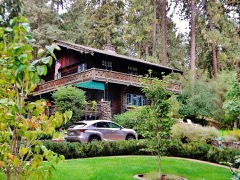 | Koerner House | 0.1 miles | 1999 |
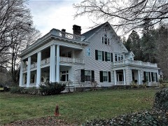 | Levi and May Arkwright Hutton House | 0.3 miles | 2002 |
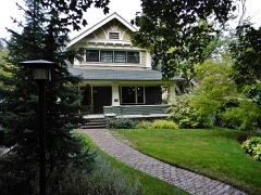 | Gus and Florence Ehrenberg House | 0.4 miles | 2007 |
 | Cambern Dutch Shop Windmill | 0.9 miles | 1989 |
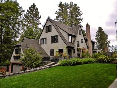 | George and Blanche Christiansen House | 0.9 miles | 2015 |
| National Archives record | The nomination case file for reference 100000946 in Record Group 79. |
| Spokane County | All 159 listed properties in this county. |