 Block
From the record
One of 215 National Register listings published here for Pierce County · listed in 2016 · category: District.
Sources: the National Register database, National Park Service
Listed on the National Register of Historic Places in 2016.
One of 215 National Register listings published here for Pierce County · listed in 2016 · category: District.
Sources: the National Register database, National Park Service
Regional context, not property-specific evidence. The federal wildfire occurrence database lists 1 fire within 5 miles of Buckley's Addition Historic District in 2005, burning under an acre in total. None started naturally. None was recorded as arson. Distance is straight-line from the map coordinates, so a fire counted here may appear on a neighbouring settlement's page as well.
| Reported cause | Fires |
|---|---|
| Recreation and ceremony | 1 |
The most recent of them, most recent first, with the day each was reported and the service that recorded it.
| Date | Cause | Size | Reported by | Name on the report |
|---|---|---|---|---|
| 6 September 2005 | Recreation and ceremony | under an acre | Washington State Department of Natural Resources Headquarters | SPILLMAN |
Regional context, not property-specific evidence. The federal mineral resources record lists 13 workings within 5 miles of Buckley's Addition Historic District: 11 past producers, 2 plants. 2 still produce. What was taken out: Sand and Gravel, Construction, Copper, Nickel, Arsenic, Aluminum, Contained or Metal. Distance is straight-line from the map coordinates, so a quarry counted here may appear on a neighbouring settlement's page as well.
| Where | Site | Commodity | Status | Recorded |
|---|---|---|---|---|
| (Facility) Asarco Refinery | Copper, Nickel, Arsenic | Plant | ||
| Tacoma Reduction Plant | Aluminum, Contained or Metal | Plant | 1943 | |
| Christel Pit | Sand and Gravel, Construction | Past Producer | ||
| Holroyd Land Pit | Sand and Gravel, Construction | Past Producer | ||
| Hylebus Pit | Sand and Gravel, Construction | Past Producer | ||
| McKinney Pit | Sand and Gravel, Construction | Past Producer | ||
| Sound Refining Pit | Sand and Gravel, Construction | Past Producer | ||
| Sprague & S. Tacoma Way Pit | Sand and Gravel, Construction | Past Producer | ||
| Unnamed Pit | Sand and Gravel, Construction | Past Producer | ||
| Unnamed Pit | Sand and Gravel, Construction | Past Producer |
Regional context, not property-specific evidence. The National Weather Service names Tacoma, the town this property stands in, in 3 storm reports between 1997 and 2015: 2 heavy rain, 1 tornado. No death or injury is recorded in these reports. Each account below is quoted exactly as the forecast office filed it, from the NOAA Storm Events Database, and each date opens the federal record of that event.
| When | Event | Place named | Harm | What the report says |
|---|---|---|---|---|
| May 1997 | Tornado (F1) | Tacoma | $150,000 | A weak tornado touched down in a south Tacoma neighborhood just east of I-5. A church suffered roof and beam damage and several trees were pushed over or snapped off. There were also some downed fences. |
| October 2015 | Heavy Rain | Tacoma | $50,000 | A landslide closed southbound Schuster Parkway in Tacoma on the afternoon of Oct 10th after a burst of heavy rain moved through Pierce County. The heavy rain and wind also caused sporadic power outages and some spinouts elsewhere in Pierce County. A part of I-705 was also closed at South 11th Street due to flooding. ||Runoff from the heavy rainfall overwhelmed drainage systems near Tacoma's Stadium High School resulting water and debris running through the campus and tumbling into and flooding the football field. |
| September 2013 | Heavy Rain | Tacoma | $50,000 | Heavy rain inundated more than 60 units in a mini storage business in Tacoma.|Tacomas environmental services crews responded to 76 calls of flooding due to heavy rain. |
No historic map-sheet match is published for this property yet. That does not mean no map exists. This record needs a coordinate-quality review before it can be joined to a sheet boundary. Browse the county's mapped places while that work is pending.
Other National Register properties close enough to walk or drive between, ordered by distance from this one. Both positions come from the same geocoding pass that matched these properties to their map sheets.
| Photograph | Property | Distance | Listed |
|---|---|---|---|
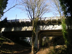 | North 21st Street Bridge | 0.3 miles | 1982 |
| College Park Historic District | 0.4 miles | 2017 | |
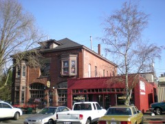 | Engine House No. 9 | 0.4 miles | 1975 |
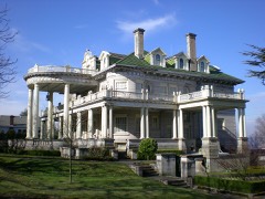 | William Ross Rust House | 0.5 miles | 1985 |
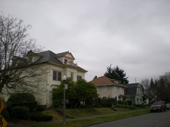 | North Slope Historic District | 0.5 miles | 2003 |
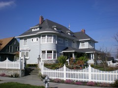 | Henry A. and Birdella Rhodes House | 0.5 miles | 2006 |
| National Archives record | The nomination case file for reference 16000882 in Record Group 79. |
| Pierce County | All 215 listed properties in this county. |