 Block
From the record
One of 324 National Register listings published here for King County · listed in 1971 · category: Building.
Sources: the case file at the National Archives · the National Register database, National Park Service
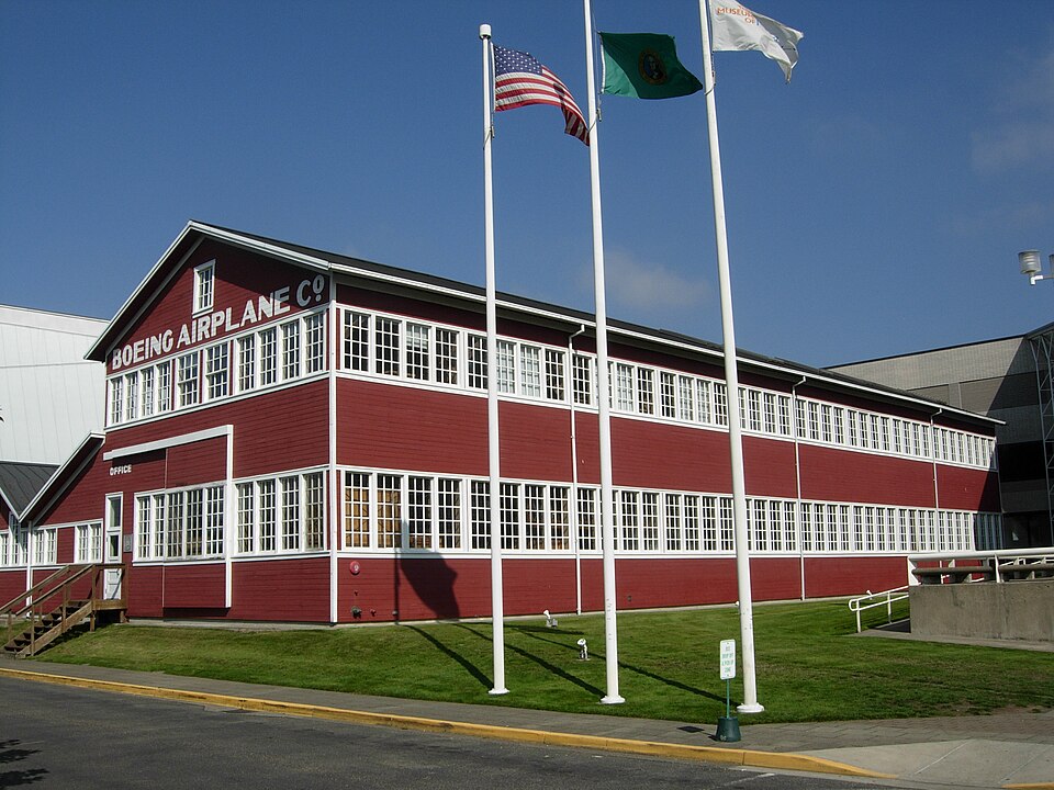
Listed on the National Register of Historic Places in 1971.
One of 324 National Register listings published here for King County · listed in 1971 · category: Building.
Sources: the case file at the National Archives · the National Register database, National Park Service
Regional context, not property-specific evidence. The federal wildfire occurrence database lists 3 fires within 5 miles of Building No. 105, Boeing Airplane Company between 2006 and 2017, burning about 5 acres in total. None started naturally. 1 was recorded as arson. Distance is straight-line from the map coordinates, so a fire counted here may appear on a neighbouring settlement's page as well.
| Reported cause | Fires |
|---|---|
| Arson/incendiarism | 1 |
| Missing data/not specified/undetermined | 1 |
| Debris and open burning | 1 |
The most recent of them, most recent first, with the day each was reported and the service that recorded it.
| Date | Cause | Size | Reported by | Name on the report |
|---|---|---|---|---|
| 3 September 2011 | Arson/incendiarism | under an acre | Washington State Department of Natural Resources Headquarters | NORTH DUCKABUSH |
| 24 September 2017 | Debris and open burning | 4.3 acres | Washington State Department of Natural Resources Headquarters | 8TH AVE |
| 5 July 2006 | Missing data/not specified/undetermined | under an acre | Washington State Department of Natural Resources Headquarters | not named |
Regional context, not property-specific evidence. The federal mineral resources record lists 9 workings within 5 miles of Building No. 105, Boeing Airplane Company: 9 past producers. None of them still produces. What was taken out: Sand and Gravel, Construction, Stone, Crushed/Broken. Distance is straight-line from the map coordinates, so a quarry counted here may appear on a neighbouring settlement's page as well.
| Where | Site | Commodity | Status | Recorded |
|---|---|---|---|---|
| Black River Quarry | Stone, Crushed/Broken | Past Producer | ||
| Riverton Quarry | Stone, Crushed/Broken | Past Producer | ||
| Riverton Quarry | Sand and Gravel, Construction, Stone, Crushed/Broken | Past Producer | ||
| Tobins Pit | Sand and Gravel, Construction | Past Producer | ||
| Unnamed Pit | Sand and Gravel, Construction | Past Producer | ||
| Unnamed Pit | Sand and Gravel, Construction | Past Producer | ||
| Unnamed Pit | Sand and Gravel, Construction | Past Producer | ||
| Unnamed Pit | Sand and Gravel, Construction | Past Producer | ||
| Unnamed Pit | Sand and Gravel, Construction | Past Producer |
Regional context, not property-specific evidence. The National Weather Service names Seattle, the town this property stands in, in 8 storm reports between 1996 and 2015: 2 lightning, 1 flood, 1 thunderstorm wind, 1 tornado. The reports record 1 death. Each account below is quoted exactly as the forecast office filed it, from the NOAA Storm Events Database, and each date opens the federal record of that event.
| When | Event | Place named | Harm | What the report says |
|---|---|---|---|---|
| December 2006 | Flash Flood | Seattle | 1 killed, $750,000 | In the Madison Valley area of Seattle, heavy rainfall produced excessive street runoff, flooding about 25 basements and drowning one woman trapped in her basement by rapidly rising water. |
| February 2000 | Thunderstorm Wind | Seattle | $25,000 | A microburst with winds estimated at 50 mph hit West Seattle knocking down a few trees, damaging two homes and a car. |
| October 2015 | Heavy Rain | Seattle | $10,000 | In Shoreline, heavy rainfall caused a section of concrete to give way in the tunnel leading to a Metro bus barn under the I-5 HOV lanes between 165th and 175th Streets. Repairs to those lanes were completed two days later. |
| July 2013 | Lightning | Seattle | $5,000 | One lightning strike damaged a transformer, which knocked out power to customers in Shoreline. |
| December 1996 | Lightning | Seattle | $3,500 | no account filed |
| May 2010 | Funnel Cloud | Seattle | - | Some bicycles were tossed and a tent blew apart at Genesee Park in the Rainier Valley of Seattle. |
| June 2001 | Tornado (F0) | Seattle | - | A very weak tornado tossed a teacher and a few children into the air. No one was injured. |
| September 1996 | Flood | Seattle | - | no account filed |
No historic map-sheet match is published for this property yet. That does not mean no map exists. This record needs a coordinate-quality review before it can be joined to a sheet boundary. Browse the county's mapped places while that work is pending.
Other National Register properties close enough to walk or drive between, ordered by distance from this one. Both positions come from the same geocoding pass that matched these properties to their map sheets.
| Photograph | Property | Distance | Listed |
|---|---|---|---|
| Jim and Betty Eng House | 0.9 miles | 2019 | |
 | Seattle Electric Company Georgetown Steam Plant | 1.8 miles | 1978 |
 | Old Georgetown City Hall | 2.2 miles | 1983 |
 | White Center Fieldhouse and Caretaker Cottage | 2.6 miles | 2015 |
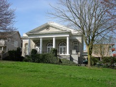 | Columbia City Historic District | 2.9 miles | 1980 |
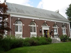 | Seattle Public Library | 2.9 miles | 1982 |
| National Archives record | The nomination case file for reference 71000872 in Record Group 79. |
| King County | All 324 listed properties in this county. |