 Block
From the record
One of 46 National Register listings published here for Chelan County · listed in 1973 · category: Building · built in 1909.
Sources: the case file at the National Archives · the National Register database, National Park Service
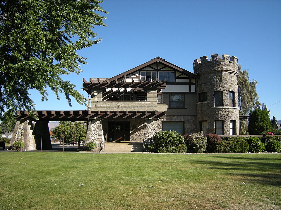
Built in 1909. Listed on the National Register of Historic Places in 1973.
One of 46 National Register listings published here for Chelan County · listed in 1973 · category: Building · built in 1909.
Sources: the case file at the National Archives · the National Register database, National Park Service
Regional context, not property-specific evidence. The federal wildfire occurrence database lists 31 fires within 5 miles of Wells House between 1992 and 2020, burning about 12,520 acres in total. 8 started naturally. None was recorded as arson. Distance is straight-line from the map coordinates, so a fire counted here may appear on a neighbouring settlement's page as well.
| Reported cause | Fires |
|---|---|
| Missing data/not specified/undetermined | 10 |
| Natural | 8 |
| Debris and open burning | 4 |
| Fireworks | 4 |
| Recreation and ceremony | 2 |
| Firearms and explosives use | 1 |
| Equipment and vehicle use | 1 |
| Smoking | 1 |
The most recent of them, most recent first, with the day each was reported and the service that recorded it.
| Date | Cause | Size | Reported by | Name on the report |
|---|---|---|---|---|
| 9 September 2008 | Missing data/not specified/undetermined | 54 acres | Washington State Department of Natural Resources Headquarters | HORSE LAKE ROAD |
| 8 September 2012 | Natural | under an acre | Okanogan-Wenatchee National Forest | NUMBER 2 CANYON |
| 4 September 2016 | Smoking | 20 acres | Washington State Department of Natural Resources Headquarters | HORSE LAKE |
| 4 September 1998 | Missing data/not specified/undetermined | 10 acres | Okanogan-Wenatchee National Forest | NUMBER TWO CANYON |
| 2 September 2007 | Missing data/not specified/undetermined | 2.0 acres | Okanogan-Wenatchee National Forest | MARTIN RANCH |
| 18 September 2018 | Missing data/not specified/undetermined | under an acre | Spokane District | EAST VIEW |
| 1 September 2018 | Missing data/not specified/undetermined | 2,610 acres | Spokane District | CRYSTAL |
| 26 August 2003 | Fireworks | 1.5 acres | Washington State Department of Natural Resources Headquarters | not named |
Regional context, not property-specific evidence. The federal mineral resources record lists 56 workings within 5 miles of Wells House: 27 past producers, 17 occurrences, 7 prospects, 2 producers. 4 still produce. What was taken out: Sand and Gravel, Construction, Silica, Gold, Silver. Distance is straight-line from the map coordinates, so a quarry counted here may appear on a neighbouring settlement's page as well.
| Where | Site | Commodity | Status | Recorded |
|---|---|---|---|---|
| (Facility) Wenatchee Aluminum Smelter | Aluminum, Contained or Metal | Plant | ||
| Cannon Mine | Silver, Gold, Copper, Antimony, Lead, Arsenic | Producer | Acanthite, Boulangerite, Chalcopyrite, Electrum, Galena, Gold, Hessite, Marcasite, Naumannite, Pyrargyrite, Silver, Sphalerite, Stibnite | |
| Lovitt | Gold, Silver, Copper, Antimony, Zinc, Arsenic, Lead | Past Producer | 1885, 1894 | |
| Monitor | Tin | Occurrence | ||
| Squaw Saddle | Mercury | Occurrence | Cinnabar | |
| Cannon | Gold, Silver | Past Producer | Acanthite, Chalcopyrite, Electrum, Galena, Gold, Hessite, Naumannite, Pyrargyrite, Sphalerite, Stibnite | |
| Dry Gulch | Perlite | Occurrence | ||
| Lovitt | Gold, Silver | Past Producer | Acanthite, Chalcopyrite, Electrum, Galena, Gold, Hessite, Naumannite, Sphalerite, Stibnite | |
| Rooster Comb | Perlite | Occurrence | ||
| Sampson Pit | Stone, Crushed/Broken | Past Producer |
Regional context, not property-specific evidence. The National Weather Service names Wenatchee, the town this property stands in, in 21 storm reports between 2003 and 2024: 10 flash flood, 3 lightning, 3 debris flow, 2 heavy rain. The reports record 1 injury. Each account below is quoted exactly as the forecast office filed it, from the NOAA Storm Events Database, and each date opens the federal record of that event.
| When | Event | Place named | Harm | What the report says |
|---|---|---|---|---|
| July 2006 | Lightning | Wenatchee | 1 hurt | no account filed |
| June 2022 | Flash Flood | West Wenatchee | $80,000 | Water and mud going into a couple residences. Several streets in area impacted from urban flooding. |
| August 2019 | Flash Flood | South Wenatchee | $50,000 | Heavy rain from a thunderstorm eroded a culvert and hillside above the Squilchuck Mobile Home Park resulting in three mobile homes being buried up to their roof lines with mud and rocks. Residents in 16 other nearby homes were advised to evacuate until the hillside stabilized. |
| August 2019 | Flash Flood | South Wenatchee | $50,000 | Numerous streets in the southern portion of Wenatchee were reported as flooded and residents were advised to avoid travel in the area. Mud and debris flows in the Squilchuck, Pritcher and Halverson Canyons flowed down these canyons and into the city. In addition heavy rain in the city of Wenatchee backed up storm drains and sewers and contributed to the flooding. |
| September 2013 | Flash Flood | West Wenatchee | $43,430 | Flash flooding from Number 2 Canyon blocked a portion of Number 2 Canyon Road above milepost 3. Flood waters reached as far as western Wenatchee. Flood waters also damaged homes and property to private residences in the Canyon. Damage costs were estimated. |
| August 2013 | Debris Flow | West Wenatchee | $30,000 | Heavy rain across the 2012 Peavine Canyon Burn Scar resulted in a large debris flow down Number One Canyon Road into southwestern portions of Wenatchee. Upwards of eight inches of mud filled yards, basements, and garages of homes along the road. Witnesses described a wall of water, mud, rocks, branches, and tree limbs coming down Number One Canyon Road with the sound of rocks scraping the road. The debris flow reached the intersection of Lars Lane and Number One Canyon Road. There were no injuries. |
| August 2013 | Debris Flow | West Wenatchee | $30,000 | Heavy rainfall led to a debris flow across Number Two Canyon Road roughly from mile post three to the end of the pavement around 0000 PST. The slide left half to one foot of mud and debris, including rocks, over the roadway rendering the road impassible. The Number One Canyon Near Wenatchee Rain Gauge (NOOW1) received 0.29 of rainfall over a span of 29 minutes. Runoff incised ditches up to four feet in diameter exposing utilities. |
| March 2016 | Debris Flow | West Wenatchee | $15,000 | The Wenatchee World Newspaper reported that a drainage culvert had plugged with debris during heavy rain over the weekend and caused water and debris to spill out from it and flood yards and streets in the Wenatchee Neighborhood on the 1600 block of Wooland Drive, which is off Pershing Street near Springwater Avenue in Wenatchee, WA. |
| June 2022 | Flash Flood | West Wenatchee | $10,000 | A mudslide on Number 1 Canyon Road was closed for several hours. |
| June 2022 | Flash Flood | West Wenatchee | $10,000 | Mudslide on Maple Street with the road temporarily impassable. |
| June 2022 | Flash Flood | West Wenatchee | $10,000 | Number 2 Canyon Rd temporarily flooded just west of Wenatchee. |
| June 2006 | Lightning | Wenatchee | $5,000 | no account filed |
| June 2019 | Flash Flood | West Wenatchee | $2,500 | Number 2 Canyon Road was cut by mud and debris carried by a Flash Flood . The road was closed for a few hours while road crews removed the debris. |
| August 2024 | Thunderstorm Wind | West Wenatchee | $2,000 | Chelan PUD reported 795 customers from a downed tree on a powerline. |
| May 2006 | Lightning | Wenatchee | $2,000 | no account filed |
| August 2024 | Flash Flood | West Wenatchee | $500 | Chelan County dispatch office reported water flowing out of manhole covers and flooding streets, including at the corner of Maple and Northwestern Avenue. Report on Facebook stated water was up to bumpers of vehicles. |
| June 2022 | Thunderstorm Wind | West Wenatchee | $500 | Observer reported 3 inch trees limbs and power poles were broken via Mping. |
| June 2013 | Flash Flood | West Wenatchee | - | In the city of Wenatchee, Miller, Western, Springwater, and McKittrick roads experienced flooding. Manhole covers were blown off along Miller Street between Millerdale Avenue and Springwater Avenue. Sections of these roads were closed for roughly one hour as one to two feet of water filled some intersections. Mud and water could be seen flowing across State Route 28 at the junction of US2 and US97 via a DOT camera on the northern sections of Wenatchee. The water and mud was estimated to be less then a foot deep. A CoCoRahs report from one mile west southwest of Wenatchee stated the lower level of their outbuilding was flooded however it is unknown if there was any damage. |
| July 2011 | Heavy Rain | Wenatchee | - | Significant rainfall resulted in cherry damage to several orchards from the Wenatchee area, northward toward Pateros. It was reported that up to approximately fifteen percent or more of the cherry orchards were damaged. The Skeena variety of cherries was most damaged as the rainfall resulted in severe cracking of fruit. The ASOS at the Wenatchee Airport reported 0.30 inches of rainfall between 0600PST and 1200PST. Damage estimations were based on a loss of 150 tons of cherries combined with the additional costs of renting roughly a dozen helicopters used to dry the orchards. One helicopter pilot died when the low-flying aircraft clipped a power-line and crashed. |
| June 2003 | Heavy Rain | Wenatchee | - | During the late afternoon of June 9th a thunderstorm dumped up to 1/3 of an inch of rain in a short period of time. Minor urban flooding of storm drains and culverts resulted. Highway 2 between Wenatchee and Cashmere was closed briefly due to water ponding over all four lanes of the road. |
| June 2009 | Dust Devil | West Wenatchee | - | no account filed |
No historic map-sheet match is published for this property yet. That does not mean no map exists. This record needs a coordinate-quality review before it can be joined to a sheet boundary. Browse the county's mapped places while that work is pending.
Other National Register properties close enough to walk or drive between, ordered by distance from this one. Both positions come from the same geocoding pass that matched these properties to their map sheets.
| Photograph | Property | Distance | Listed |
|---|---|---|---|
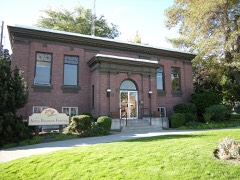 | Wenatchee Carnegie Library | 1.1 miles | 1982 |
 | Downtown Wenatchee Historic District | 1.1 miles | 2008 |
| Burke-Hill Apartments | 1.2 miles | 2021 | |
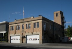 | Wenatchee Fire Station #1 | 1.2 miles | 2004 |
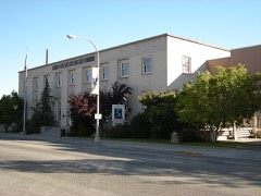 | U.S. Post Office and Annex | 1.2 miles | 1977 |
| Brown's First Addition Historic District | 1.7 miles | 2021 |
| National Archives record | The nomination case file for reference 73001865 in Record Group 79. |
| Chelan County | All 46 listed properties in this county. |