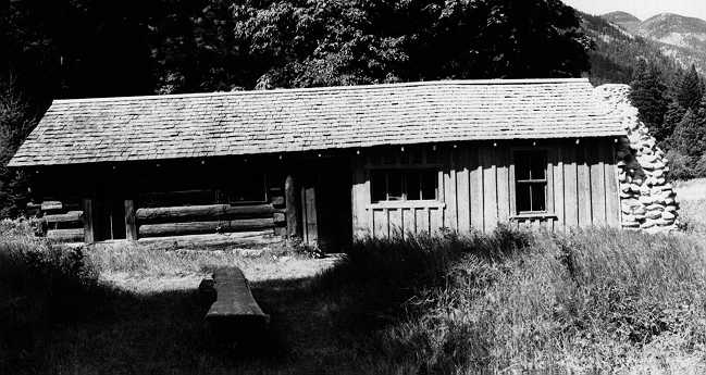
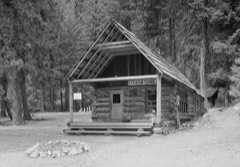
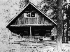
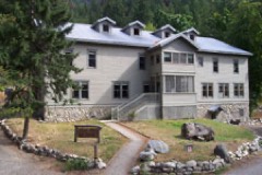
Photograph by National Park Service inventory, Public domain. Via
Wikimedia Commons.
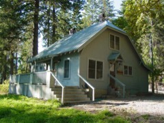
Buckner Cabin
Listed on the National Register of Historic Places in 1974.
From the record
“The Buckner Cabin, also known as William Buzzard's Cabin, located about 2.6 miles (4.2 km) northwest of Stehekin, Washington in Lake Chelan National Recreation Area of North Cascades National Park Complex, is one of a group of structures relating to the theme of early settlement in the Lake Chelan area. The original cabin, listed individually as the Buckner Cabin on the National Register of Historic Places, was built in 1889 by Willam Buzzard and altered in 1911 by William and Harry Buckner.”
Wikipedia article Buckner Cabin, CC BY-SA 4.0.
One of 46 National Register listings published here for Chelan County · listed in 1974 · category: Building.
National Register reference number.74000912- the number the National Park Service assigned this property when it was listed, and the key its nomination file is catalogued under at the National Archives.
Fires near this property
73 since 1992
Regional context, not property-specific
evidence. The
federal wildfire occurrence database
lists 73 fires within 5 miles of Buckner Cabin
between 1992 and 2019, burning about 6,774 acres in total. 47 started naturally. 1 was recorded as arson.
Distance is straight-line from the map coordinates, so a fire counted
here may appear on a neighbouring settlement's page as well.
Reported cause
Fires
Natural
47
Recreation and ceremony
7
Smoking
4
Power generation/transmission/distribution
4
Debris and open burning
4
Equipment and vehicle use
2
Misuse of fire by a minor
2
Missing data/not specified/undetermined
2
Arson/incendiarism
1
The most recent of
them, most recent first, with the day each was reported and the service
that recorded it.
Regional context, not property-specific
evidence. The federal mineral resources record lists
3 workings within 5 miles of Buckner Cabin: 2 prospects, 1 occurrence.
None of them still produces. What was taken out: Copper, Uranium, Gold. Distance is straight-line from the
map coordinates, so a quarry counted here may appear on a neighbouring
settlement's page as well.
Regional context, not property-specific
evidence. The National Weather Service names
Stehekin, the town this property stands in, in 17 storm reports between 2006 and 2026: 11 flood, 4 debris flow, 2 flash flood.
No death or injury is recorded in these reports. Each account below is quoted exactly as the forecast office
filed it, from the NOAA Storm Events Database, and each date
opens the federal record of that event.
Heavy rainfall of 7-8 inches in two days led to river flooding on the Stehekin River at Stehekin. The river crested at 28.8 feet, with a flood stage of 24.0 feet. Some homes were flooded by the river. Washed out roads prevented Stehekin residents from reaching town.
Flash flooding and debris traveled down Imus Creek near Stehekin and covered approximately 350 linear feet of Stehekin Valley Road. Mud and debris covered the road up to eight feet deep in spots. Several vehicles and bicycles in a parking area were damaged and/or pushed into Stehekin Lake. An office and residential building were surrounded by mud and debris, but only received minimal interior flood damage. Damage costs were estimated.
Several reports of flood impacts were received from the Lake Chelan Recreation Area and Stehekin. A rockslide took place outside the Pioneer burn area from 2024 and blocked the road, damaging 200 yards of the road between Purple Point and Loggers Point. Several debris flows coming down onto roads in the area, including Stehekin Valley Road. The town of Stehekin experienced a debris flow from the Pioneer Fire Burn Scar. A debris flow has washed out multiple roads, and swept away the water treatment plant and sewer system. They are currently receiving pallets of water and other resources. Damage cost is estimated.
A debris flow blocked the road to Harts Pass just below Deadhorse Point. The slide continued down onto Lost River Road near the River Bend Campground. Mud and debris accumulated to about five feet in depth across the road. Damage costs were estimated.
The Stehekin River Gage at Stehekin recorded a rise above the Flood Stage of 24.0 feet at 5:00 PM PST May 23rd, crested at 24.8 feet at 12:30 AM May 24th and then dropped below Flood Stage at 10:15 AM May 24th. The river then rose again above Flood Stage at 8:30 PM PST on May 28th, crested near 25.8 feet at 2:15 AM on May 31st, and remained above Flood Stage through early June.
The Stehekin River reached minor flood on November 23rd. The Stehekin COOP observer reported minor damage to a bridge. Several access roads to private residencies and a camp ground were flooded with minor gravel damage to the road surface.
The Stehekin River Gage at Stehekin recorded a rise above the Flood Stage of 24.0 feet at 8:30 PM PST on May 28th, crested near 25.8 feet at 2:15 AM on May 31st, and then receded, passing below the Flood Stage at 7:45 AM on June 1st.
Heavy rain caused a mudslide at Thimbleberry Creek at the 7.5 mile marker on Stehekin Valley Road. Three large culverts and creek channels are filled with debris. The water became rerouted around the debris and along the road to a culvert 1000 feet down valley. A second smaller slide was at the No Named Creek. A third slide is at mile 9.2 where debris slid to a barn and corral at a ranch.
Debris flow and flooding near Eagle Creek off the Twisp River. Several large logs and mud moved down the channel and impacted the forest service roads. Rain, for areas around the spot, several days prior ranged from 0.30-1 inch.
The USGS River Gage on the Stehekin River at Stehekin recorded a rise above the Flood Stage of 24 feet at 5:15 PM PST on May 15th. The river fluctuated slightly above and below the Flood Stage due to the diurnal snow melt and run off cycle through May 17th, with a maximum crest of 24.4 feet at 11:00 PM on May 15th. The river dropped below the Flood Stage and continued to recede at 3:30 AM on May 17th.
The Stehekin River Gage at Stehekin rose above the Flood Stage of 24.0 feet at 3:45 AM PST on November 23rd. The river crested at 25.8 feet at 8:30 AM and dropped back below Flood Stage at 8:00 PM.
No historic map-sheet match is published
for this property yet. That does not mean no map exists. This record needs
a coordinate-quality review before it can be joined to a sheet boundary.
Browse the county's mapped places while that work is
pending.
Listed places nearby
6 within 8 miles
Other National Register properties close
enough to walk or drive between, ordered by distance from this one. Both
positions come from the same geocoding pass that matched these properties
to their map sheets.
Listing record. National Park Service National Register of Historic Places, listed-properties dataset, current to 2026-05-22.
Map join. Address geocoded through the United States Census geocoder, then tested against the published boundary of every sheet in the USGS Historical Topographic Map Collection.
How this page is made. Listing fields come from federal records; map-sheet coverage is a labelled coordinate-to-boundary calculation, not a source-field claim.
Wildfire. Short, Karen C. 2022. Spatial wildfire occurrence data for the United States, 1992-2020 [FPA_FOD_20221014]. 6th Edition. Fort Collins, CO: Forest Service Research Data Archive. https://doi.org/10.2737/RDS-2013-0009.6 Collected with United States Government funding and usable without additional permissions or fees.
Mines and quarries. USGS Mineral Resources Data System (MRDS) https://mrdata.usgs.gov/mrds/ A work of the United States government, no copyright under 17 U.S.C. 105.
Storms. NOAA National Centers for Environmental Information, Storm Events Database https://www.ncei.noaa.gov/stormevents/ A work of the United States government, no copyright under 17 U.S.C. 105. Narratives are quoted verbatim from the National Weather Service report and are not edited or summarised.
 Block