BlockBefore
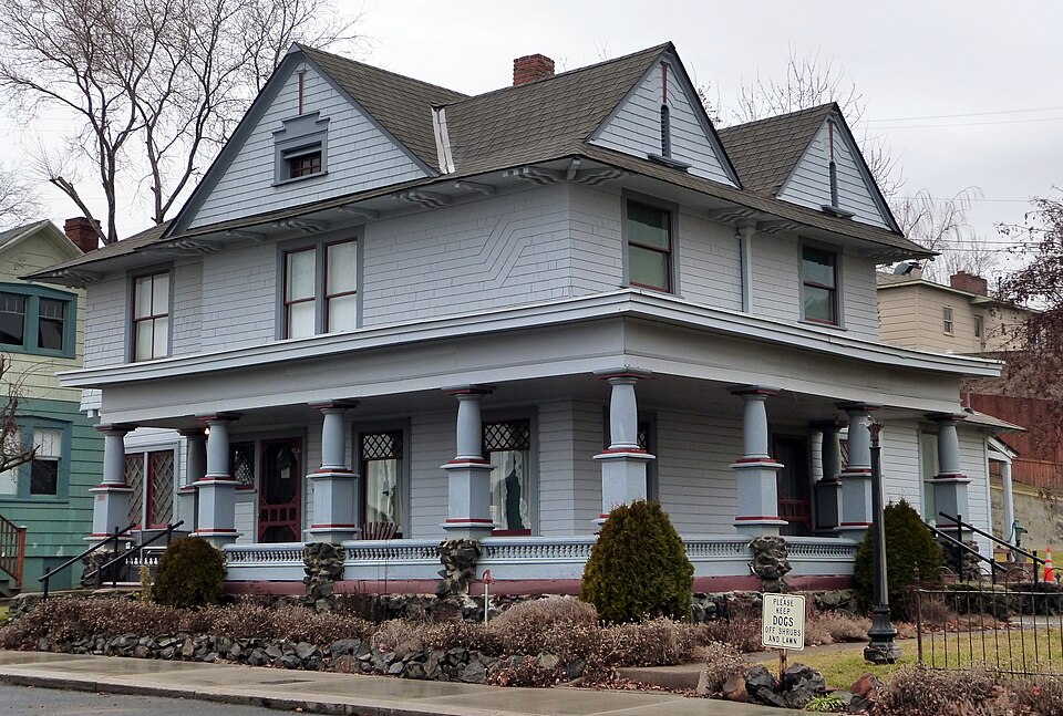
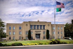
Photograph of Dr. Frank R. Burroughs House
Photograph by Ian Poellet, CC BY-SA 4.0. Via Wikimedia Commons.

Dr. Frank R. Burroughs House

Listed on the National Register of Historic Places in 1975.

From the record

“Burroughs House, located in Ritzville, Washington, United States, is a house listed on the National Register of Historic Places. Burroughs Home Museum, is owned by the city and open for tours.”

Wikipedia article Dr. Frank R. Burroughs House, CC BY-SA 4.0.

One of 13 National Register listings published here for Adams County · listed in 1975 · category: Building.

Sources: the Wikipedia article · the case file at the National Archives · the National Register database, National Park Service
The listing

  • What is counted as historic. The nomination lists 1 building as contributing to the listing.
  • Listed as. Burroughs, Dr. Frank R., House - the National Register files a house under its owner's surname.
  • Address. 408 Main St., Ritzville, 99169
  • When was it listed? November 1975
  • Category. building
  • Census division. Ritzville
  • National Register reference number. 75001838 - the number the National Park Service assigned this property when it was listed, and the key its nomination file is catalogued under at the National Archives.

Mines and quarries near this property

9 within 5 miles

Regional context, not property-specific evidence. The federal mineral resources record lists 9 workings within 5 miles of Dr. Frank R. Burroughs House: 8 past producers, 1 producer. 1 still produces. What was taken out: Stone, Crushed/Broken, Sand and Gravel, Construction. Distance is straight-line from the map coordinates, so a quarry counted here may appear on a neighbouring settlement's page as well.

Where SiteCommodity StatusRecorded
Gravel PitSand and Gravel, ConstructionPast Producer
Ritzville Pre-MixSand and Gravel, ConstructionProducer
Unnamed PitSand and Gravel, ConstructionPast Producer
Daughters QuarryStone, Crushed/BrokenPast Producer
Quarry Site Ad-50Stone, Crushed/BrokenPast Producer
Ritzville QuarryStone, Crushed/BrokenPast Producer
Unnamed QuarryStone, Crushed/BrokenPast Producer
Wellsandt QuarryStone, Crushed/BrokenPast Producer

Every working recorded in Adams County

Storms near this property

8 since 1997

Regional context, not property-specific evidence. The National Weather Service names Ritzville, the town this property stands in, in 8 storm reports between 1997 and 2024: 2 hail, 2 funnel cloud, 2 thunderstorm wind, 1 wildfire. The reports record 1 injury. Each account below is quoted exactly as the forecast office filed it, from the NOAA Storm Events Database, and each date opens the federal record of that event.

WhenEvent Place namedHarm What the report says
August 1998WildfireRitzville1 hurt, $60,000A tractor sparked a fire in a wheat field which was fanned by gusty winds. Over 20,000 acres were burned and a rancher was injuried.
June 2024Thunderstorm WindRitzville$2,000Several trees at the fairgrounds suffered significant damage. Time estimated. A nearby sensor recorded a max gust of 42 MPH.
August 2008Thunderstorm WindRitzville$1,000Strong outflow winds from a thunderstorm uprooted a large tree in Ritzville.
May 2020Funnel CloudRitzville-A member of the public reported a brief funnel cloud seen in Ritzville, Washington.
June 2001FloodRitzville-Water flowed over a county road near Bauer Coulee and Harder Road.
June 2001HailRitzville-A severe supercell thunderstorm containing large hail and torrential rainfall moved from southwest to northeast across northern Adams County, first entering the county east of Warden and exiting the county north of Schoonover. The only observation from Adams County of hail size with this storm was a report of dime-sized hail at 500 PM PDT at the Franz Ranch Airport (23 WSW Ritzville). The hail caused a widespread swath of crop destruction that was 20 miles long and 2-3 miles wide, laying waste to about 22,000 acres of crops. The severity of crop damage in the storm's path suggests hail likely reached the size of golf balls. Hail piled up to a foot deep in some farm yards. In the center of the storm's path, nearly 100% of the wheat, barley, bean and pea crops were a loss.
July 1998Funnel CloudRitzville-Adams county sheriff reported a funnel cloud.
May 1997HailRitzville-3/4 inch hail

Every storm recorded in Adams County

Map coverage status

No historic map-sheet match is published for this property yet. That does not mean no map exists. This record needs a coordinate-quality review before it can be joined to a sheet boundary. Browse the county's mapped places while that work is pending.

Listed places nearby

5 within 8 miles

Other National Register properties close enough to walk or drive between, ordered by distance from this one. Both positions come from the same geocoding pass that matched these properties to their map sheets.

Photograph PropertyDistance Listed
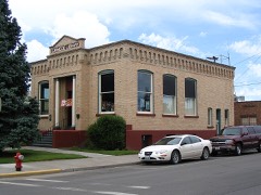
Ritzville Carnegie Libraryunder 500 feet1982
Adams County Courthouse0.2 miles2018
Ritzville Historic District0.2 miles1990
Nelson H. Greene House0.4 miles1980
Ritzville High School0.6 miles1994

Sources for this property

National Archives recordThe nomination case file for reference 75001838 in Record Group 79.
Wikipedia articleCommunity-written account of this property, licensed CC BY-SA.
Adams CountyAll 13 listed properties in this county.

Provenance

  • Listing record. National Park Service National Register of Historic Places, listed-properties dataset, current to 2026-05-22.
  • Map join. Address geocoded through the United States Census geocoder, then tested against the published boundary of every sheet in the USGS Historical Topographic Map Collection.
  • How this page is made. Listing fields come from federal records; map-sheet coverage is a labelled coordinate-to-boundary calculation, not a source-field claim.
  • Mines and quarries. USGS Mineral Resources Data System (MRDS) https://mrdata.usgs.gov/mrds/ A work of the United States government, no copyright under 17 U.S.C. 105.
  • Storms. NOAA National Centers for Environmental Information, Storm Events Database https://www.ncei.noaa.gov/stormevents/ A work of the United States government, no copyright under 17 U.S.C. 105. Narratives are quoted verbatim from the National Weather Service report and are not edited or summarised.