 Block
From the record
13 National Register listings published here.
Sources: the National Register database, National Park Service
67 topographic sheets cover 48 settlements here, and 13 properties are on the National Register of Historic Places.
13 National Register listings published here.
Sources: the National Register database, National Park Service
Every property in this county listed on the National Register of Historic Places, with the year it was listed and the federal nomination document.
| Photograph | Property | Type | Listed | Reference |
|---|---|---|---|---|
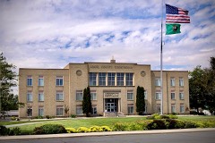 | Adams County Courthouse | building | 2018 | 100003256 |
| Bassett Hardware Co. Store | building | 2022 | 100007729 | |
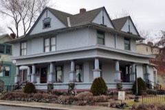 | Dr. Frank R. Burroughs House | building | 1975 | 75001838 |
| Denver and Rio Grande Western Railroad Business Car No. 101 | object | 1988 | 88000740 | |
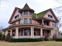 | Nelson H. Greene House | building | 1980 | 80003996 |
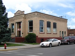 | Ritzville Carnegie Library | building | 1982 | 82004192 |
| Ritzville High School | building | 1994 | 94000476 | |
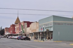 | Ritzville Historic District | district | 1990 | 90000676 |
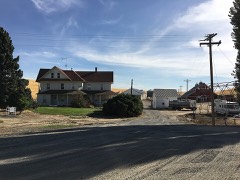 | Seivers Brothers Ranchhouse and Barn | building | 1979 | 79002524 |
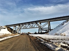 | Spokane, Portland and Seattle Railway Company Bridge 291.4-O.W.R.&N. Crossing-Washtucna | structure | 2018 | 100003279 |
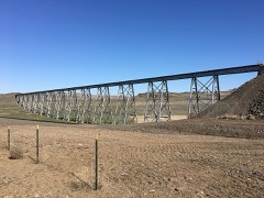 | Spokane, Portland and Seattle Railway Company-Cow Creek Viaduct | structure | 2018 | 100003278 |
| Strap Iron Corral | structure | 1975 | 75001837 |
Every wildfire the federal occurrence database records inside this county: 74 of them, burning about 34,678 acres. 15 started naturally and 4 were recorded as arson. Each settlement page carries the fires within five miles of it.
| Reported cause | Fires |
|---|---|
| Missing data/not specified/undetermined | 19 |
| Debris and open burning | 15 |
| Natural | 15 |
| Equipment and vehicle use | 11 |
| Recreation and ceremony | 5 |
| Arson/incendiarism | 4 |
| Railroad operations and maintenance | 1 |
| Smoking | 1 |
| Fireworks | 1 |
| Other causes | 1 |
| Power generation/transmission/distribution | 1 |
The five largest, by the area the report gives. One of them was set deliberately.
| Date | Cause | Size | Reported by | Name on the report |
|---|---|---|---|---|
| 12 August 2017 | Natural | 17,465 acres | Hanford Reach National Monument | EAST SADDLE |
| 21 July 1997 | Natural | 5,000 acres | Columbia National Wildlife Refuge | CORFU |
| 6 September 2017 | Missing data/not specified/undetermined | 3,000 acres | Washington State Fire Marshal's Office | O'BRIEN ROAD |
| 9 July 2016 | Power generation/transmission/distribution | 1,952 acres | Spokane District | ROCKY FORD |
| 13 July 2007 | Natural | 1,454 acres | Columbia National Wildlife Refuge | HIGHWAY 26 |
| 17 June 2005 | Arson/incendiarism | 1,200 acres | Hanford Reach National Monument | HAMMER |
| 6 July 2000 | Fireworks | 991 acres | Columbia National Wildlife Refuge | LYLE LK |
| 29 June 2008 | Missing data/not specified/undetermined | 700 acres | Columbia National Wildlife Refuge | LINDA LAKE |
Every settlement page carries the fires within five miles of it - see the settlement index below.
The NOAA Storm Events Database holds 38 reports for this county, causing 1 death, 1 injury and about $356,530 in recorded property damage. Each settlement page carries the reports that name it.
| Kind of event | Reports |
|---|---|
| Thunderstorm Wind | 16 |
| Hail | 10 |
| Flood | 4 |
| Tornado | 3 |
| Funnel Cloud | 2 |
| Wildfire | 1 |
| Heavy Rain | 1 |
| Flash Flood | 1 |
The most serious of them, by death, then injury, then recorded damage. The accounts are quoted exactly as the forecast office filed them.
| When | Event | Place named | Harm | What the report says |
|---|---|---|---|---|
| May 2020 | Thunderstorm Wind | Washtucna | 1 killed, $15,000 | The Washtucna Community reported that a man lost his life during storm clean up. Due to strong winds, numerous trees were uprooted, property damage, and an unoccupied trailer was blown into a power pole. |
| August 1998 | Wildfire | Ritzville | 1 hurt, $60,000 | A tractor sparked a fire in a wheat field which was fanned by gusty winds. Over 20,000 acres were burned and a rancher was injuried. |
| February 2017 | Flood | Servia | $200,000 | A section of the Lind-Warden Road was washed out producing a gaping 30 foot wide and 15 foot deep canyon across the road. A motorist drove into the gap and dropped 15 feet. The car was destroyed but the driver was unharmed. |
| May 2020 | Thunderstorm Wind | Washtucna Arpt | $36,000 | A member of the public reported that 12 power poles were blown onto Highway 260 near Gill Road in Prescott, Washington. There were no known injuries. |
| August 2013 | Thunderstorm Wind | Othello Arpt | $20,000 | Several trees and power lines were knocked down from strong thunderstorm winds across east and southeastern sections of Othello. Reports from the utility company included: power lines down from a fallen tree two miles southeast of Othello, a downed power pole six miles southeast of Othello, and another power pole downed six miles southeast of Warden. A newspaper also reported at least eight large trees blown down in the town of Lind. The downed trees resulted in damage to fences and power lines. |
| July 1998 | Thunderstorm Wind | Othello | $10,000 | trees down and power lines down along with widespread damage to nearby wheat fields. |
| February 2017 | Flood | Lind | $5,000 | Multiple road closures due to flooding occurred along Highway 21 between Lind and Interstate 90. |
| February 2014 | Flood | Lauer | $5,000 | Areas of flooding were observed across portions of northern and eastern Adams County. State route 21 nine miles south of Odessa was flooded for a period of time. |
| June 2024 | Thunderstorm Wind | Ritzville | $2,000 | Several trees at the fairgrounds suffered significant damage. Time estimated. A nearby sensor recorded a max gust of 42 MPH. |
| August 2008 | Thunderstorm Wind | Ritzville | $1,000 | Strong outflow winds from a thunderstorm uprooted a large tree in Ritzville. |
| June 2008 | Thunderstorm Wind | Hooper Jct | $1,000 | no account filed |
| July 2006 | Hail | Washtucna | $1,000 | no account filed |
| August 2014 | Thunderstorm Wind | Washtucna Arpt | $500 | A large tree was blown down at a golf course in Ritzville. |
| April 1983 | Tornado (F0) | not stated | $30 | no account filed |
| August 2022 | Hail | Hatton | - | A thunderstorm developed East of Connell and traveled North toward Ritzville. It produced hail 1.5 inch in Lind WA around 0709PST. It also had reports of 0.75 inch and 1 inch. |
| May 2020 | Funnel Cloud | Ritzville | - | A member of the public reported a brief funnel cloud seen in Ritzville, Washington. |
| May 2020 | Thunderstorm Wind | Ralston | - | A trained spotter reported that blowing dust, followed by wind and heavy rainfall, reduced visibility below one mile. |
| September 2013 | Thunderstorm Wind | Othello Tango Arpt | - | Numerous trees and power lines downed in Othello. Trees toppled onto homes and fences. An estimate of forty power poles snapped off. Schools across the Othello area were closed the following day due to impacts from the storm. |
| September 2013 | Thunderstorm Wind | Paha | - | Numerous trees and power lines downed in Ritzville. Some trees fell on houses and on outdoor equipment. |
| September 2013 | Thunderstorm Wind | Washtucna | - | Strong winds from a thunderstorm destroyed a combine shed, uprooted 5 trees and blew off a roof of a barn. Winds also knocked out power to 40 customers. |
| July 2012 | Hail | Moody | - | Caller reported quarter size hail and very heavy rain which resulted in localized urban flooding. |
| June 2001 | Flood | Ritzville | - | Water flowed over a county road near Bauer Coulee and Harder Road. |
| June 2001 | Heavy Rain | Countywide | - | Crop damage for Adams County is incorporated with the severe hail report below. |
| June 2001 | Hail | Ritzville | - | A severe supercell thunderstorm containing large hail and torrential rainfall moved from southwest to northeast across northern Adams County, first entering the county east of Warden and exiting the county north of Schoonover. The only observation from Adams County of hail size with this storm was a report of dime-sized hail at 500 PM PDT at the Franz Ranch Airport (23 WSW Ritzville). The hail caused a widespread swath of crop destruction that was 20 miles long and 2-3 miles wide, laying waste to about 22,000 acres of crops. The severity of crop damage in the storm's path suggests hail likely reached the size of golf balls. Hail piled up to a foot deep in some farm yards. In the center of the storm's path, nearly 100% of the wheat, barley, bean and pea crops were a loss. |
| April 1998 | Hail | Othello | - | 1 inch hail |
| July 1998 | Hail | Lind | - | 1.75 inch diameter hail |
| July 1998 | Funnel Cloud | Ritzville | - | Adams county sheriff reported a funnel cloud. |
| July 1998 | Hail | Lind | - | 1.75 inch diameter hail |
| May 1997 | Hail | Ritzville | - | 3/4 inch hail |
| April 1993 | Thunderstorm Wind | not stated | - | Winds 6 miles southwest of Othello went from light and variable to 50+ mph within 30 seconds. The storm also dropped pea- to marble-size hail over the area. The observer also reported "a tight spiral in the cell overhead." |
| August 2008 | Thunderstorm Wind | Lind | - | no account filed |
| July 2006 | Hail | Washtucna | - | no account filed |
| May 2005 | Flash Flood | North Portion | - | no account filed |
| June 2005 | Thunderstorm Wind | Countywide | - | no account filed |
| July 1982 | Hail | not stated | - | no account filed |
| May 1980 | Tornado (F0) | not stated | - | no account filed |
| July 1978 | Tornado (F1) | not stated | - | no account filed |
| July 1975 | Thunderstorm Wind | not stated | - | no account filed |
The Survey's mineral resources record lists 69 workings inside this county. 3 still produce and 66 are closed or unrecorded. Each settlement page carries the workings within five miles of it.
| Commodity | Workings |
|---|---|
| Sand and Gravel, Construction | 39 |
| Stone, Crushed/Broken | 28 |
| Diatomite | 2 |
The least common of them first, because a county's hundredth gravel pit says nothing its first ten did not.
| Where | Site | Commodity | Status | Recorded |
|---|---|---|---|---|
| Klepharot Deposit | Diatomite | Past Producer | ||
| Wenzelberger | Diatomite | Past Producer | ||
| Borrow Pit | Stone, Crushed/Broken | Past Producer | ||
| Cunningham Quarry | Stone, Crushed/Broken | Past Producer | ||
| Daughters Quarry | Stone, Crushed/Broken | Past Producer | ||
| Elmore Quarry | Stone, Crushed/Broken | Past Producer | ||
| Gravel Pit | Stone, Crushed/Broken | Past Producer | ||
| Hatton Quarry | Stone, Crushed/Broken | Past Producer | ||
| Hill Quarry | Stone, Crushed/Broken | Past Producer | ||
| Lind Quarry | Stone, Crushed/Broken | Past Producer | ||
| Lind Quarry | Stone, Crushed/Broken | Past Producer | ||
| Oestreich Quarry | Stone, Crushed/Broken | Past Producer | ||
| Quarry Site Ad-50 | Stone, Crushed/Broken | Past Producer | ||
| Ritzville Quarry | Stone, Crushed/Broken | Past Producer | ||
| State Pit Ps-Ad-142 | Stone, Crushed/Broken | Past Producer | ||
| State Pit Psad-89 | Stone, Crushed/Broken | Producer | ||
| Unnamed Quarry | Stone, Crushed/Broken | Past Producer | ||
| Unnamed Quarry | Stone, Crushed/Broken | Past Producer | ||
| Unnamed Quarry | Stone, Crushed/Broken | Past Producer | ||
| Unnamed Quarry | Stone, Crushed/Broken | Past Producer | ||
| Unnamed Quarry | Stone, Crushed/Broken | Past Producer | ||
| Unnamed Quarry | Stone, Crushed/Broken | Past Producer | ||
| Unnamed Quarry | Stone, Crushed/Broken | Past Producer | ||
| Unnamed Quarry | Stone, Crushed/Broken | Past Producer | ||
| Unnamed Quarry | Stone, Crushed/Broken | Past Producer | ||
| Unnamed Quarry | Stone, Crushed/Broken | Past Producer | ||
| Unnamed Quarry | Stone, Crushed/Broken | Past Producer | ||
| Unnamed Quarry | Stone, Crushed/Broken | Past Producer | ||
| Unnamed Quarry | Stone, Crushed/Broken | Past Producer | ||
| Wellsandt Quarry | Stone, Crushed/Broken | Past Producer | ||
| Bauer Pit | Sand and Gravel, Construction | Past Producer | ||
| Borrow Pit | Sand and Gravel, Construction | Past Producer | ||
| Charrie Pit | Sand and Gravel, Construction | Past Producer | ||
| Finnel Lake Pit | Sand and Gravel, Construction | Past Producer | ||
| Gravel Pit | Sand and Gravel, Construction | Past Producer | ||
| Gravel Pit | Sand and Gravel, Construction | Producer | ||
| H. Harder Pit | Sand and Gravel, Construction | Past Producer | ||
| Hartman Pit | Sand and Gravel, Construction | Past Producer | ||
| Hille Pit | Sand and Gravel, Construction | Past Producer | ||
| Kaspar Farms Pit | Sand and Gravel, Construction | Past Producer | ||
| Keystone Jct. Pit | Sand and Gravel, Construction | Past Producer | ||
| Krause Pit | Sand and Gravel, Construction | Past Producer | ||
| Lind Pit | Sand and Gravel, Construction | Past Producer | ||
| Othello Pit | Sand and Gravel, Construction | Past Producer | ||
| Ritzville Pre-Mix | Sand and Gravel, Construction | Producer | ||
| Robbins Pit | Sand and Gravel, Construction | Past Producer | ||
| Roxboro Pit | Sand and Gravel, Construction | Past Producer | ||
| Schneider Pit | Sand and Gravel, Construction | Past Producer | ||
| School Land Pit | Sand and Gravel, Construction | Past Producer | ||
| Schott Pit | Sand and Gravel, Construction | Past Producer | ||
| Sorenson Pit | Sand and Gravel, Construction | Past Producer | ||
| Stolzer Pit | Sand and Gravel, Construction | Past Producer | ||
| Taunton Pit | Sand and Gravel, Construction | Past Producer | ||
| Tokio Pit | Sand and Gravel, Construction | Past Producer | ||
| Unnamed Pit | Sand and Gravel, Construction | Past Producer | ||
| Unnamed Pit | Sand and Gravel, Construction | Past Producer | ||
| Unnamed Pit | Sand and Gravel, Construction | Past Producer | ||
| Unnamed Pit | Sand and Gravel, Construction | Past Producer | ||
| Unnamed Pit | Sand and Gravel, Construction | Past Producer | ||
| Unnamed Pit | Sand and Gravel, Construction | Past Producer | ||
| Unnamed Pit | Sand and Gravel, Construction | Past Producer | ||
| Unnamed Pit | Sand and Gravel, Construction | Past Producer | ||
| Unnamed Pit | Sand and Gravel, Construction | Past Producer | ||
| Unnamed Pit | Sand and Gravel, Construction | Past Producer | ||
| Unnamed Pit | Sand and Gravel, Construction | Past Producer | ||
| Unnamed Pit | Sand and Gravel, Construction | Past Producer | ||
| Unnamed Pit | Sand and Gravel, Construction | Past Producer | ||
| Washtucna Pit | Sand and Gravel, Construction | Past Producer | ||
| Yorgerson Pit | Sand and Gravel, Construction | Past Producer |
Named settlements recorded in the Geographic Names Information System, each with the topographic sheets covering it. Villages, hamlets and abandoned places alike. Each is shown with the nearest named watercourse or landform and the survey quadrangle it falls on.
Lind-Washtucna census division · 99344 · In Cunningham Coulee · Hatton quadrangle
8 sheets, 1916 to 1983
Lind-Washtucna census division · 99344 · In Hatton Coulee · Hatton quadrangle
8 sheets, 1916 to 1983
Lind-Washtucna census division · 99333 · On Cow Creek · Hooper quadrangle
9 sheets, 1950 to 1983
Lind-Washtucna census division · 99333 · On Cow Creek · Hooper quadrangle
9 sheets, 1950 to 1983
Ritzville census division · 99032 · Near Harper Island · Sprague Lake quadrangle
7 sheets, 1953 to 1982
Lind-Washtucna census division · 98857 · Weber quadrangle
10 sheets, 1925 to 1982
Lind-Washtucna census division · 99371 · Near Staley Coulee · Washtucna North quadrangle
9 sheets, 1923 to 1983