BlockBefore
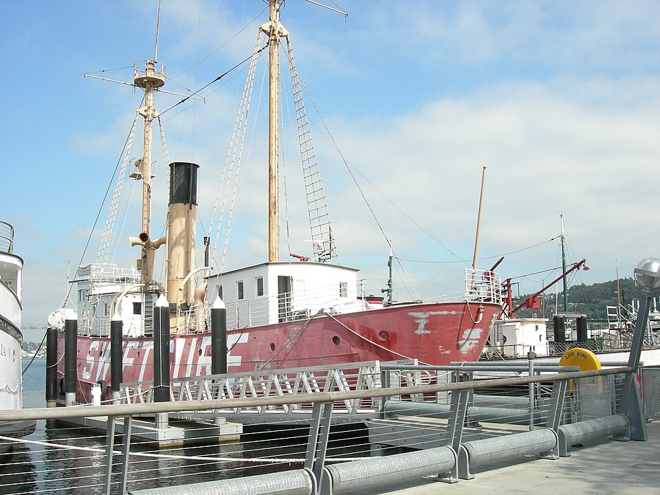
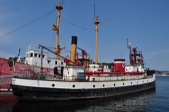
Photograph of Swiftsure
Photograph by Joe Mabel, CC BY-SA 3.0. Via Wikimedia Commons.

RELIEF (lightship)

A National Historic Landmark. Listed on the National Register of Historic Places in 1975.

From the record

“Light Vessel Number 83 (LV-83) Swiftsure is a lightship and museum ship owned by Northwest Seaport in Seattle, Washington. Launched in 1904 at Camden, New Jersey and in active service until 1960 after serving on all five of the American west coast's lightship stations, it is the oldest surviving lightship in the United States, the only one still fitted with its original steam engine, and the last lightship with wooden decks.”

Wikipedia article United States lightship Swiftsure (LV-83), CC BY-SA 4.0.

One of 324 National Register listings published here for King County · listed in 1975 · category: Structure · a National Historic Landmark.

Sources: the Wikipedia article · the case file at the National Archives · the National Register database, National Park Service
The listing

  • National Historic Landmark. The highest federal designation, held by about 2,600 places in the country against roughly 100,000 Register listings.
  • What is counted as historic. The nomination lists 1 structure as contributing to the listing.
  • Still standing. The Park Service records this property as extant.
  • Address. Central Waterfront at Moss Bay, Kirkland, 98109
  • When was it listed? April 1975
  • Category. structure
  • Census division. Seattle
  • National Register reference number. 75001852 - the number the National Park Service assigned this property when it was listed, and the key its nomination file is catalogued under at the National Archives.

Mines and quarries near this property

2 within 5 miles

Regional context, not property-specific evidence. The federal mineral resources record lists 2 workings within 5 miles of RELIEF (lightship): 2 past producers. None of them still produces. What was taken out: Sand and Gravel, Construction. Distance is straight-line from the map coordinates, so a quarry counted here may appear on a neighbouring settlement's page as well.

Where SiteCommodity StatusRecorded
Unnamed PitSand and Gravel, ConstructionPast Producer

Every working recorded in King County

Storms near this property

6 since 1997

Regional context, not property-specific evidence. The National Weather Service names Kirkland, the town this property stands in, in 6 storm reports between 1997 and 2008: 2 lightning, 2 heavy rain, 2 funnel cloud. No death or injury is recorded in these reports. Each account below is quoted exactly as the forecast office filed it, from the NOAA Storm Events Database, and each date opens the federal record of that event.

WhenEvent Place namedHarm What the report says
December 2006Heavy RainKirkland$1,000,000Up to 2 inches of rain fell during the day, causing a sinkhole to develop under a road in Woodinville and flooding several businesses in Kirkland. Freeway ramps were closed off of I-405 in Kirkland and there was ankle high water at intersections. A sinkhole also developed near a West Seattle home, flooding the basement. In Rainier Valley several businesses were flooded. Seattle Goodwill's downtown building suffered water damage.
July 2007LightningKirkland$5,000Lightning struck a home in Kirkland, causing minor damage.
September 2003Heavy RainKirkland$5,000no account filed
June 2008Funnel CloudKirkland-A funnel cloud was observed from the Seattle NWS forecast office.
October 2006Funnel CloudKirkland-no account filed
August 1997LightningKirkland-no account filed

Every storm recorded in King County

Map coverage status

No historic map-sheet match is published for this property yet. That does not mean no map exists. This record needs a coordinate-quality review before it can be joined to a sheet boundary. Browse the county's mapped places while that work is pending.

Listed places nearby

6 within 8 miles

Other National Register properties close enough to walk or drive between, ordered by distance from this one. Both positions come from the same geocoding pass that matched these properties to their map sheets.

Photograph PropertyDistance Listed
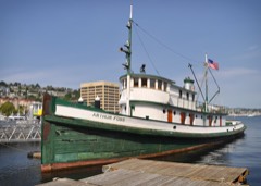
ARTHUR FOSS (tugboat)under 500 feet1989
DUWAMISHunder 500 feet1989
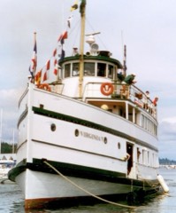
VIRGINIA Vunder 500 feet1973
F/V Tordenskjold (West Coast Halibut Schooner)under 500 feet2023
SCHOONER MARTHAunder 500 feet2001
MV WESTWARD (Wooden Motor Vessel)under 500 feet2007

Sources for this property

National Archives recordThe nomination case file for reference 75001852 in Record Group 79.
Wikipedia articleCommunity-written account of this property, licensed CC BY-SA.
King CountyAll 324 listed properties in this county.

Provenance

  • Listing record. National Park Service National Register of Historic Places, listed-properties dataset, current to 2026-05-22.
  • Map join. Address geocoded through the United States Census geocoder, then tested against the published boundary of every sheet in the USGS Historical Topographic Map Collection.
  • How this page is made. Listing fields come from federal records; map-sheet coverage is a labelled coordinate-to-boundary calculation, not a source-field claim.
  • Mines and quarries. USGS Mineral Resources Data System (MRDS) https://mrdata.usgs.gov/mrds/ A work of the United States government, no copyright under 17 U.S.C. 105.
  • Storms. NOAA National Centers for Environmental Information, Storm Events Database https://www.ncei.noaa.gov/stormevents/ A work of the United States government, no copyright under 17 U.S.C. 105. Narratives are quoted verbatim from the National Weather Service report and are not edited or summarised.