Block
From the record
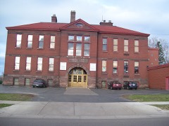
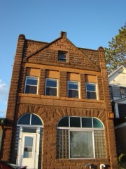
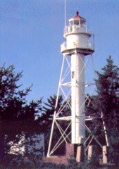
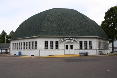
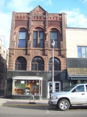
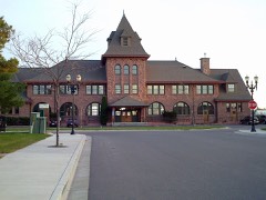
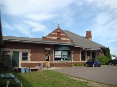
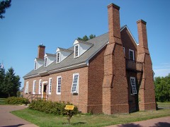
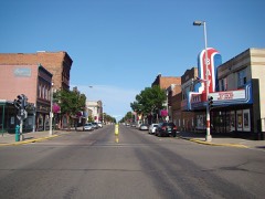
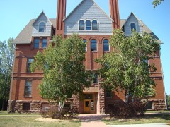
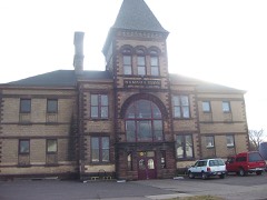
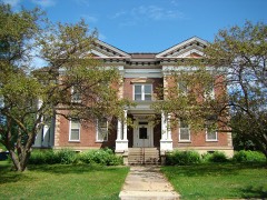
32 National Register listings published here.
Sources: the county history on the Internet Archive · the National Register database, National Park Service
67 topographic sheets cover 25 settlements here, and 32 properties are on the National Register of Historic Places.
32 National Register listings published here.
Sources: the county history on the Internet Archive · the National Register database, National Park Service
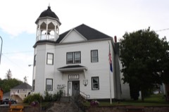
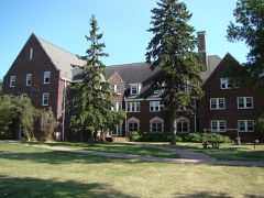
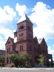
Every property in this county listed on the National Register of Historic Places, with the year it was listed and the federal nomination document.
Every wildfire the federal occurrence database records inside this county: 431 of them, burning about 513 acres. 21 started naturally and 21 were recorded as arson. Each settlement page carries the fires within five miles of it.
| Reported cause | Fires |
|---|---|
| Debris and open burning | 137 |
| Missing data/not specified/undetermined | 67 |
| Railroad operations and maintenance | 49 |
| Equipment and vehicle use | 48 |
| Arson/incendiarism | 21 |
| Misuse of fire by a minor | 21 |
| Natural | 21 |
| Recreation and ceremony | 20 |
| Other causes | 18 |
| Power generation/transmission/distribution | 12 |
| Fireworks | 9 |
| Smoking | 8 |
The five largest, by the area the report gives. One of them was set deliberately.
| Date | Cause | Size | Reported by | Name on the report |
|---|---|---|---|---|
| 14 April 2012 | Fireworks | 45 acres | Great Lakes Agency | WHITE RIVER |
| 1 June 2010 | Natural | 20 acres | Wisconsin Department of Natural Resources | PLUM CREEK FIRE |
| 1 June 2010 | Natural | 20 acres | Chequamegon-Nicolet National Forest | 164 |
| 21 May 1998 | Arson/incendiarism | 20 acres | Wisconsin Department of Natural Resources | not named |
| 18 September 2008 | Debris and open burning | 19 acres | Wisconsin Department of Natural Resources | not named |
| 17 April 2009 | Missing data/not specified/undetermined | 18 acres | Wisconsin Department of Natural Resources | GILGEN FIRE |
| 29 April 2001 | Debris and open burning | 17 acres | Wisconsin Department of Natural Resources | not named |
| 8 April 2017 | Recreation and ceremony | 13 acres | Great Lakes Agency | JOLMA |
Every settlement page carries the fires within five miles of it - see the settlement index below.
The NOAA Storm Events Database holds 205 reports for this county, causing 2 deaths, 3 injuries and about $601,280 in recorded property damage. Each settlement page carries the reports that name it.
| Kind of event | Reports |
|---|---|
| Thunderstorm Wind | 101 |
| Hail | 70 |
| Flash Flood | 13 |
| Tornado | 11 |
| Flood | 7 |
| Lightning | 2 |
| Funnel Cloud | 1 |
The most serious of them, by death, then injury, then recorded damage. The accounts are quoted exactly as the forecast office filed them.
| When | Event | Place named | Harm | What the report says |
|---|---|---|---|---|
| June 2018 | Flash Flood | Sandborn | 1 killed | A truck went into a ditch on County Truck E just south of County Trunk C in the Township of White River. The roadway was completely underwater and the water in the ditch was 6 to 8 feet in depth. The truck was found unoccupied with the driver side door open. The 75 year old male driver was found deceased 60 feet from the vehicle. |
| July 2016 | Flood | Marengo | 1 killed | An 82-year-old man from Marengo was found dead in his pickup truck in the flooded waters along the Marengo River near the Riemer Road Bridge west of Marengo. The exact circumstances of how, when, and where he died are not known, only that he was found a few days after the heavy rains some time early Thursday. |
| June 2018 | Lightning | La Pointe Madeline I | 3 hurt | Lightning struck a tree in Big Bay Town Park. The current then traveled through the root system and struck a woman getting into her vehicle, throwing her to the ground. Two men in a tent next to the tree were also struck. The woman and one of the men had minor injuries, but the other man sustained serious burns and was transported off the island for medical treatment. |
| August 1961 | Tornado (F2) | not stated | $250,000 | no account filed |
| June 1999 | Thunderstorm Wind | Marengo | $150,000 | no account filed |
| July 2011 | Lightning | Ashland | $80,000 | no account filed |
| July 2011 | Thunderstorm Wind | Marengo | $50,000 | The winds blew down numerous trees. Several homes were damaged from falling trees. There was also some structural damage at the Ashland County fairgrounds. |
| September 1992 | Tornado (F0) | not stated | $25,000 | no account filed |
| July 1980 | Tornado (F1) | not stated | $25,000 | no account filed |
| May 2011 | Thunderstorm Wind | Butternut | $10,000 | There was minor siding damage to a home, a metal barn collapsed, and some trees were blown down along Balsam Lane to the east-southeast of Butternut. The metal barn probably collapsed at a lower wind speed than would normally be expected, given a lack of damage to nearby pine trees. Estimated wind gusts in this area were around 80 mph. |
| August 2010 | Thunderstorm Wind | Odanah | $3,000 | Trees were blown down onto roads. |
| July 2010 | Thunderstorm Wind | Mellen | $2,000 | Power lines were reported down along U.S. Highway 13. |
| April 2011 | Hail | Odanah | $1,500 | Oblong and spiky hail stones up to 3 inches in diameter fell near the town of Odanah. |
| July 2016 | Flash Flood | Ashland | $1,000 | The Ashland County Sheriff Office reported nearly all roads across the city of Ashland were under water. |
| July 2016 | Flash Flood | Odanah | $1,000 | Flash flooding along the Denomie Creek washed out a portion of Highway 2. |
| July 2016 | Flash Flood | Sanborn | $1,000 | Flash flooding along Trout Brook washed out the nearby stretch of Highway 13. |
| July 2016 | Flash Flood | Clam Lake | $1,000 | Flash flooding along Frog Creek washed out the nearby stretch of Highway 77. |
| July 2010 | Thunderstorm Wind | Glidden | $500 | Large tree branches were blown down. |
| July 1983 | Tornado (F0) | not stated | $250 | no account filed |
| June 1983 | Tornado (F0) | not stated | $30 | no account filed |
| April 2026 | Thunderstorm Wind | La Pointe Madeline I | - | A gust of 66 mph was recorded by the K4R5 AWOS station at the La Pointe Airport. |
| May 2025 | Thunderstorm Wind | Marengo | - | A photo was received showing the top half of a large spruce tree that had been snapped off along with a large branch downed from another nearby tree. |
| June 2025 | Thunderstorm Wind | Marengo | - | Several trees were snapped and a large portion of roofing material was ripped off of a machine shed. |
| June 2025 | Thunderstorm Wind | Odanah | - | A tree fell onto a powerline causing a power outage. |
| July 2025 | Thunderstorm Wind | Ashland | - | A photo was received showing a tree down in Ashland. |
| July 2025 | Thunderstorm Wind | Clam Lake | - | Multiple trees were down on a road. |
| July 2025 | Thunderstorm Wind | Odanah | - | Eleven trees were down across Bad River reservation roadways that had to be removed by road crews. |
| June 2024 | Thunderstorm Wind | Foster Jct | - | Four trees were down across Highway GG between Clam Lake and Mellen. |
| April 2023 | Flood | Ashland | - | Warm temperatures early in April led to rapid snowmelt of a well above normal snowpack across the region. Additionally, heavy rainfall on top of the snowpack led to additional high runoff across the county as well. Roads began to be impacted on the 11th with water overtopping low spots leading to washouts and failed culverts. Temperatures cooled during the middle of the month along with a heavy snow event the 16th into the 17th. This allowed the runoff to slow and water levels to drop. Numerous road closures were reported across the entire county due to failed culverts, washouts and gravel roads being washed away. Multiple communities issued disaster declarations due to the extent of washed out roads. Copper Falls State Park was also closed for a period due to damaged roads within the park. Damage estimates were not readily available from the county. |
| July 2023 | Thunderstorm Wind | Odanah | - | Trees were down onto powerlines between the casino and Lake Road. |
| July 2023 | Thunderstorm Wind | Ashland | - | Tree limbs eight inches in diameter were knocked down in Ashland. |
| August 2023 | Thunderstorm Wind | La Pointe Madeline I | - | Numerous trees eight to 12 inches in diameter were down along with a power line on Madeline Island. |
| July 2023 | Thunderstorm Wind | Glidden | - | Powerlines were downed in Glidden by the strong winds. |
| July 2023 | Thunderstorm Wind | Ashland | - | A power pole was knocked down and on fire in Ashland. |
| July 2023 | Thunderstorm Wind | Butternut | - | Powerlines were downed in Glidden by the strong winds. |
| May 2022 | Thunderstorm Wind | Ashland Arpt | - | A gust of 59 mph was reported at the KASX ASOS at the Ashland Airport. |
| May 2022 | Thunderstorm Wind | Butternut | - | Half of a maple tree was damaged with a few 2 foot diameter branches broken off. |
| May 2022 | Thunderstorm Wind | Birch | - | Downed trees and power lines were reported from the storm. |
| September 2021 | Thunderstorm Wind | Ashland Arpt | - | A large pine tree was blown over at the spotter's location. |
| July 2020 | Thunderstorm Wind | Ashland Arpt | - | A wind gust to 52 knots was recorded by the Ashland Airport ASOS. |
| July 2020 | Thunderstorm Wind | Agnew | - | Several white and red pine trees were damaged by the winds along with a spruce tree that was uprooted. |
| July 2020 | Thunderstorm Wind | Marengo | - | A tree fell onto a power line during the storm. |
| July 2020 | Thunderstorm Wind | Marengo | - | A tree was downed onto a power line in Marengo. |
| July 2020 | Tornado (EF1) | Sandborn | - | A brief tornado occurred near the community of Sanborn (within the township of White River) near the intersection of County Road E and Petrin Rd/Highway 112. Damage was localized to just a few properties and included a major loss of roof panels of a garage and total collapse of a metal outbuilding. |
| September 2020 | Thunderstorm Wind | Cayuga | - | A tree was downed onto Highway 77. |
| June 2020 | Thunderstorm Wind | Peeksville | - | A dozen ore more healthy trees were downed along Highway 13 between Griffith Road and Neuberger Road north of Butternut. |
| June 2020 | Thunderstorm Wind | Peeksville | - | Trees were downed across Highway 13 south of Peeksville Road. |
| July 2019 | Flash Flood | Odanah | - | Water to a depth of 6 inches was flowing across Maple Street near Kinnickinnic Street and Denomie Creek. |
| June 2018 | Flood | Ashland Arpt | - | The White River near Ashland set a record crest reaching 9.91 feet at 9AM June 17th. This broke the previous record crest of 8.54 feet set on July 12th, 2016. |
| June 2018 | Flash Flood | Sedgwick | - | The Tyler Forks River was flowing quickly over the bridge on Wisconsin Highway 169. |
| June 2018 | Flash Flood | Mellen | - | Five inches of water was over the road on County Highway GG on the west side of Mellon. |
| July 2018 | Hail | Sandborn | - | Nickel-sized hail destroyed a garden. |
| August 2018 | Flash Flood | Odanah | - | Denomie Creek overflowed its banks and was flowing over Maple Street near the Bad River Casino. |
| July 2018 | Thunderstorm Wind | Agnew | - | A large tree was uprooted. |
| May 2017 | Flood | Peeksville | - | Multiple rounds of heavy rain caused the East Fork of the Chippewa River to flood parts of Glidden. Much of the town was under water, flooding homes and low-lying areas in town. County Highway N, east of town, was closed, and many other roads in the area town were closed due to flooding. |
| July 2016 | Thunderstorm Wind | La Pointe Madeline I | - | There were numerous trees down on Stockton Island. |
| July 2016 | Thunderstorm Wind | La Pointe Madeline I | - | There were numerous trees down on Michigan Island. |
| July 2016 | Flash Flood | Ashland | - | The Sheriff office in Ashland County reported nearly every street in the city of Ashland was under water. |
| July 2016 | Thunderstorm Wind | Ashland | - | There were numerous trees down in the city of Ashland. The tree diameters ranged from 8 to 10. Some branches were thrown 100' feet away. |
| July 2016 | Thunderstorm Wind | La Pointe Madeline I | - | There were numerous trees down on Oak Island. |
The Survey's mineral resources record lists 100 workings inside this county. 10 still produce and 90 are closed or unrecorded. Each settlement page carries the workings within five miles of it.
| Commodity | Workings |
|---|---|
| Sand and Gravel, Construction | 84 |
| Iron | 11 |
| Nickel, Copper | 2 |
| Copper, Nickel | 1 |
| Water, Free | 1 |
| Stone | 1 |
| Stone, Dimension | 1 |
The least common of them first, because a county's hundredth gravel pit says nothing its first ten did not.
| Where | Site | Commodity | Status | Recorded |
|---|---|---|---|---|
| Anderson Pit | Stone | Producer | ||
| Ashland Black Granite Quarry | Stone, Dimension | Past Producer | ||
| Mellen Prospect | Copper, Nickel | Occurrence | ||
| South Butternut Deposit | Iron, Water, Free | Prospect | Surface | |
| Mellen Prospect | Nickel, Copper | Prospect | ||
| Mineral Lake Cu-Ni Prospect | Nickel, Copper | Occurrence | Bornite, Chalcopyrite, Cubanite, Marcasite, Niccolite, Pentlandite, Pyrrhotite | |
| Agenda Deposit | Iron | Occurrence | ||
| Agenda Deposit | Iron | Prospect | Surface | |
| Berkshire Mine | Iron | Past Producer | 1848, 1922, 1924 | |
| Berkshire Mine | Iron | Past Producer | 1922 | |
| Butternut Exploration | Iron | Unknown | Magnetite | |
| Ford Lucas | Iron | Unknown | Magnetite | |
| Michigan Mine | Iron | Unknown | Hematite, Magnetite | |
| Penokee Deposit | Iron | Prospect | 1848 | |
| South Butternut Deposit | Iron | Occurrence | ||
| West Gogebic Taconite Deposit | Iron | Past Producer | 1848 | |
| Anderson Gravel Pit | Sand and Gravel, Construction | Occurrence | ||
| Ashland County Highway Dept. | Sand and Gravel, Construction | Producer | ||
| Ashland County Pit | Sand and Gravel, Construction | Producer | ||
| Ashland County Pit | Sand and Gravel, Construction | Producer | ||
| Ashland County Pit | Sand and Gravel, Construction | Producer | ||
| Ashland County Pit | Sand and Gravel, Construction | Producer | ||
| Ashland County Pit | Sand and Gravel, Construction | Producer | ||
| Ashland County Pit | Sand and Gravel, Construction | Producer | ||
| Ashland County Sand & Gravel Pit | Sand and Gravel, Construction | Past Producer | ||
| Ashland County Sand & Gravel Pit | Sand and Gravel, Construction | Past Producer | ||
| Ashland Sand Pit | Sand and Gravel, Construction | Past Producer | ||
| Boch Rd Gravel Pit | Sand and Gravel, Construction | Past Producer | ||
| Borman Rd Gravel Pit | Sand and Gravel, Construction | Occurrence | ||
| Bucheger Sand Pit | Sand and Gravel, Construction | Occurrence | ||
| Bump Rd Gravel Pit | Sand and Gravel, Construction | Past Producer | ||
| Butternut Lake Pit #1 | Sand and Gravel, Construction | Past Producer | ||
| Butternut Lake Pit #2 | Sand and Gravel, Construction | Past Producer | ||
| Butternut Sand Pit | Sand and Gravel, Construction | Occurrence | ||
| Camp Four Creek Sand Pit | Sand and Gravel, Construction | Past Producer | ||
| Cayuga Gravel Pit | Sand and Gravel, Construction | Occurrence | ||
| Cemetery Rd Gravel Pit | Sand and Gravel, Construction | Past Producer | ||
| Chequamegon National Forest Pit | Sand and Gravel, Construction | Occurrence | ||
| City Creek Gravel Pit | Sand and Gravel, Construction | Past Producer | ||
| Copper Falls State Park Gravel Pit | Sand and Gravel, Construction | Occurrence | ||
| Dale Gravel Pit | Sand and Gravel, Construction | Occurrence | ||
| Dales Pit | Sand and Gravel, Construction | Producer | ||
| Devils Creek Gravel Pit #1 | Sand and Gravel, Construction | Occurrence | ||
| Devils Creek Gravel Pit #2 | Sand and Gravel, Construction | Occurrence | ||
| Devils Creek Gravel Pit #3 | Sand and Gravel, Construction | Occurrence | ||
| Devils Creek Gravel Pit #4 | Sand and Gravel, Construction | Past Producer | ||
| Dingdong Creek Gravel Pit #1 | Sand and Gravel, Construction | Past Producer | ||
| Dingdong Creek Gravel Pit #2 | Sand and Gravel, Construction | Occurrence | ||
| Dryden Creek Pit | Sand and Gravel, Construction | Occurrence | ||
| East Fork Chippewa River Sand Pit | Sand and Gravel, Construction | Past Producer | ||
| East Fork Torch River Pit #1 | Sand and Gravel, Construction | Past Producer | ||
| East Fork Torch River Pit #2 | Sand and Gravel, Construction | Occurrence | ||
| East Fork Torch River Pit #3 | Sand and Gravel, Construction | Past Producer | ||
| Eder Rd Gravel Pit | Sand and Gravel, Construction | Occurrence | ||
| Eger Gravel Pit | Sand and Gravel, Construction | Occurrence | ||
| Engel Sand Pit | Sand and Gravel, Construction | Occurrence | ||
| Gates Lake Pit | Sand and Gravel, Construction | Occurrence | ||
| Gilgen Rd Gravel Pit | Sand and Gravel, Construction | Occurrence | ||
| Glidden Gravel Pit | Sand and Gravel, Construction | Occurrence | ||
| Gordon Lake Pit | Sand and Gravel, Construction | Occurrence | ||
| Herman Throm Gravel Pit | Sand and Gravel, Construction | Past Producer | ||
| Honest John Lake Gravel Pit | Sand and Gravel, Construction | Occurrence | ||
| Howard Russell Gravel Pit | Sand and Gravel, Construction | Past Producer | ||
| John Rybak Gravel Pit | Sand and Gravel, Construction | Occurrence | ||
| Kickapoo Lodge Inc Gravel Pit | Sand and Gravel, Construction | Occurrence | ||
| Krans Sand Pit | Sand and Gravel, Construction | Occurrence | ||
| Krause Rd Gravel Pit | Sand and Gravel, Construction | Occurrence | ||
| Landgraf Gravel Pit | Sand and Gravel, Construction | Past Producer | ||
| Linsmeyer Gravel Pit | Sand and Gravel, Construction | Past Producer | ||
| Little Clam Lake Pit | Sand and Gravel, Construction | Occurrence | ||
| Mellen Sand Pit | Sand and Gravel, Construction | Past Producer | ||
| Moose River Pit | Sand and Gravel, Construction | Past Producer | ||
| Morgan Creek Gravel Pit | Sand and Gravel, Construction | Past Producer | ||
| Muskellunge Lake Pit | Sand and Gravel, Construction | Occurrence | ||
| Old 13 Rd East Sand Pit | Sand and Gravel, Construction | Occurrence | ||
| Old 13 Rd Pit | Sand and Gravel, Construction | Past Producer | ||
| Old 13 Rd Sand Pit | Sand and Gravel, Construction | Occurrence | ||
| Petroski Pit | Sand and Gravel, Construction | Past Producer | ||
| Primax Corporation Sand Pit | Sand and Gravel, Construction | Past Producer | ||
| Ralph Hakala Gravel Pit | Sand and Gravel, Construction | Occurrence | ||
| Roffers Construction Co. Pit | Sand and Gravel, Construction | Producer | ||
| Rothsack Sand Pit | Sand and Gravel, Construction | Past Producer | ||
| Russell Niemi Gravel Pit | Sand and Gravel, Construction | Prospect | ||
| Schliss Rd Gravel Pit | Sand and Gravel, Construction | Past Producer | ||
| Schraum Creek Pit #1 | Sand and Gravel, Construction | Occurrence | ||
| Schraum Creek Pit #2 | Sand and Gravel, Construction | Occurrence | ||
| Silver Creek Gravel Pit #1 | Sand and Gravel, Construction | Occurrence | ||
| Silver Creek Gravel Pit #2 | Sand and Gravel, Construction | Occurrence | ||
| Spiller Creek Pit #1 | Sand and Gravel, Construction | Occurrence | ||
| Spiller Creek Pit #2 | Sand and Gravel, Construction | Occurrence | ||
| Spiller Creek Pit #3 | Sand and Gravel, Construction | Past Producer | ||
| Spillerberg Creek Sand Pit | Sand and Gravel, Construction | Occurrence | ||
| Torrey Lake Pit | Sand and Gravel, Construction | Past Producer | ||
| Trout Brook Gravel Pit #1 | Sand and Gravel, Construction | Occurrence | ||
| Trout Brook Gravel Pit #2 | Sand and Gravel, Construction | Occurrence | ||
| Upper Clam Lake Pit | Sand and Gravel, Construction | Occurrence | ||
| Vernon Rein Rd Pit | Sand and Gravel, Construction | Past Producer | ||
| Waldemar Hanson Sand Pit | Sand and Gravel, Construction | Occurrence | ||
| York Rd Gravel Pit | Sand and Gravel, Construction | Past Producer | ||
| Zielke Rd Pit | Sand and Gravel, Construction | Occurrence |
Ashland County, Wisconsin, in the World War, 1917-1919 devotes a chapter to each township: its boundaries and streams, who settled it and when, the mills, the schools and the churches. The one chapter is reproduced here in full. Each row shows the township's own shape and where it lies in the county, drawn from the Census Bureau's boundary. Which settlements belong to which township is computed from that same boundary, not taken from the book.
| Shape and position in the county | Township | Settlements in it | Length | Sections |
|---|---|---|---|---|
| Butternut Village | Butternut | 2,087 words | 1 |
Named settlements recorded in the Geographic Names Information System, each with the topographic sheets covering it. Villages, hamlets and abandoned places alike. Each is shown with the nearest named watercourse or landform and the survey quadrangle it falls on.
Agenda town · 54514 · On Bosner Creek · Hay Creek Flowage quadrangle
10 sheets, 1940 to 1984
Shanagolden town · 54527 · On Dryden Creek · Shanagolden quadrangle
11 sheets, 1942 to 2005